Get the route and the tide right, and Porthdinllaen feels effortless.
CHECK FIRST · TIDE
The beach route between Morfa Nefyn and Porthdinllaen narrows at high tide. Find tide times (Admiralty EasyTide station search) before setting out that way, or take the golf-course footpath instead: it works at any tide.
Time needed
Half a day · ~20 min each way on the golf-course path
Best time
Spring–summer for cliff birds and seals · low tide for the beach route
Opening, entry & booking
Open access NT hamlet, free, no booking · you pay only to park
Access & difficulty
Footpath or beach only: no cars · RADAR-key gate · ~3 miles round
Parking & start point
Lôn Golff for the footpath · Morfa Nefyn for the beach route
Getting there
Nefyn and Morfa Nefyn are the bases · no confirmed bus: car needed
Toilets, food & facilities
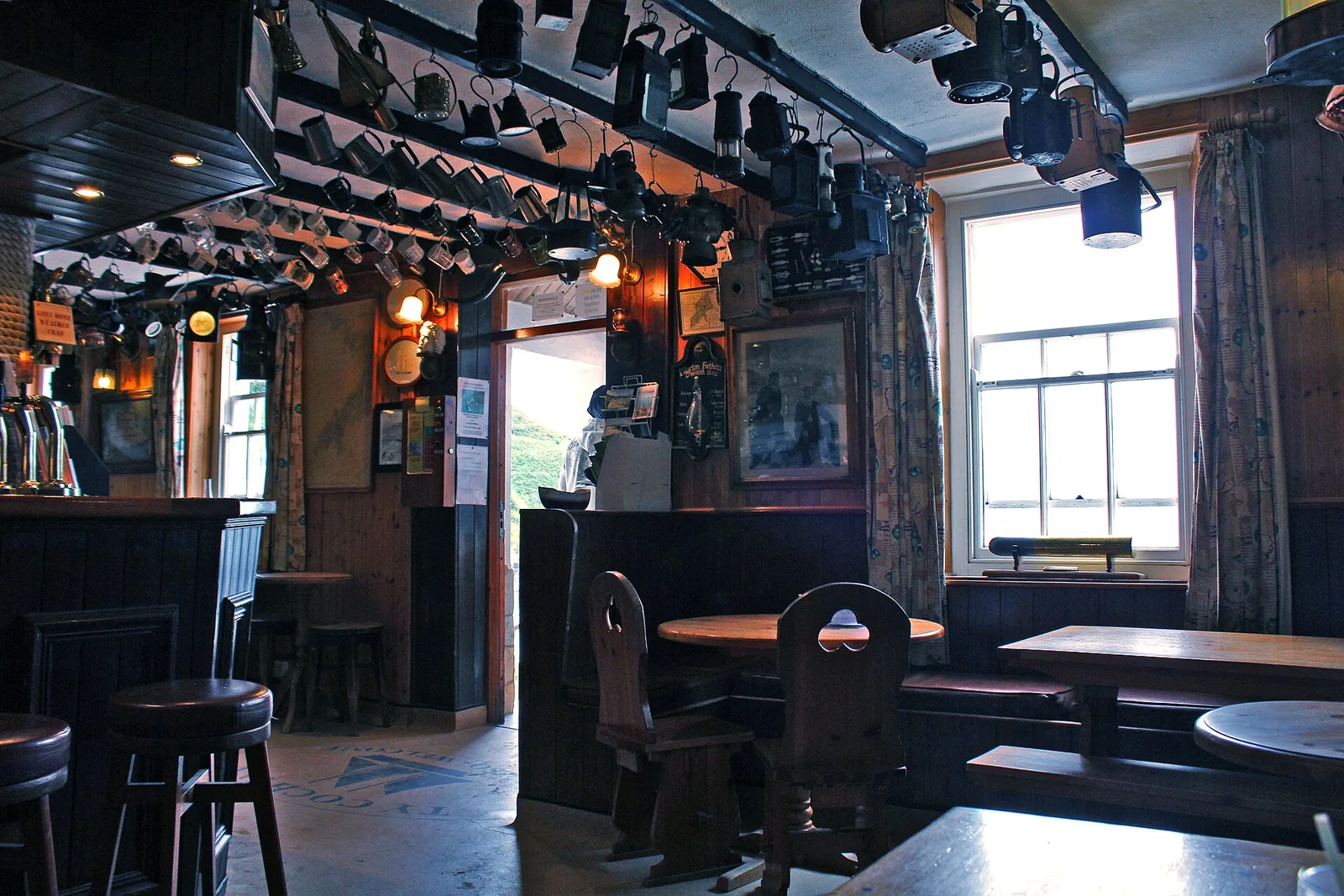
Toilets at Morfa Nefyn car park · Tŷ Coch Inn on the beach
Dogs
Welcome, on lead near the Tŷ Coch Inn
Plan with confidence.Detailed information on arrival, access, facilities, restrictions and local conditions.
Opening, entry & booking
Open
Porthdinllaen is a lived-in National Trust hamlet on an open headland: free, ungated, with no ticket and no booking.
What you pay for
Parking at one of the two car parks. Which one you choose decides your route, not your price.
Tŷ Coch Inn
The pub keeps its own seasonal hours and is a separate business. Do not plan the walk around it being open.
It is someone's home
People live here year-round. There is no visitor infrastructure, and the lanes are private in places.
Booking
None for access.
Parking, start point & arrival
Footpath route
Nefyn & District Golf Club / National Trust car park area near Lôn Golff: this is where you start the footpath crossing to Porthdinllaen. Open the National Trust car park in Google Maps (LL53 6DA).
Beach route
A separate National Trust car park at the end of Lôn y Traeth serves Morfa Nefyn Beach: a different car park, for the tidal beach approach.
Charges
Both are paid car parks. The Morfa Nefyn Beach car park is reported at around £4 per day or £1.50 after 4pm (24 hours). Treat this as indicative and confirm on arrival.
Avoid
Confusing the two: they lead to different approaches.
Public transport & car-free access
No confirmed service
No bus timetable to Nefyn or Morfa Nefyn was confirmed by the sources checked for this guide. Treat this as a car destination.
Nearest town
Pwllheli, the Llŷn's main town, is the nearest place with rail: the Cambrian Coast line terminates there.
From Pwllheli
Around 8 miles by road to Morfa Nefyn, with no confirmed onward public link.
Confirmed at the Morfa Nefyn Beach car park. No official source for this guide confirms toilets at Porthdinllaen itself. Plan to use the beach car park facilities first.
Food
The Tŷ Coch Inn sits on the beach at Porthdinllaen. Caffi Porthdinllaen and the Cliffs Inn sit along the coast path from Nefyn.
No public bins
National Trust asks visitors to take litter home: there are none at Porthdinllaen.
Accessibility & terrain
Two routes, both walks
There is no vehicle access to the hamlet for visitors. Whichever car park you use, you walk in.
Golf-course footpath
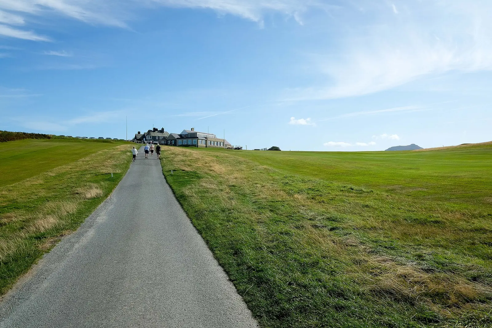
About 20 minutes each way across the Nefyn & District course: grass, undulating, and the reliable option at any state of tide.
Beach route
Along the sand from Morfa Nefyn. Flatter, but it narrows and can be cut off at high tide. Take the footpath if you are unsure.
Not step-free
Neither route is suitable for wheelchairs; the beach route also depends on the tide.
Toilets
At the Morfa Nefyn Beach car park. No source confirms toilets at Porthdinllaen itself. Go before you walk.
Dogs & restrictions
At Porthdinllaen
Welcome, but kept on leads near the Tŷ Coch Inn.
At Morfa Nefyn Beach
A seasonal zone/date restriction is reported by a single visitor-guide source, not yet confirmed by the council or National Trust, so no exact dates are stated here.
Safety, weather & local conditions
Beach route & tide
Narrows and can be cut off at high tide. Take the golf-course footpath if you are unsure.
Lifeguard
No lifeguard service is confirmed at Porthdinllaen or the adjoining Morfa Nefyn Beach. Take general coastal-water care.
Current notice
The footpath from Porthdinllaen village to the lifeboat station is currently closed for safety reasons: view the station from a distance.
Emergency
If you are in danger on the coast, call 999 and ask for the Coastguard.
PLACE-SPECIFIC DETAILS
ON ARRIVAL: getting to Porthdinllaen
No cars
There is strictly no public vehicular access to Porthdinllaen, the RNLI station, or the Tŷ Coch Inn: confirmed directly by Nefyn & District Golf Club.
On foot
Either the public footpath through the golf course, or along the beach from Morfa Nefyn (tide-dependent).
Accessible gate
A RADAR-key kissing gate sits to the right of the footpath barrier.
Courtesy
The footpath crosses a working golf course. Keep to the path and give way to golfers.
Other place details
Wildlife
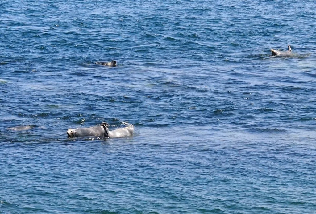
Grey seals, nesting cliff birds (not guaranteed) · a seagrass meadow lies beneath the sheltered water below the headland
What to bring
Water
Snacks
Windproof layer
Suitable shoes
Charged phone
Tide times checked
Dog lead if needed
Binoculars optional
Don’t come here for a drive-up beach.
Come for the moment the golf course falls away and the headland opens ahead: a fishing village with no road in, and a beach pub at the end of the walk.
Porthdinllaen feels remote long before it is ever difficult. Two dozen buildings, a working lifeboat station, and the sea on three sides.
Where the road stops and the walk begins.
Should this shape your day?
Worth a half-day. Not worth a rushed hour.
Good fit for
coastal walkers
anyone curious about the lifeboat’s rescue history
seal and seabird watchers
anyone drawn to a car-free village
Think twice if
you want to drive straight to the beach
you need guaranteed step-free access throughout
the tide rules out the beach route and you can’t take the footpath
Take the golf-course footpath if the tide is against you, and build the visit around the Tŷ Coch Inn and the headland view out to the lifeboat station.
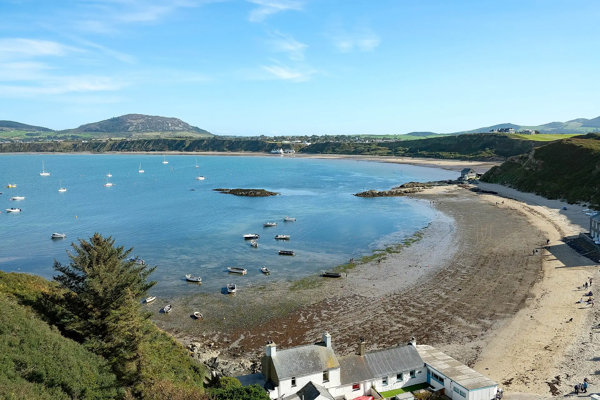
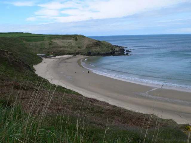
The bay at low tide: sheltered water, moored boats, the hills of Llŷn beyond.
One walk, seven scenes.
See the shape of the visit before you commit to it.
01 Arrive
Choose your car park: footpath or beach.
02 Cross
Golf-course footpath, or sand at low tide.
03 First sight
The headland comes into view.
04 The bay
Sheltered water: maybe seals.
05 The village
A couple of dozen buildings, one pub.
06 The lifeboat station
A working station, not a museum.
07 The walk back
Same path, changed light.
Seen along the way.
Footpath, sand and sea: the visit before you make it.
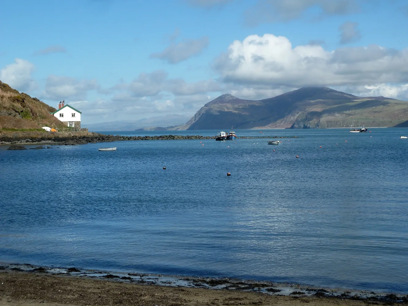
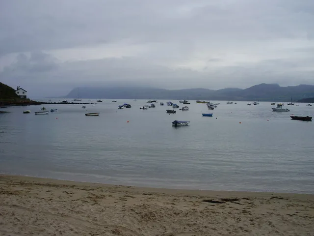
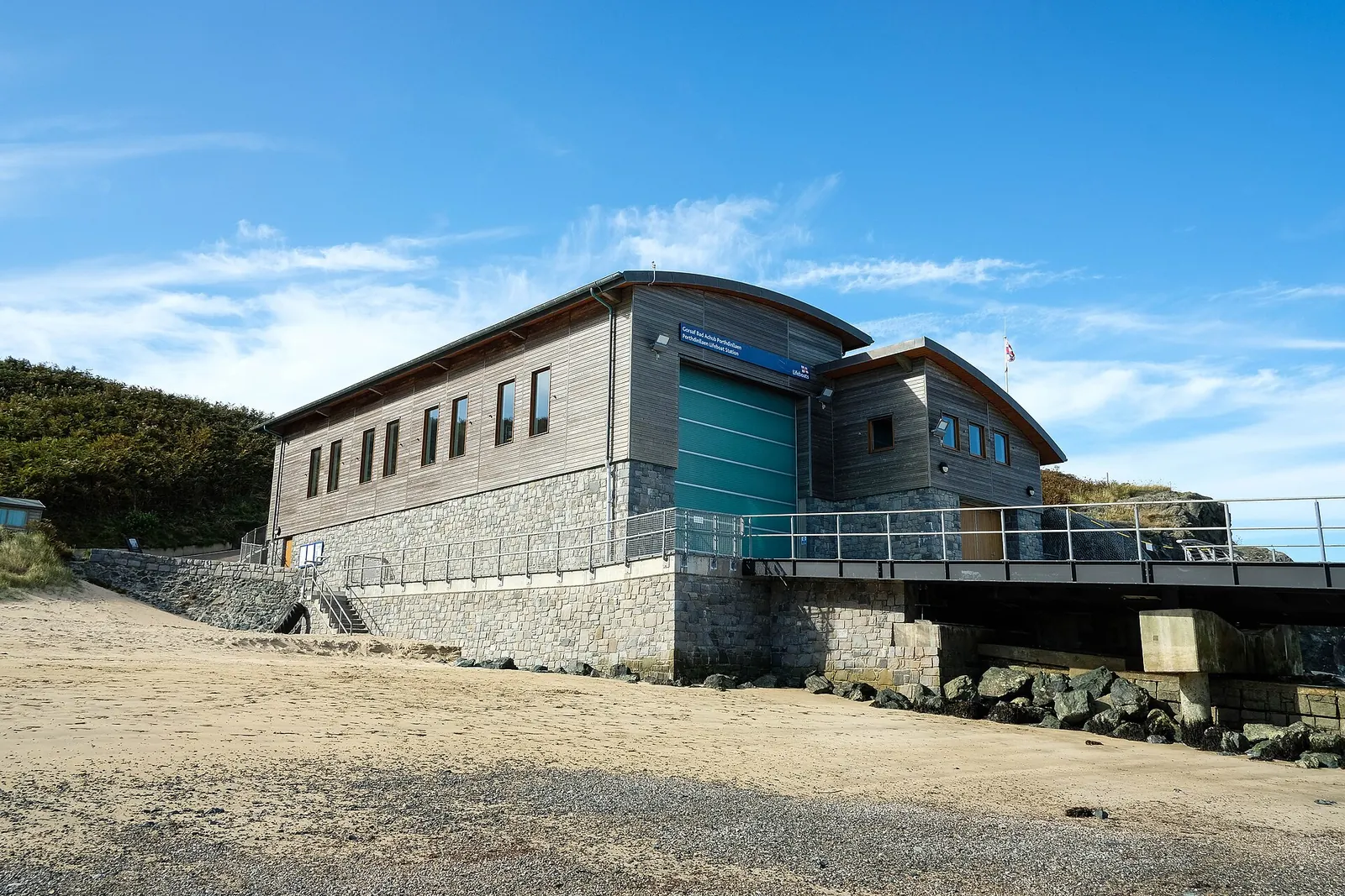
The golf-course footpath: the tide-proof way inBoats moored in the harbour: a working coast, not a resortInside the Tŷ Coch Inn: the pub at the end of the walkThe lifeboat station: a working RNLI post, not a museumThe bay at low tide: sand and shoreline curving round to the villageGrey seals near the headland, not guaranteed, but regularly reported
The parts people remember
A village reached only on foot, and the walk decides how it feels.
01
Leaving the car behind
The road stops at the car park. From here everything is on foot, and the village stays completely out of sight for the first stretch.
02
The fairway falls away
The path crosses open mown ground on the headland, and then the land drops on the far side and the bay, the beach and the roofs appear together.
03
Down at sand level
The last of the walk drops onto the beach itself. Two dozen buildings stand along the shore with the sea on three sides and no road behind them.
04
A live station at the point
At the headland's end the lifeboat house sits above the slipway: equipment out, doors working, plainly still in service rather than preserved.
05
The headland closes it off
Walking out, the village goes first and the bay follows, until the headland stands between you and all of it and the car park could be anywhere.
The kind of place that stays remote because nobody built a road to it.
Porthdinllaen Archive
Old stories, carefully told.
Four field notes on what this headland has been: a storm, a rescue, a harbour that never was, and a station still on watch.
This is documented history, not folklore, but some detail rests on a single accessible source, and is told with that honesty.
Field notes
Four entries. Open one to read the note.
The storm History
The night of December 1863
Field note I · filed under the storm that started it
A single night of weather changed this headland for good.
What is known
On the night of 2–3 December 1863, a storm drove eighteen ships sheltering in Porthdinllaen bay onto the shore. Robert Rees of Morfa Nefyn, with four other men, saved 28 lives.According to lifeboat records
What tradition says
The rescue is remembered as the reason the RNLI was asked to station a lifeboat here at all: the vicar of Boduan wrote to the RNLI directly afterwards.
What to notice there
Nothing marks the storm itself, but the lifeboat station at the tip of the headland is its direct consequence.
The station History
Founding the lifeboat station
Field note II · filed under service
The RNLI approved a station here within months of the 1863 storm.
What is known
Porthdinllaen Lifeboat Station was established on 3 March 1864, with the first lifeboat arriving that August.According to lifeboat records
What tradition says
The crew have since won one silver and three bronze RNLI medals for bravery, the most recent in 1981.
What to notice there
The current boathouse and slipway, completed in 2014, replaced an older station on the same working site.
Working coast History
The harbour that never was
Field note III · filed under the road not taken
This tiny village was once proposed as the gateway to Ireland.
What is known
An 1806 Act of Parliament proposed Porthdinllaen as the harbour for Irish steam-packet trade. The plan was rejected in 1810 in favour of Holyhead.According to secondary sources
What tradition says
Through the 19th century the port still worked hard: over 700 ships passed through in 1861 alone, with shipbuilding, herring processing and livestock export.
What to notice there
The couple of dozen buildings here are the scale that harbour would have outgrown, had the vote gone the other way.
Still on watch Current
A working station today
Field note IV · filed under the present tense
This isn’t a heritage display: it’s a live RNLI post.
What is known
The current lifeboat is the Tamar-class John D. Spicer, on station since 2012, crewed from the 2014 boathouse.According to lifeboat records
What tradition says
Porthdinllaen is reported as the only RNLI station where Welsh is the crew’s normal working language.
What to notice there
The footpath connecting the village to the station itself is currently closed for safety reasons: view it from a distance, not up close.
Don’t let the day end at one pin.
There’s no genuinely nearby Atlas of Wales guide to pair Porthdinllaen with yet: more Llŷn Peninsula places will follow as the Atlas grows.