Llŷn · Gwynedd · Mountain

Yr Eifl561 m · three tops above the Llŷn coast, and an Iron Age town on one of them

The highest ground on the Llŷn Peninsula, and the sea starts where the hill stops. On the eastern top, a stone town with walls still standing head-high after two thousand years.

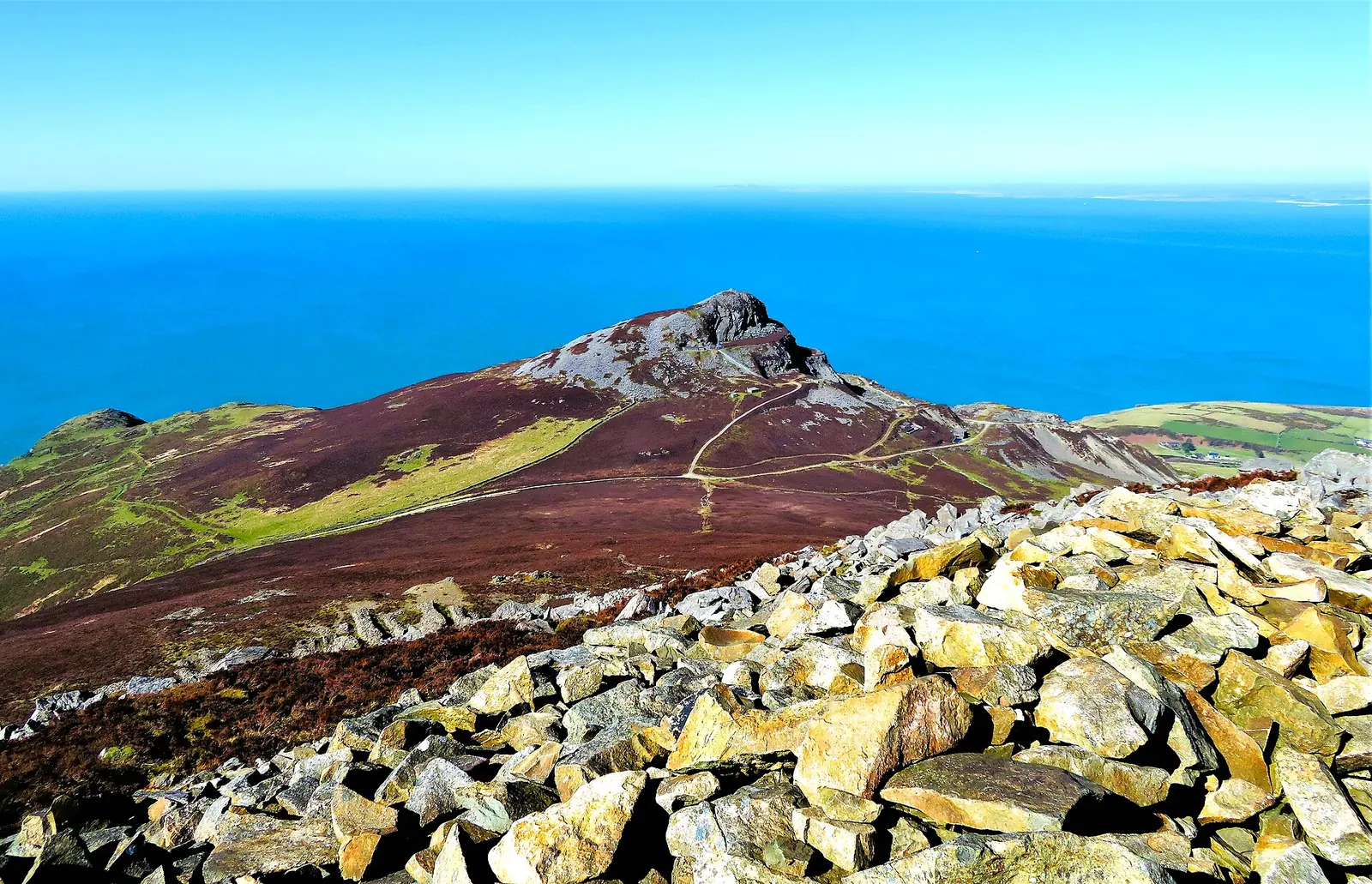
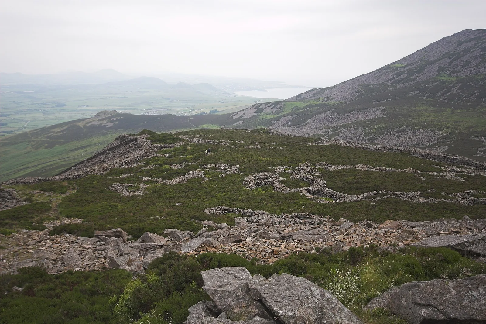
Three volcanic tops closing the north coast of Llŷn: Garn Ganol at 561 m is the highest ground on the peninsula, and the eastern top carries Tre’r Ceiri, one of the best-preserved Iron Age hillforts in Britain. Modest heights, full sea weather, and a descent looser than the numbers suggest.

Height
561 m
Ways up
Two · the three-top circuit or the fort path
Commitment
About 3–4½ hrs for the circuit
Terrain
Heather, a boggy col, rock and loose stone
Exposure & navigation
Low exposure; awkward in cloud

Choose your lineChoose your route

Two ways up. They are not the same day.

People arrive here meaning one thing and get the other. The circuit from the mountain road takes in the tops and the fort in half a day; the path from the B4417 is a short, steep hour on one hillside to reach the fort alone. Pick by what you actually came for. The whole board below redraws to your line: its terrain, its shape, its numbers.

Walking routes

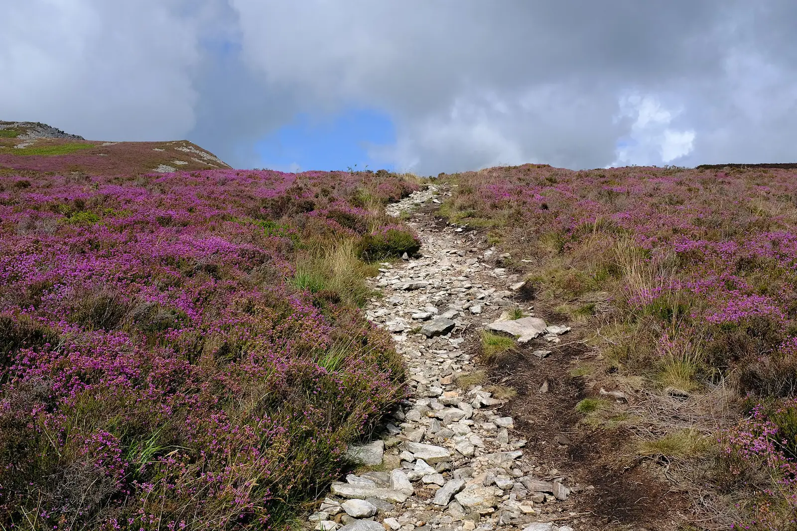
A stony track over heather on the slopes of Garn Ganol, with the tops of Yr Eifl beyond
Your line
1 2 3 4 5 6
  1. 1
    Bwlch yr Eifl car parkOn the mountain road between Llithfaen and Nant Gwrtheyrn. Small; the approach is a narrow mountain road. Easiest turn-around.
  2. 2
    Onto the heatherA track leaves the road and climbs across open, grazed moorland. Kissing gates in the field walls.
  3. 3
    444 mGarn FôrThe western top: relay mast, cairns, and quarried ground falling to the sea. Skip it and the day is shorter.
  4. 4
    561 mGarn GanolThe final pull is rocky enough that hands come out of pockets. Trig pillar and cairn at the top. The highest ground on Llŷn.
  5. 5
    The boggy colThe saddle between the two tops holds water and loses the path in cloud. Poor going after rain.
  6. 6
    485 mTre’r CeiriThe eastern top and the hillfort, then the steep, loose descent back to the road.
1 2 3 4 5 6
  1. 1
    The B4417 laybyA small roadside layby west of Llanaelhaearn: a layby, not a car park. Do not block the road or a gateway. Easiest turn-around.
  2. 2
    The signposted footpathThe path leaves the road signed and obvious, and starts climbing almost immediately.
  3. 3
    Through the field wallsGrassy going between drystone walls and grazed intake land, with the scree dome above.
  4. 4
    The loose stoneThe steepest section is rough, ankle-turning stone. Worse coming down than going up.
  5. 5
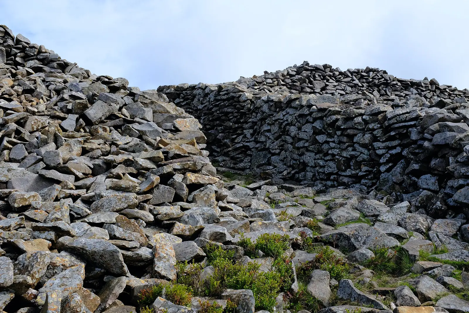
    The rampartThe wall comes into view whole: head-high in places, with the entrance passage through it.
  6. 6
    485 mInside Tre’r CeiriThe eastern top, the hut circles, the Bronze Age cairn, then the same path back down.

Practical brief

Your lineroute in practice ·

The half-day that takes in everything: the tops, the fort, and the whole peninsula from the highest point on it.

Start point
The car park on the mountain road between Llithfaen and Nant Gwrtheyrn (about SH353440)
Parking / booking
Small, on a narrow mountain road. Charging is not confirmed: guides disagree and no council or operator source was found. Arrive prepared to pay.
Public transport
No bus service to the car park has been confirmed. Llithfaen village has a limited service; check Traveline Cymru rather than assume.
Facilities
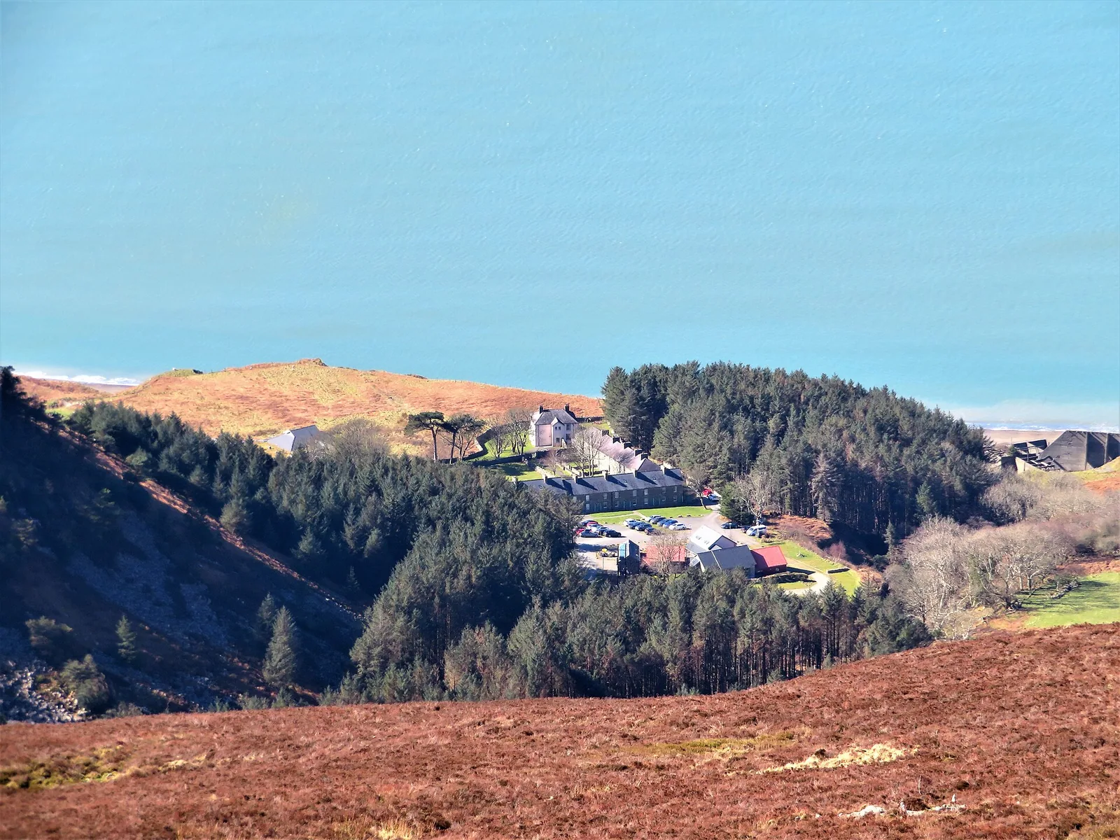
None on the hill: no toilets, water, café or shelter. Nant Gwrtheyrn, below, has its own facilities and its own car park.
Return / descent
Steep and loose back to the same road. No alternative descent has been verified for this guide.
Avoid this route if
You want firm way-marked ground, or cloud is down and you can’t navigate a featureless boggy col.

One hillside, one objective: the shortest honest way to stand inside the fort.

Start point
A small layby on the B4417 west of Llanaelhaearn, at the signposted footpath
Parking / booking
A roadside layby, not a car park: a handful of spaces, no facilities. Do not block the road or a field gateway.
Public transport
No service to the layby has been confirmed. Llanaelhaearn is the nearest village; check Traveline Cymru.
Facilities
None at the layby and none on the hill.
Return / descent
Back down the same path. No alternative has been verified for this guide.
Avoid this route if
Loose steep stone is hard on your knees or your confidence, or you were expecting a graded heritage-site path.

Route figures: no official register exists for Yr Eifl. The circuit’s figures come from independent walking guides and vary by whether Garn Fôr is included: published here as a range, checked 25 July 2026. No reliable distance, ascent or time was found for the fort path, so none is given. Parking charges and transport change. Confirm before you go.

Before you go

Need the exact mountain details?

Parking, transport, toilets, dogs, weather, emergency and descent planning: checked before you go.

Parking & booking
  • Bwlch yr Eifl · the car park on the mountain road between Llithfaen and Nant Gwrtheyrn (about SH353440), the standard start for the circuit. It is small, and the approach is a narrow mountain road. Charging is not confirmed for this guide: one published walking guide describes it as free, another as a pay car park, and no council or operator source was found either way. Arrive prepared to pay. Open parking area (opens in a new tab).
  • The B4417 layby · a small roadside layby west of Llanaelhaearn at the signposted footpath to Tre’r Ceiri. A handful of spaces, no facilities. Do not block the carriageway or a field gateway.
  • Nant Gwrtheyrn · has its own separate car park at the bottom of the hairpins. It is a destination in its own right, not the mountain’s car park, and the road down is steep and narrow.

Checked 25 July 2026 — confirm current charges before you travel via Cyngor Gwynedd — car parks (opens in a new tab).

Public transport

No bus service to the Bwlch yr Eifl car park or to the B4417 layby has been confirmed for this guide. Llithfaen village has a limited service. Plan to drive, and note that both approaches are narrow. No route number is published here, so plan door to door with the Traveline Cymru journey planner (opens in a new tab) before relying on a connection rather than assuming one does or does not run.

Toilets, food & water
  • On the hill · nothing. No toilets, no water, no café, no shelter on any of the three tops or at either start.
  • Nant Gwrtheyrn · the Welsh-language centre below the western slope has visitor facilities, but it is a long descent and re-ascent away from the ridge, not a mid-walk stop.
  • Villages · Llithfaen, Llanaelhaearn and Trefor are the nearest settlements; carry what you need up.
Dogs & livestock

Yr Eifl is open, grazed upland, so keep dogs under close control around livestock. On Open Access Land, dogs must be on a lead no more than 2 m long between 1 March and 31 July (the breeding season), and at any time near livestock. No dog ban specific to Yr Eifl was found for this guide. Inside Tre’r Ceiri, keep dogs on the worn paths with you: the hut circles and wall footings are the monument, not scrub.

Routes & approach differences

No national-park or Cadw route register exists for Yr Eifl: both lines on this page are assembled from independent walking guides, not official routes. They are genuinely different outings. The circuit from the mountain road is a half-day over three tops with the fort near the end; the path from the B4417 is a short, steep climb up one hillside to the fort and back. People regularly set out for one and find themselves committed to the other.

Trefor, on the north side, is a third approach named in general descriptions of the hill, but no route detail was confirmed for it in this guide, so it is not published here.

Weather, visibility & winter conditions

The Met Office does not name a forecast location “Yr Eifl”: its Wales index was checked on 25 July 2026. The nearest named point is Nefyn, at sea level: useful, but it carries no altitude bands and no freezing level, and it is not a summit forecast. The MWIS mountain forecast covers Eryri, the neighbouring area, not Llŷn. Read it as an indication of the day’s mountain conditions, not as a forecast for these tops.

Height is not the point here. These are sea-facing hills taking the full weather off the Irish Sea, and cloud on the col makes the ground genuinely hard to read. In snow or ice the rocky summit ground and the steep loose descent need crampons, an ice axe and the skills to use them. No site-specific winter advisory or ground-condition report exists for Llŷn; that is the scope of this guide, not proof that equipment is or is not required.
Descent planning & route mistakes

The descent is steeper and looser than 561 m suggests. Coming off Garn Ganol there is more than one line of use and several path junctions, and in cloud it is easy to commit to the wrong one and end up above the wrong side of the hill. Fix your line before you leave the top.

The mountain road between Llithfaen and Nant Gwrtheyrn is never far below the circuit: dropping back to it is the reliable retreat from either of the western tops. From Tre’r Ceiri, the way you came is the way back. No further alternative descent has been verified for this guide.

Emergency & what not to rely on

Dial 999 and ask for Police, then Mountain Rescue. Those with hearing or speech needs can text “register” to 999 in advance to set up emergency SMS access. Give your location, what’s happened, and how many are in your group.

Neither start point is a rescue plan. The relay mast on Garn Fôr says nothing about mobile coverage for you, and no signal claim is made here. Carry the means to look after yourselves.

Accessibility & realistic limitations

There is no step-free route to any of the three summits, and none to the fort: heather, bog, loose stone and steep gradients throughout, on both lines. That is stated as fact, not inferred favourably. There is no shelter, facility or seating on any top.

Tre’r Ceiri is a protected ancient monument. Stay on the worn paths, do not climb on the walls or the hut circles, and take nothing away. The wall you are walking beside has stood for two thousand years partly because most people leave it alone.

Sourced from the Llŷn AONB, the Royal Commission’s Coflein record for Tre’r Ceiri (NPRN 95292), Bangor University’s Ecoamgueddfa, the Database of British & Irish Hills, Wikipedia and independent walking guides, checked 25 July 2026. Tre’r Ceiri means “town of the giants”, from cewri, the plural of cawr.

The reckoning

Now: is today the day?

You have seen the line and the climb; the last question is the weather. Height is not what makes these hills serious: the sea is. They stand exposed at the end of the peninsula and take whatever comes off the Irish Sea first.

Read both, and know what each one is. The Met Office names no forecast location “Yr Eifl”: Nefyn is the nearest named point, and it is a sea-level forecast with no altitude bands and no freezing level. MWIS is a genuine mountain forecast, but for Eryri next door, not for Llŷn. Neither replaces your own judgement about wind, cloud, visibility, snow and ice on the tops. A bright morning in Nefyn does not mean a clear col.

  • Nothing to get behind

    There is no building, café, wall or shelter on any of the three tops: just bare block field, open to the sea on three sides.

  • Wet turns the descent nasty

    The loose stone on the steep sections is unkind dry and worse wet, and the col between the two tops holds water and goes to bog.

  • Cloud takes the col, not just the view

    In mist the saddle between Garn Ganol and Tre’r Ceiri loses its path and its features, and the junctions on the way down all look alike. That is where people go wrong here.

Winter is a different hill. 561 m sounds gentle; a sea-facing summit in snow and wind is not. On ice, the rocky top and the steep loose descent need crampons, an ice axe and the skills to use them. No site-specific winter advisory or ground-condition report exists for Llŷn. Treat winter here as a serious undertaking regardless.

Good fit for

  • Walkers who want three real summits inside half a day
  • Anyone who wants to stand inside one of the best-preserved hillforts in Britain
  • Photographers after the whole Llŷn Peninsula from the highest point on it

Think twice if

  • You want firm way-marked ground: you’ll get heather, bog and loose stone
  • You’re navigating in cloud without map-and-compass skill
  • You need step-free access, or you’re bringing young legs to a steep loose descent

The summit

What the climb gives back.

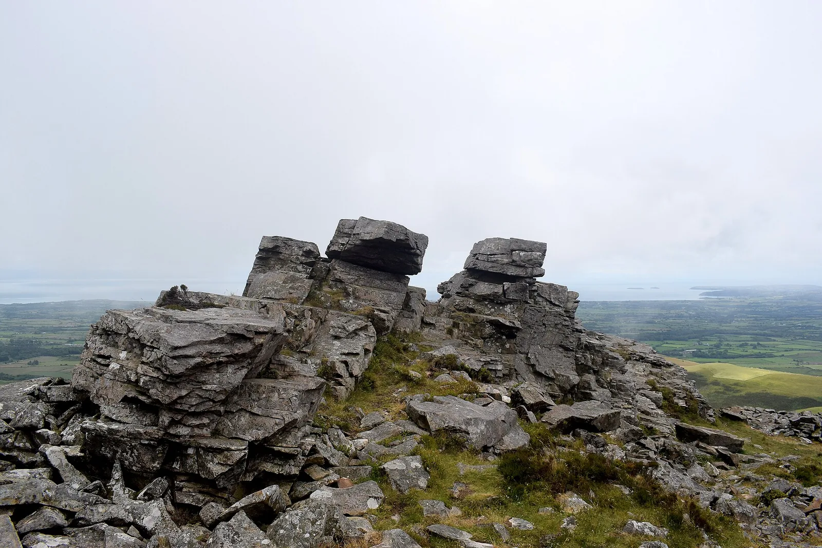
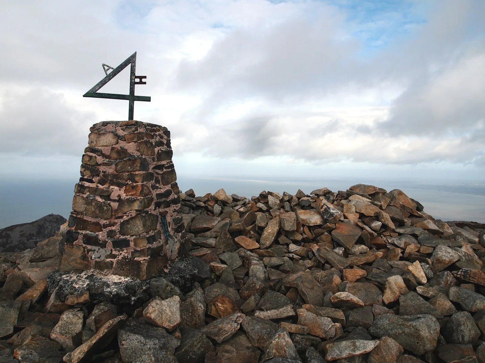
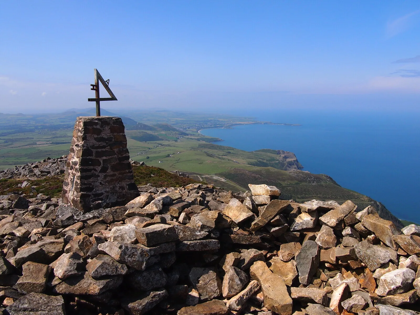
Garn Ganol is the highest ground on Llŷn, and it does not feel like 561 m. The summit is a heap of angular blocks with a trig pillar on it, and the land runs out beneath you in every direction at once.

The trig pillar and block cairn on the summit of Garn Ganol, with the Llŷn coastline and the sea below
The summit of Garn Ganol, 561 m

The top itself

A pillar on a pile of blocks

There is no neat cone here. The summit is a broad field of angular broken stone with a stone trig pillar standing in the middle of it, and the walking is awkward for the last few metres because the ground is all edges.

What it stands over

The land runs out below you

The drop from the summit rocks to green farmland and then to open sea happens fast: a few hundred metres of hillside and the coast is done. It is what makes a modest height feel like a great deal more.

Bring a layer

Nothing breaks the wind

No shelter, no wall, no cairn big enough to hide behind. On an exposed sea-facing top that matters more than the altitude does: people who stop here for lunch usually do not stop for long.

Wider context

The highest point on Llŷn

Nothing on the peninsula stands higher than these 561 m, which is why the view west runs the whole length of it on a clear day, with Eryri behind you to the east. It also explains the fort on the next top: whoever held this ground could see anyone coming.

The way down

Before you leave the summit.

The way down is steeper and looser than 561 m has any right to be, and it is where the day usually goes wrong. Read the notices, then make the call.

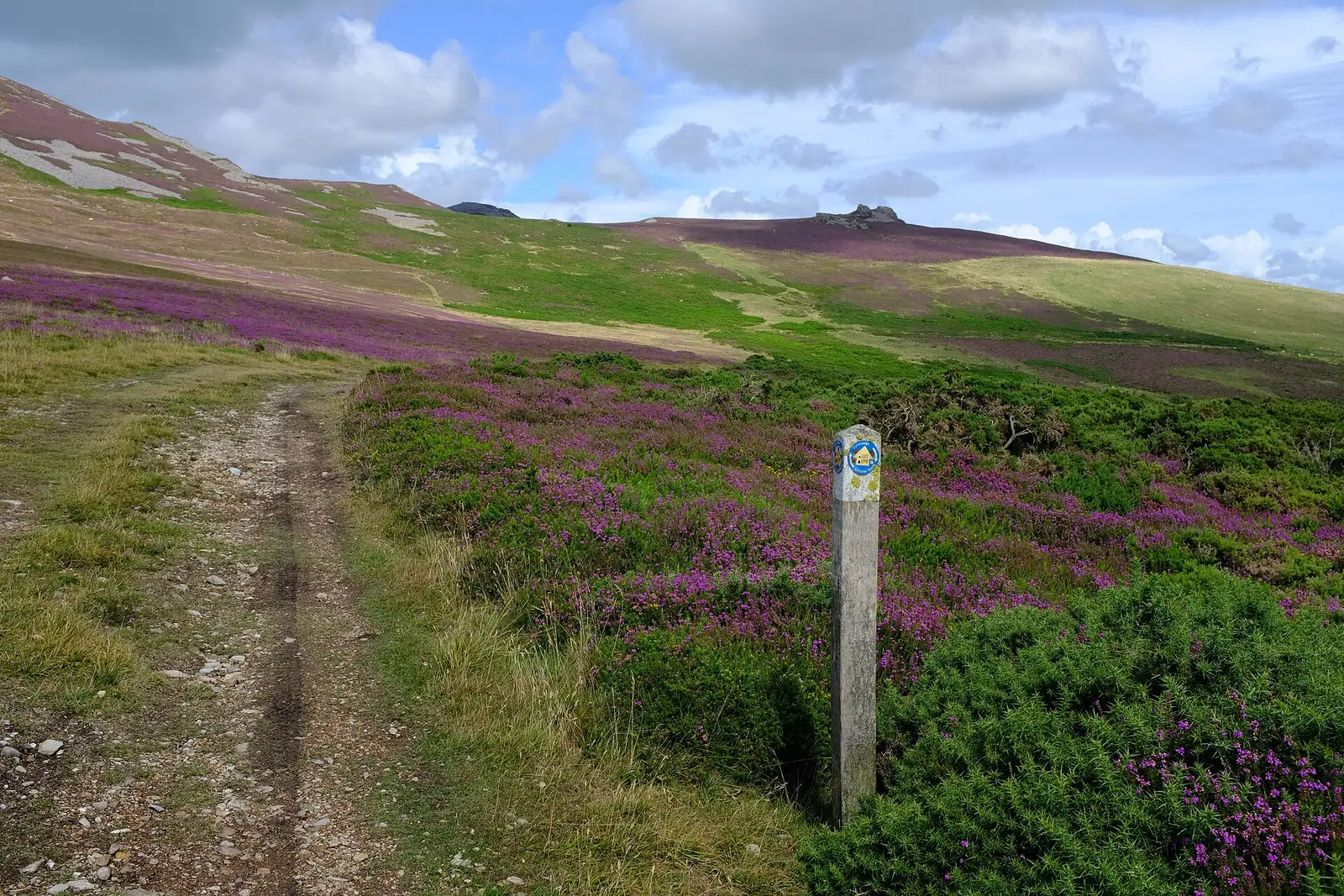
A stony footpath running down through purple heather on the slopes of Yr Eifl
Summit noticeboard
1

Junctions in cloud

Coming off Garn Ganol there is more than one line of use, and in mist the junctions all look the same. Commit to the wrong one and you finish above the wrong side of the hill.

  • Fix your descent line before you leave the top.
  • Carry a map and compass. Do not rely on a phone alone.
  • If unsure, stop and re-check rather than press on.
Common mistake
2

The boggy col

The saddle between Garn Ganol and Tre’r Ceiri holds water and loses its path after rain. It is short, but it slows a group more than the climb does.

  • Expect wet feet: boots, not trainers.
  • Allow more time across it than the map suggests.
  • Keep the group together where the path fades.
Slower than it looks
3

Steep, loose stone

The steepest sections are rough, ankle-turning stone that rolls underfoot. It is unkind dry, worse wet, and genuinely serious under snow or ice.

  • Take it slowly and give the group space: dislodged stone travels.
  • Poles help far more here than they do going up.
  • Carry an ice axe and crampons if snow or ice is present.
Real hazard
4

Walk the paths, not the walls

The circuit leaves over Tre’r Ceiri, so most people cross a protected ancient monument on tired legs. The walls and hut circles are the reason it is protected.

  • Stay on the worn paths through the fort.
  • Do not climb on the walls or the hut circles.
  • Take nothing away, and move nothing.
Scheduled monument

Back down on the peninsula.

Everything you looked at from the top is a short drive away. These are the ones worth stopping for.

On the Atlas

Continue from Yr Eifl.

On the north Llŷn coast, the highest ground on the peninsula.

Open Yr Eifl on the map

Continue exploring

People held this ground.Yr Eifl holds it still.

The rest of the peninsula is laid out below. Go and find it.