Pen y Pass car park
Pyg Track, Miners' Track, Crib Goch
- Booking
- Mandatory · JustPark
- Address
- LL55 4NU
- Price
- £25 (≤8 hrs) · £35 (8–12 hrs) · £45 (full day)
Very limited; no on-the-day guarantee without a booking. Blue-badge bays first-come.
Eryri · Gwynedd · Mountain
Six paths and one scramble to the roof of Wales, and weather that rewrites the mountain by the hour. What the day asks depends on the line you choose.
The highest ground in Wales: a broad massif of ridges and cwms above Eryri, reached by six named paths, one knife-edge scramble, and a rack railway to a summit café. What the climb asks of you depends on the line, so read the routes before you read the weather.
Choose your lineChoose your route
There is no single "Snowdon walk". Pick by climb, exposure, and the company you can bear. The whole board below redraws to your line: its terrain, its shape, its numbers.
Walking routes
Serious scramble
This is not a walking route. Crib Goch is a Grade 1 scramble along a narrow, exposed ridge with severe drops on both sides: for experienced scramblers, with a head for heights, in still and dry weather only. There is no way off until you reach Bwlch Coch, partway along the ridge.
Practical brief
High start, rocky steps and lake views.
A level lakeside walk to Glaslyn, then one steep climb to join the Pyg.
The longest, steadiest line: village to summit beside the mountain railway.
The biggest climb of the six: from near sea level, through woods and quarry ruins, to a loose final slope.
The quietest line: an old quarry track, then a narrowing ridge to the top. The National Park doesn't publish an official ascent figure for this route, so treat the height climbed as an estimate, not a confirmed number.
The oldest line up the mountain: quiet zigzags from Llyn Cwellyn, then steep ground above the cliffs.
A serious exposed scramble, not a walking route.
Route figures, parking, transport and facilities: Eryri National Park Authority and Sherpa'r Wyddfa, checked 9 July 2026. Prices, fares and seasonal hours change. Confirm current details before you go. Official planning source: Eryri National Park · safety and planning advice
Before you go
Parking, buses, toilets, route starts, weather, dogs, emergency and descent planning: checked before you go.
Pyg Track, Miners' Track, Crib Goch
Very limited; no on-the-day guarantee without a booking. Blue-badge bays first-come.
Shuttle to Pen y Pass
Sherpa'r Wyddfa buses (S1/S2/S5) link to Pen y Pass: 15 min weekends/school holidays, 30 min otherwise.
Llanberis Path
No single official parking pin is published for Llanberis. Use the marked pay-and-display village car parks, not side streets or residential roads.
Watkin Path
Extremely limited; often full by 7:30am in peak season.
Rhyd Ddu Path
About 60 spaces; full by 8am in peak season.
Snowdon Ranger Path
Fewer spaces than Rhyd Ddu; EV charging on site.
Prices checked 20 July 2026: the National Park reviews them annually; confirm before you travel via Eryri National Park parking (opens in a new tab).
Sherpa'r Wyddfa buses (opens in a new tab) link the valley towns to every trailhead: S1 Caernarfon–Llanberis–Betws-y-Coed, S2 Bangor–Llanberis–Pen y Pass, S3 Beddgelert–Caernarfon–Rhyd Ddu–Llyn Cwellyn, S4 Pen y Pass–Beddgelert–Porthmadog, S5 Llanberis–Pen y Pass.
Adult day ticket £7.50; family (2 adults + up to 3 children) £16. The myTrip app gives live tracking and cashless tickets. Walking up one path and down another is possible, but in practice the connection is often limited by the bus timetable. Check it before you commit to a linear route.
Dogs must be on a lead of no more than 2 metres on open access land between 1 March and 31 July, and under close control near livestock at all times: a farmer may legally act against a dog attacking livestock. Dogs are not permitted on Crib Goch under any circumstances, or on the Snowdon Mountain Railway.
The six named paths differ mainly in directness, crowding and exposure: the Pyg and Miners' Tracks share the busy Pen y Pass start (the Miners' begins flatter, past the lakes); the Llanberis Path is the longest but gentlest, running beside the railway; the Watkin climbs the most from near sea level, with loose scree near the top; and Rhyd Ddu and the Snowdon Ranger are the quietest lines, each narrowing to more serious ground near the summit: Bwlch Main's ridge on Rhyd Ddu, the cliffs of Clogwyn Du'r Arddu on the Ranger. Crib Goch is not one of these six: it's a separate, severe scramble, never a walking alternative.
Cloud is common on the summit and can hide the junctions where several paths converge, making the wrong descent line an easy mistake even when the climb itself went well. Wind is regularly much stronger at summit and upper-mountain level than anything felt in the valley, and wet or icy rock adds real difficulty to steps and zig-zags that are straightforward when dry. Snow or ice can turn any of the six walking routes into a winter mountaineering objective: an ice axe, crampons and the skill to use them may be needed, depending on conditions and the party's own competence, not as a fixed rule for every visit. Crib Goch is a separate, more serious case again: in wet, windy, wintry or otherwise poor conditions it isn't simply harder than the six paths, it's a different proposition entirely and shouldn't be attempted.
The Met Office publishes a location forecast for the Yr Wyddfa / Snowdon Summit point (opens in a new tab), and a separate Eryri/Snowdonia mountain forecast (opens in a new tab) that breaks conditions down by altitude — wind speed at 900 m, 600 m and 300 m, and the freezing level — figures a location forecast never carries. Read the first for the summit point and the second for the altitude picture; neither replaces your own judgement about summit wind, cloud, visibility, snow and ice. Yr Wyddfa Live (opens in a new tab) adds live summit and valley temperatures, current hazards and a webcam, and publishes ground-condition reports specific to the winter routes twice a week, Tuesday and Friday, through the season. Check them before assuming a walking route is still a walking route.
The Bwlch Glas standing stone is where the Pyg, Miners', Llanberis and Snowdon Ranger paths all converge just below the summit: in cloud, identify your line down before you leave the top, or you'll end up on the wrong path entirely.
The classic loop is up the Pyg, down the Miners', not the other way round. The Watkin Path's upper scree is easier and safer climbed than descended. On the Llanberis Path, keep off the railway line.
Dial 999 or 112 and ask for Police, then Mountain Rescue. Register for emergencySMS in advance so you can text 999 if you can't get a voice signal. Give your location, what's happened, and how many are in your group.
Llanberis Mountain Rescue Team covers this ground: one of the busiest teams in the UK. The railway, the buses and the car parks all run to a timetable, not to you: none of them is a rescue plan. AdventureSmart (opens in a new tab) sets out the basics: the right knowledge and skills, the right weather, the right gear.
Every summit route is graded Hard/Strenuous by the National Park: there is no step-free or easy way to the top, and none of the six is an easy family walk despite the maintained look of paths like the Llanberis. First-timers are pointed toward the Llanberis Path. Blue-badge parking bays exist at Pen y Pass (first-come) and at Rhyd Ddu and Llyn Cwellyn (two spaces each).
The Snowdon Mountain Railway is the only non-walking way up: seasonal, weather-dependent, and best booked ahead. It does not sell single tickets down in advance; those are first-come-first-served at the summit on the day.
Specific to this mountain
Park in a car park, not a layby or verge, and never walk or stop on the Pen y Pass road itself: it's narrow and dangerous. Wild camping isn't permitted anywhere in Eryri without the landowner's permission, and never in car parks or on verges.
Yr Wyddfa is a National Nature Reserve and working farmland. Take litter home and keep dogs under control near livestock. Around 600,000 people climb it each year (National Park figure); a quieter route such as Rhyd Ddu or the Snowdon Ranger spreads that pressure.
Sourced from Eryri National Park Authority, Sherpa'r Wyddfa, the Met Office and Mountain Rescue England & Wales, checked 9 July 2026.
The reckoning
You have seen the line and the climb; the last question is the weather. Yr Wyddfa is a fair-weather mountain: in cloud the summit is a navigation exercise, and the higher you go the less the valley forecast means.
The Met Office link is a location forecast for the Yr Wyddfa / Snowdon Summit point; MWIS is a regional mountain forecast for Eryri/Snowdonia; Yr Wyddfa Live adds live summit conditions and, in season, ground-condition reports for the winter routes. Read them together: none of them is a substitute for judging summit wind, cloud, visibility, snow and ice yourself. Valley sunshine does not guarantee a clear summit, and a late start eats the daylight you need to get down. Judge the day by the top, not the car park.
The summit sits in cloud on many days. The Met Office mountain forecast publishes the chance of a cloud-free summit: a figure a valley forecast simply doesn't carry.
Bwlchau and ridge lines accelerate the wind well past the valley reading. On the exposed sections it turns people back before the gradient does.
Up top the ground flattens and the paths converge. In mist, finding the finger-stone is the difference between the right descent and the wrong valley.
Winter is a different mountain. Snow and ice make the walking routes a full winter climb: axe, crampons, and the skills to use them. It is impossible to reach the summit safely without them.
The summit
You climb for the view, but the mountain does not always give it. On clear days the north opens; on cloud days, the cairn, the wind and the way down become the reward.
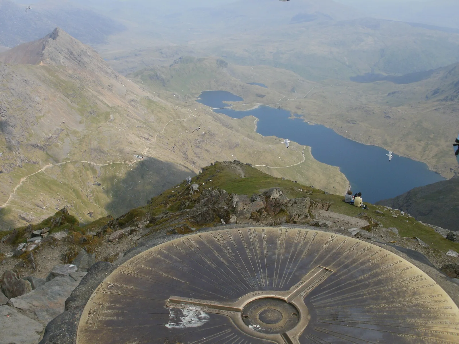
At the topVisible feature
A cast-bronze table that names the hills and valleys around you.
Why it mattersYou are standing on the highest ground in Wales; every route has led to this one point.
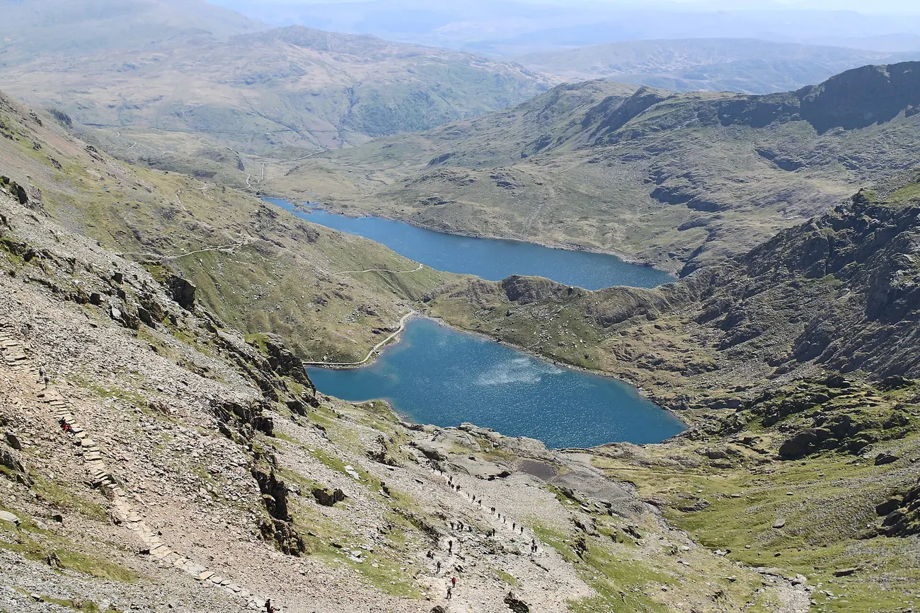
BelowGeneral view
The long water on the valley floor beneath the summit.
Why it mattersThe eastern paths run down toward it, so it stays in sight for much of the way off.
The way downVisible feature
The line threading back down the mountain below you.
Why it mattersIn cloud, finding the right line off the summit matters more than the view.
On the skylineGeneral view
The pinnacled crest standing across the cwm.
Why it mattersThat is the mountain's sharper side: exposed and serious, not a walking path.
Six frames from a day on the mountain: summit and ridge, lake and railway. Each image is credited in full in the footer.
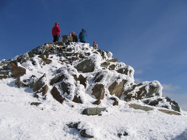
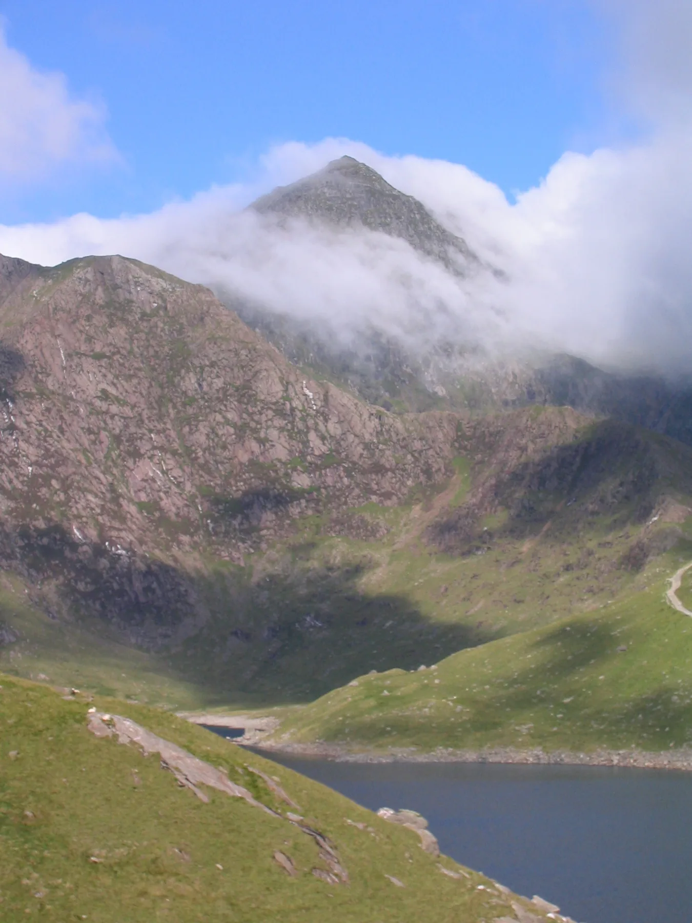
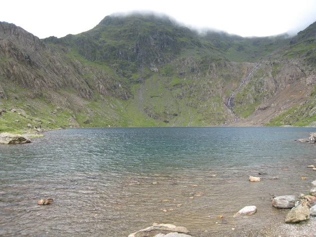
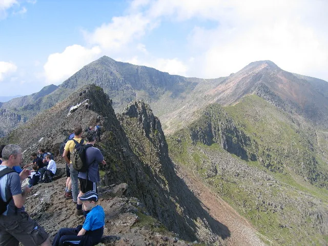
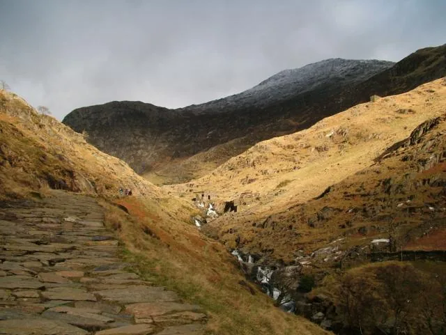
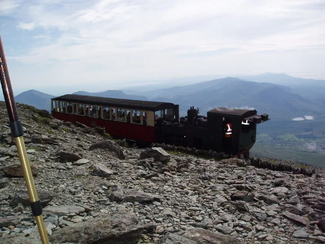
Every photograph here is credited in full in the footer.
The way down
Before you leave the summit, confirm your descent route. Most of the day's trouble comes after the top. Read the notices, then make the call.
Even experienced walkers take the wrong line when tired.
Conditions change quickly. Do not get caught out.
Fatigue slows decisions and increases risk.
Railway, buses and parking run to timetables, not to you.
Crib Goch: serious scrambleA narrow crest with severe drops on both sides. No escape once committed. Only in still, dry weather.
The mountain casts a long day. These are the places around it.
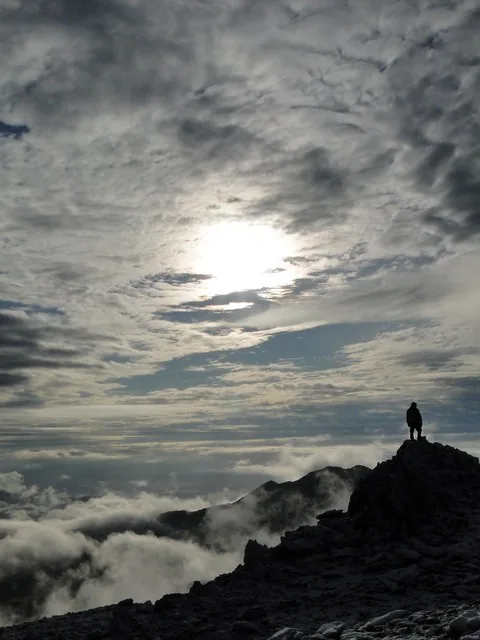
The Glyderau’s high point over the pass: a shattered rock-tor plateau, and no maintained path to the top.
Read the guide →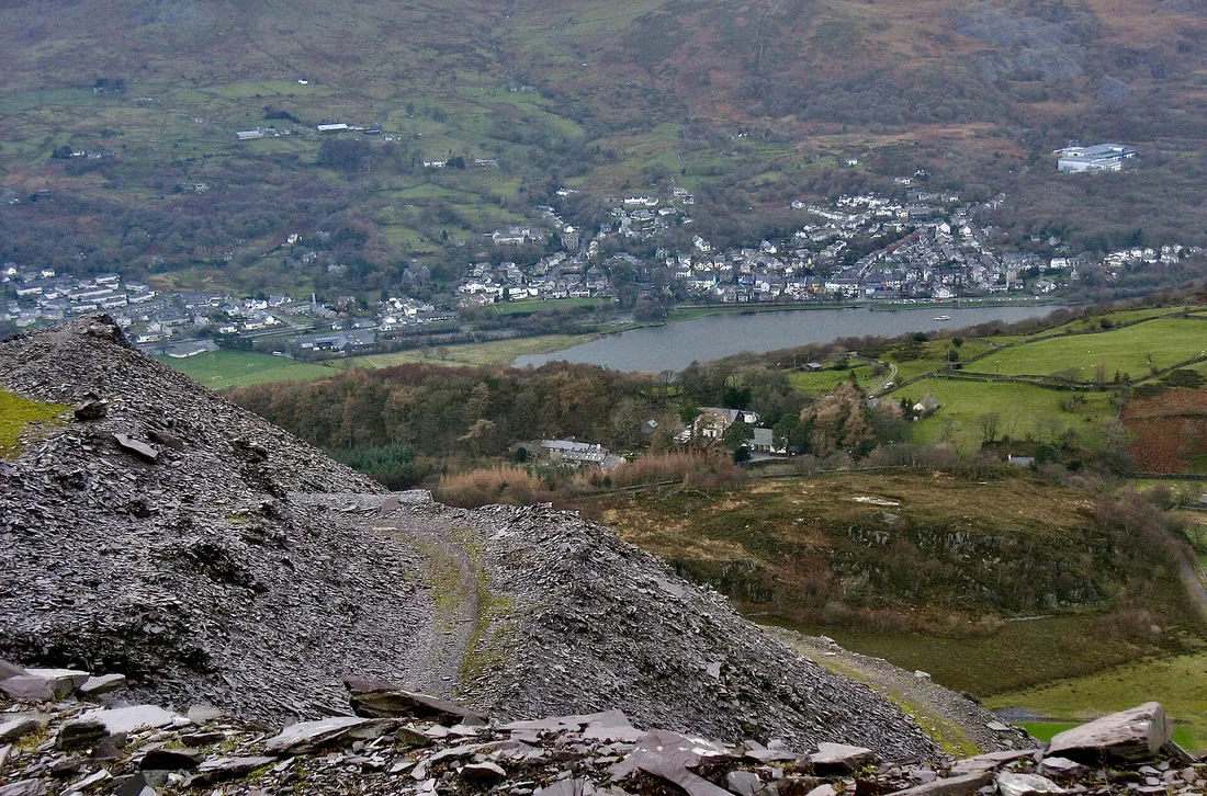
The village at the foot of the Llanberis Path and the railway; food, beds and the slate town after the hill.
Read the guide →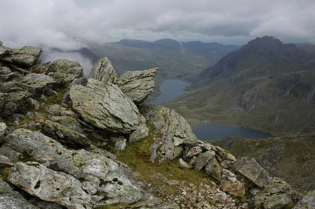
A 947m Glyderau top above Cwm Idwal: a walked ascent, and a shorter day than any route up this mountain.
Read the guide →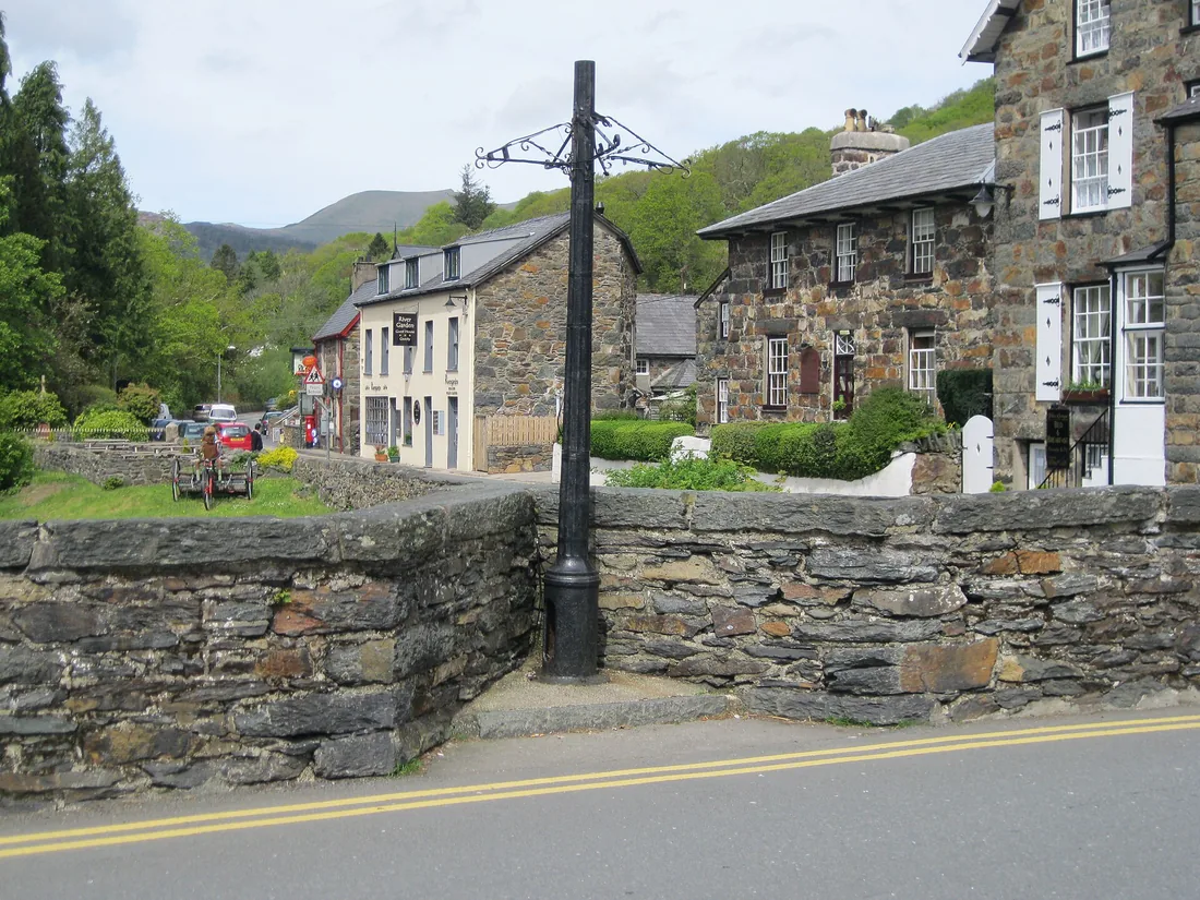
A stone village where two rivers meet, and the grave-story of Gelert the hound. Good for the evening after.
Read the guide →On the Atlas
The highest ground in Wales, at the heart of Eryri.
Open Yr Wyddfa on the mapContinue exploring
Take the scale of the mountain into the wider landscape of Gwynedd.