Eryri · Gwynedd · Mountain

Y Garn947 m · above Cwm Idwal in the Glyderau

A well-known circuit past Devil's Kitchen, or a longer, quieter ridge from Marchlyn: no railway, no café, just real ascent and a wide view. What the day asks depends on the line you choose.

A 947 m Glyderau summit above Cwm Idwal, in Eryri National Park: one of the Welsh 3000s, reached by scree and rock steps, not a maintained path. What the climb asks of you depends on the line, so read the routes before you read the weather.

Height
947 m
Ways up
Two · Ogwen/Cwm Idwal or Marchlyn ridge
Commitment
About 4–6 hrs
Terrain
Rock steps, scree, a remote ridge
Exposure & navigation
Moderate → moderate-high

Choose your lineChoose your route

Two ways up. Only one is yours today.

The popular circuit from Ogwen past Devil's Kitchen, or the longer, quieter ridge from Marchlyn via Elidir Fawr, not interchangeable, and not waymarked. Pick by climb and exposure. The whole board below redraws to your line: its terrain, its shape, its numbers.

Walking routes

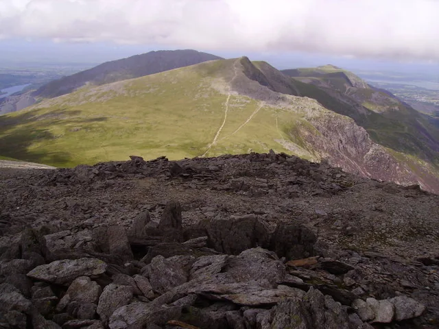
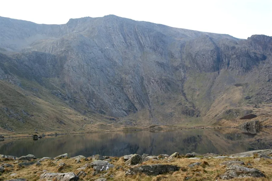
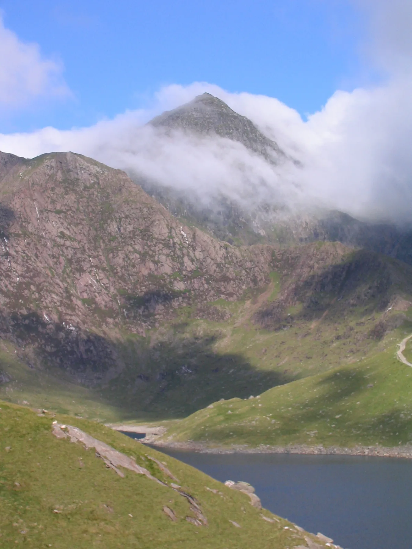
Cwm Idwal and Devil's Kitchen, seen from the Ogwen path up Y Garn
Your line
1 2 3 4 5 6
  1. 1
    Ogwen Centre car parkThe start: £6/day or £3 for up to 4 hrs, card only. Easiest turn-around.
  2. 2
    Llyn Idwal shoreThe signed path into Cwm Idwal, a National Nature Reserve since 1954: "Tin Can Alley" rises ahead.
  3. 3
    "Tin Can Alley"A quarry-gully ascent through Cwm Clyd with rock steps you may need your hands for. Last easy retreat.
  4. 4
    Llyn Clyd detourA small mountain lake just off the path: easy to miss, worth the few extra minutes.
  5. 5
    The summit ridgeLoose scree near the top; poor-visibility navigation is the main hazard here, not technical scrambling.
  6. 6
    947 mY Garn summitA large summit cairn/shelter: "Y Garn" means "the cairn."
1 2 3 4 5 6
  1. 1
    Marchlyn roadheadThe end of the public road to Marchlyn Reservoir: no NPA-managed car park found for this guide. Easiest turn-around.
  2. 2
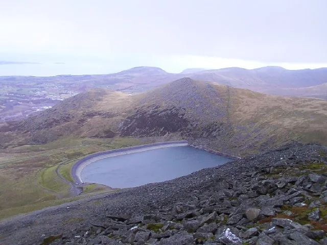
    Toward Elidir FachA faint path rises along the wall above Marchlyn Bach reservoir.
  3. 3
    Elidir FawrThe first summit of the day: views open to Marchlyn Mawr reservoir below.
  4. 4
    The ridge to Y GarnRemote, sometimes pathless ground. Route-finding in mist is the main hazard.
  5. 5
    Approaching the summitViews open to Foel-goch and Twll Du / Devil's Kitchen.
  6. 6
    947 mY Garn summitDescent continues via Y Gribin Ridge: a longer, quieter finish to the day.

Practical brief

Your lineroute in practice ·

The classic, well-supported circuit: lake path, quarry-gully ascent, Devil's Kitchen on the way down.

Start point
Ogwen Centre car park, on the A5
Parking / booking
No booking needed: card/contactless only, no cash. Fills quickly at weekends and in spring/summer, with overflow parking nearby.
Public transport
TrawsCymru T10 (Bangor–Bethesda–Betws y Coed) and the Bws Ogwen shuttle serve Ogwen; frequency not confirmed. Check Traveline Cymru.
Facilities
Toilets and a snack bar at the Cwm Idwal Centre, Ogwen, 24 hrs. Nothing above it.
Return / descent
Back the same way: no alternative descent has been verified for this route.
Avoid this route if
You're not confident on loose scree, or visibility is poor near the summit.

A longer, quieter ridge day via Elidir Fawr: solid navigation required.

Start point
Marchlyn roadhead, end of the public road (grid ref SH593 631)
Parking / booking
No NPA-managed car park identified for this guide. Do not assume a formal facility exists.
Public transport
Not identified serving this start. Check Traveline Cymru before relying on a bus connection.
Facilities
Not confirmed at Marchlyn this pass. Do not assume toilets or food are available.
Return / descent
Descends via Y Gribin Ridge and further summits: steep sections, not a reversal of the ascent.
Avoid this route if
You want a waymarked path: this route crosses remote, sometimes pathless ground with real route-finding demands in mist.

Route figures: no Eryri National Park-published register exists for Y Garn's summit ascent. Figures are Tier-2 specialist sources, checked 18 July 2026. Parking prices and transport change. Confirm current details before you go. Official planning source: Eryri National Park · safety and planning advice

Before you go

Need the exact mountain details?

Parking, transport, toilets, dogs, weather, emergency and descent planning: checked before you go.

Parking & booking
  • Ogwen Centre (near Bethesda): the Cwm Idwal approach. £6/day or £3 for up to 4 hrs, card/contactless only, no cash. No booking system; fills quickly at weekends and in spring/summer. Overflow at Bethesda Football Club, £7/day. Open parking area (opens in a new tab).
  • Marchlyn roadhead (near Deiniolen): the ridge approach. No NPA-managed car park identified for this guide. Do not assume a formal facility exists.

Prices checked 18 July 2026 — confirm before you travel via Eryri National Park — Ogwen (opens in a new tab).

Public transport

The TrawsCymru T10 (opens in a new tab) (Bangor–Bethesda–Betws-y-Coed–Corwen) stops at Llyn Ogwen; Eryri National Park Authority names it as the way in. Partneriaeth Ogwen also runs the Bws Ogwen electric minibus from Bethesda, but it publishes no fixed timetable page. Check the current service before relying on a bus connection. No public transport was identified serving the Marchlyn roadhead.

Toilets, food & water
  • Ogwen · toilets and a snack bar at the Cwm Idwal Centre, accessible 24 hours.
  • Marchlyn · not confirmed for this guide. Do not assume toilets or food are available.
  • On the mountain · no toilets, café or shelter on either route between the start point and the summit.
Dogs & livestock

On Open Access Land generally, dogs must be on a 2 m lead between 1 March and 31 July (breeding season). On the Cwm Idwal walk itself — a National Nature Reserve — dogs must be on a lead at all times, year-round, per the National Trust's own management of that walk. These are two different rules for the same mountain, not a contradiction.

Routes & approach differences

No Eryri National Park route register exists for Y Garn's summit ascent: both lines on this page are assembled from independent, Tier-2 route guides, not an NPA-designated path. The Ogwen/Cwm Idwal circuit and the Marchlyn/Elidir Fawr ridge are genuinely different days, not interchangeable: one is the well-supported classic route past Devil's Kitchen, the other a longer, quieter, more remote ridge via Elidir Fawr, with route-finding as the main extra demand.

Weather, visibility & winter conditions

No summit-specific webcam or ground-condition report exists for Y Garn. Use the mountain forecast linked above, and treat visibility as the main daily hazard: both routes cross open, largely unsheltered ground.

Moderate snow accumulation is common on the west-facing slope from October to May. A snow cornice collapsed on the descent ridge in December 2011, with a fatal fall. Treat winter conditions here seriously, and carry an ice axe and crampons if snow or ice is present.

Descent planning & route mistakes

No alternative descent has been verified for the Ogwen route: reversal is the only confirmed way down. The Marchlyn route descends via Y Gribin Ridge, which has its own steep sections, not an easier finish.

Poor-visibility navigation is repeatedly flagged as the main hazard on both routes: more so than technical difficulty. Fix your descent line before leaving the summit.

Emergency & what not to rely on

Dial 999 and ask for Police, then Mountain Rescue. Those with hearing or speech needs can text "register" to 999 in advance to set up emergency SMS access. Give your location, what's happened, and how many are in your group.

Ogwen Valley Mountain Rescue Organisation (OVMRO) covers "the mountains and valleys surrounding the Ogwen Valley, Glyderau, and Carneddau" on call 24 hours a day, year-round. Neither start point is a rescue plan.

Accessibility & realistic limitations

No step-free or easy route to the summit exists on either approach: honest, not inferred favourably; this is not a first-mountain choice, and not a route for anyone wanting a maintained path. There is no summit facility, shelter, or café on Y Garn.

Sourced from Eryri National Park Authority, the National Trust (Cwm Idwal), Ogwen Valley Mountain Rescue Organisation and the Met Office, checked 18 July 2026.

The reckoning

Now: is today the day?

You have seen the line and the climb; the last question is the weather. Neither route has a maintained path or a summit shelter: in cloud, the featureless upper ground is a navigation exercise.

The Met Office link is a location forecast named for Y Garn; MWIS is a regional mountain forecast for Eryri/Snowdonia. Read them together: a location forecast is not a substitute for judging summit wind, cloud, visibility, snow and ice yourself. Valley sunshine does not guarantee a clear summit. Judge the day by the top, not the car park.

  • No summit shelter

    There is no building, café or trig shelter at the top: just the summit cairn, exposed to whatever the weather is doing.

  • Rock steps and scree are worse wet

    Both routes involve rock steps or loose ground. Rain makes already-loose scree genuinely treacherous, on the way up and — more so — on the way down.

  • Navigation matters more than the view

    In mist, finding the right line — especially off the summit and on the Marchlyn ridge — matters more than the panorama.

Winter is a different mountain. Moderate snow accumulation is common on the west-facing slope from October to May, and a fatal cornice collapse occurred on the descent ridge in December 2011. No official equipment mandate specific to Y Garn was found for this guide. Treat winter conditions here as a serious undertaking regardless.

Good fit for

  • Walkers comfortable on rock steps and loose scree
  • Parties self-reliant enough for a remote ridge with no maintained path
  • Anyone wanting a high Glyderau summit away from the busiest ground

Think twice if

  • You want a maintained, waymarked route throughout
  • This would be a first mountain: neither approach is an introduction
  • You're relying on a summit shelter or facilities: there are none

The summit

What the climb gives back.

You climb for the view, but the mountain does not always give it. On clear days the panorama opens toward Snowdon and the Carneddau; on cloud days, the rock underfoot is the reward.

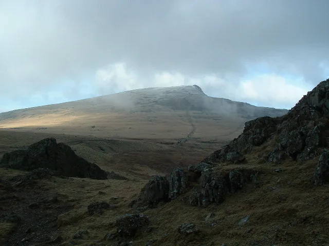
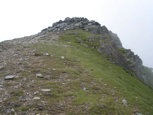
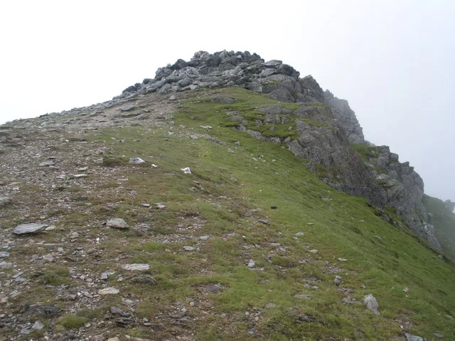
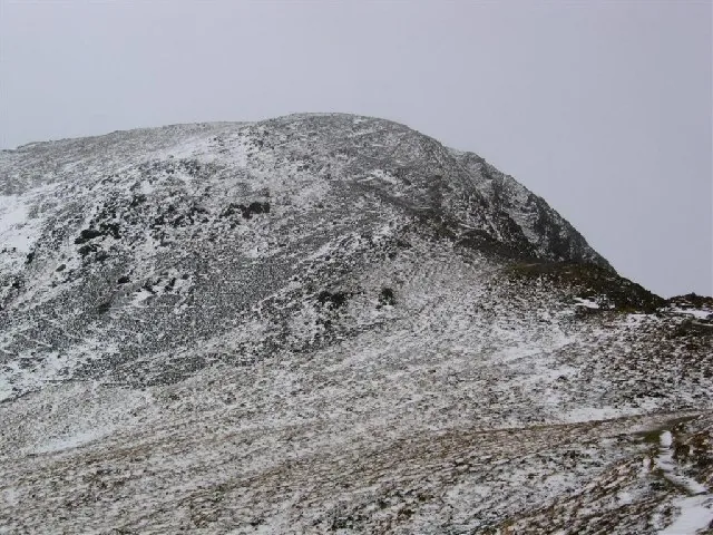
The cairn-topped summit crest of Y Garn in cloud, with a stony ridge rising to the cairn and the ground beyond lost in mist
The summit of Y Garn, in cloud

The defining feature

The cairn that names the mountain

A large cairn and shelter sits on the crest: "Y Garn" simply means "the cairn." There is no trig pillar and no building here; the stones are the summit marker, and on a day like this one they are the only thing that tells you that you have arrived.
Weather permitting

The view is a bonus, not a promise

This photograph is an honest average rather than a best day: cloud on the tops here is common enough that the panorama should be treated as luck. Clear, the summit opens north-east across the cwms and out along the Ogwen valley; clouded, it closes to a few metres of wet rock.

Wider summit context

The cwms fall away north-east

Two steep cirques, Cwm Clyd and Cwm Cywion, drop from the summit ridge toward Llyn Idwal, and Twll Du — Devil's Kitchen — cuts the crags about 1.1 km along toward Glyder Fawr. None of it is visible in this photograph; on a clear day it is the ground the Ogwen route has just climbed through.

Why it matters

Navigation is the real demand

Both routes cross broad, largely featureless upper ground, and independent guides flag poor-visibility navigation — not technical difficulty — as the main hazard on this mountain. In conditions like these, knowing your line off the summit matters more than anything the climb asked on the way up.

The way down

Before you leave the summit.

No alternative descent has been verified for the Ogwen route: reversal is the only confirmed way down. Read the notices, then make the call.

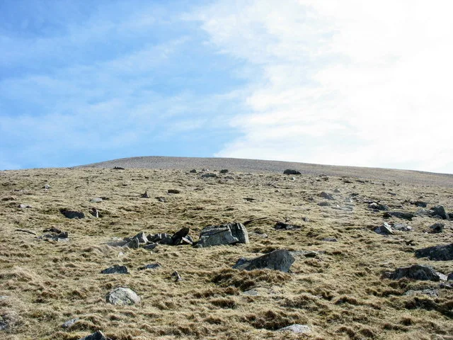
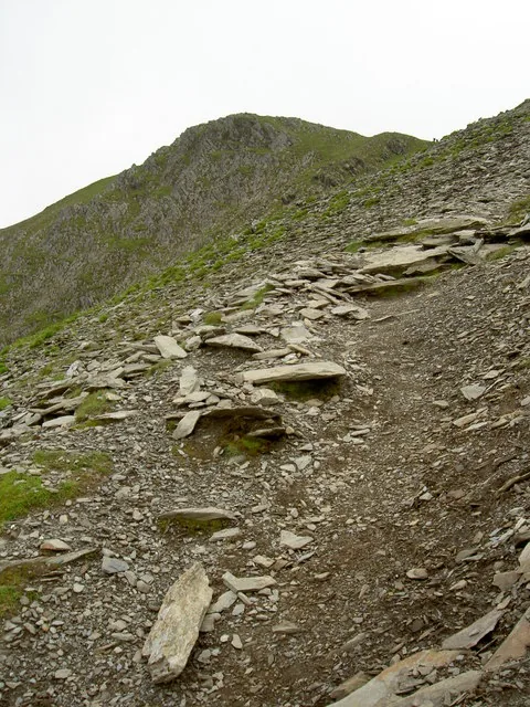
A rocky path on the final approach to Y Garn
Summit noticeboard
1

Navigation near the summit

Poor-visibility navigation is flagged as the main hazard on both routes: more than technical difficulty.

  • Fix the descent line before you leave the summit.
  • Carry a map and compass. Do not rely on a phone alone.
  • If unsure, stop and re-check.
Common mistake
2

Fading light

There's no shortcut down and no shortcut back. Do not get caught out.

  • Turn around early enough to avoid a late finish.
  • Keep headtorches ready.
  • Plan for slower progress than you expect.
Turn back early
3

Changing weather, real winter risk

A snow cornice collapsed on the descent ridge in December 2011, with a fatal fall. Treat winter conditions seriously.

  • Carry an ice axe and crampons if snow or ice is present.
  • Check the mountain forecast before you leave the summit.
  • Keep well back from cornices on the descent ridge.
Real hazard
4

Transport is not rescue

Neither start point is a rescue plan: OVMRO covers this ground on call, 24 hours a day.

  • Dial 999, ask for Police then Mountain Rescue.
  • Do not rely on signal, luck, or a bus connection.
  • Self-reliance keeps the group safe.
Know the plan

Back in the valley.

The mountain casts a long day. These are the places around it.

On the Atlas

Continue from Y Garn.

Above Cwm Idwal, in the Glyderau.

Open Y Garn on the map

Continue exploring

The path ends.Y Garn stays with you.

Take the quiet of the ridge into the wider landscape.