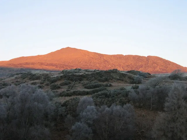
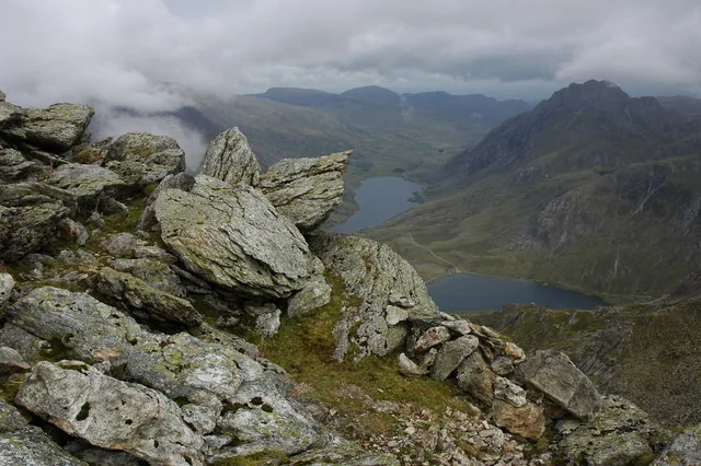
Eryri · Conwy County Borough · Mountain

Tryfan917 m · every route is a scramble

The one Ogwen Valley summit you climb with your hands as much as your feet. A Grade 1 ridge, two quieter lines, and two stones at the top that ask how far you want to take it.

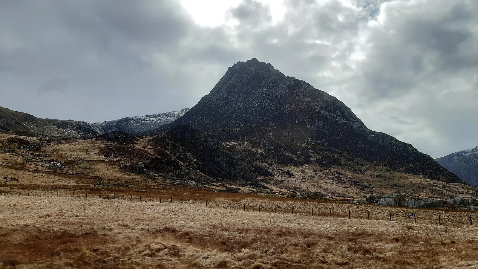
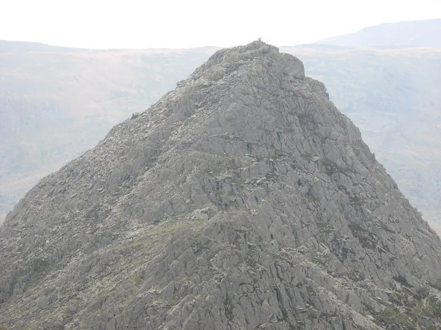
Tryfan stands right over the A5 in the Ogwen Valley, one of the very few British mountains where no route to the summit lets you keep your hands in your pockets.

Height
917 m
Ways up
3 scrambling routes
Commitment
A full mountain day, any line
Terrain
Rock-ridge scrambling, scree, gullies
Exposure & navigation
Serious exposure, every line

Choose your route

Three ways up. None of them a walk.

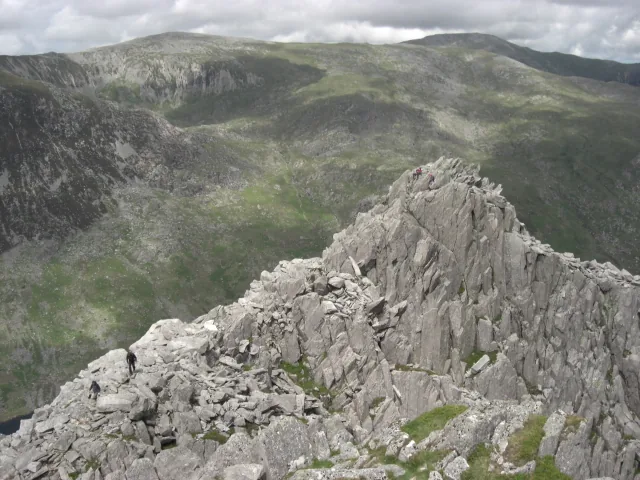
The North Ridge is the classic line: a Grade 1 scramble BMC itself recommends as an introduction to the sport. The South Ridge is the usual way down, and an easier way up. Heather Terrace needs fewer hand-holds but demands careful navigation. Pick one and the board below redraws to it.

Ways up

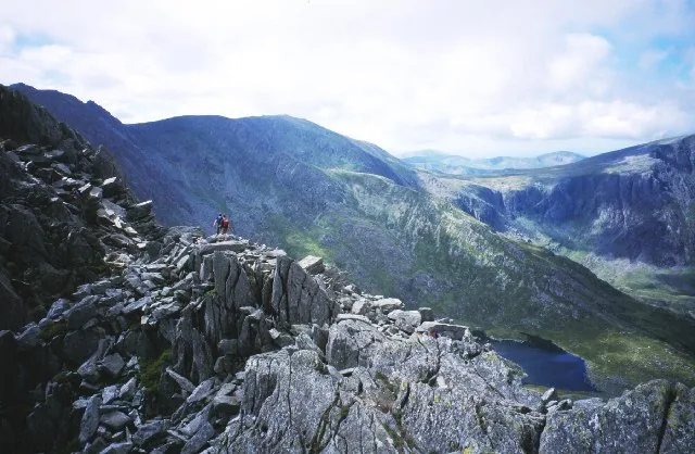
Tryfan's North Ridge: scree, a rock step, then quartz slabs toward the North Tower
Your line
  1. 1
    A5 layby, Milestone ButtressThe path leaves the road directly, with no approach walk-in.
  2. 2
    Scree and a rock stepThe scrambling begins in earnest.
  3. 3
    Quartz slabsThe ridge's signature rock, past the Canon Stone.
  4. 4
    The North TowerThe crux: bad weather can leave this section treacherously slippery.
  5. 5
    Trig point & Adam and EveThe summit, and its twin rocks.

Grade 1 for most of its length, with the odd move that would feel like Grade 2 in exposed terrain. Straying into the gullies either side of the ridge is a known trap. Reverse the ridge if you lose the line, never the gullies.

  1. 1
    Idwal CottageThe Ogwen NPA car park, across the valley from the North Ridge start.
  2. 2
    Cwm BochlwydThe approach into the corrie below the ridge.
  3. 3
    The South RidgeStill a scramble: don't treat it as a walk-off.
  4. 4
    Bwlch TryfanThe col where the ridge meets the wider Glyderau.
  5. 5
    Tryfan summitTrig point, and Adam and Eve.

Described as easier than the North Ridge, though still genuinely a scramble. Most commonly used as the descent after climbing the North Ridge, but usable as a gentler ascent from Idwal Cottage via Cwm Bochlwyd.

  1. 1
    The East FaceThe line begins along Tryfan's eastern flank.
  2. 2
    The narrow ledgeRoute-finding is the real difficulty: the path can easily be lost.
  3. 3
    Far South PeakWhere the terrace joins the South Ridge.
  4. 4
    Onward to the summit ridgeThe final stretch shares ground with the South Ridge.
  5. 5
    Tryfan summitTrig point, and Adam and Eve.

By picking the route carefully, it's possible to reach the summit largely hands-free, but this is mountainous terrain with a genuinely difficult-to-follow path, and there have been fatalities. Don't mistake fewer hand-holds for an easy walk.

Practical brief

Your route in practice ·

The classic line, from the A5.

Start point
A5 layby near Milestone Buttress, or Gwern Gof Uchaf farm (western flank of Tryfan Bach)
Parking / booking
No booking needed. Roadside laybys are reported free but small, so arrive early, especially at weekends. The managed Ogwen car park is further away but has facilities (card only).
Public transport
The TrawsCymru T10 runs the A5 through the valley; the Bws Ogwen minibus from Bethesda publishes no fixed timetable. Check the current service before travelling.
Facilities
No toilets at the layby starts. The nearest are at the Cwm Idwal Centre, Ogwen.
Return / descent
No safe gully escape exists. Reverse the ridge, or continue to the summit and descend via the South Ridge.
Avoid this route if
Poor visibility, wet or windy conditions, or you're not comfortable with sustained hands-on scrambling.

The gentler line, from Idwal Cottage.

Start point
Idwal Cottage / Ogwen car park, via Cwm Bochlwyd
Parking / booking
No booking needed. The managed Ogwen (Cwm Idwal) car park, card/contactless only.
Public transport
The TrawsCymru T10 stops at Ogwen; the Bws Ogwen minibus from Bethesda publishes no fixed timetable. Check the current service before travelling.
Facilities
Toilets and showers at the Cwm Idwal Centre, 24-hour access.
Return / descent
No alternative escape or descent has been verified for this guide. Still a scramble, so don't treat it as a walk-off in either direction.
Avoid this route if
Assuming this line is an easy walk throughout. It isn't.

The quieter line, along the East Face.

Start point
East Face, joining the South Ridge near Far South Peak
Parking / booking
Same A5 layby / Ogwen options as the other two lines, not generalised from one to another.
Public transport
Same T10 / Bws Ogwen options. Check the current service before travelling.
Facilities
No toilets on this line. Nearest at the Cwm Idwal Centre, Ogwen.
Return / descent
No alternative escape or descent has been verified for this guide.
Avoid this route if
You're relying on it as an "easy" alternative. The navigation is genuinely difficult, and there have been fatalities on this line.

Checked 16 July 2026 against the British Mountaineering Council, Eryri National Park Authority and the National Trust. Check current parking, transport and ground conditions before you go.

Before you go

Need the exact mountain details?

Parking, transport, dogs, the routes, and safety — checked before you go.

Parking & booking
  • A5 layby, Milestone Buttress / Tryfan Bach: reported free, roadside, and small; not council-confirmed. Quiet on weekdays, fills early at weekends.
  • Ogwen (Cwm Idwal) car park: £6.00/day (expires midnight), £3.00 for up to 4 hours, 2 Blue Badge bays, EV charging, card/contactless only (no cash). Open parking area (opens in a new tab).
  • Gwern Gof Uchaf farm: a private National Trust tenant farm at the head of Llyn Ogwen, offering an alternative North Ridge start; its own parking/camping terms weren't confirmed in this research pass, so arrive prepared to pay and to be turned away. Open the farm entrance (opens in a new tab). The farm itself; the terms, not the location, are what is unconfirmed.

Details from Eryri National Park Authority · Ogwen (opens in a new tab).

Public transport

The TrawsCymru T10 (opens in a new tab) (Bangor–Bethesda–Betws-y-Coed–Corwen) runs the A5 through the valley and stops at Llyn Ogwen. Partneriaeth Ogwen also runs the Bws Ogwen electric minibus from Bethesda, but it publishes no fixed timetable page. Check the current service before travelling.

Toilets, food & water

No toilets are confirmed at any of the three lines' own trailheads. The nearest are at the Cwm Idwal Centre, Ogwen, with showers and 24-hour access. There is no food or water source on the mountain itself between the car park and the summit, on any route.

Dogs & livestock

No dog rule specific to Tryfan is published. This is National Trust open-access farmland with grazing sheep, and a hands-and-feet scramble. Most dogs, and most owners, are better suited to a different day.

Routes & approach differences

The North Ridge (Grade 1, BMC) is the classic line. The South Ridge is the usual descent and an easier ascent alternative, though still a scramble. Heather Terrace needs fewer hand-holds but is genuinely difficult to navigate, and not an easy or safe alternative to the two ridges. No route on Tryfan carries an official waymarked status: all three are well-documented, de-facto lines assembled from British Mountaineering Council and specialist route descriptions, not a National Trust or National Park-designated path.

Weather, visibility & winter conditions

Cloud and mist are a genuine hazard on Tryfan. Losing the line matters as much as the ground underfoot, especially with gullies close on both sides of the North Ridge. Rock left wet by bad weather is treacherously slippery, BMC's own guidance warns, and wind that feels manageable at valley level can be a different proposition higher up the ridge. Snow or ice can turn Tryfan into a winter mountaineering objective. Conditions may require an ice axe and crampons, together with the skills to use them; turn back if you are not properly equipped or experienced.

The Met Office publishes a location forecast named for Tryfan (opens in a new tab); MWIS (opens in a new tab) publishes a regional mountain forecast for Eryri/Snowdonia covering the Glyderau. Read both, and read them as inputs rather than answers. A location forecast does not replace your own judgement about summit wind, cloud, visibility, snow and ice on ground this steep.
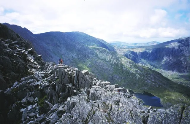
Descent planning & route mistakes

No safe gully escape exists from the North Ridge, and no alternative descent has been verified for the South Ridge or Heather Terrace. Reversal is the only confirmed plan on every line. Straying into the gullies either side of the North Ridge is a known trap, not a shortcut down.

Emergency & what not to rely on

Dial 999 or 112 and ask for Police, then Mountain Rescue (emergencySMS also works if registered). Ogwen Valley Mountain Rescue Organisation covers this mountain. The T10 bus and the roadside car parks run to a timetable, and neither is a rescue plan.

Accessibility & realistic limitations

No route to Tryfan's summit is a walking-only day: every line involves genuine hands-on scrambling, and none is step-free or suitable for anyone uneasy on exposed rock. Heather Terrace has fewer hand-holds than the two ridges, but its genuinely difficult navigation and the fatalities recorded on it mean it is not a beginner or family alternative.

Sourced from the British Mountaineering Council, Eryri National Park Authority, the National Trust and Ogwen Valley Mountain Rescue Organisation, checked 16 July 2026.

The reckoning

Now, is today the day?

You've seen the three lines; the last question is the weather. Judge the day by the ridge, not the valley.

The Met Office link is a location forecast named for Tryfan; MWIS is a regional mountain forecast for Eryri/Snowdonia. Read them together. A location forecast is not a substitute for judging summit wind, cloud, visibility, snow and ice yourself.

  • Location forecast, not a summit verdict

    The Met Office lists a location forecast for Tryfan, and MWIS covers the Glyderau in its regional view. Neither is a summit-specific mountaineering forecast. On this ground they inform the decision rather than make it.

  • Read the ridge, not the valley

    BMC's own guidance is direct: bad weather can leave the rock treacherously slippery, and wind that's manageable at Ogwen can turn the North Tower into a different proposition.

  • Navigation is the real hazard

    On every one of the three routes, losing the line — not the climbing itself — is what catches people out, especially in cloud.

Treat snow and ice as winter conditions. No official mandatory-equipment requirement is published for Tryfan specifically, but a 917 m Welsh summit holds snow and ice like any other, so don't assume a route is in summer condition without checking first.

Good fit for

  • Hillwalkers ready to progress into scrambling
  • Parties comfortable navigating in poor visibility
  • Anyone specifically wanting the Adam and Eve moment

Think twice if

  • You want a walking-only mountain day, but no such route exists here
  • You're uneasy on exposed rock
  • You lack scrambling experience to fall back on when conditions turn

What the climb gives back.

You climb for the moment at the top. Tryfan's is a physical one: two stones, a stride apart, and a choice about how far you take it.

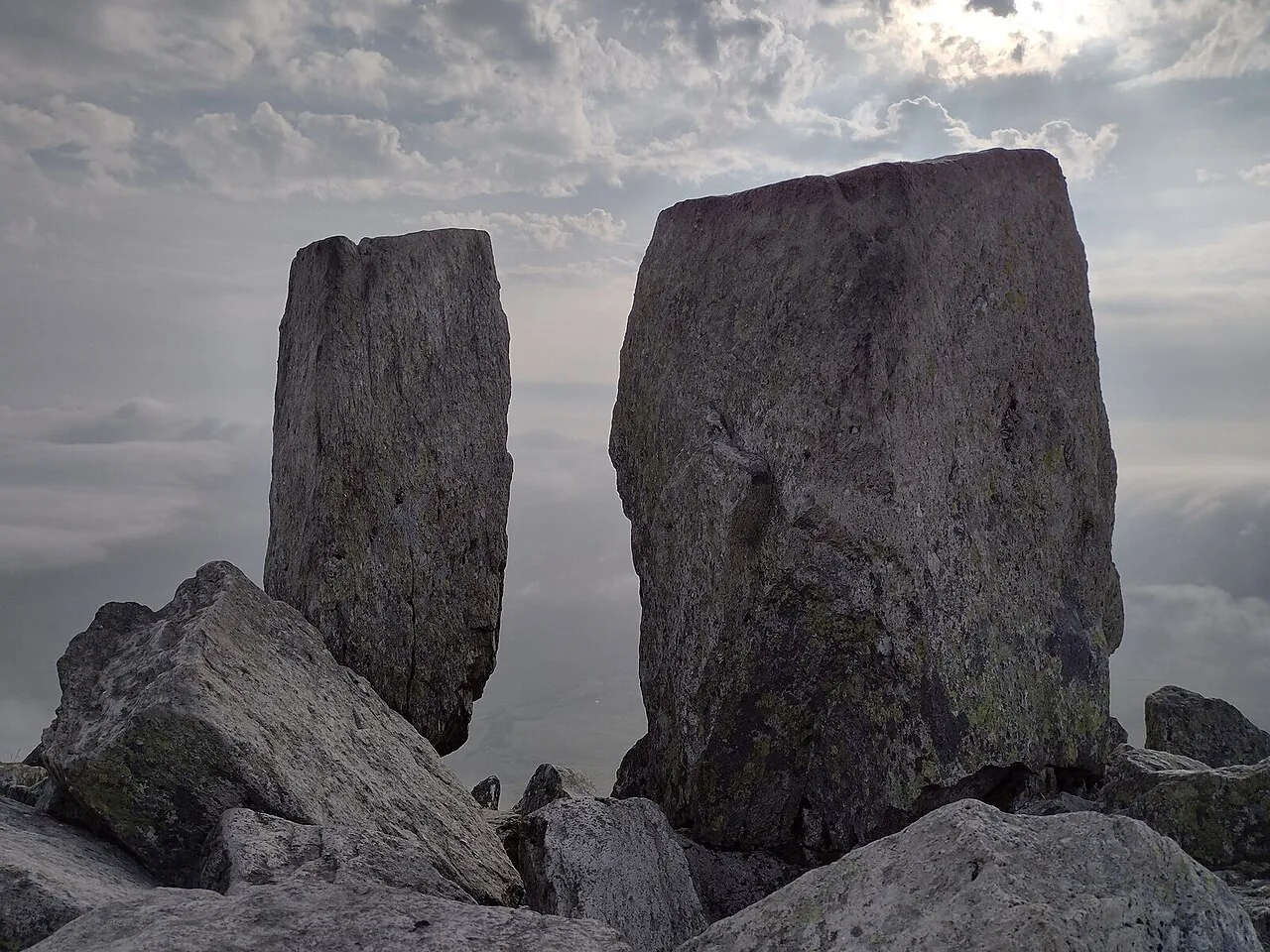
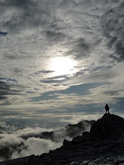
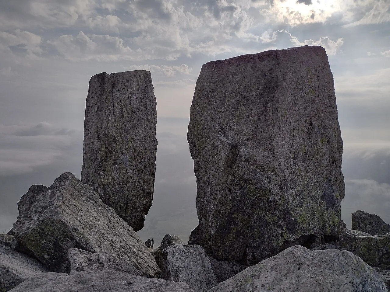
Adam and Eve, the twin summit rocks of Tryfan, standing a stride apart with cloud filling the valley below
The summit of Tryfan

The defining feature

Two stones, a stride apart

Adam and Eve, or Siôn a Siân, stand 1.2 metres apart on the summit. Stepping between them is the traditional “Freedom of Tryfan,” though mountain writer Frank Showell Styles warned that “the penalties of failure are unpleasant in the extreme.” Plenty of people change their mind once they're actually standing here.

Underfoot

A summit made of rock

There's no flat top here: just broken, angular stone in every direction, the two standing pillars rising straight out of a jumble of shattered blocks. The summit is small and uneven; wherever you stand, it's bare rock, not turf or path.

On the day

When cloud takes the view

In clear conditions the BMC describes “vertiginous views in every direction” from the summit push, opening out across the Ogwen Valley and the wider Glyderau. This photograph shows the other version: cloud filling the space below the rocks, the valley and the peaks around it lost from sight. Which one you get isn't something you can plan for, only be ready for either.

The way down

Before you head down.

A dated 2024 rescue on this exact ridge tells the story plainly: it's the descent, not the climb, that catches people out. Read the notices, then make the call.

Descent notes
1

Don't stray into the gullies

BMC's own guidance warns you can end up in a gully and be unable to escape. A 2024 rescue on this exact ridge began the same way.

  • Reverse the ridge you climbed.
  • Never treat a gully as a shortcut down.
Know the way down
2

Weather turns fast

Wet rock is treacherously slippery on this mountain, and conditions can shift while you're still on the ridge.

  • Turn back before the cloud or wind decides for you.
  • Keep a buffer for the descent.
Turn back early
3

Tired group

Fatigue slows decisions and increases risk, especially on scrambling terrain.

  • Watch for lagging, quiet or unsteady walkers.
  • Take a proper break before the descent.
Know your limits
4

No transport reaches the ridge

The T10 bus and the Ogwen car park run to a timetable, at the roadside, not partway up the mountain.

  • Plan your own way down, on foot, in full.
  • Don't rely on a bus, signal, or luck.
Plan, don't rely

Back in the valley.

The Ogwen Valley holds more than one mountain. These are the places around it.

On the Atlas

Continue from Tryfan.

Right over the A5, between the Carneddau and the wider Glyderau.

Open Tryfan on the map

Continue exploring

The scramble ends.Tryfan keeps its hold.

Carry the sharpness of the ridge into the wider Ogwen Valley.