Eryri · Gwynedd · Mountain

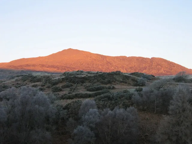
Cnicht691 m · the Matterhorn of Wales, above Croesor

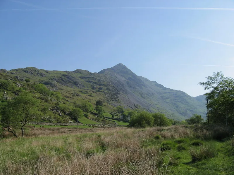
A short, characterful scramble from Croesor, or a far longer, boggy day from the north. The pyramid you see from Porthmadog is the end of a ridge, not a peak.

A 691 m summit at the end of a ridge in the Moelwynion, above Croesor: the "Matterhorn of Wales" seen from the south-west, and a short Grade-1 scramble up close. What the climb asks of you depends on the line, so read the routes before you read the weather.

Height
691 m
Ways up
Two · the Croesor scramble or the long north
Commitment
About 4–4½ hrs from Croesor
Terrain
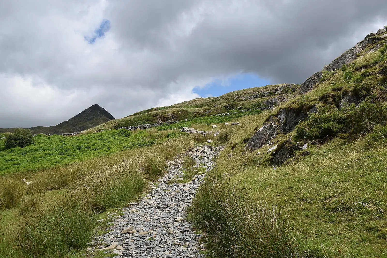
Lane, bog, and a short rock scramble
Exposure & navigation
Low exposure; hard navigation past the top

Choose your lineChoose your route

Two ways up. Only one is yours today.

The short, classic scramble from Croesor, or the far longer, boggy northern approach from Nantmor, not interchangeable, and only the lower half is waymarked. Pick by length and navigation. The whole board below redraws to your line: its terrain, its shape, its numbers.

Walking routes

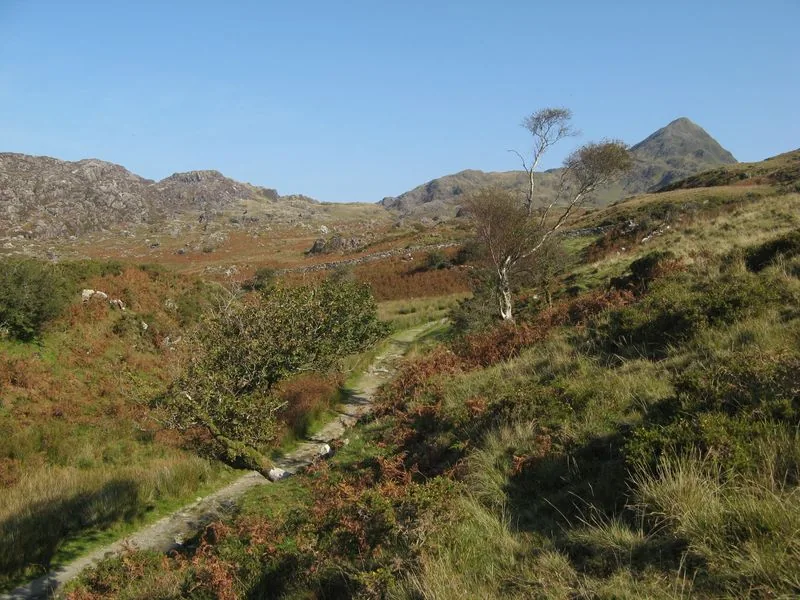
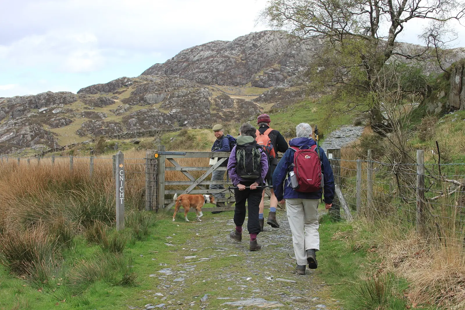
Walkers on the ridge climbing toward Cnicht from Croesor
Your line
1 2 3 4 5 6
  1. 1
    Croesor car parkFree Eryri NP car park (LL48 6SR); a portable toilet is usually here. Easiest turn-around.
  2. 2
    The lane out of CroesorPast the old school and chapel, then onto open hillside above the village.
  3. 3
    Onto the south-west ridgeThe broad ridge that gives Cnicht its pyramid profile from below. Last easy retreat.
  4. 4
    The scramble stepA short Grade-1 rock step just below the top: you will use your hands, but it is brief.
  5. 5
    The summit outcropsThe middle of three rocky outcrops; Tremadog Bay and Moelwyn Mawr open out.
  6. 6
    691 mBwlch y RhosyddThe old quarry road home through slate ruins into Cwm Croesor.
1 2 3 4 5 6
  1. 1
    Nantmor / BeddgelertStart from the Aberglaslyn side; nearest rail is Porthmadog. Easiest turn-around.
  2. 2
    The moorland trackA track climbs onto open moorland above Nantmor.
  3. 3
    Open moorlandBoggy, tussocky ground with faint paths, high above the Aberglaslyn gorge.
  4. 4
    Faint moorland to the topSometimes pathless ground toward the summit. Navigation in mist is the main hazard.
  5. 5
    The summit outcropsThe same rocky top, reached the long way, over Cwm Croesor.
  6. 6
    691 mToward Llyn DinasA long descent through the Glaslyn and Llyn Dinas country back to the start.

Practical brief

Your lineroute in practice ·

The classic line: a wooded lane, the SW ridge, and a short scramble to a false-pyramid summit.

Start point
Free Eryri NP car park, Croesor (LL48 6SR): open the car park in Google Maps
Parking / booking
Free, no booking, but small; fills on fine weekends. Single-track approach roads with passing places.
Public transport
No regular bus into Croesor. Plan to drive. Nearest rail is Porthmadog; check Traveline Cymru.
Facilities
A portable toilet is usually at the car park (not guaranteed). Nothing on the mountain.
Return / descent
The graded quarry track from Bwlch y Rhosydd, or reverse the ridge.
Avoid this route if
You won't scramble a short rock step, or can't navigate faint moorland in cloud.

A far longer, committing day from the north: boggy underfoot, serious in mist.

Start point
Nantmor or Beddgelert, on the Aberglaslyn side
Parking / booking
Car parks at Nantmor and in Beddgelert (charges apply). Confirm current details before you go. Open the Beddgelert parking area. No location pin was found for the Nantmor car park.
Public transport
Buses serve Beddgelert (e.g. the Snowdon Sherpa): frequency not confirmed; check Traveline Cymru.
Facilities
Toilets and cafés in Beddgelert; nothing on the mountain.
Return / descent
A long circuit, often through the Glaslyn / Llyn Dinas country, not a reversal.
Avoid this route if
You want a short day, or lack confident navigation over remote, boggy ground.

Route figures: no Eryri National Park register exists for Cnicht. Figures are Tier-2 specialist route guides, hedged and checked 24 July 2026. The Croesor circular varies ~10–10.5 km / ~515–576 m of ascent by source. Parking and transport change. Confirm before you go. Official planning source: Eryri National Park · safety and planning advice

Before you go

Need the exact mountain details?

Parking, transport, toilets, dogs, weather, emergency and descent planning: checked before you go.

Parking & booking

Checked 24 July 2026 — confirm before you travel via Eryri National Park — parking (opens in a new tab).

Public transport

There is no regular bus into Croesor. Plan to drive, and note the single-track approach roads. The nearest railway station is Porthmadog. Beddgelert, on the northern approach, is served by Sherpa’r Wyddfa (opens in a new tab) services S3 and S4; frequency has not been confirmed against a timetable for this guide. Check the current service before relying on a connection.

Toilets, food & water
  • Croesor · a portable toilet is usually present at the car park, but is not guaranteed. No café or shop in the village beyond seasonal opening.
  • Beddgelert · toilets, cafés and shops for the northern approach.
  • On the mountain · no toilets, café or shelter on either route between the start and the summit.
Dogs & livestock

Cnicht is open upland grazed by sheep, so keep dogs under close control around livestock. On Open Access Land, dogs must be on a lead no more than 2 m long between 1 March and 31 July (the breeding season), and at any time near livestock. No blanket dog ban specific to Cnicht was found for this guide, but a mountain with a scramble step and faint moorland is a serious outing for a dog.

Routes & approach differences

No Eryri National Park route register exists for Cnicht: both lines on this page are assembled from independent, Tier-2 route guides, not an NPA-designated path. The Croesor circular and the long northern approach from Nantmor are genuinely different days, not interchangeable: one is a short, characterful scramble with a good escape track; the other is far longer, boggy, and committing, with route-finding across sometimes pathless ground as the main extra demand.

Weather, visibility & winter conditions

No summit-specific webcam or ground-condition report exists for Cnicht. Use the forecasts linked above, and treat visibility as the main daily hazard: beyond the summit the paths fade across open, unsheltered moorland.

Cnicht is winter-capable. In snow or ice the short scramble step below the summit and the faint descent paths become serious. Carry an ice axe and crampons and the skills to use them, and judge cornice and avalanche risk from the MWIS Eryri forecast. No equipment mandate specific to Cnicht was found for this guide; treat winter here as a serious undertaking regardless.

Descent planning & route mistakes

The descent is the vague half of the day. On the Croesor circular the old quarry track from Bwlch y Rhosydd is a reliable, graded way down; reversing the ascent ridge is the fallback. The northern approach is a long circuit with few quick escapes.

Beyond the summit the paths fade across boggy moorland, and poor-visibility navigation — not the scramble — is repeatedly flagged as the main hazard. Fix your descent line before you leave the top.

Emergency & what not to rely on

Dial 999 and ask for Police, then Mountain Rescue. Those with hearing or speech needs can text "register" to 999 in advance to set up emergency SMS access. Give your location, what's happened, and how many are in your group.

Aberglaslyn Mountain Rescue Team covers this part of southern Eryri, including the Moelwynion and the Croesor and Aberglaslyn valleys, on call around the clock. Neither start point is a rescue plan. Carry the means to look after yourselves.

Accessibility & realistic limitations

No step-free or easy route to the summit exists on either approach: honest, not inferred favourably. A short scramble step, bog and faint paths mean this is not a first-mountain choice unaccompanied, nor a route for anyone wanting a maintained path throughout. There is no shelter, facility or café on Cnicht's summit.

Sourced from Eryri National Park Authority, the Database of British & Irish Hills, Wikipedia and independent route guides, checked 24 July 2026. The name "Cnicht" is thought to derive from English "knight": a folk etymology, not documented history.

The reckoning

Now: is today the day?

You have seen the line and the climb; the last question is the weather. Only the lower half is waymarked: in cloud, the featureless upper ground and the faint paths beyond the summit are a navigation exercise.

The Met Office link is a location forecast named for Cnicht; MWIS and the Met Office mountain forecast are regional mountain forecasts for Eryri/Snowdonia. Read all three together: a location forecast is not a substitute for judging summit wind, cloud, visibility, snow and ice yourself. Valley sun over Porthmadog does not mean a clear ridge. Judge the day by the top, not the car park.

  • No summit shelter

    There is no building, café or shelter at the top: just bare rocky outcrops, exposed to whatever the weather is doing.

  • The scramble is worse wet

    The short rock step below the summit is greasy and less forgiving in the rain, and the faint paths beyond the top turn to bog.

  • Navigation matters more than the view

    In mist, finding the line off the summit across featureless moorland matters more than the panorama: this is where people go wrong.

Winter is a different mountain. Cnicht is winter-capable; in snow or ice the summit scramble and the faint descent paths need crampons, an ice axe and the skills to use them. No equipment mandate specific to Cnicht was found for this guide. Treat winter here as a serious undertaking regardless.

Good fit for

  • Hillwalkers wanting a real mountain day at a modest height
  • Anyone happy with one short scramble step and vague moorland underfoot
  • Photographers after the Cwm Croesor and Tremadog Bay view

Think twice if

  • You want a waymarked path all the way: past the summit you won't get one
  • You're navigating in cloud without map-and-compass skill
  • You expect step-free or family-easy ground, or a shelter at the top

The summit

What the climb gives back.

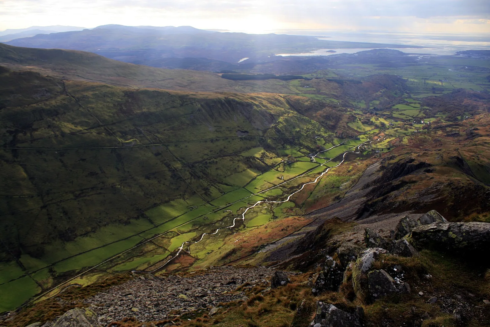
You climb for the view, and on Cnicht it is worth it. The ridge ends at a rocky pedestal over Cwm Croesor, with Tremadog Bay beyond and the Yr Wyddfa range to the north: when the cloud lets you see it.

The view down Cwm Croesor from the summit of Cnicht, the valley falling away toward Tremadog Bay
Cwm Croesor, from the summit of Cnicht

The defining feature

Three outcrops, no trig

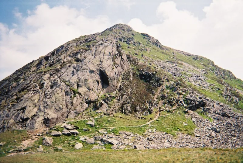
The summit is the middle of three rocky outcrops at the end of a long ridge: no trig pillar, no shelter, just the rock. It is that abrupt end of the ridge that gives Cnicht its false-pyramid look from below.
Weather permitting

The view is the reward

Clear, the pedestal opens across Cwm Croesor to Moelwyn Mawr, out over Tremadog Bay, and north to the Yr Wyddfa range. Cloud closes it to a few metres of wet rock, and makes the ground beyond far harder to read.

Wider summit context

The ridge runs on

North-east the ground drops to a scatter of moorland lakes — Llyn yr Adar and Llyn y Biswail among them — on the way to the Rhosydd quarries. None of it is a waymarked path; it is where the Croesor circuit's navigation begins.

Why it matters

Not a peak: the end of a ridge

For all the "Matterhorn" talk, Cnicht is not an isolated summit; the pyramid flattens the moment you stand on it. That matters for the descent: there is no single obvious way off, and the vague half of the day starts here.

The way down

Before you leave the summit.

Beyond the summit the paths fade: the descent is the vague half of the day. Read the notices, then make the call.

The old quarry track descending from Cnicht toward Cwm Croesor
Summit noticeboard
1

Navigation beyond the summit

Past the top the paths fade across boggy moorland: poor-visibility navigation is the main hazard here, more than the scramble.

  • Fix the descent line before you leave the summit.
  • Carry a map and compass. Do not rely on a phone alone.
  • If unsure, stop and re-check.
Common mistake
2

Fading light

There's no shortcut down and no shortcut back. Do not get caught out.

  • Turn around early enough to avoid a late finish.
  • Keep headtorches ready.
  • Plan for slower progress than you expect.
Turn back early
3

Greasy rock, real winter risk

The scramble step is greasy when wet and serious under snow or ice, and the moorland holds cloud. Treat winter conditions seriously.

  • Carry an ice axe and crampons if snow or ice is present.
  • Check the mountain forecast before you leave the summit.
  • Take the scramble step slowly when the rock is wet.
Real hazard
4

Transport is not rescue

Neither start point is a rescue plan: Aberglaslyn Mountain Rescue covers this ground on call.

  • Dial 999, ask for Police then Mountain Rescue.
  • Do not rely on signal, luck, or a bus connection.
  • Self-reliance keeps the group safe.
Know the plan

Back in the valley.

The mountain casts a long day. These are the places around it.

On the Atlas

Continue from Cnicht.

In the Moelwynion above Croesor, the ridge you see from Porthmadog.

Open Cnicht on the map

Continue exploring

The ridge ends.Cnicht stays with you.

Take the quiet of the ridge into the wider landscape.