Eryri · Conwy County Borough · Mountain

Moel Siabod872 m · highest of the Moelwynion

A quieter Eryri summit above Capel Curig: a hands-on ridge on one side, a gentler shoulder on the other, and a view the mountain doesn't always give up.

The highest ground in the Moelwynion, standing apart from the main Eryri massif above Capel Curig: a hands-on ridge on one side, a gentler shoulder on the other.

Height
872 m
Ways up
Two · a scrambling ridge or a gentler shoulder
Commitment
About 4–5 hrs on the ridge circuit
Terrain
Exposed rock and scree on the ridge
Exposure & navigation
Present on the ridge, less on the shoulder

Choose your route

Two ways up. Choose how you meet the mountain.

A hands-on, exposed ridge from Pont Cyfyng, or a gentler shoulder from Plas y Brenin with a difficult stretch near the top. Two further lines exist nearby, but this guide covers only the two approaches detailed enough to describe safely; pick one and the board below redraws to it.

Ways up

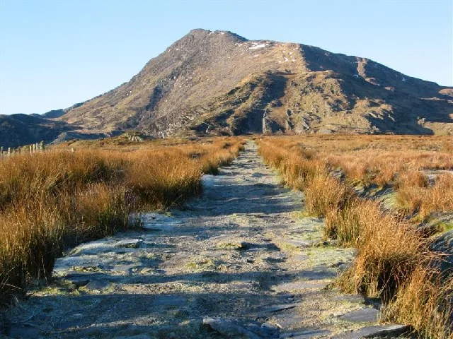
Past the old quarry track, onto exposed rock
Your line
  1. 1
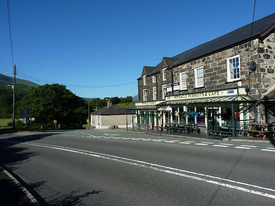
    Pont CyfyngThe start, near Capel Curig.
  2. 2
    The old Rhos quarry trackSlate-quarry remains mark the way up from Pont Cyfyng.
  3. 3
    Open groundThe track gives way to open mountain ground below the ridge.
  4. 4
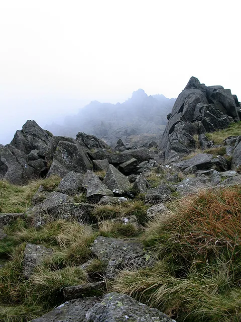
    Hands-on exposed ridgeScrambling begins: exposed rock, no visible path at times.
  5. 5
    Moel Siabod summitTrig point, wind shelter, and Eryri beyond.

Expect hands-on scrambling, exposed rocky ground and consequential terrain in places. Treat it as a scramble, not an ordinary mountain walk.

  1. 1
    Plas y BreninThe National Mountain Sports Centre, Capel Curig.
  2. 2
    WoodlandThe lower, sheltered section of the route.
  3. 3
    Open hillsideThe woodland gives way to open ground.
  4. 4
    Difficult upper sectionTurns genuinely difficult. Don't assume an easy walk throughout.
  5. 5
    Moel Siabod summitTrig point, wind shelter, and Eryri beyond.

The gentler option overall, but the final section near the summit turns genuinely difficult; avoid assuming this is an easy walk throughout.

Practical brief

Your route in practice:

The scrambling line, from Pont Cyfyng.

Start point
Pont Cyfyng, near Capel Curig, via the former Rhos slate-quarry track
Parking / booking
A free, 24-hour car park is listed under "Capel Curig" by Eryri National Park Authority; no booking system. Possibly the same car park known locally as "Bryn Glo", not independently confirmed.
Public transport
The TrawsCymru T10 stops at Capel Curig and Pont-Cyfyng. Check the current service before travelling.
Facilities
No toilets are currently confirmed at Capel Curig.
Return / descent
No alternative escape or descent has been verified for this guide. Plan to reverse this route unless you've independently planned another established line.
Avoid this route if
Poor visibility, wet rock, or you're not comfortable with hands-on scrambling and exposed rocky ground.

The gentler line, from Plas y Brenin.

Start point
Plas y Brenin, the National Mountain Sports Centre, Capel Curig
Parking / booking
No booking system confirmed; Plas y Brenin offers free parking to course attendees and centre visitors, but whether a casual walker with no booking counts isn't stated either way.
Public transport
The same T10 stops serve this general area, though a direct Plas y Brenin stop isn't confirmed.
Facilities
No toilets are currently confirmed at Capel Curig.
Return / descent
No alternative escape or descent has been verified for this guide. Plan to reverse this route unless you've independently planned another established line.
Avoid this route if
Assuming this is easy throughout: the final section near the summit turns genuinely difficult.

Checked 13 July 2026 against Eryri National Park Authority, Plas y Brenin and Traveline Cymru. Check current parking and transport details before you go.

Before you go

Need the exact mountain details?

Parking, transport, dogs, camping, the approaches, and safety — checked before you go.

Parking & booking
  • Pont Cyfyng laybys (the quarry-track start): the published route starts from the A5 laybys at Pont-Cyfyng, grid ref SH735571. Roadside, no facilities, and limited; this is the start the route description means. Open parking area (opens in a new tab).
  • Capel Curig car park: a free, 24-hour car park listed under "Capel Curig" by Eryri National Park Authority, no capacity given. It sits about 1.9 km up the A5 from the Pont Cyfyng laybys, so the two are not interchangeable starts. Whether this is the car park walking guides call "Bryn Glo" isn’t independently confirmed. Open parking area (opens in a new tab). The Authority’s own coordinate for the listing.
  • Plas y Brenin: free parking for course attendees and centre visitors; whether a casual walker with no booking counts isn't stated either way. Open Plas y Brenin in Google Maps (opens in a new tab).

Two further approaches are documented: from Pen y Gwryd and from Dolwyddelan (the latter reaching the Daear Ddu ridge). No parking location has been confirmed for either, so none is given here rather than guessed. Details from Eryri National Park parking (opens in a new tab) and Plas y Brenin's own parking FAQ (opens in a new tab).

Public transport

The TrawsCymru T10 (opens in a new tab) (Bangor–Betws-y-Coed–Corwen) stops at Capel Curig and at Pont-Cyfyng. The route is confirmed; current frequency is not. Check the current service before travelling.

Toilets, food & water

No toilets are currently confirmed at Capel Curig, at either start point. There's no food or water source on the mountain itself on either route.

Dogs & livestock

Dogs must be on a lead of no more than 2 metres on Open Access Land between 1 March and 31 July, and under close control near livestock at all times; a farmer may legally act against a dog attacking livestock. No route-specific dog ban is confirmed for either approach on this mountain.

Routes & approach differences

The Daear Ddu ridge (from Pont Cyfyng) involves hands-on scrambling, exposed rocky ground and consequential terrain. The Plas y Brenin path is the gentler option, but its final section near the summit turns genuinely difficult, not an easy alternative throughout. Allow half a day for the shoulder route; the ridge takes longer.

Two further named approaches — from Pen y Gwryd and from Dolwyddelan — exist, but aren't detailed enough here to describe safely; this guide covers the two approaches above only.

Weather, visibility & winter conditions

Wind on the Daear Ddu's exposed sections can feel like a different climb from what the valley suggested, and cloud on either line makes route-finding harder than the ground itself. Wet rock adds real difficulty to the scramble. Snow or ice can turn either line into a winter mountaineering day; no official equipment mandate is published for this mountain specifically, but an ice axe and crampons may be needed depending on conditions.

The Met Office publishes a location forecast named for Moel Siabod (opens in a new tab); MWIS (opens in a new tab) publishes a regional mountain forecast for Eryri/Snowdonia. Read both, and read them as inputs rather than answers: a location forecast does not replace your own judgement about summit wind, cloud, visibility, snow and ice. No summit webcam or ground-condition report exists for this mountain specifically.

Descent planning & route mistakes

Neither route has a verified alternative descent; reversal is the confirmed plan on both the ridge and the shoulder. The Plas y Brenin path's difficult final section, flagged on the way up, is just as awkward reversed on the way down; don't assume the gentler line stays gentle in both directions near the top.

Emergency & what not to rely on

Dial 999 or 112 and ask for Police, then Mountain Rescue. No specific mountain rescue team is confirmed as covering this mountain. The T10 bus and the free car parks run to a timetable; neither is a rescue plan.

Accessibility & realistic limitations

Neither route is flat or step-free; the Daear Ddu is genuine hands-on scrambling throughout, and the gentler Plas y Brenin line still turns genuinely difficult near the summit. Neither is a first-mountain or family walk, and no toilets or facilities are confirmed at either trailhead.

Specific to this mountain

Wild camping

Wild camping isn't permitted anywhere in Eryri without the landowner's or farmer's permission.

Sourced from Eryri National Park Authority, Plas y Brenin and Traveline Cymru, checked 13 July 2026.

The reckoning

Now: is today the day?

You've seen the two lines; the last question is the weather. Check the Moel Siabod forecast, and judge the day by the ridge, not the valley; no site-specific ground-condition report exists for this summit (that resource covers Yr Wyddfa only).

The Met Office link is a location forecast named for Moel Siabod; MWIS is a regional mountain forecast for Eryri/Snowdonia. Read them together: a location forecast is not a substitute for judging summit wind, cloud, visibility, snow and ice yourself.

  • Check the forecast for this summit

    Use the Moel Siabod forecast, or the wider Eryri mountain forecast for regional hazards; this mountain has no summit webcam or ground-condition report of its own.

  • Read the ridge, not the valley

    The Daear Ddu ridge in particular carries real exposure; wind that's manageable in the valley can turn a ridge into a different proposition.

  • Weather changes by the hour

    Weather in upland areas of Eryri can change within hours, not days; the general park-wide caution applies here as much as anywhere.

Treat snow and ice as winter conditions. This is still an 872 m Welsh summit that will hold snow and ice like any other; check the regional forecast and don't assume a route is in summer condition (no site-specific winter resource exists for this mountain).

Good fit for

  • Walkers comfortable navigating without continuous waymarking
  • Anyone willing to handle exposed, hands-on scrambling on the Daear Ddu ridge
  • A quieter, more self-reliant mountain day

Think twice if

  • You need a fully waymarked route throughout
  • You're not comfortable with hands-on scrambling
  • This would be a first mountain; neither line is a beginner's introduction

What the climb gives back.

You climb for the view, but the mountain does not always give it. On clear days the summit opens onto much of Eryri; on cloud days, the trig point and the ground underfoot are the reward.

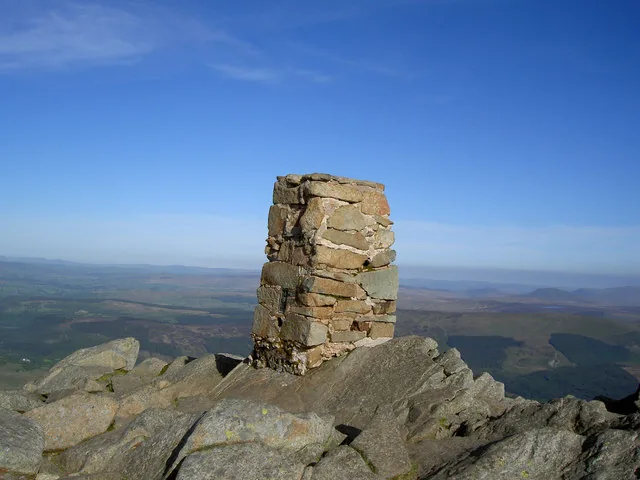
The stone trig point on the summit of Moel Siabod, standing on bare rock with a hazy panorama of Eryri behind
The summit of Moel Siabod

The summit markerVisible feature

The trig point

A stone-built trig pillar stands on bare rock at the highest point: the one fixed, unambiguous marker of the summit.

Why it mattersIn cloud, this is the one thing you can be certain of reaching; everything else about the day is conditional on the weather.
Beyond the rockGeneral view

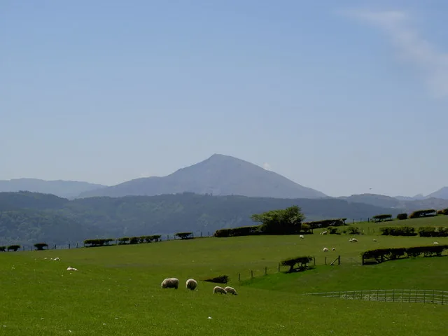
The Eryri panorama

Hazy high ground rolls away on every side: genuinely open, though this particular day doesn't offer enough clarity to name a single peak in frame.

Why it mattersSources disagree on exactly how many named summits are visible from here; treat any specific count as an estimate, not a fixed fact.

The way down

Before you head down.

Most of a mountain day's trouble comes after the top. Read the notices, then make the call.

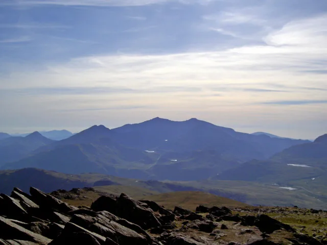
Layered blue ridges falling away toward the Snowdon massif on the skyline, seen over broken rock from the top of Moel Siabod
Descent notes
1

Plan your own way down

No alternative escape or descent has been verified for either line on this mountain.

  • Plan to reverse your chosen route.
  • Don't assume a shortcut exists.
Know the way down
2

Weather turns fast

Upland weather in Eryri can change within hours, not days.

  • Turn back before the cloud or wind decides for you.
  • Keep a buffer for the walk out.
Turn back early
3

Tired group

Fatigue slows decisions and increases risk.

  • Watch for lagging, quiet or unsteady walkers.
  • Take a proper break.
  • If needed, choose the safer option.
Know your limits
4

Transport is not rescue

The T10 bus and the free car parks run to a timetable, not to you.

  • Plan your own way down and out.
  • Don't rely on a bus, signal, or luck.
Plan, don't rely

Back in the valley.

The mountain casts a long day. These are the places around it.

On the Atlas

Continue from Moel Siabod.

Above Capel Curig, standing apart from the main Eryri massif.

Open Moel Siabod on the map

Continue exploring

The ridge falls quiet.Moel Siabod still stands apart.

Take its quieter character into the wider landscape of Conwy.