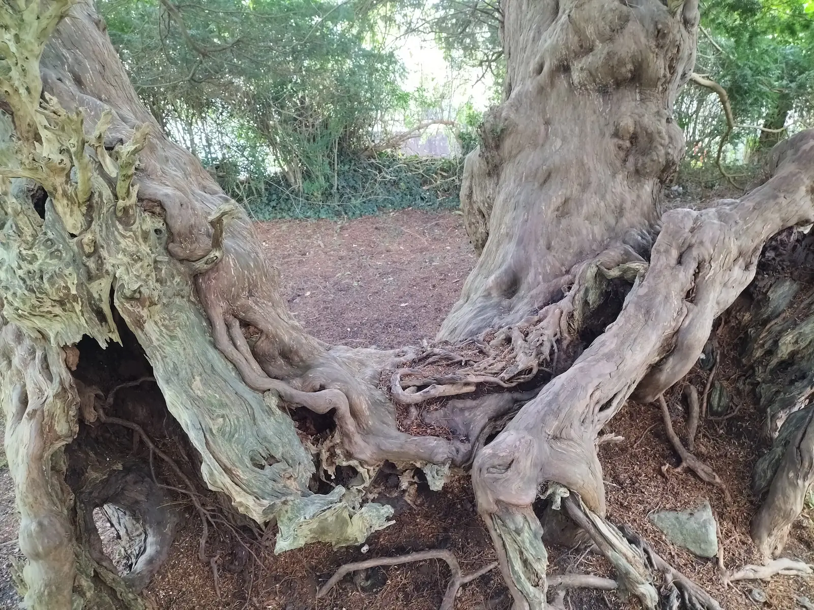
The tree with nothing in the middle
What looks like a small grove is one tree, its heartwood long gone, live wood still winding around the space where it stood.
Conwy · the Elwy valley
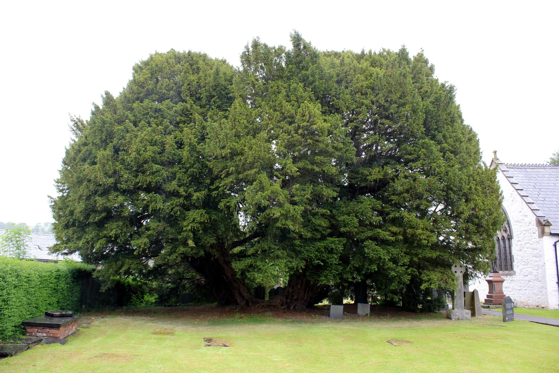
Three rivers meet here and leave as the Elwy. In the churchyard above them stands a yew that was already old when the parish was new.
01The village
Llangernyw sits on one road. The A548 comes over the hills from the coast, drops to a crossing at the bottom of the village and climbs away towards the Conwy valley; the churchyard, the shop and the toilets are all within a hundred metres of that dip. The cottage museum is three hundred metres south on the same road, the old bridge two hundred and fifty east, and a lane runs west towards a Gothic hall in the trees.
Almost everything else in this county asks for a day. Llangernyw asks for forty minutes and gives you something nowhere else in Wales can: a living thing older than the building, the parish and probably the language that named it.
Character
A community of about 1,100 people, only a few hundred of them in the village itself, and a clear majority Welsh-speaking. There is a shop, a pub, a school and a church, and no visitor economy built on top of them.
Pace
The churchyard alone takes about forty minutes. Adding the museum frontage and the bridge makes an hour and a half on foot. A published circular walk of 6.1 km loops out through the valley in roughly two hours.
Landscape
The Cledwen, the Collen and the Gallen converge at the village, and the water leaves it as the Elwy. Pasture and hedged fields rise on both sides; the valley opens northward towards Abergele.
Best for
Best for anyone crossing between the coast and the Conwy valley with an hour spare, for churchyard and early-medieval-stone interest, and for walkers on the North Wales Pilgrim’s Way.
02Discover
What looks like a small grove is one tree, its heartwood long gone, live wood still winding around the space where it stood.
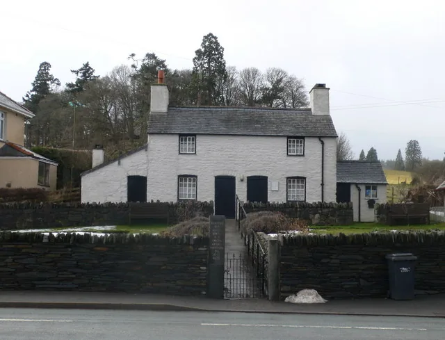
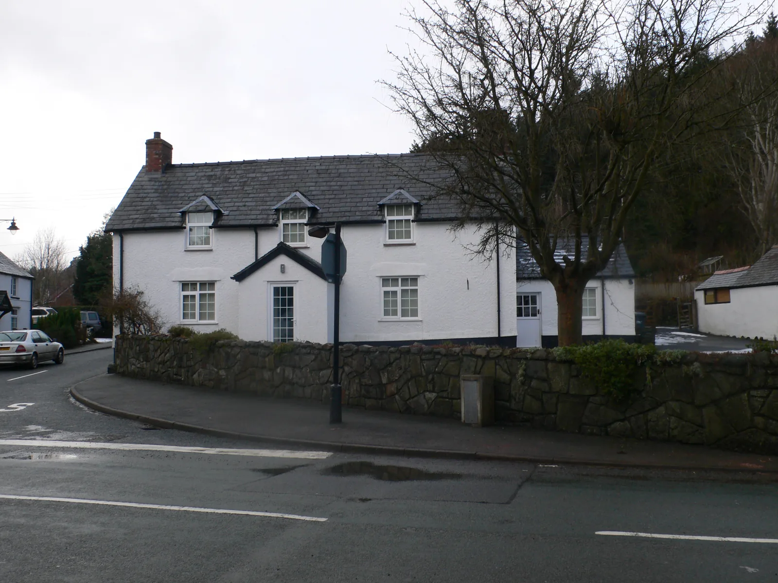
The cottage where a shoemaker’s son studied at night before leaving for a professor’s chair in Glasgow, kept as he knew it.
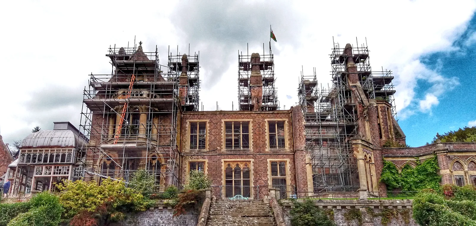
A mile west, the only secular building Scott ever raised in Wales stands scaffolded above its terraces, twenty years on from the fire.
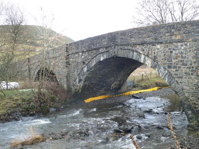
Walk east out of the village and you can stand over the water that only takes the name Elwy from here.
Beyond the first defining moments, the fuller Llangernyw catalogue continues below.
One road through the village, with the churchyard on it. Three of the four points are within three hundred metres of the crossing; the fourth is a mile west along a lane.
 No verified image yet
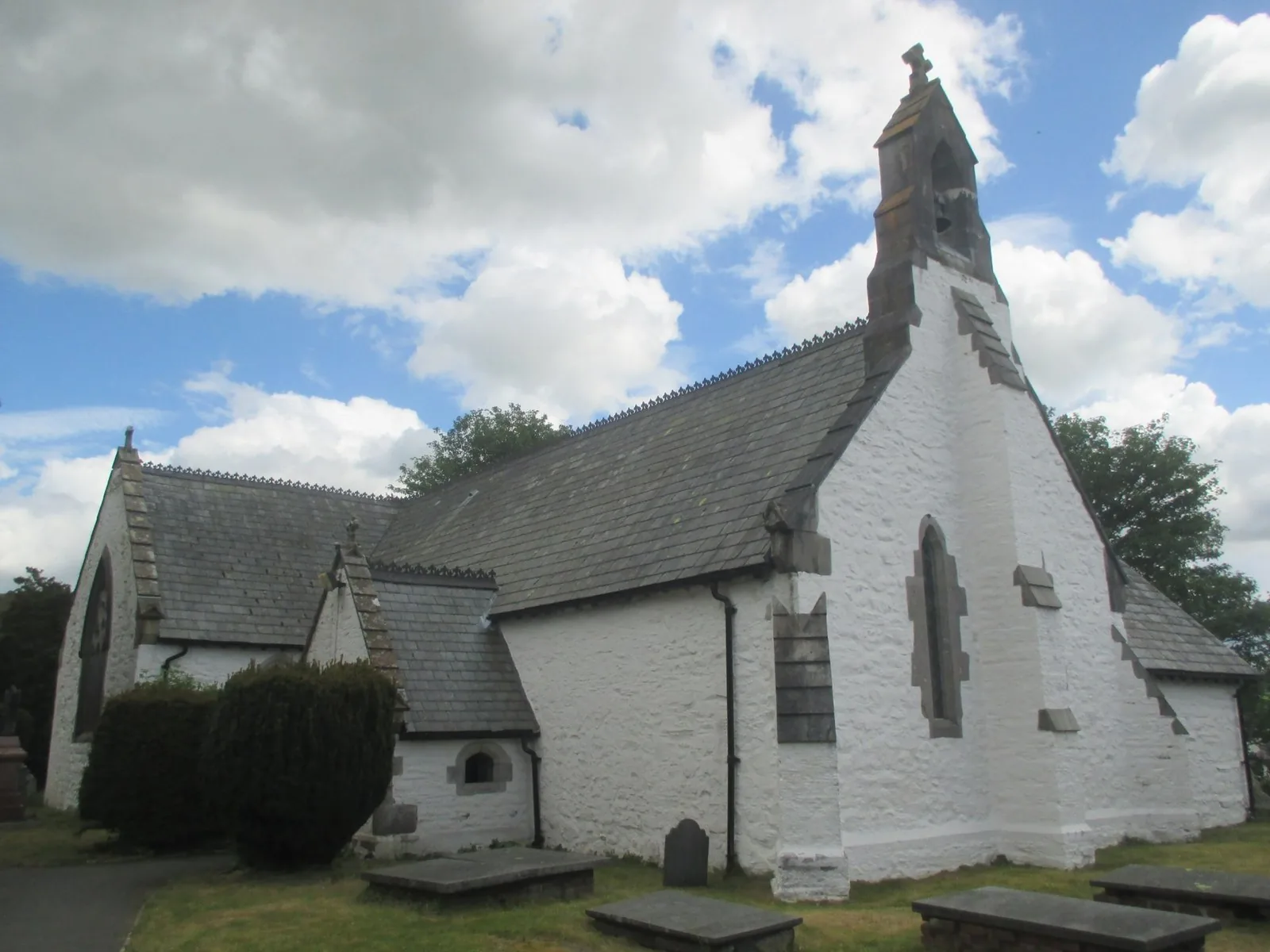
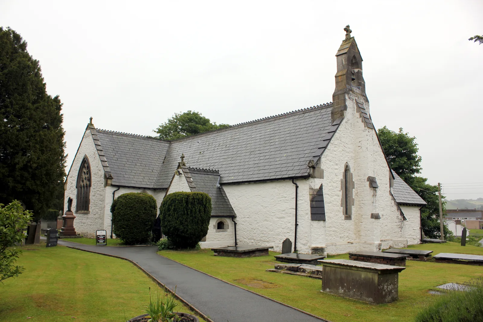
St Digain’s Church
South of the crossroads, through the lychgate. The yew stands north of the church.
Four entries: a Grade II* church and its yew, a cottage museum that opens for events, a Grade II bridge, and a Grade I house you currently cannot enter. No pubs, cafés or shops are listed here; see Local life for the village’s everyday character.
Grade II* church & ancient yew
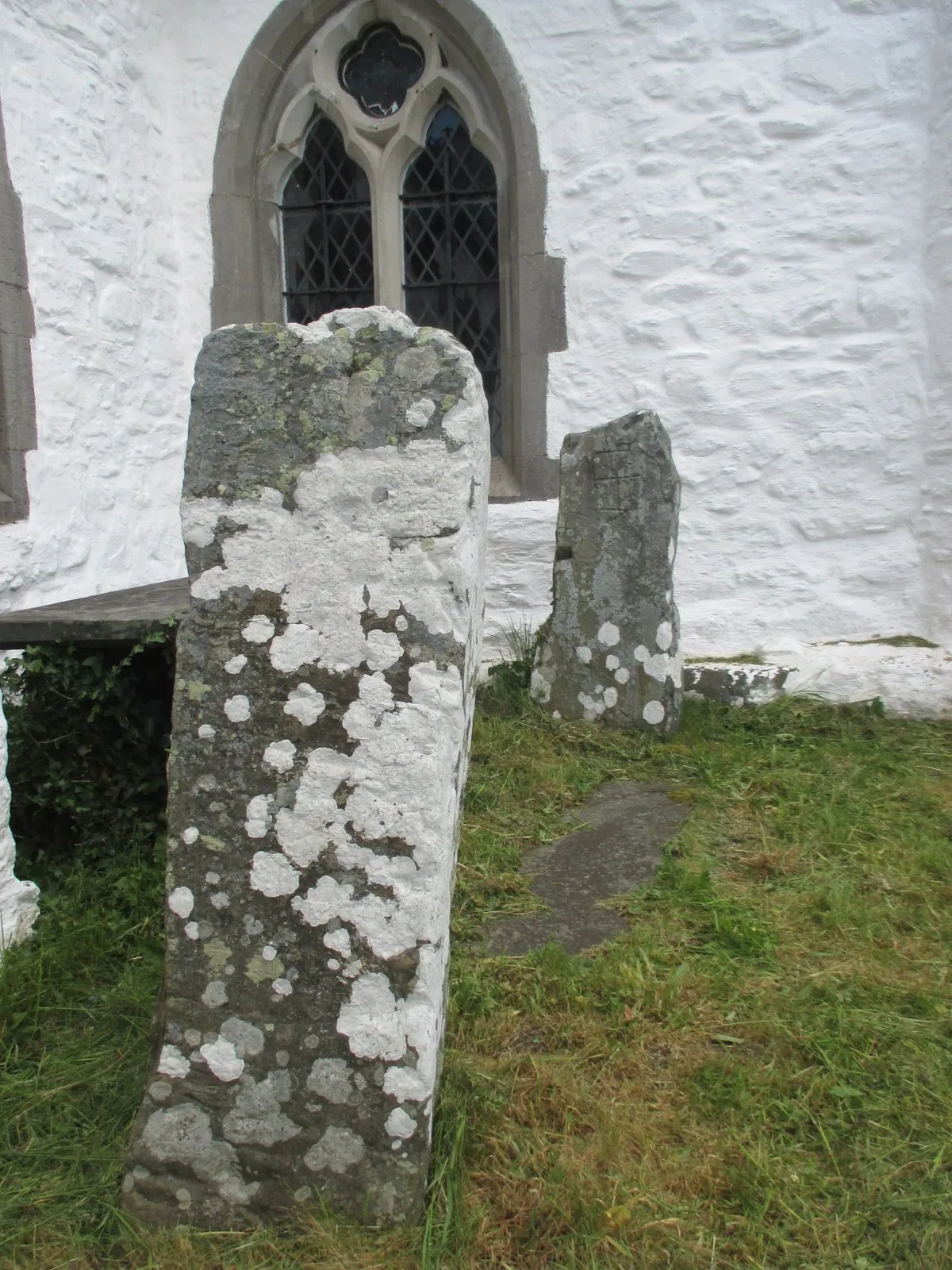
A low whitewashed church with two cross-cut stones against its south wall, and, north of it, the tree the whole village is known for.
Church in Wales: parish information (opens in a new tab)Museum · special events only
Two labourers’ cottages kept as a shoemaker’s family knew them, because one of the children became a professor. Opens for events only.
Contact the museum about opening (opens in a new tab)Grade II bridge
Three stone arches on the Llansannan road, and the clearest place to stand over the water that leaves this village as the Elwy.
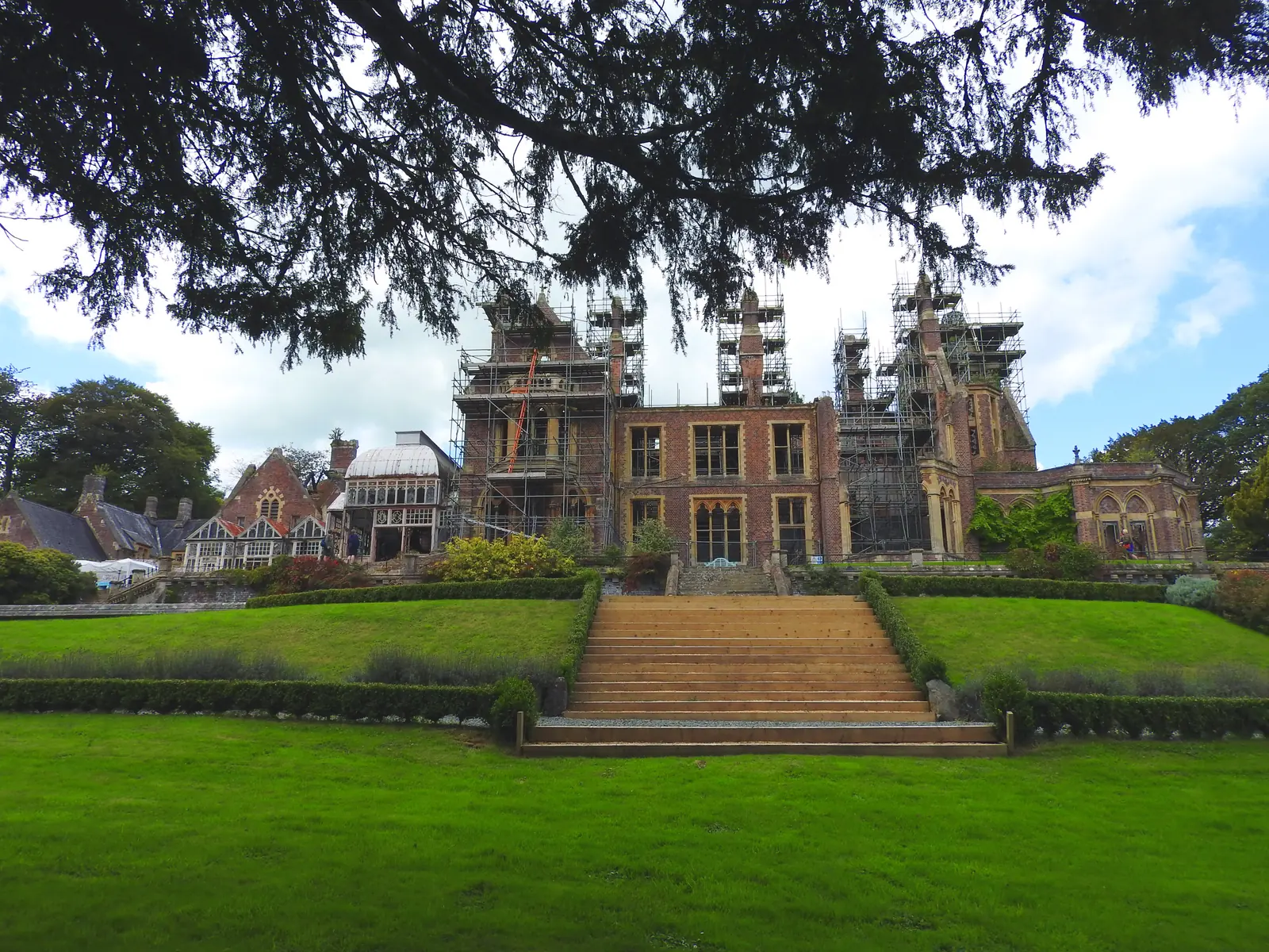
Grade I · no access in 2026
Liverpool money and a famous architect put a Gothic mansion in this small valley. Fire took it; one family is putting it back, slowly and privately.
Check for future open days (opens in a new tab)Two of these four are not simply open. The museum opens for special events and asks you to contact it first; Hafodunos is a private restoration whose owners have said there will be no events or open days in 2026. Confirm both before you plan a day around them.
Sir Henry Jones Museum: contact and opening03Story
Almost every Welsh village can be told from its church outwards. Llangernyw has to be told from a tree that was already standing when someone chose this ground to build on.
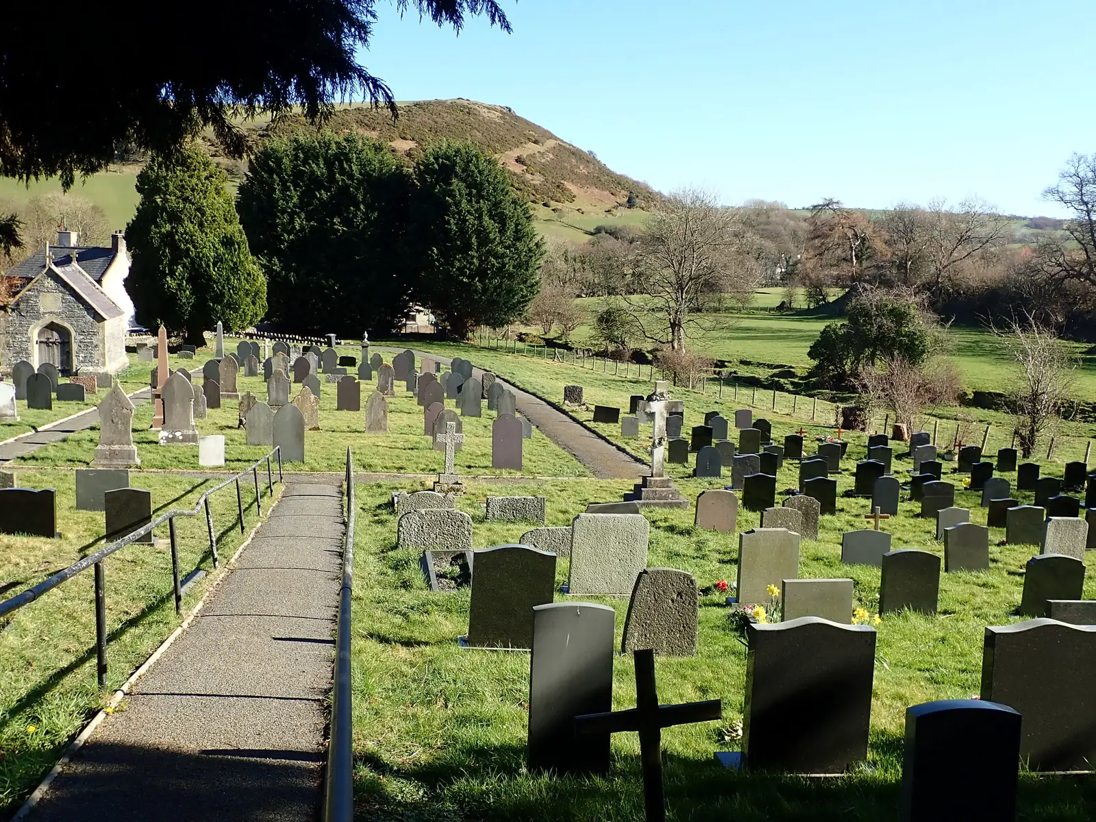
The churchyard is roughly oval: the shape of an early enclosure rather than a laid-out plot. The yew stands north of the church, its heartwood entirely gone, offshoots growing on around the space. Some authorities take it to have been on this ground before Christianity reached the valley. The board beside it, placed by the Tree Council, puts it at over four thousand years old; the measurable facts are a girth of 10.75 metres at ground level, and 1,036 centimetres recorded here in 1998.
The dedication is to Digain, said to have lived in the fifth century; the building is much later, probably thirteenth-century on the site of an earlier church, and Grade II* listed. Two stones about 1.4 metres high, each cut with a cross, stand against its south wall: early medieval, and the oldest worked stone anyone here has to show. A Grade II lychgate closes the churchyard to the west.
The Cledwen, the Collen and the Gallen meet at the village, and it is from here that the river is called the Elwy. The crossing made a place; the road made it a stop. Grade II bridges survive at Pont Faen, Pont Sylltu and Pont Ty’n-y-ddol, a listed milestone stands on the A548 south of the village, and two toll-gates — posts, gates and turnstiles — still stand on the lane running west.
The estate belonged to the Lloyd family from about the early thirteenth century, with a manor house of 1674. In 1830 it passed to Samuel Sandbach of Liverpool, a slave-owner, and Liverpool money rebuilt it: Sir George Gilbert Scott designed the present hall between 1861 and 1866, the only secular building he raised in Wales. The Sandbachs are buried a hundred metres east of the church, in a mausoleum of their own.
Henry Jones was born in the village on 30 November 1852 and worked at his father’s bench while he studied. He became Professor of Moral Philosophy at Glasgow, was knighted in 1912 and made a Companion of Honour in 1922, the year he died. A memorial fund opened his childhood home as a museum in 1934, and it is still one. He is buried at Kilbride on the Isle of Bute, not here.
An oil tank sat inside the hollow centre of the tree until the 1990s. Nobody had worked out what they were storing it in.
Atlas of Wales
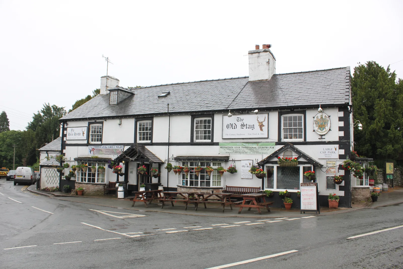
Everyday Llangernyw is one shop, one pub, one primary school and a church, gathered within a hundred metres of the dip in the A548. The building the shop occupies is itself listed. The community council runs the public toilets. That is close to the whole list, and it is offered without apology.
At the 2011 census 63.7% of the community spoke Welsh, down from 67% a decade earlier. This is a Welsh-language village doing ordinary Welsh-language things, and a visitor arriving for the tree is walking through the middle of it.
The church keeps refreshments and an honesty box at the back, and display boards on the church, the village and its people. It is the one indoor stop here, and it is free.
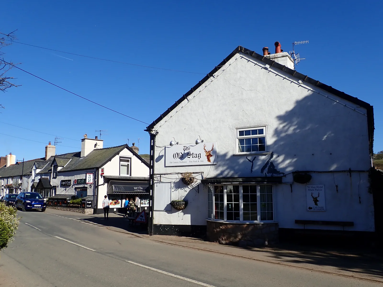
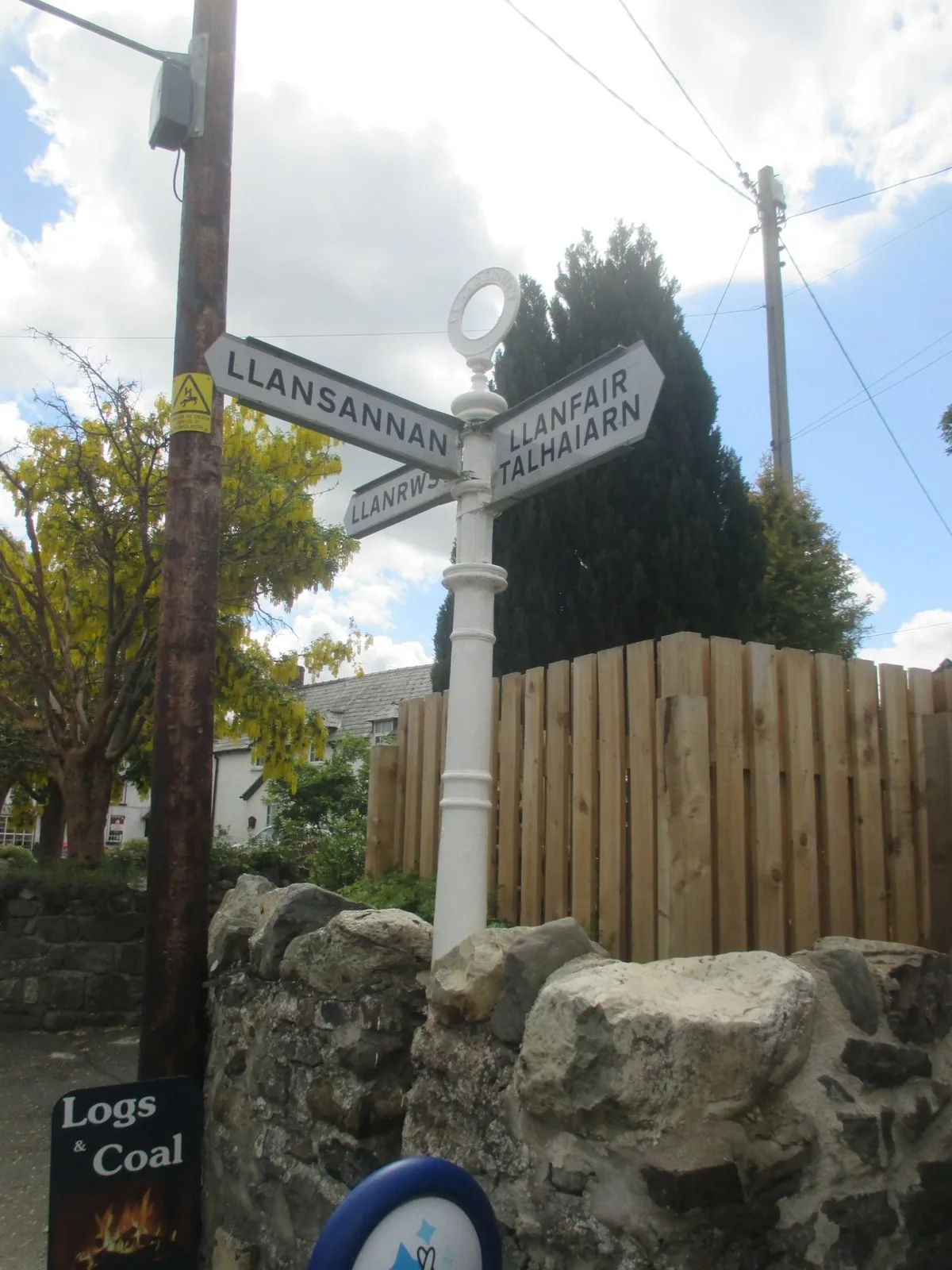
The signage is bilingual because the village is. Welsh is the working language here rather than a heritage feature, and the census figure has held broadly steady for two decades.
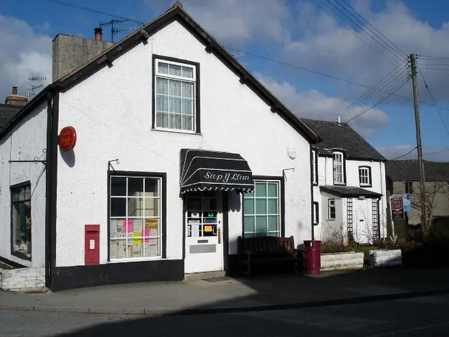
The building carries its own Grade II listing as the General Store, forty metres north of the centre. A shop, a postbox and a pub are what a village of this size gets to keep.
St Digain’s is a stop on the North Wales Pilgrim’s Way. Walkers arrive here at the end of the short stage from Pandy Tudur, and leave on the long one north to Penmaenmawr.
A guest, not a customer
There is no visitor centre, no car park, no ticket desk and no interpretation trail. What the village puts on for a stranger amounts to a set of display boards inside the church and an honesty box beside the kettle. Arriving on those terms is the point: you are walking into somewhere that would carry on identically if you did not.
Plan your time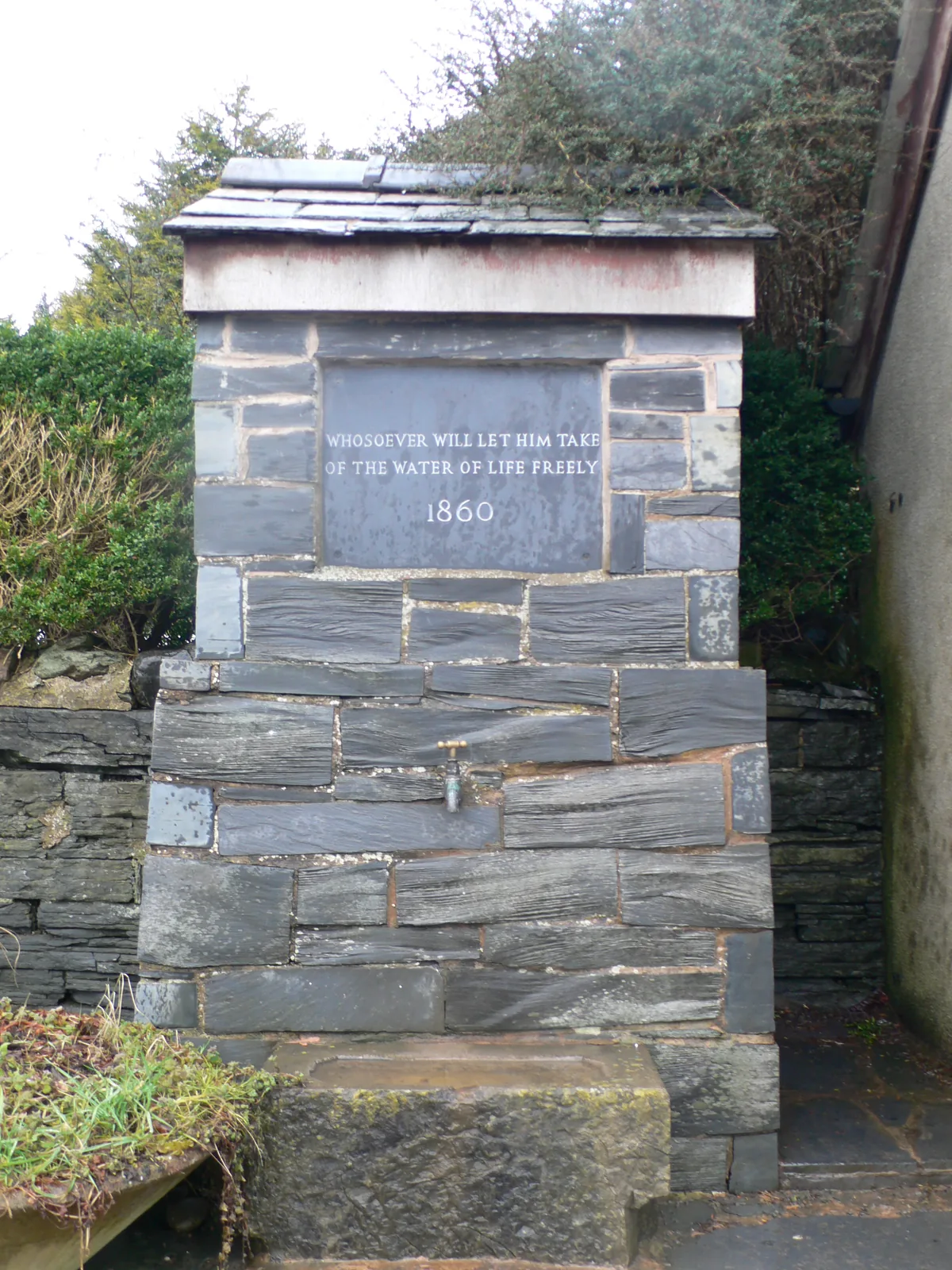
Every Hallowe’en, the story goes, a voice in the church reads out who will not see the next one.
The Angelystor · a local tradition
04Plan
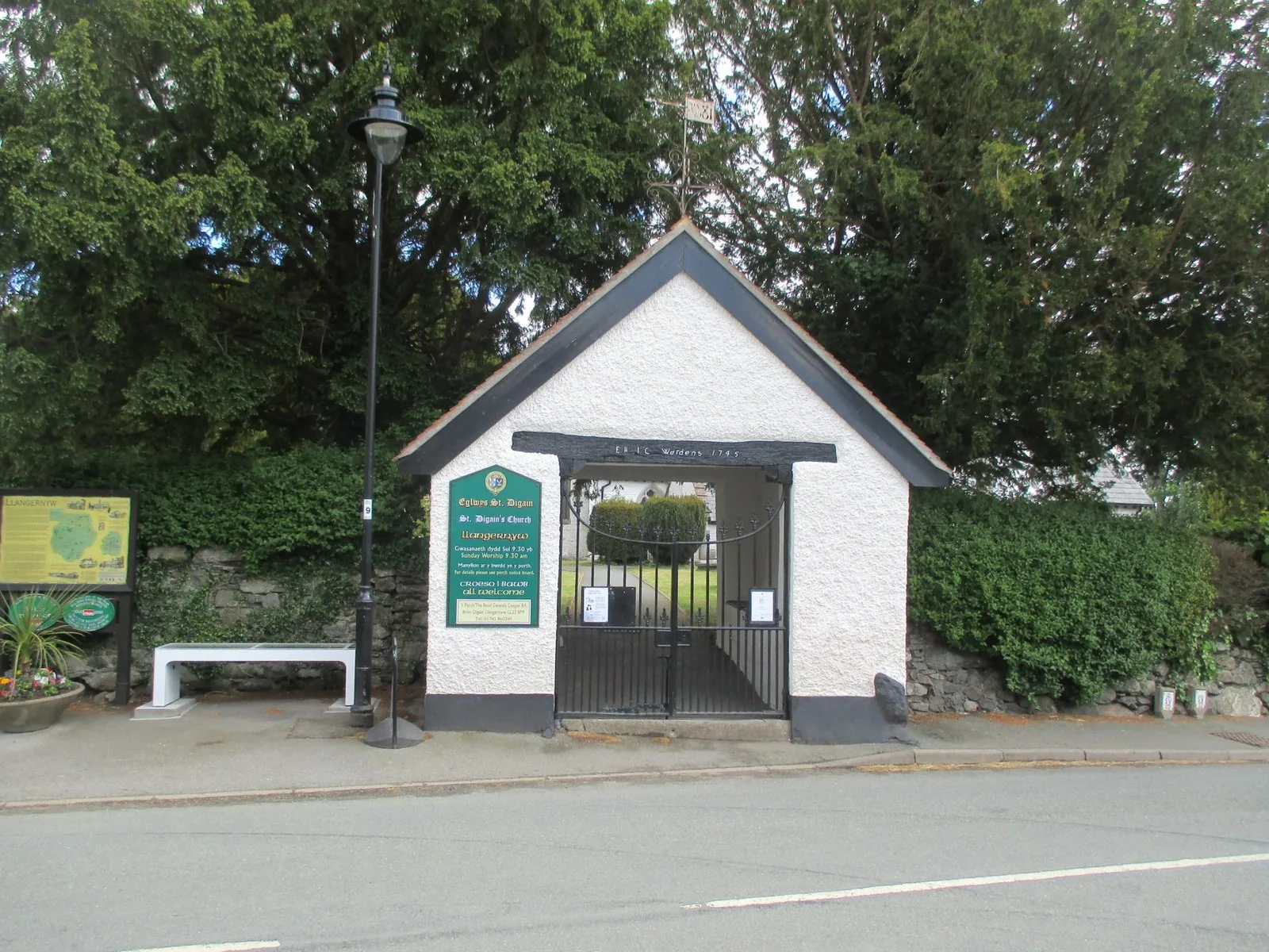
The churchyard opens off the west side, straight from the road.
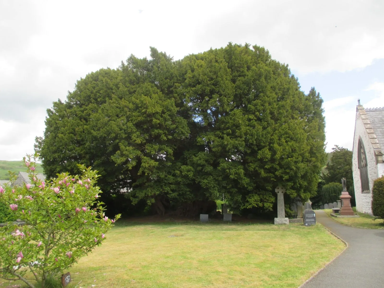
Walk round it before you decide how many trees you are looking at.
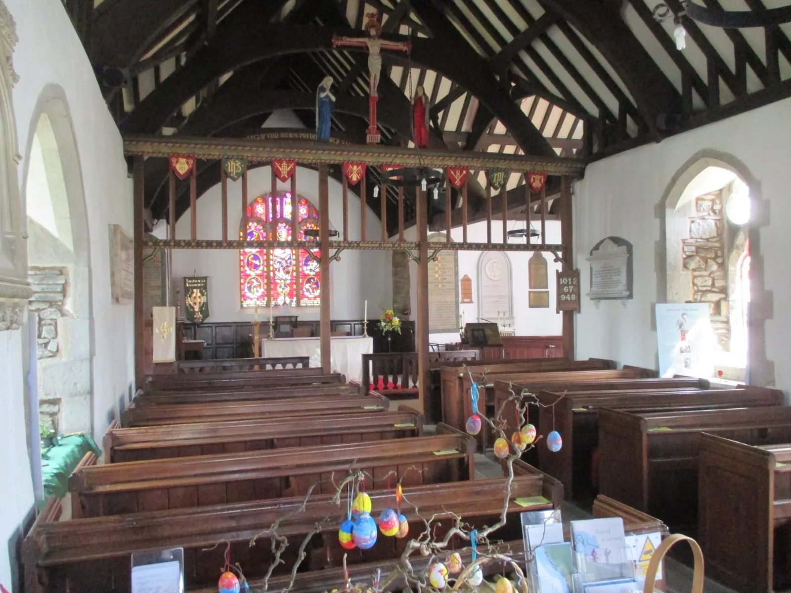
Open to visitors, with refreshments and an honesty box at the back.
Early medieval, about 1.4 metres high, and easy to walk past.
Get your bearings from the dip in the road; the toilets are here.
The tree, the church and the stones: the short visit, done properly.
The pump, the shop and the cottages, all within a hundred metres.
Three hundred metres down the road; check first if you want inside.
Three arches over the water, and the point the whole valley drains to.
The route starts and finishes here. Boots: there are field paths.
The Sandbach tomb sits at the churchyard’s eastern end, before the fields.
The lane west, then woodland. Steps and ravine edges along the way.
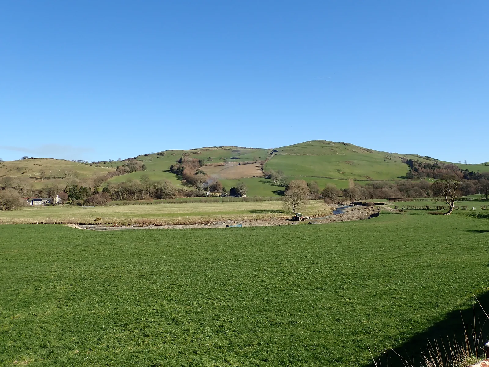
Fields and river meadows, with the valley opening away northward.
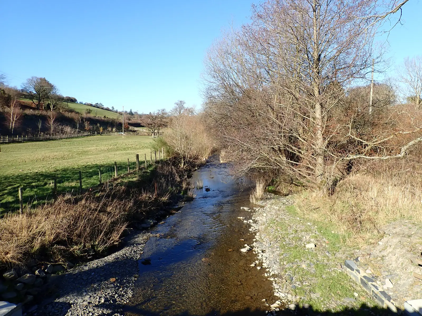
The last stretch follows the river in, and returns you to the road.
Practical
Everything you need for arriving and getting around.
Getting here
The A548 runs through the village between Abergele to the north-east and Llanrwst to the south-west; the museum records roughly twenty minutes from one and fifteen from the other. The B5382 leads east over Pont Faen towards Llansannan. No public car park is published for the village.
Open Llangernyw in Google MapsService 43 (M&H Coaches) runs Llanfair Talhaiarn to Pensarn by way of Abergele, calling at Llangernyw Post Office, under a hundred metres from the museum by its own account. Monday to Saturday only, a small number of journeys a day, and the pattern differs between days of the week.
Service 43: current timetablePractical details
No public car park is published for Llangernyw by Conwy County Borough Council or by any other source checked for this guide.
Needs research. This guide will not describe an arrangement it cannot evidence; treat parking as unconfirmed and plan accordingly, particularly if you are travelling in a group or a larger vehicle.
Unconfirmed · no published provision found
Free public toilets in the village, run by Bro Cernyw Community Council rather than the county, and listed by Conwy as open every day from 9am to 4.30pm.
Check the Conwy public toilets listingLlangernyw, LL22 8PP
Monday to Sunday, 9am–4.30pm; free
Accessible cubicle and baby changing, both listed
The museum states that the roads approaching the village have no pedestrian pavements. The churchyard is entered through a lychgate and its ground is uneven and sloping. The published circular walk includes steps and ravine-side sections and is described as unsuitable for prams, pushchairs or wheelchairs.
Per-site accessibility is not independently confirmed for this guide; contact the church or the museum directly if this matters to you.
No pedestrian pavements
Uneven and sloping; the walk has steps and ravine edges
The church is open to visitors and the churchyard is not gated. The museum opens for special events only and asks you to contact it. Hafodunos is a private restoration; its owners have said there will be no events or open days in 2026.
Sir Henry Jones Museum: contactOpen to visitors; free
Special events only · contact before travelling
No events or open days in 2026
Conwy operates a county-wide Dog Control Public Spaces Protection Order covering fouling, carrying a means to pick up, exclusion areas and dogs on leads by direction.
The order’s exclusion and lead areas are set out land parcel by land parcel in its own schedules. No Llangernyw-specific zone is stated here. The churchyard is a churchyard; treat it as one.
Conwy County Borough Council: controlling your dog in public
Everything in this guide except Hafodunos is within three hundred metres of the crossing. Hafodunos is a mile west along the lane, and you will not be going inside it.
Llangernyw is a stop, not a day
Four real Atlas destinations pair with a Llangernyw visit; distances are straight-line from the village centre, not driving times.
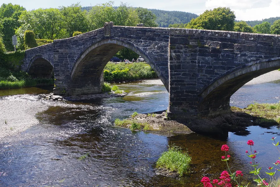
The valley’s working market town, at the far end of the same road: the town Llangernyw sends its business to, and a bridge from 1636 to stand on.
About 6.0 miles south-west (straight-line)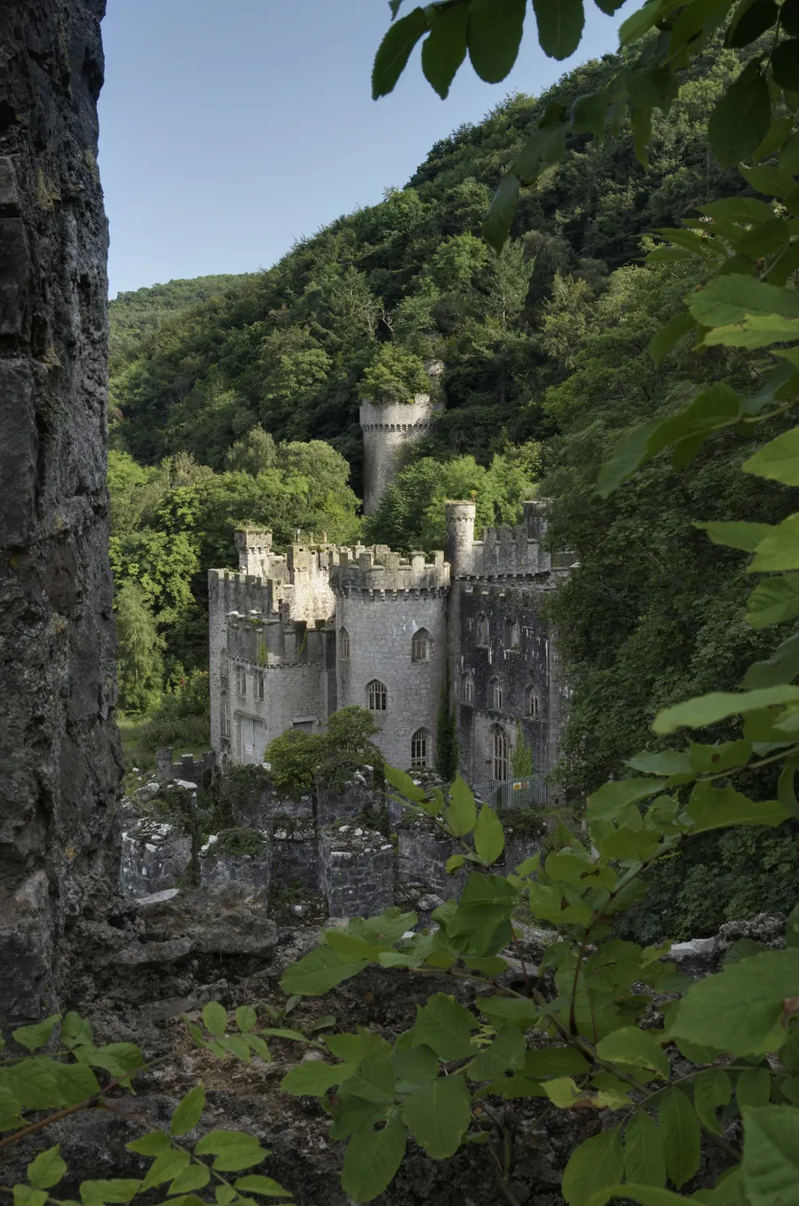
The same century’s ambition, the same long decline, and a restoration you can actually walk into: the counterpart to Hafodunos, up the road towards the coast.
About 7.1 miles north-east (straight-line)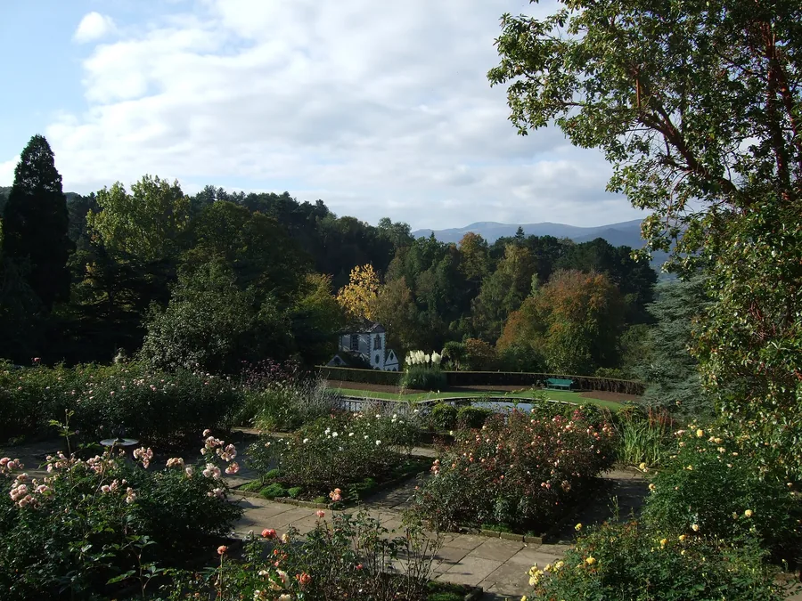
Eighty acres of Victorian planting in the next valley west: the fully realised version of what Hafodunos’s terraces are still being dug back out of.
About 5.5 miles north-west (straight-line)
A valley village that still runs on water: a mill the river drives and a waterfall off the street.
About 6.5 miles south-west (straight-line)Before you go
Give it forty minutes on the way through, and the scale of the place rearranges itself.