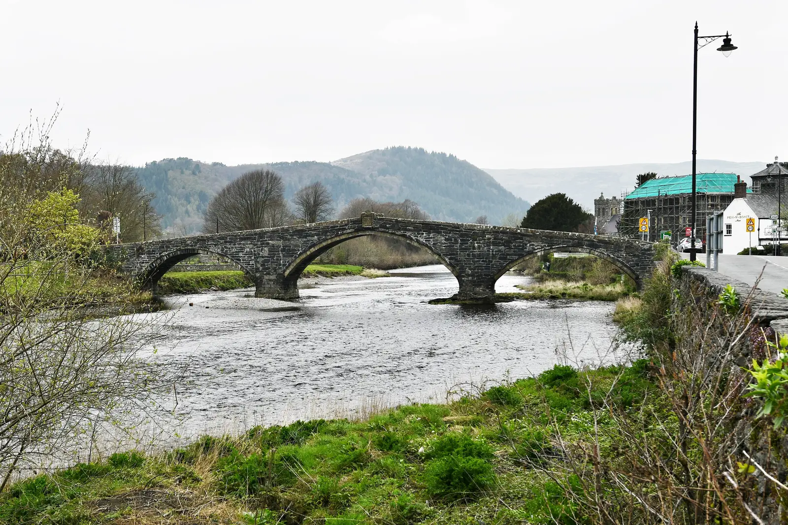
Standing on Pont Fawr
You cross the same steep single-file camber the carts did, the parapets low enough to watch the river underneath.
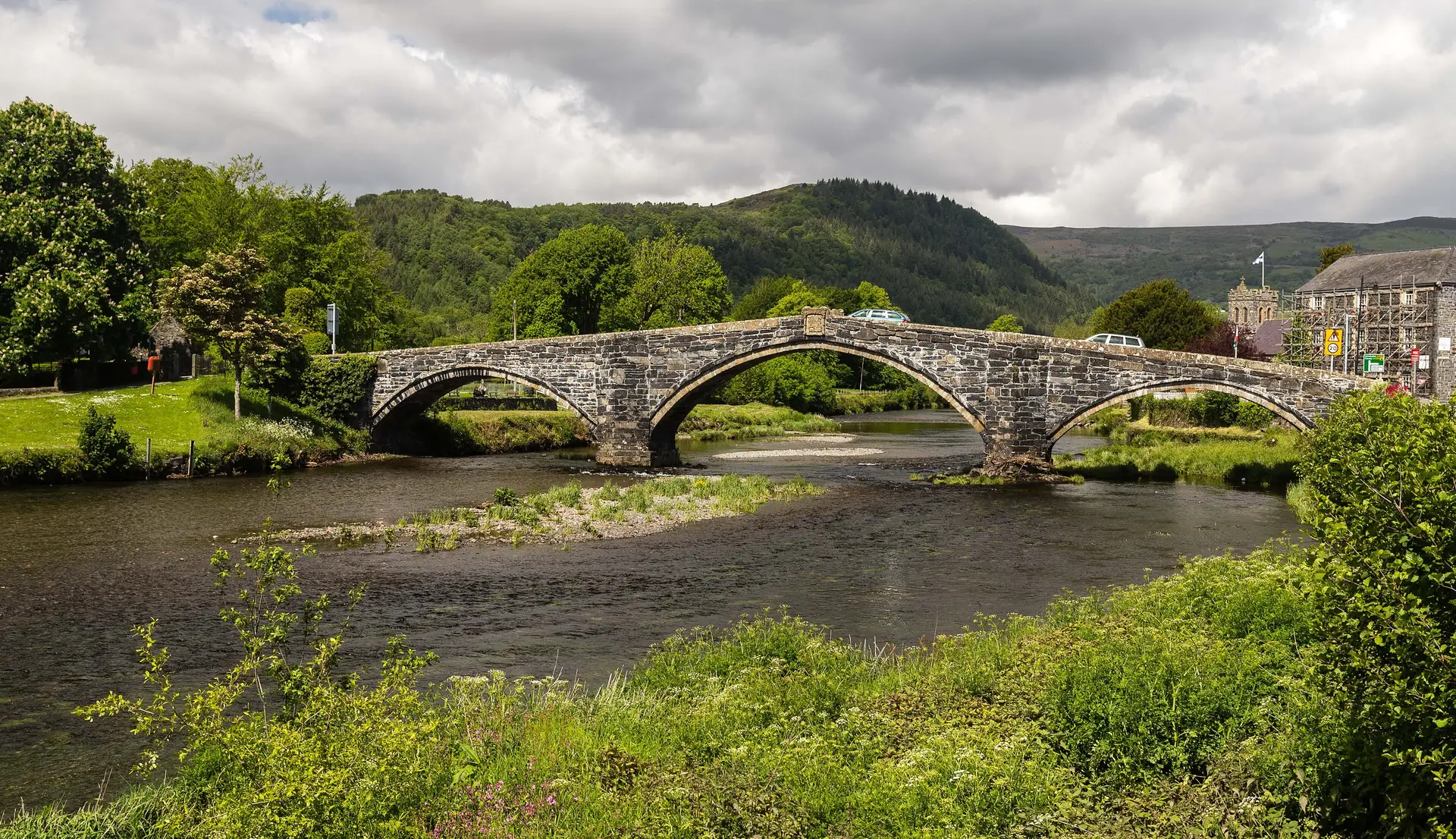
Conwy · the Conwy Valley
A wool town that once set the price of British wool, a bridge from 1636 you can still drive over, and a church holding a coffin nobody can quite claim.
01The town
Llanrwst is a compact market town on the east bank of the Conwy, tipped downhill toward the river with Gwydir Forest climbing the far side. About 3,100 people live here, and the streets fold together closely enough that the square, the church and the bridge are only a few minutes apart on foot. It has been the valley’s trading town for centuries, and it still feels like one.
Most of the valley drives straight through Llanrwst. What they pass is the genuine article: a town where the sights are still its working parts, not set aside for visitors. Worth stopping for precisely because it isn’t trying to stop you.
Character
Shops, a market, schools and a surgery, used by the people who live here. The visitor sights sit inside that, rather than replacing it.
Pace
Square to church is a couple of minutes, church to bridge about five. Gwydir Castle is the one stop that asks you to cross the river, roughly ten minutes on foot.
Landscape
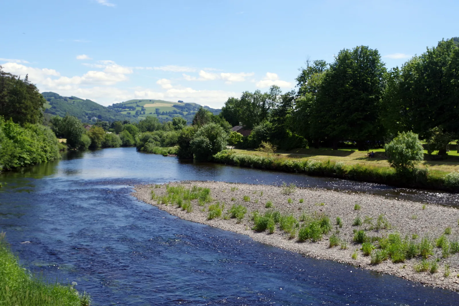
The Conwy runs along the town’s western edge; Gwydir Forest Park climbs the far bank, carrying the lakes and the old lead mines.
Best for
Two Grade I buildings and a Grade I garden, none of them behind a visitor centre. Best for anyone who would rather walk into a town than around an attraction.
02Discover
You cross the same steep single-file camber the carts did, the parapets low enough to watch the river underneath.
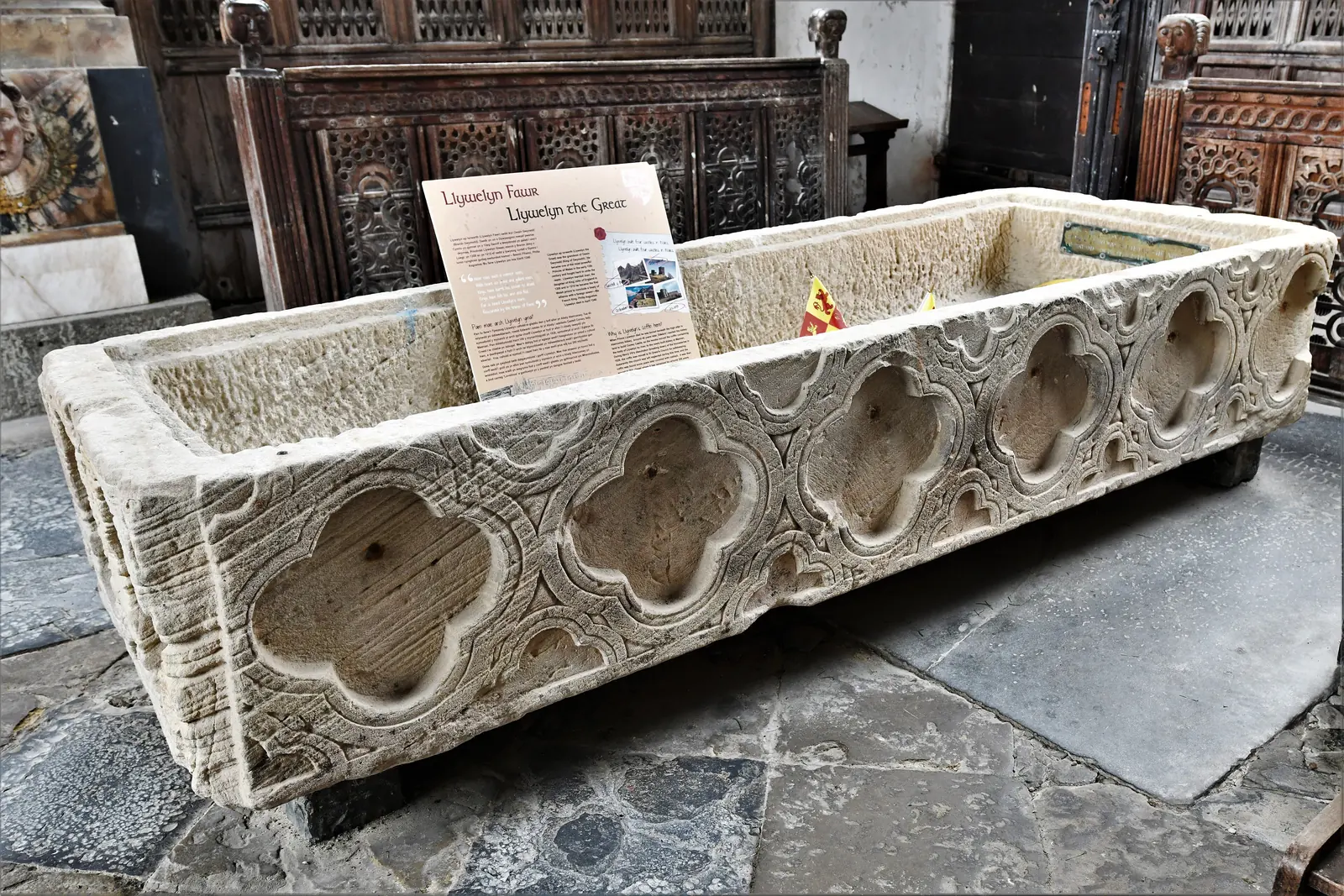
A dim side chapel holding a stone coffin said to be Llywelyn the Great’s. Stand over it and decide.
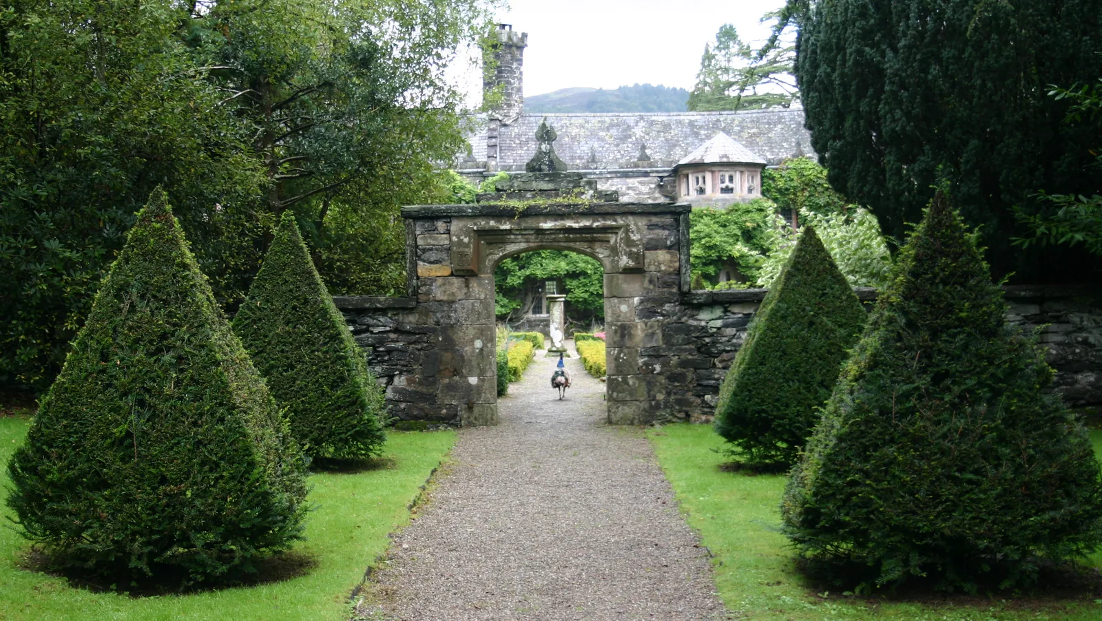
Cross the bridge and walk ten minutes to a Tudor house still lived in, set in ten acres of garden.
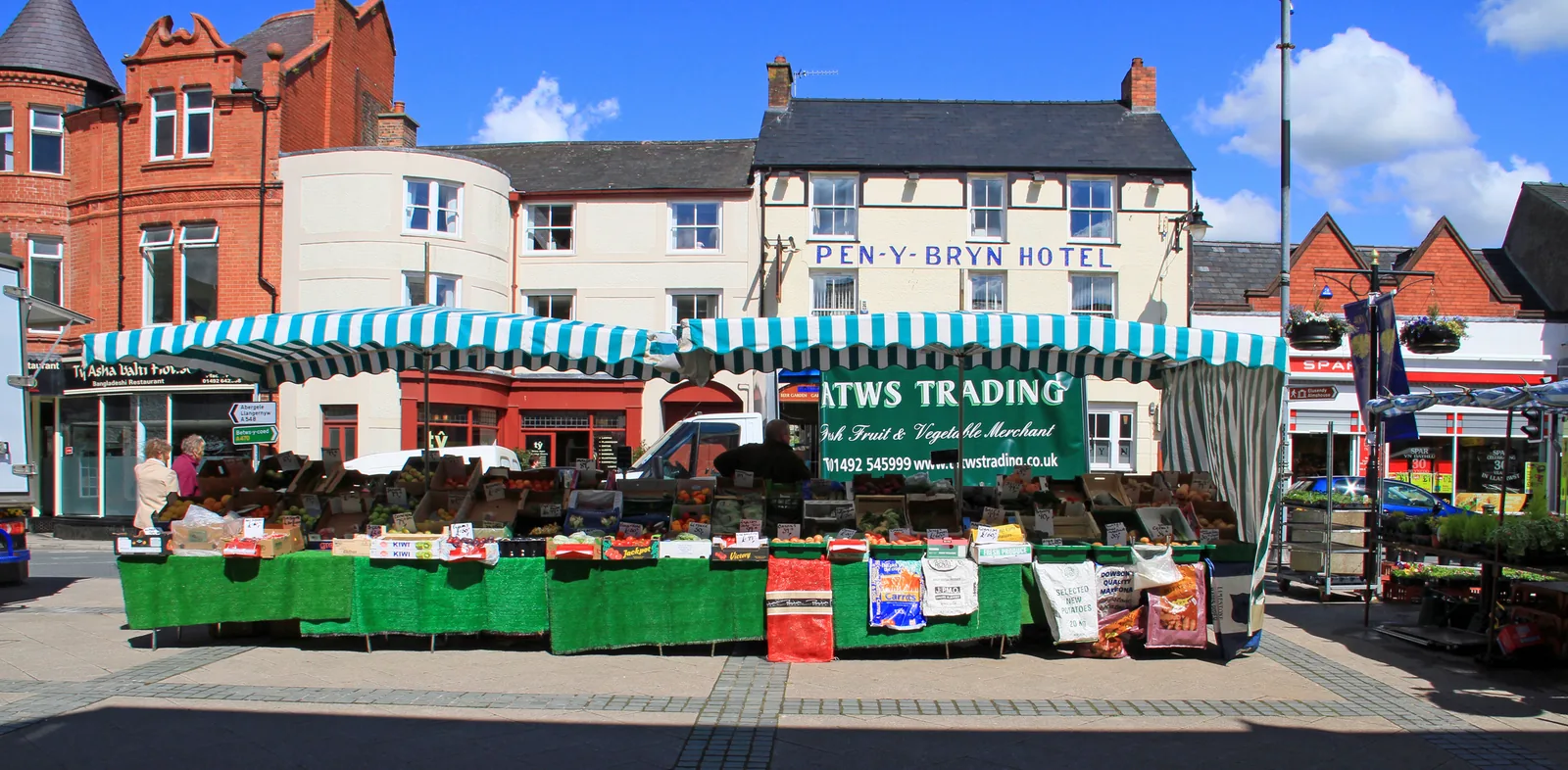
Once a week the stalls go up and the square fills, a real market in a real working town.
Beyond the first defining moments, the fuller Llanrwst catalogue continues below.
One line downhill from the square to the river, across the bridge, then up to Gwydir on the far bank. Seven points, most within a few hundred metres of the square.
 No verified image yet
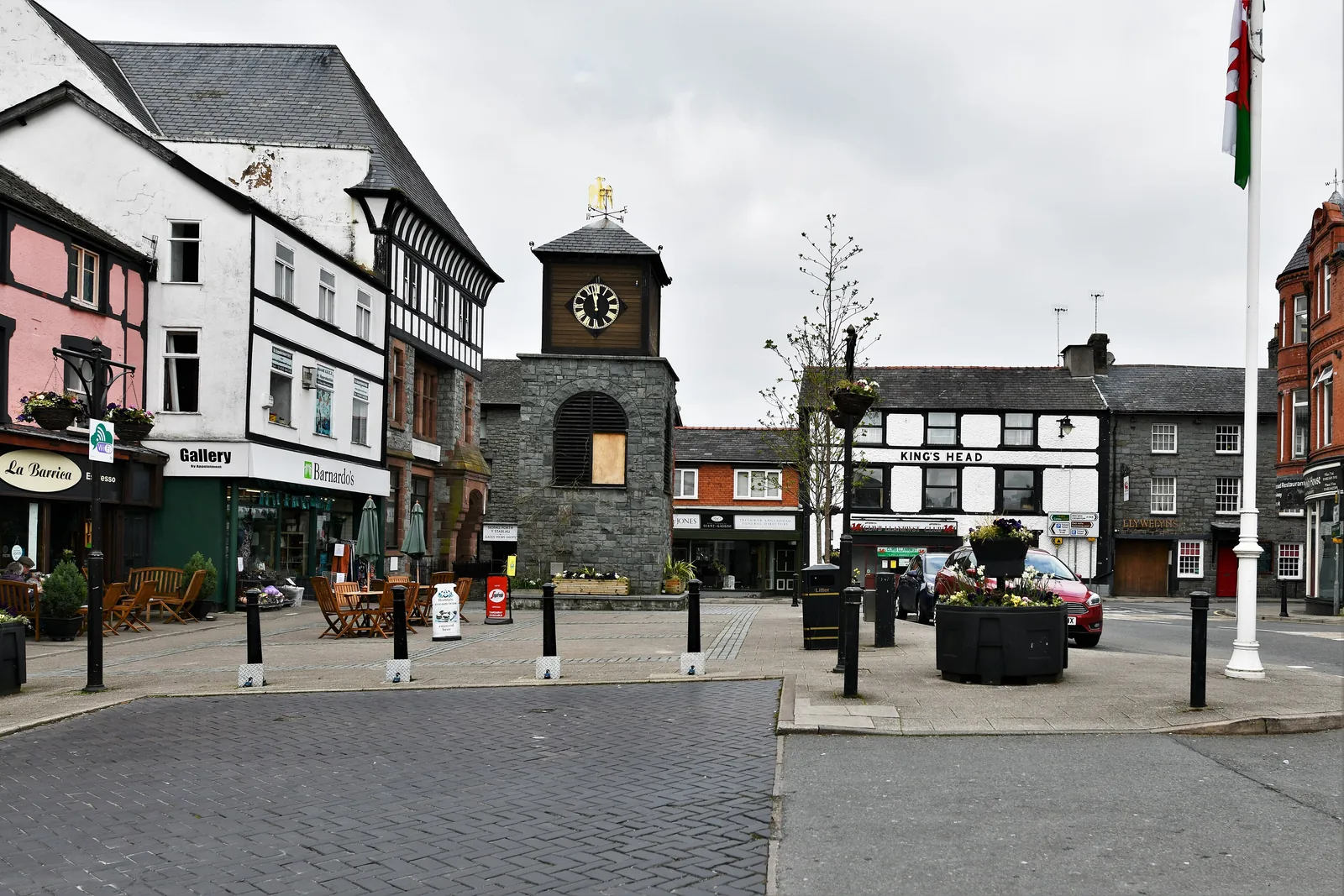
Ancaster Square
The town centre and market place at the top of the hill; everything else runs downhill from here.
Seven entries: two Grade I buildings, a Grade I garden, a National Trust cottage, a Cadw chapel that needs booking, a square with a market, and one building that is no longer open at all. No pubs, cafés or shops are listed here. See Local life for the town’s everyday character.
Square & market
The square at the top of the hill, where the town still does the thing it has always done. The market takes it over every Tuesday.
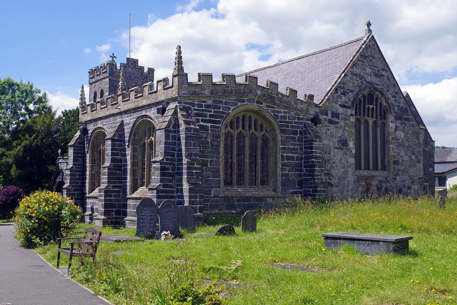
Grade I church
The rood screen and its loft survived here where most did not. In the chapel alongside stands the stone coffin said to be Llywelyn the Great’s.
Grade I bridge
A narrow three-arched bridge that never became a monument, because it is still the road: steep, single file, and carrying traffic into town.
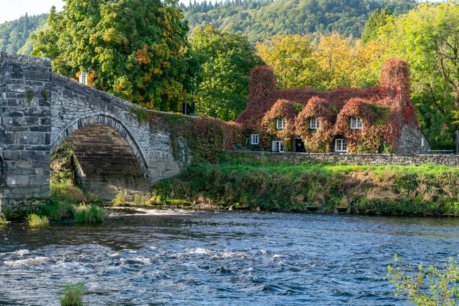
National Trust, Grade II
“Beyond the Bridge” is older than the bridge it is named after, and has spent its whole life being useful: a house, a courthouse, now a tearoom.
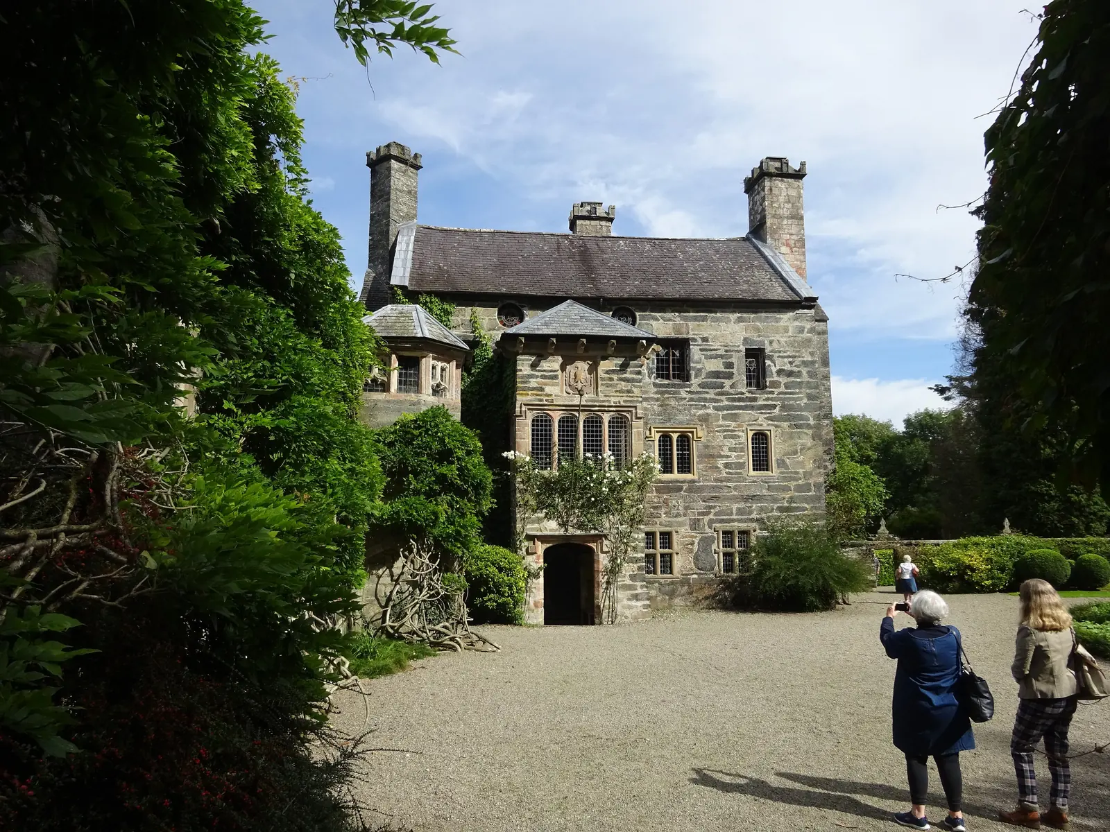
Seasonal, charged
The Wynn family seat, and the reason so much of Llanrwst carries their name. A Tudor courtyard house in ten acres, open only in season.
Check opening times (opens in a new tab)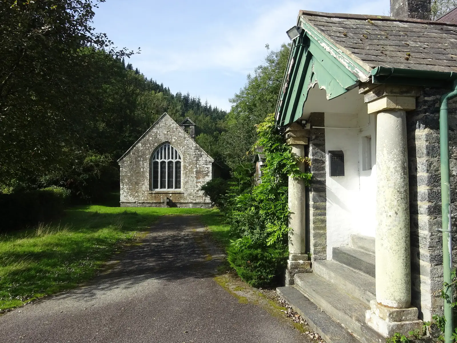
Cadw · By appointment
A plain stone box from outside, hiding a painted firmament of sun, moon, stars and angels over box pews. Free, but only by appointment.
Check access arrangements (opens in a new tab)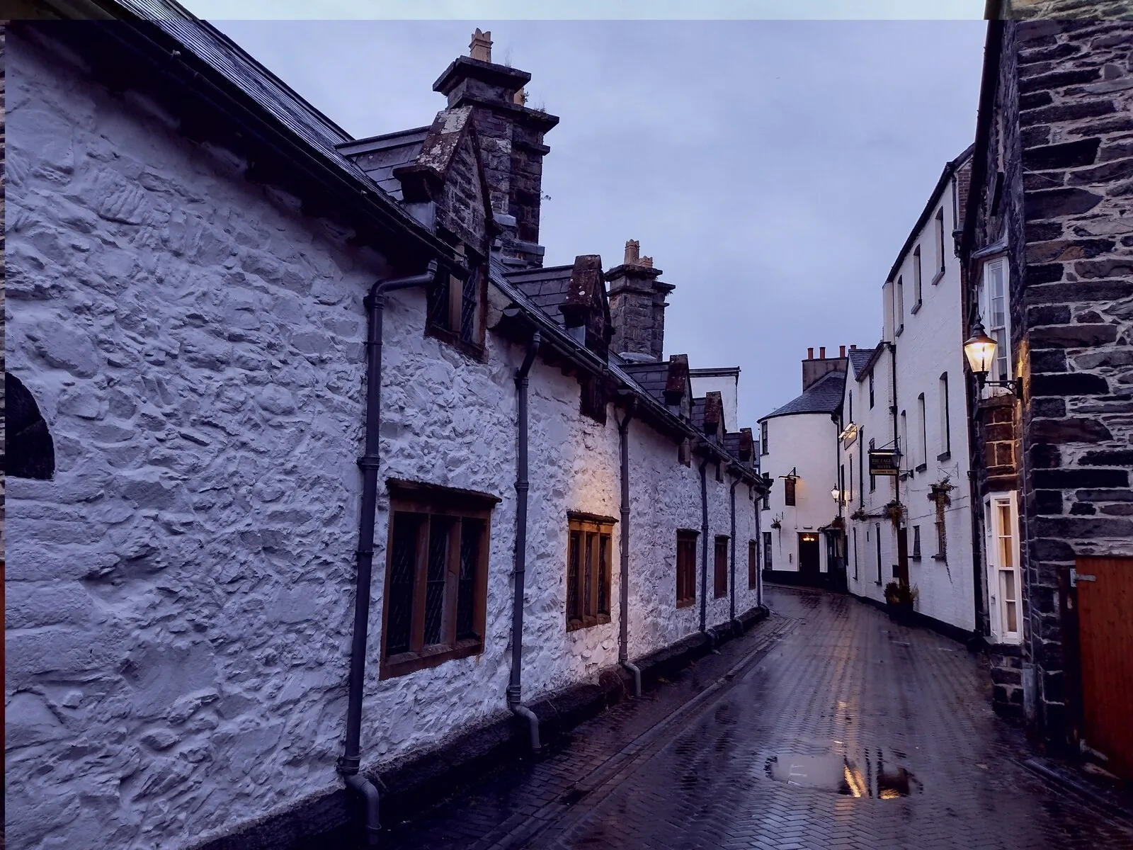
Seen from the street only
The Wynns’ civic gesture to a town they had already stamped their name across, built for twelve poor men, council offices now. Street view only.
Gwydir Castle’s season and admission change year to year, and Gwydir Uchaf Chapel is free but must be booked with its keyholder. Confirm both before you plan a day around them.
Gwydir Castle · current opening03Story
For a long stretch the River Conwy was a border, and the town on its bank was neither one thing nor the other. The saying is the town’s own summary of that: Cymru, Lloegr a Llanrwst: Wales, England and Llanrwst.
The town council’s own record dates the first mention of the place (as Gwrgwst) to 954, in a Welsh succession dispute. There was a ford here long before there was a bridge, and the river was a line as often as it was a route.
Edward I’s edict kept Welsh traders ten miles clear of Conwy. Llanrwst, thirteen miles upriver, took the trade, and for a long period the price of British wool was set here. A 1334 survey lists the town as one of three boroughs in the Lordship of Denbigh, a status that did not last.
Gwydir Castle went up around 1500. Then the almshouses and free grammar school in 1610, the Gwydir Chapel in 1633–34, Pont Fawr in 1636, and Gwydir Uchaf Chapel in 1673. Ancaster Square carries the family’s marriage into the Ancaster line in 1678 in its name.
A market hall was built on the Bryn y Boten marketplace in 1661. Beyond wool the town made clocks, harps, rope, nails, leather, beer, coaches and bottled mineral water. A working list, recorded by the town council, that reads nothing like a tourist economy.
The Conway and Llanrwst Railway opened in 1863 and stopped here before pushing on to Betws-y-Coed in 1868 and Blaenau Ffestiniog by the early 1880s. A Llanrwst solicitor, Richard James, secured the legislation, and in 1895 bought Llyn Crafnant and gave it to the town for its water. Llanrwst has hosted the National Eisteddfod three times since: 1951, 1989 and 2019.
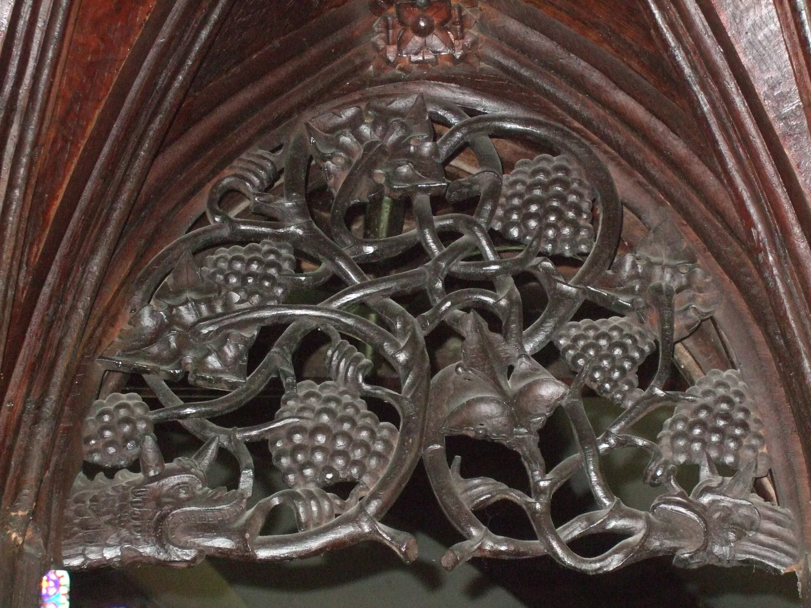
The Wynns built the bridge, the chapel, the almshouses and the school. The screen in the church was already two centuries old when they started.
Atlas of Wales
Everyday Llanrwst gathers on Ancaster Square and the streets running off it: Denbigh Street, Station Road, Church Street. Cafés, pubs, a butcher, a greengrocer and independent shops, plus the library at Plas yn Dre and the surgery on School Bank Road.
There is no high-street bank branch left; a mobile service calls weekly and the town council keeps a 24-hour cash machine on the square. It is that kind of town, small enough to notice what it has lost, still working.
Come on a Tuesday if you want the town at its busiest, and don’t arrive expecting a large market. Conwy’s own words for it are “small but long established.”
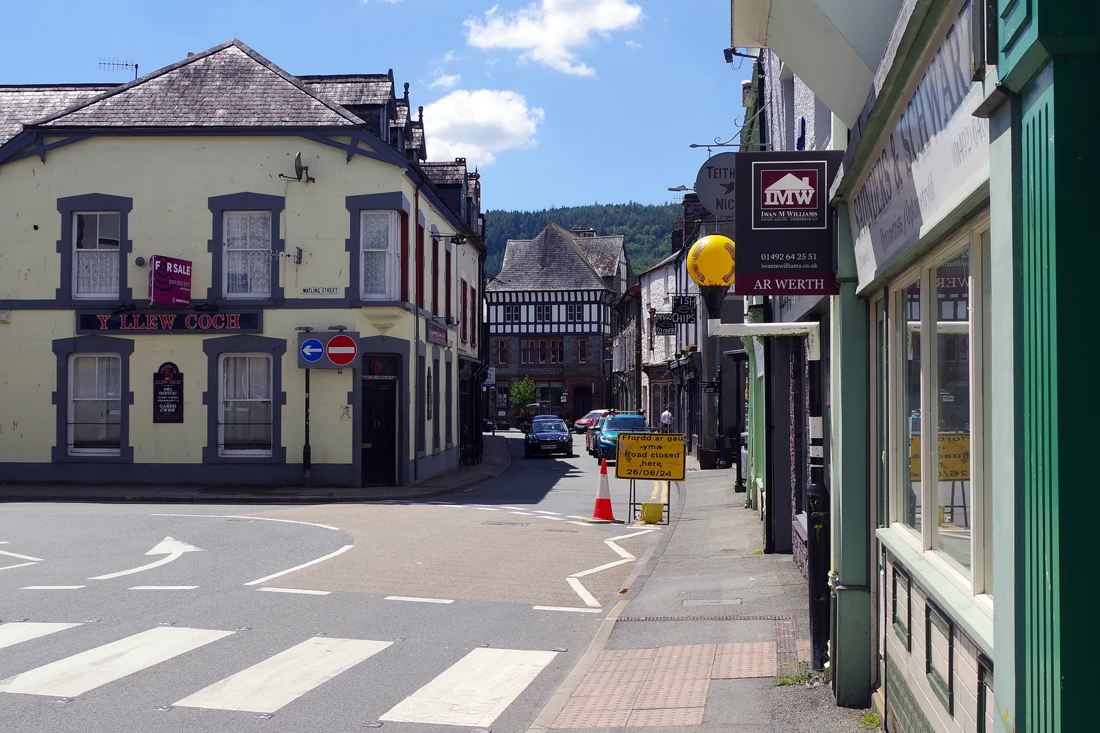
Stalls set up on the square from about eight, run by the town council, and pack down around four. The rest of the week it is simply the middle of town.
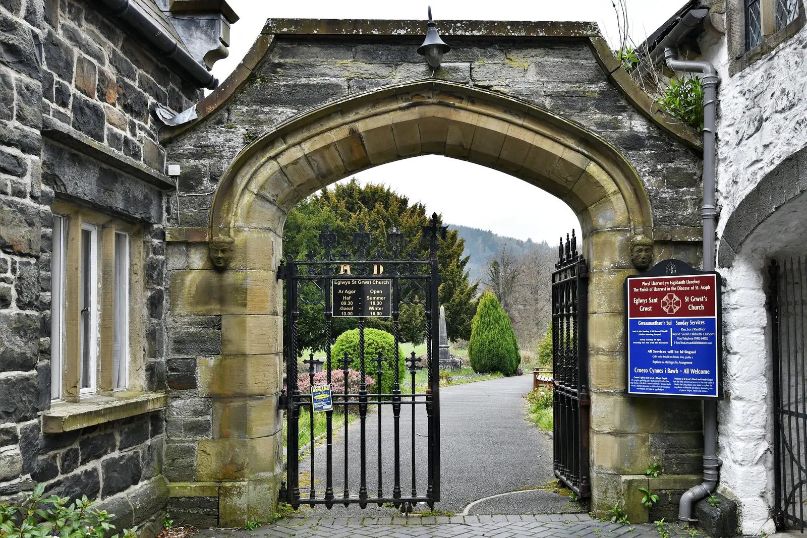
An arch off Church Street drops you straight into the churchyard. It is a shortcut as much as an entrance, and it is how most of the town reaches St Grwst’s.
The Conwy runs along the western edge, with a riverside walk and the flood defences that the valley has needed more than once. Everything in the town slopes towards it.
A town first
Come on a weekday and the town is simply at work: shops taking deliveries, the surgery busy, someone crossing the bridge to start the day. A visit fits around that rather than replacing it, which is the whole appeal: you are a guest in a working place, not a customer of a staged one.
Plan your timeCymru, Lloegr a Llanrwst: Wales, England and Llanrwst.
The town’s own saying
04Plan
Pay and display, 49 spaces, a couple of minutes from the square.
The clock, the frontages, and on a Tuesday the stalls.
The rood screen, and the Gwydir Chapel behind it.
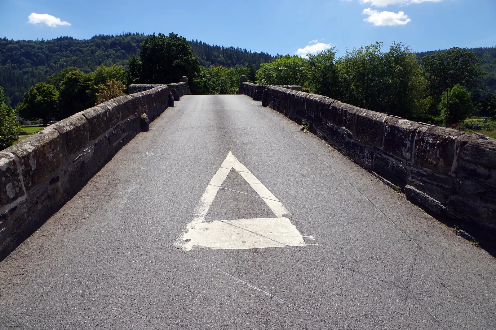
Walk out onto the camber. Single file, and watch for traffic.
Get your bearings; the whole town runs downhill from here.
The 15th-century rood screen, then the Gwydir Chapel behind it.
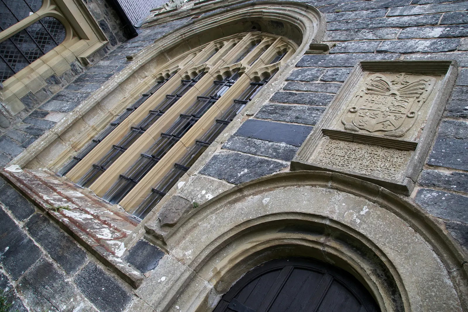
The Wynn monuments, and the coffin said to be Llywelyn’s.
Out onto the single-file camber, then across to the west bank.
The creeper-covered building at the bridge’s far end, best when it turns in autumn.
Confirm Gwydir Castle is open on your date before you set out, then take the bridge.
About ten minutes on from the bridge, following the road along the west bank.
Walled terraces, old clipped yews, and three cedars of Lebanon.
Free, in Cadw’s care, but the keyholder needs at least a day’s notice.
Recross the bridge and finish where the town does its own business.
Practical
Everything you need for arriving and getting around.
Getting here
The A470 runs through the town; the B5106 crosses Pont Fawr to the west bank and Trefriw. Watling Street and Plas yn Dre are the town-centre pay-and-display car parks, with a third at Gwydyr on the B5106.
View parking detailsTwo stations on the Conwy Valley Line (Llandudno–Blaenau Ffestiniog), operated by Transport for Wales: Llanrwst, near the centre, and North Llanrwst. Most stops on the line are request stops, so signal the driver.
Check current timesService 19 (Llew Jones) runs the Conwy valley between Betws-y-Coed and Llandudno, calling at Llanrwst Watling Street. Weekday and Sunday timetables differ. Check the current service before travelling.
Llew Jones service 19 timetablesPractical details
Three council car parks serve the town: Watling Street, just east of Ancaster Square; Plas yn Dre at Glasdir, north-west of the centre; and Gwydyr, out on the B5106 by Gwydyr Park. Plas yn Dre was free until the county introduced charges. The council’s own Llanrwst listing names only the first two.
Llanrwst car parks (Conwy County Borough Council)Charges and restrictions can change. Check the signs when you arrive.
Watling Street
Town centre · east of the square
Google Maps (opens in a new tab)Plas yn Dre
Glasdir · north-west of the centre
Google Maps (opens in a new tab)Gwydyr
B5106 · by Gwydyr Park
Google Maps (opens in a new tab)Three council-listed public toilets, all free. Hours are limited and differ by site and by day, and they are not summarised here.
Check the Conwy public toilets listingGlasdir, LL26 0DF · Llanrwst Swimming Pool, LL26 0LS · Cae Melwr Cemetery, LL26 0HJ
Glasdir and the swimming pool; the cemetery has neither an accessible cubicle nor baby changing
The square and the main shopping streets are broadly level. The churchyard is elevated, the bridge is narrow with a steep camber, and Gwydir’s gardens are grass and gravel.
Per-site accessibility is not independently confirmed for this guide, so contact each site directly if this matters to you.
Broadly level
Slopes, steps and uneven ground · Not confirmed per site
Conwy operates a county-wide Dog Control Public Spaces Protection Order covering fouling, carrying a means to pick up, exclusion areas and dogs on leads by direction.
The order’s exclusion and lead areas are set out land parcel by land parcel in its own schedules. No Llanrwst-specific zone is stated here. Read the schedules before you travel.
Every Tuesday on Ancaster Square, run by Llanrwst Town Council. Stalls normally open after 8am and trading normally ends after 4pm.
Conwy County Borough Council · Llanrwst MarketTuesdays, roughly 8am to 4pm
The council’s own description is “a small but long established market”, covering a regular group of traders, including a butcher and a greengrocer
Everything in this guide is walkable from Watling Street. Gwydir Castle is the longest leg, about ten minutes past the bridge.
Use Llanrwst as a base
Four real Atlas destinations pair with a Llanrwst visit. Distances are straight-line from the town centre, not driving times.
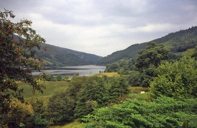
The two lakes in Gwydir Forest, directly above the town, and the reservoir a Llanrwst solicitor bought in 1895 and gave to the town for its water.
About 3.1 miles west (straight-line)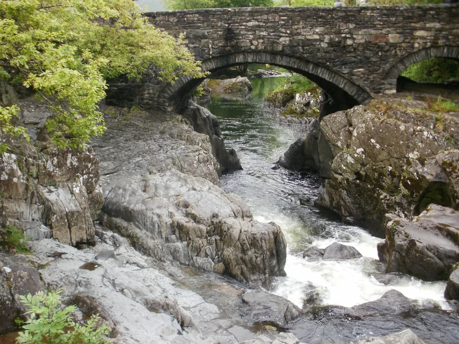
The valley’s visitor village, four miles south on the same river and the same railway: the busier, more geared-up half of the same valley.
About 3.2 miles south (straight-line)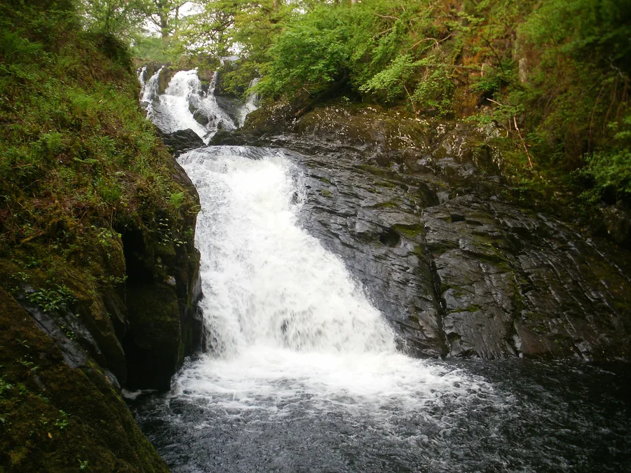
The Llugwy dropping through a rock staircase on the far side of Gwydir Forest. The valley’s loudest half hour.
About 3.2 miles south-west (straight-line)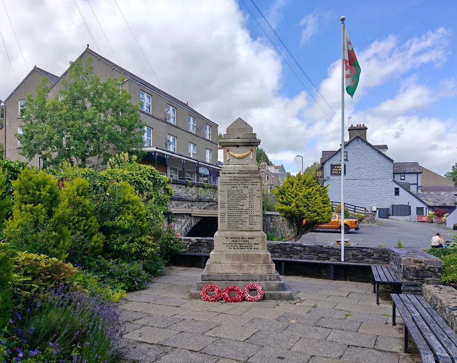
A valley village that still runs on water, with a mill the river drives and a waterfall off the street.
About 1.5 miles north-west (straight-line)Before you go
Walk downhill from the square to Pont Fawr, and the town reveals itself along the way.