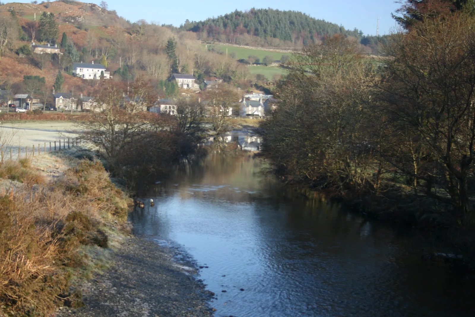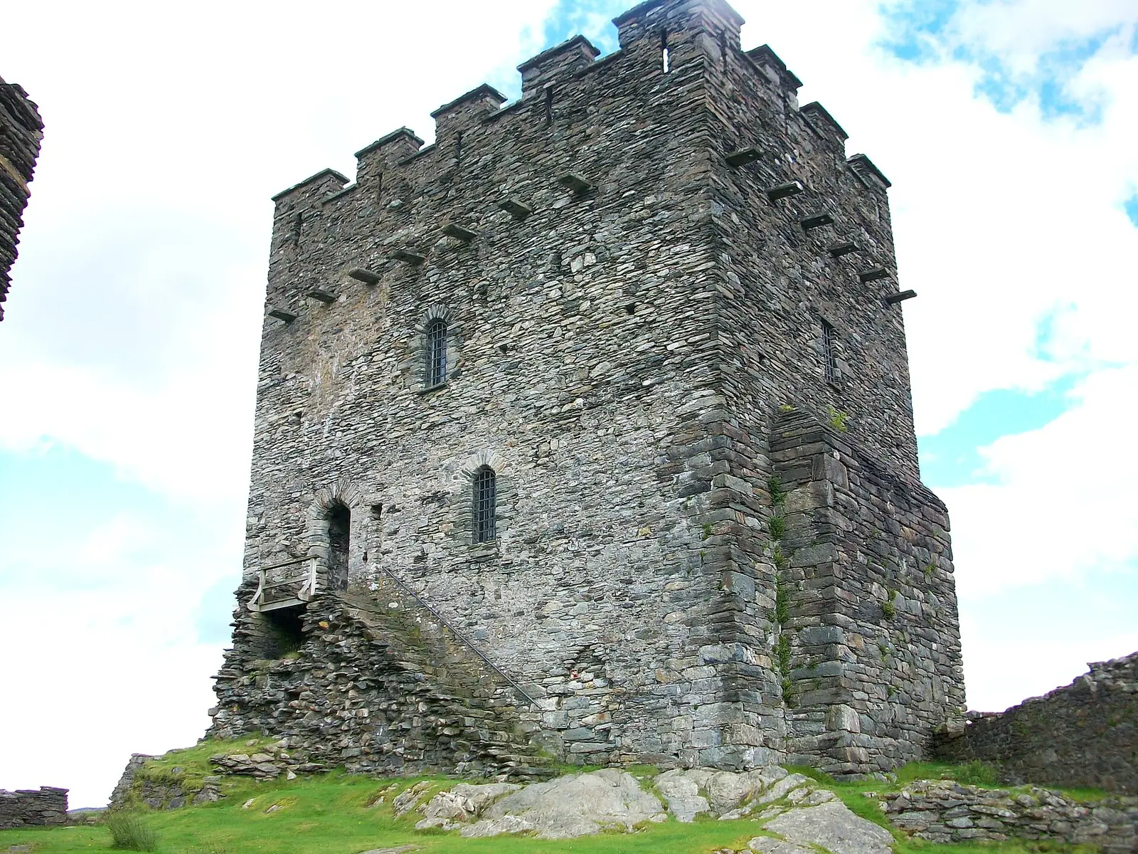
The join in the stonework
Two building campaigns six centuries apart meet partway up the keep, and once you have seen the line you cannot unsee it.
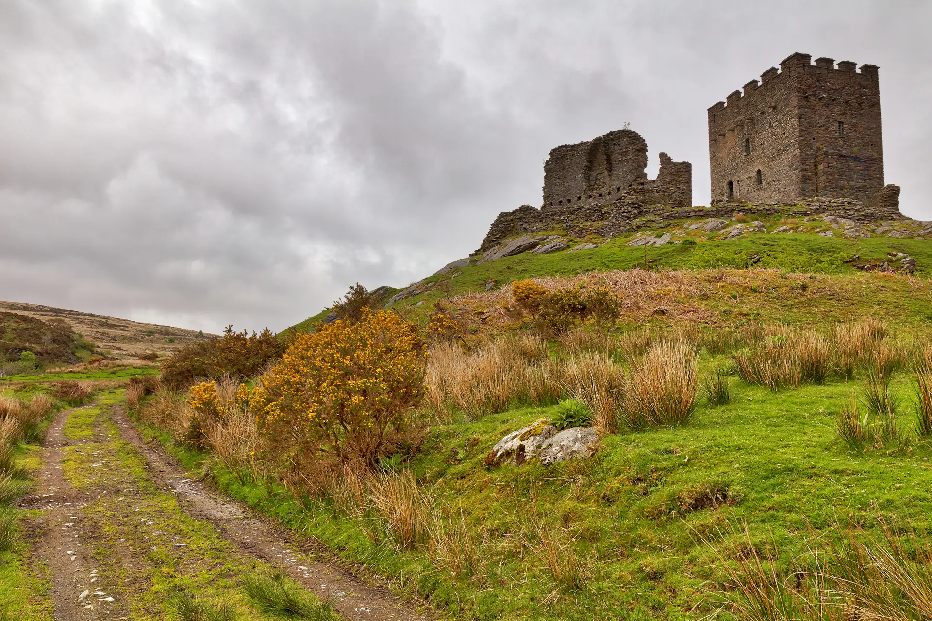
Conwy · the Lledr valley
Everything crossing these mountains has to come down this valley. A prince put a tower on the one rock that watches the gap, and a village grew up under it.
01The village
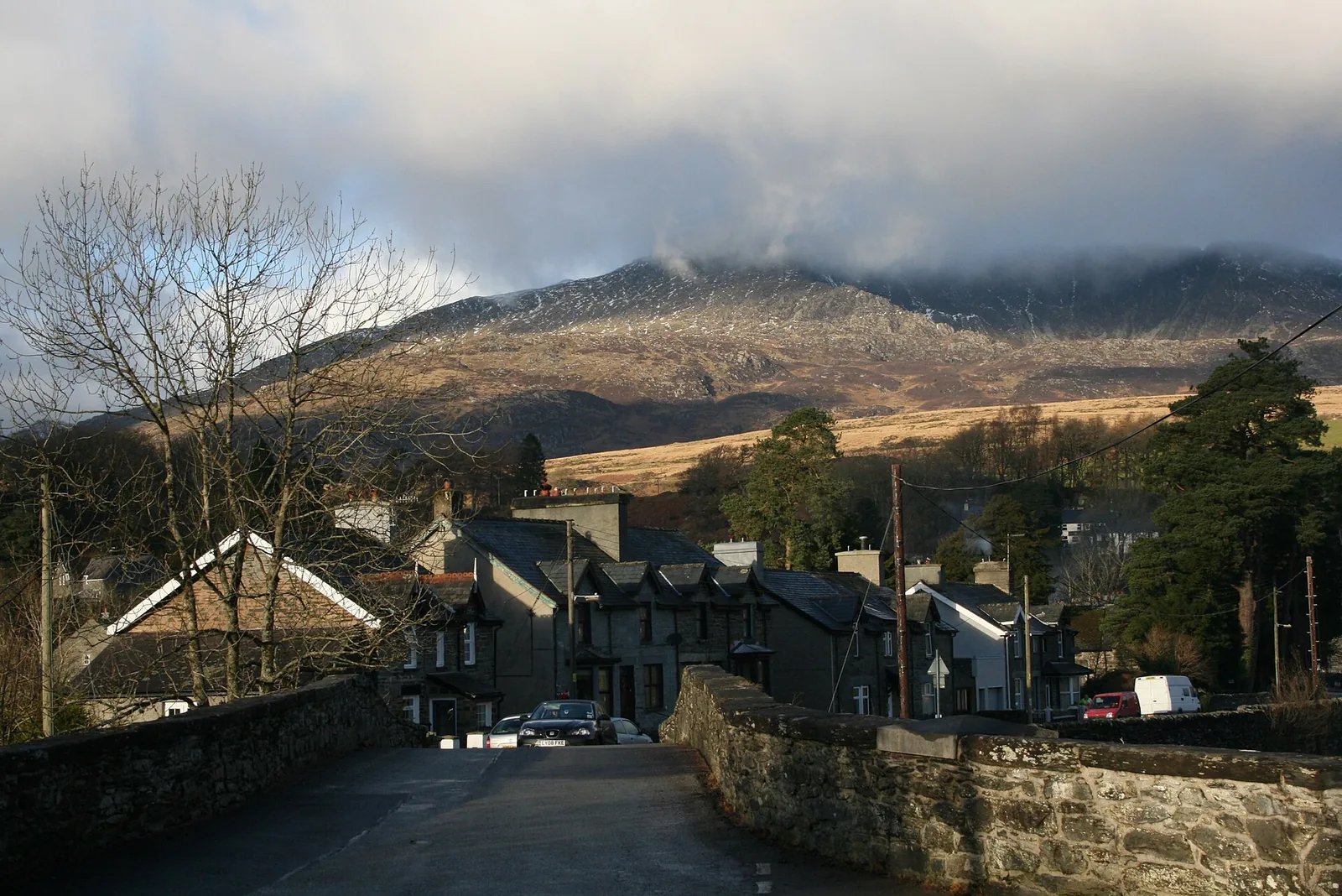
The main road runs the length of the valley, and the village lines up along it on the north bank of the Lledr. Everything in the centre is within about four hundred metres. Turn south and you cross the river at the old bridge, with the church on one side and the school on the other; the station is a little further, and the forest valley begins behind it. The castle is a separate walk, a mile and a half west on its own rock.
Most traffic treats this valley as the way to somewhere else. Stop, and three separate medieval landscapes sit within a mile and a half of each other — a prince’s tower, the church a Tudor gentleman built, and the ruin of his own house — with a train that will stop here if you ask it.
Character
A community of about 450 people, half of them Welsh-speaking at the last census that measured it. The slate terraces went up for quarrymen; the workings closed by the 1930s and the terraces stayed.
Pace
The centre, the bridge and the church take under an hour on foot. The castle adds roughly fifteen minutes each way on a farm track, and the waymarked forest walk is 3.4 km with a 9.5 km circuit above it.
Landscape
The Afon Lledr runs ten miles east to the Conwy. Moel Siabod stands 872 metres above the north side, Cwm Penamnen closes in forest to the south, and the pass climbs away towards Blaenau Ffestiniog.
Best for
Best for anyone who wants a mountain valley without a summit, for a castle you have to earn on foot, and for a car-free day: the forest walk starts at the station car park.
02Discover
Two building campaigns six centuries apart meet partway up the keep, and once you have seen the line you cannot unsee it.
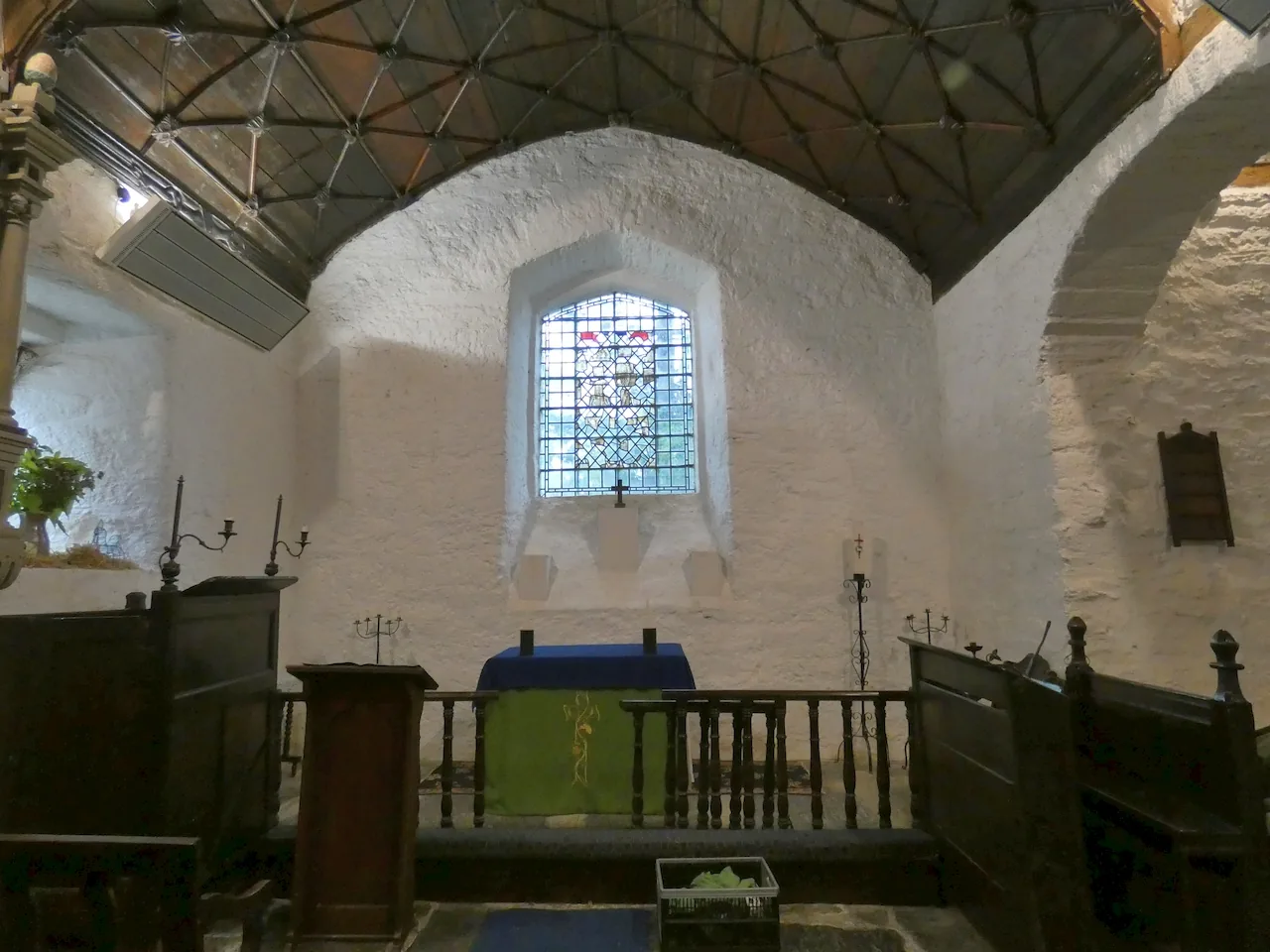
A bronze hand bell dug out of a hillside in 1850 now sits inside a building raised some seven centuries after it was cast.
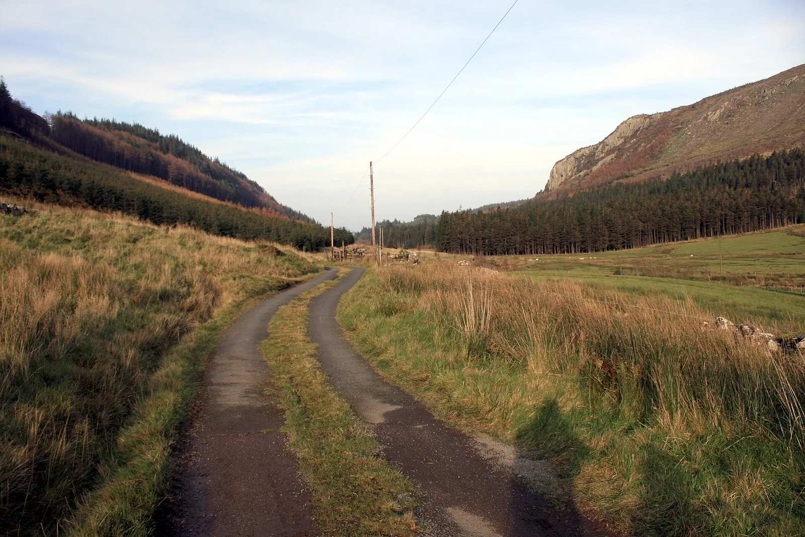
The forest track climbs the side valley one way and returns you to the village along the line of a Roman road.
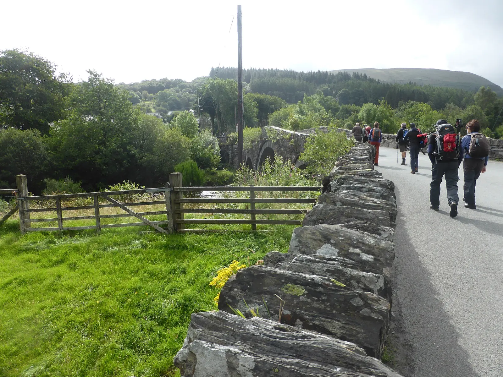
Stop halfway across the Lledr and the parapet tells you, by name, who built the bridge and who checked the work.
Beyond the first defining moments, the fuller Dolwyddelan catalogue continues below.
The village and its bridge are one cluster. The castle sits a mile and a half west on the far side of the valley, and the ruins are a mile and a half south, up the side valley behind the station.
 No verified image yet
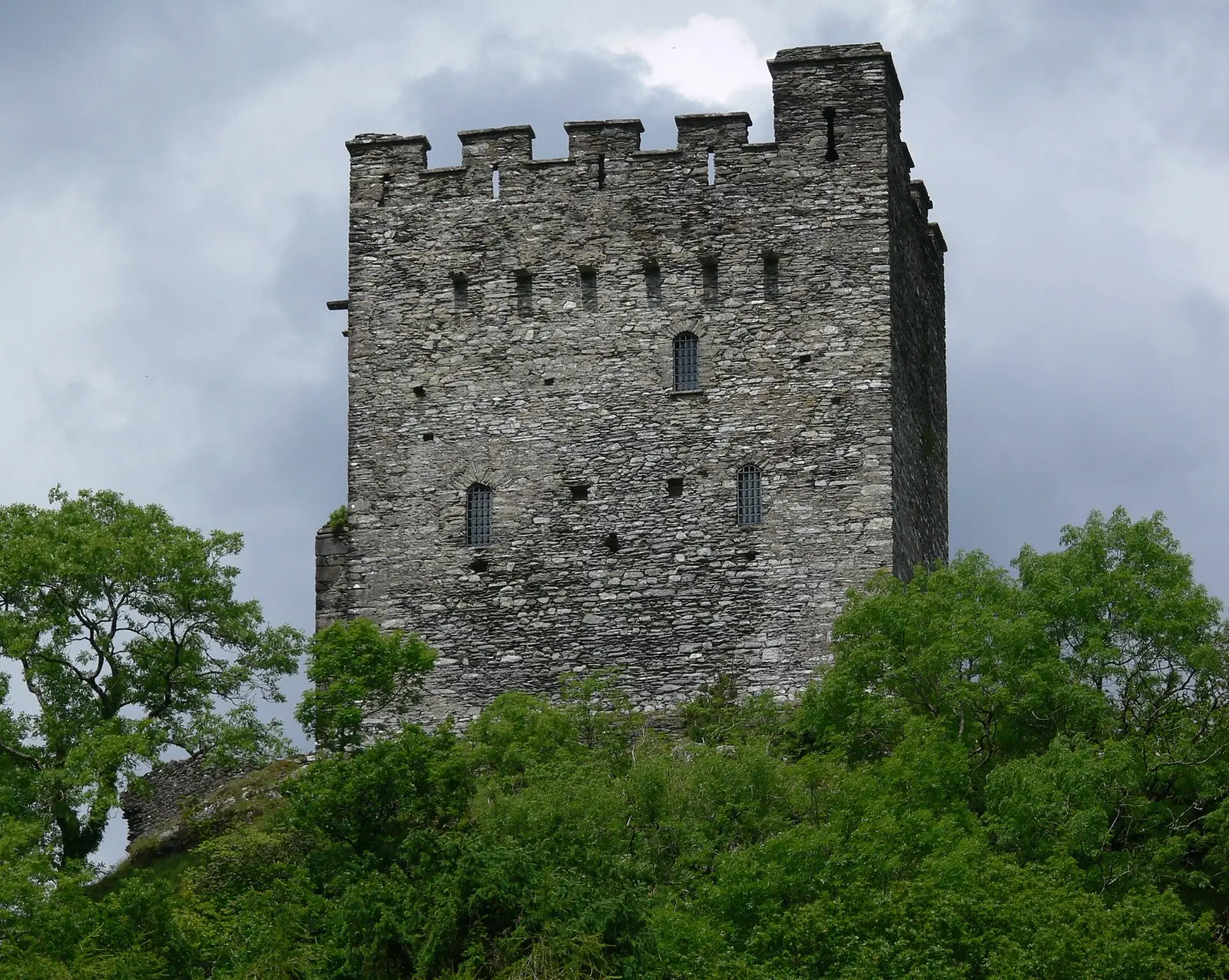
Dolwyddelan Castle
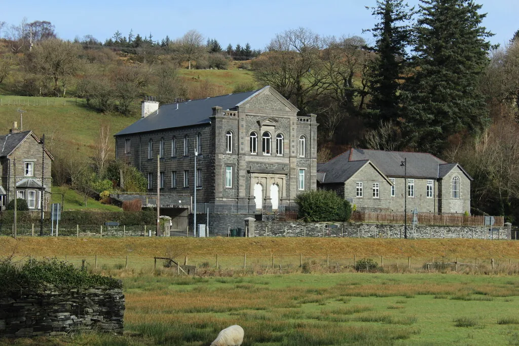
1.5 km west, on its own rock. Layby on the main road, then a 15-minute farm track.
Four entries: a Cadw castle you walk to, a Grade I church, a Grade II bridge in the middle of the village, and a fifteenth-century ruin at the top of a waymarked forest walk. No pubs, cafés or shops are listed here; see Local life for the village’s everyday character.
Cadw castle · free entry
Llywelyn’s tower stands alone on a rock above the valley, reached only across fields on a farm track. Free, and rarely crowded.
Check Cadw opening times (opens in a new tab)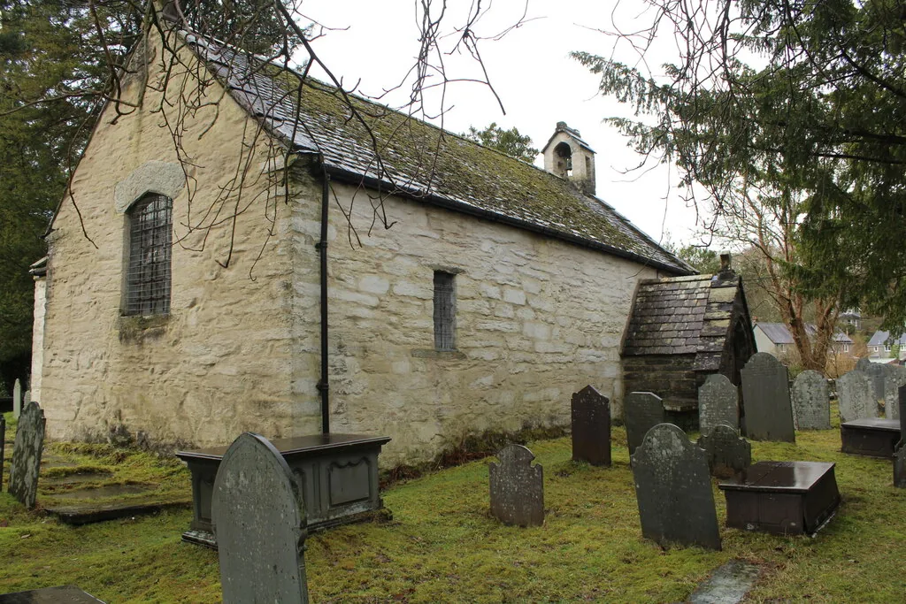
Grade I church
A small whitewashed church put here by a man who judged the old one too far from the village to reach safely. Its oldest object is a bell.
Grade II bridge
Three arches over the Lledr between the church and the school, and a parapet stone naming both the man who built it and the man who surveyed it.
Ruins & a waymarked forest walk
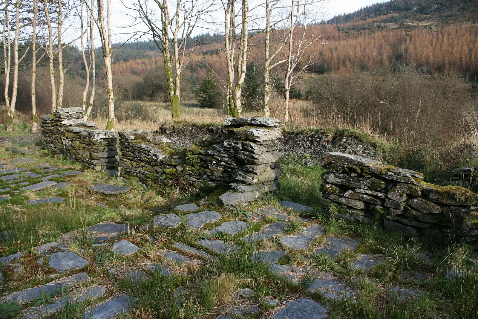
Slate floors and knee-high walls in a forest clearing: the house of the man who built the village church, at the top of an easy waymarked loop.
Natural Resources Wales: trail information (opens in a new tab)Two of these four change with the season. Cadw opens the castle’s interior only for part of the year, and shows it from the outside for the rest; the forest trails are on the ground all year but the tracks soften badly in sustained rain. Check the castle before you plan a day around going inside it.
Dolwyddelan Castle: Cadw opening and access03Story
The castle, the church and the ruin in the forest are not three unrelated sights. They are the same story told three times, by people who each held this valley in turn.
The Lledr carries the route between the Conwy valley and the heart of Gwynedd, and whoever held the valley controlled the crossing. On a small rocky knoll on the valley floor stands Tomen Castell, an earlier motte with the traces of a rectangular tower on top. It belongs to a cluster of small stone castles raised in Gwynedd late in the twelfth century, after Owain Gwynedd’s death in 1170: statements of a prince’s lordship rather than defences against invasion.
Llywelyn ab Iorwerth — Llywelyn the Great — probably began the rectangular keep on the rock west of the village between 1210 and 1240, to guard the route through his own territory. Tradition makes this his birthplace, and the tradition is worth knowing rather than believing: he was born around 1173, and the building almost certainly did not exist then. Tomen Castell, below in the valley, is the likelier site.
The castle fell to Edward I in 1283, during the conquest of Gwynedd. He raised the height of the keep and added a new tower, turning a Welsh princely stronghold into an English garrison post at the head of the pass. The west tower, now ruinous, is undated but was probably built late in the thirteenth century or early in the fourteenth.
Around 1489 Maredudd ab Ieuan ap Robert bought the lease of the castle, having left Eifionydd to keep clear of his kinsmen’s feuds. He built Tai Penamnen up the side valley, and around 1500 he built a new church in the village itself; the recorded account is that the old one stood too far away to reach safely. His descendants moved on to Gwydir and became the Wynns; three and a half centuries later one of them came back to rebuild the top of the keep.
Chwarel Ddu was working before 1810, the first quarry in the valley, and reached about 700 tons a year in the late 1850s. Prince Llewellyn quarry opened on the west side around 1820; in 1846 the road from Betws-y-Coed was re-routed to make room for a new mill and for Prince Llewelyn Terrace, built to house the workers. The railway arrived in 1879. The quarries closed between the late 1920s and 1934, and the terraces are still lived in.
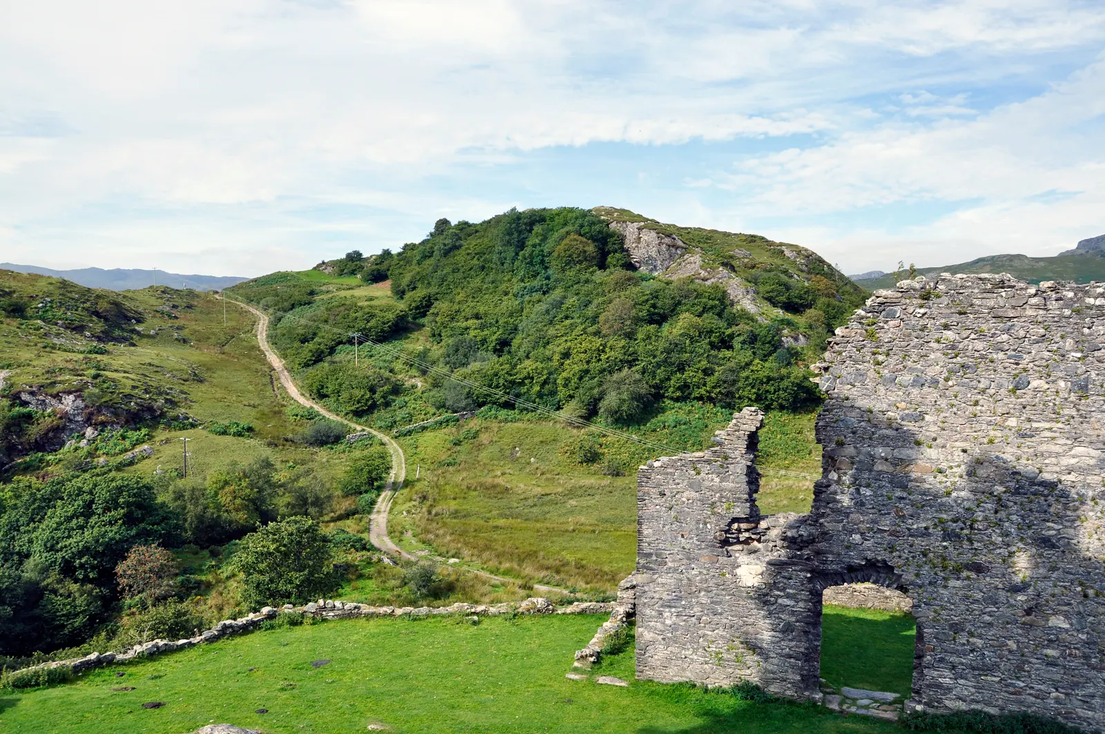
The battlements were added in the 1840s by a distant descendant of the man who had leased the castle three and a half centuries before.
Atlas of Wales
The terraces along the road were put up for quarrymen. The workings above the valley shut down between the late 1920s and 1934, and nothing replaced them, but the houses filled again, the school stayed open, and the chapel and the memorial garden are still where they were.
At the 2011 census half the community spoke Welsh. This is a working Welsh-language village of about 450 people that happens to have a castle a mile up the road, and a visitor walking to that castle is walking through the middle of it.
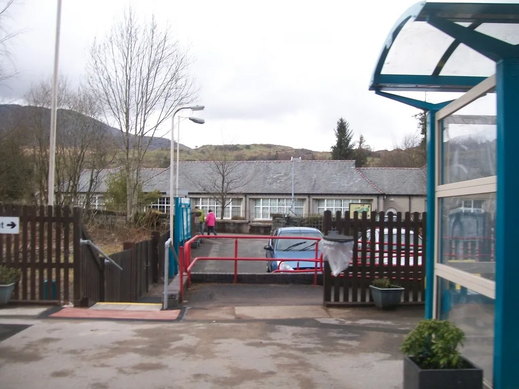
The station car park is run by the community, not the railway, and it is also the trailhead. The waymarked walk into Cwm Penamnen starts from the same tarmac the train drops you beside.
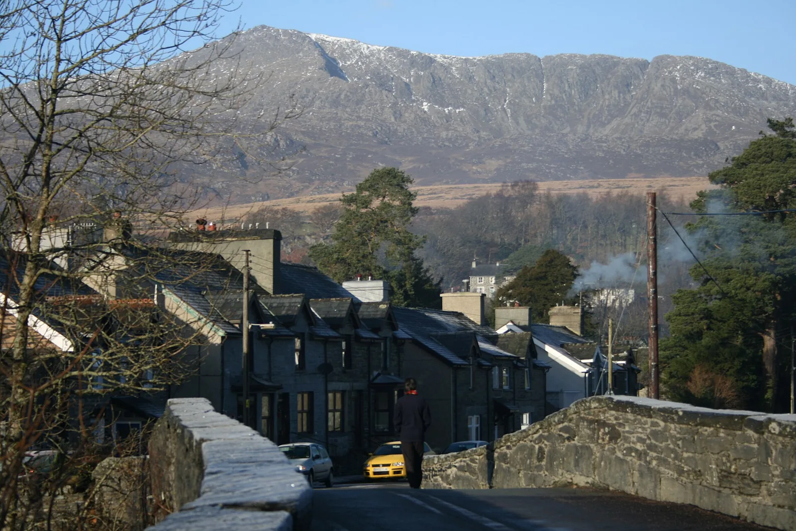
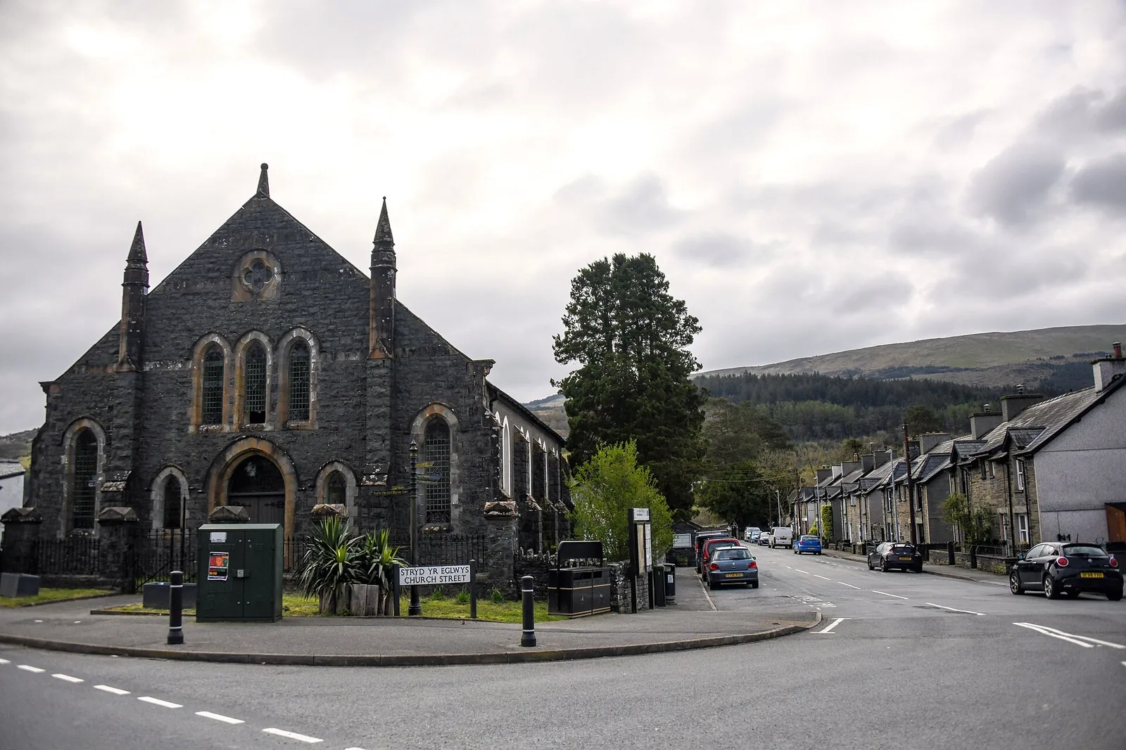
Welsh is the working language here rather than a heritage feature. The village keeps its own primary school, and the street names on the corner are Welsh first.
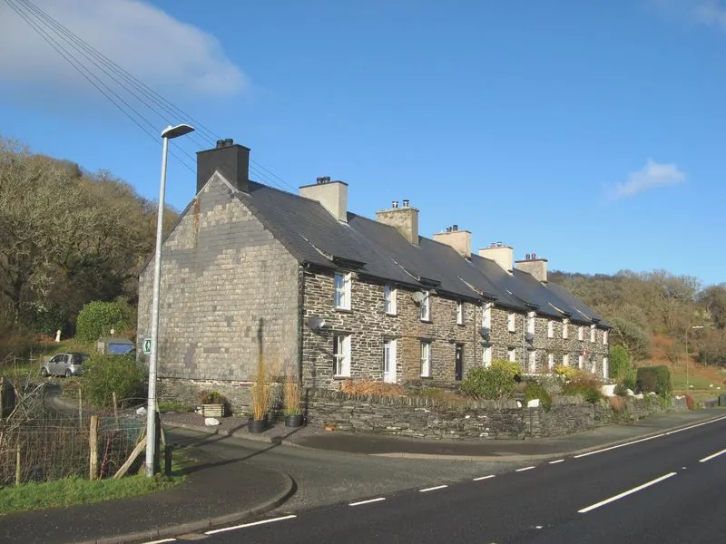
The terrace went up when the road was moved to make room for a new slate mill. The mill and the quarry are gone; the row is still somebody’s front door.
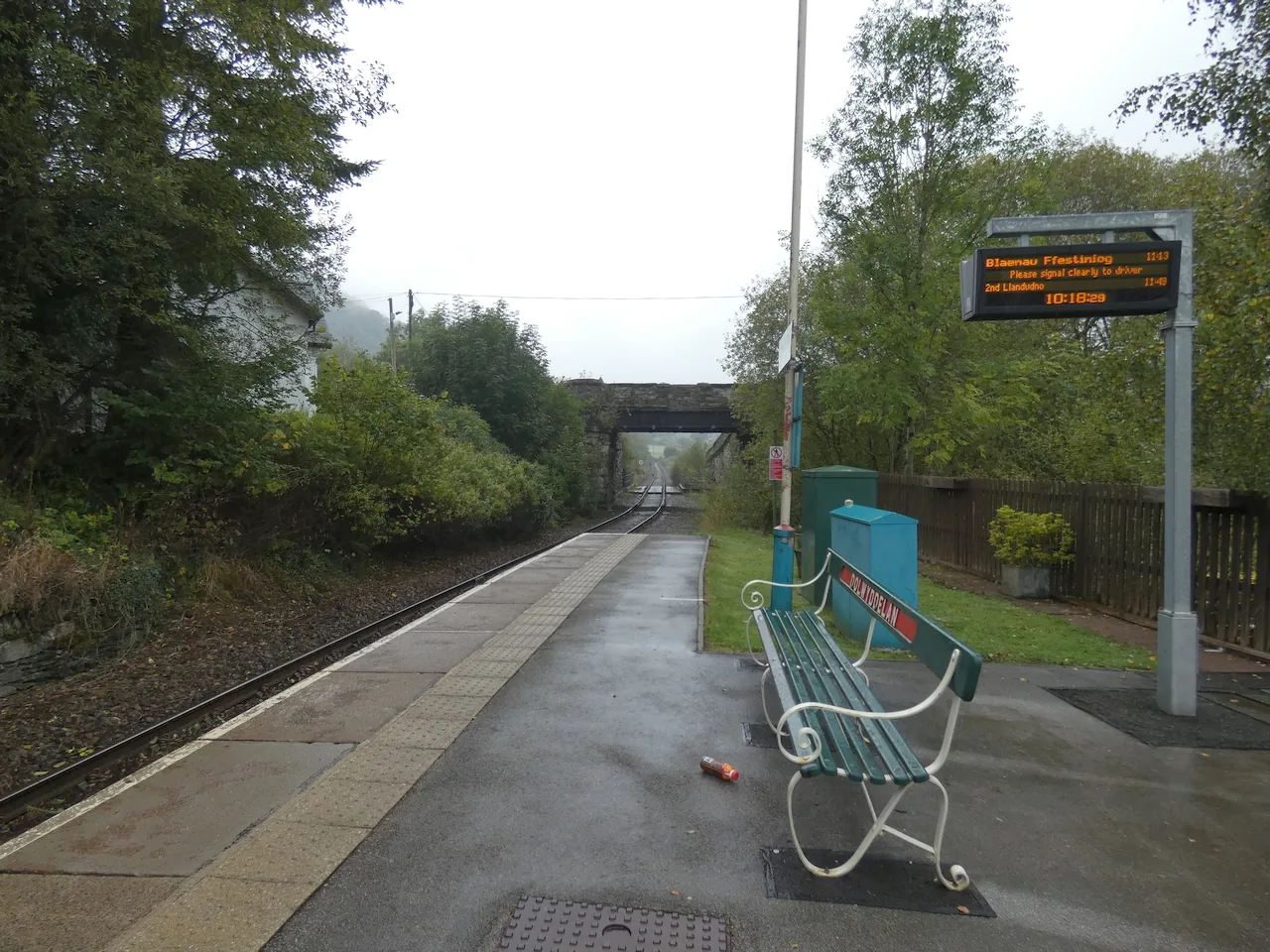
The station opened in 1879 and is unstaffed. Trains call on request, and there is step-free access from the car park to the platform.
What the village keeps
A chapel, a memorial garden, a primary school and four streets of quarry housing. None of it was built for visitors and none of it has been repurposed for them, which is why the walk between the bridge and the station tells you more about the last two centuries here than any of the medieval sites do.
Plan your time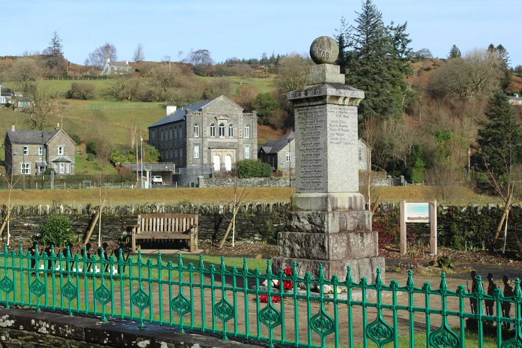
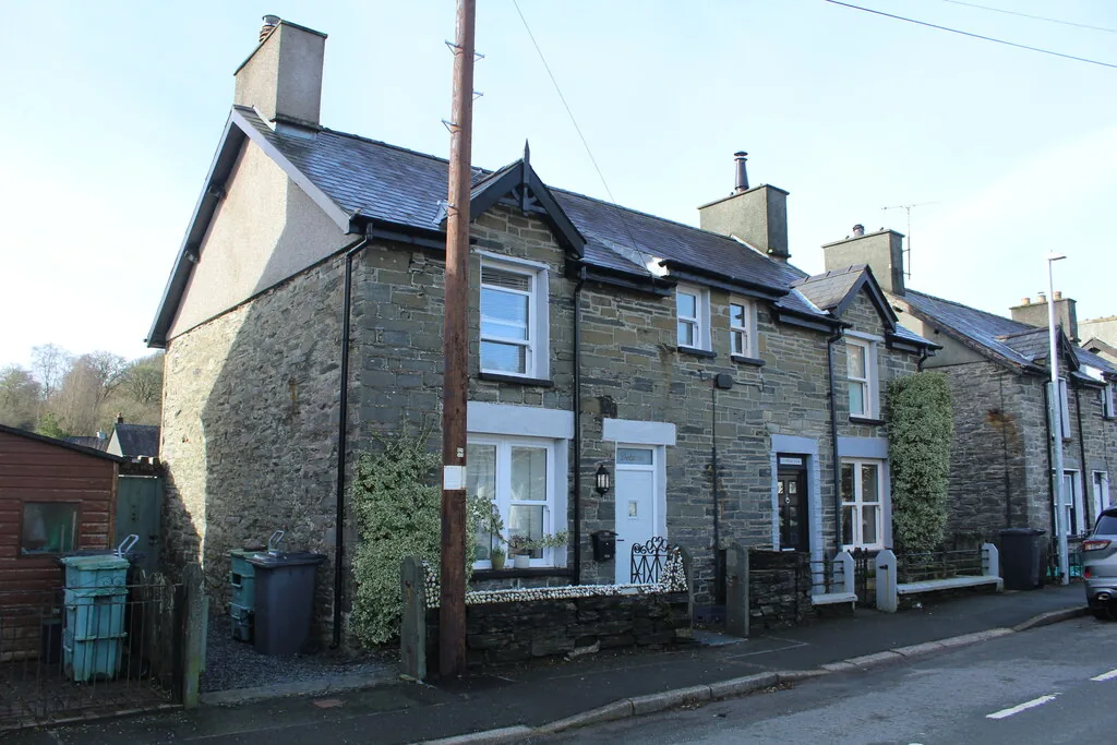
In 1846 the road was moved so a slate mill could be built. The mill closed. The road never went back.
Prince Llewellyn quarry, 1820–1934
04Plan
Four hundred metres of village, with the mountain filling the north side.
Look for the inscribed stone set into the north-east parapet.
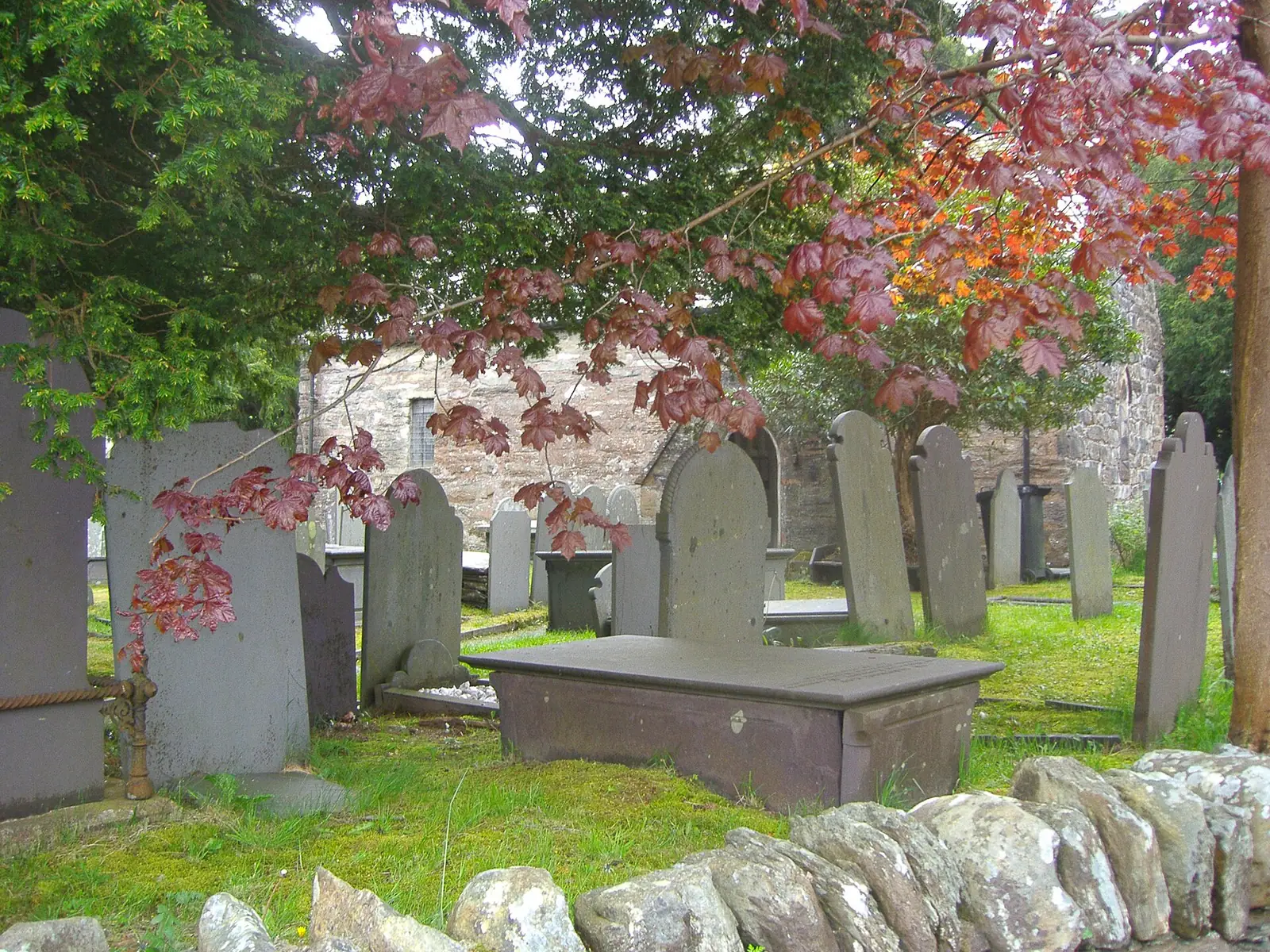
Small, whitewashed, and much older inside than the outside suggests.
Park in the layby, cross the right of way, and climb the last of it.
Community-run, with a charge, and the marked start of both loops.
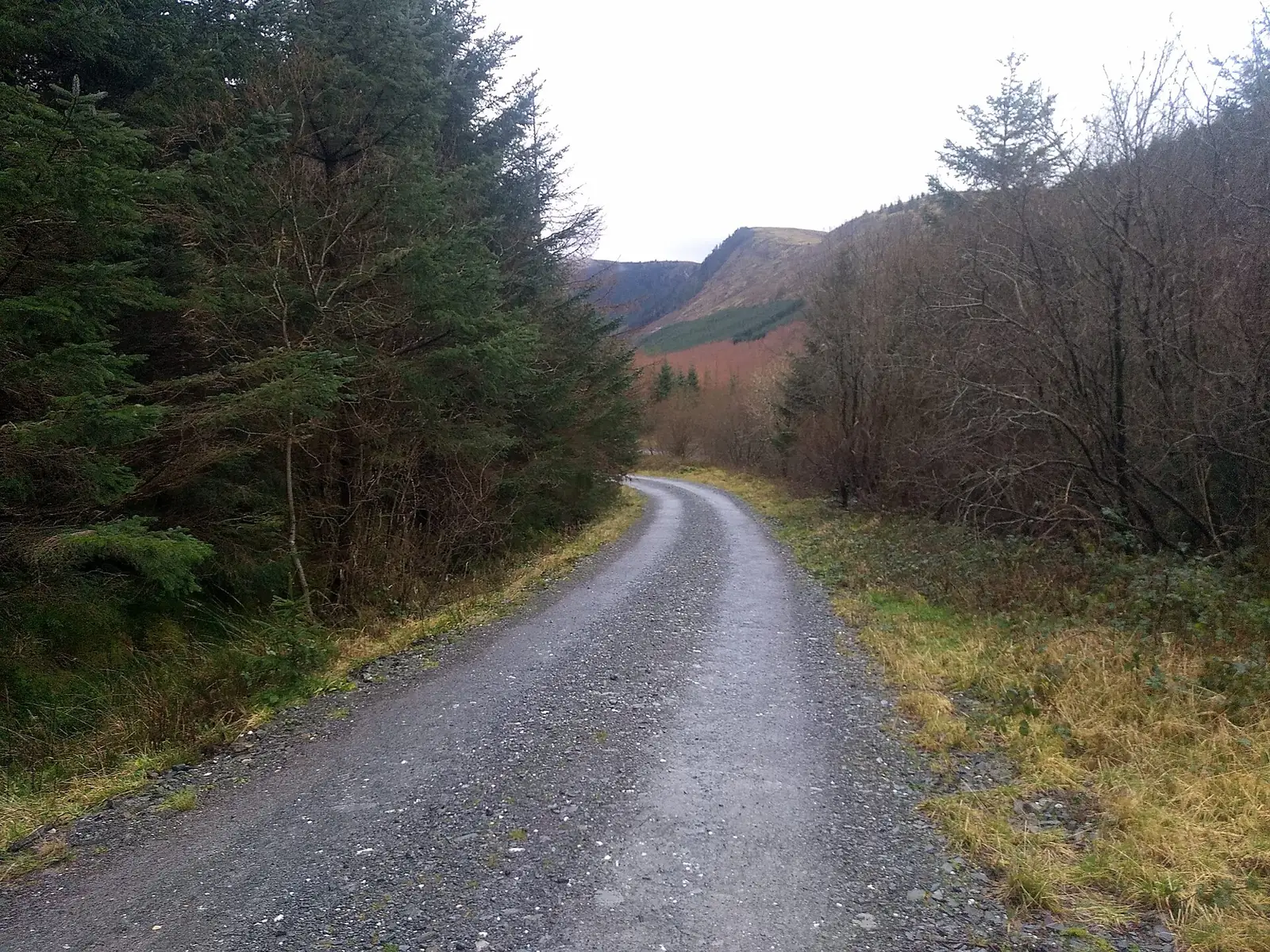
Wide, graded and easy underfoot, climbing steadily into the side valley.
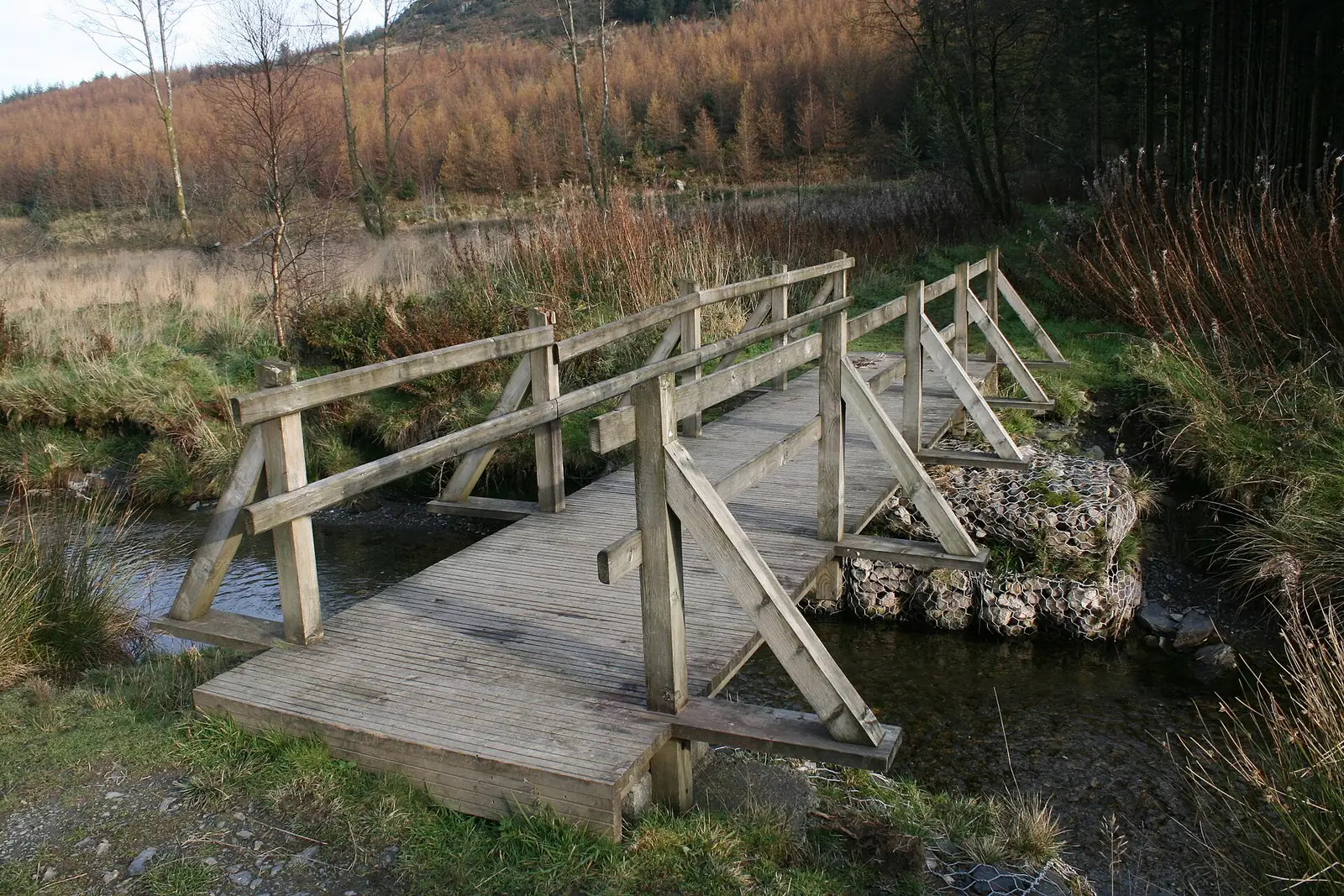
The picnic area sits by the river here, two tables and the valley view.
Slate floors, low walls and an interpretation panel in the clearing.
The return leg follows the Roman road back down to the village.
Practical
Everything you need for arriving and getting around.
Getting here
The A470 runs through the village, between Betws-y-Coed to the north-east and Blaenau Ffestiniog to the south-west over the Crimea Pass (Bwlch y Gorddinan). Village parking is limited; the station car park is community-managed and a charge applies. The castle has no car park of its own; Cadw directs visitors to a layby on the A470 about 500 metres east of the monument, and the farm route is private.
Open Dolwyddelan in Google MapsDolwyddelan is a request stop on the Conwy Valley Line between Llandudno Junction and Blaenau Ffestiniog, operated by Transport for Wales. Signal the driver to board and tell the conductor to alight. The station is unstaffed, with a shelter and a live information display, and step-free access from the car park to the platform. Journeys are limited and the pattern differs on Sundays.
Conwy Valley Line: current timetablePractical details
The car park at the railway station is managed by the local community and a charge applies; Natural Resources Wales names it as the start of both waymarked walks. The castle has no car park; Cadw directs visitors to a layby on the A470 about 500 metres east of the monument, and states the farm route is private.
Natural Resources Wales: Gwydir Forest Park, DolwyddelanThe station car park is the one mapped destination here. The castle layby is described by Cadw rather than mapped as a car park, so it is not pinned above. Charges and restrictions can change — check the signs when you arrive.
Dolwyddelan Station
By the station · the walks start here
Google Maps (opens in a new tab)Entry to the castle is free. Cadw opens the interior on a seasonal pattern and shows the monument from the outside only for the rest of the year, so check before travelling. The churchyard is not gated. Cwm Penamnen’s forest tracks and the Sarn Helen lane are open at all times.
Dolwyddelan Castle: current opening timesFree; interior seasonal, exterior viewing otherwise
No opening hours published · churchyard open
Open at all times; no admission
The station has step-free access from the car park to the platform. The castle does not: Cadw grades the approach as strenuous, on farm tracks with wooden bridges, muddy in wet weather, and warns of smooth stone at the entrance and steep stone staircases to the wall walks. The short forest walk follows wide forest road and a single-track lane.
Per-site accessibility inside the church is not published and is not claimed here. Contact the parish directly if this matters to you.
Step-free from the car park to the platform
Strenuous farm track; steep stairs inside
Conwy operates a county-wide Dog Control Public Spaces Protection Order covering fouling, carrying a means to pick up, exclusion areas and dogs on leads by direction. The route to the castle crosses working farmland with livestock.
Cadw publishes no dog policy for the inside of this monument, so none is stated here. The churchyard is a churchyard; treat it as one.
Conwy County Borough Council: controlling your dog in public
The village, the bridge and the church are one short walk. The castle and the forest valley are separate outings in opposite directions, and both want boots.
One valley, four ways out
Four real Atlas destinations pair with a Dolwyddelan visit; distances are straight-line from the village centre, not driving times.
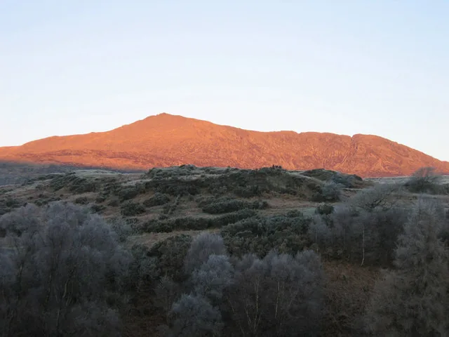
The mountain filling this village’s northern sky, from the other side: 872 metres, a lake in its eastern cwm, and the ridge that looks down on the whole Lledr valley.
About 2.2 miles north-west (straight-line)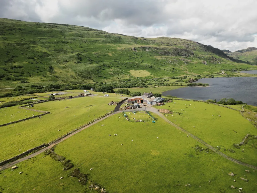
The other side of Siabod’s shoulder, and the village most walkers start the mountain from: a climbing settlement where Dolwyddelan is a quarrying one.
About 3.7 miles north (straight-line)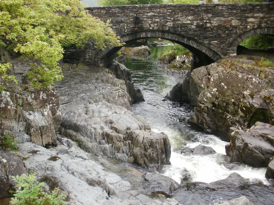
Where the Lledr finishes: the busy end of the same valley road and the same railway line, with everything Dolwyddelan deliberately does not have.
About 4.5 miles north-east (straight-line)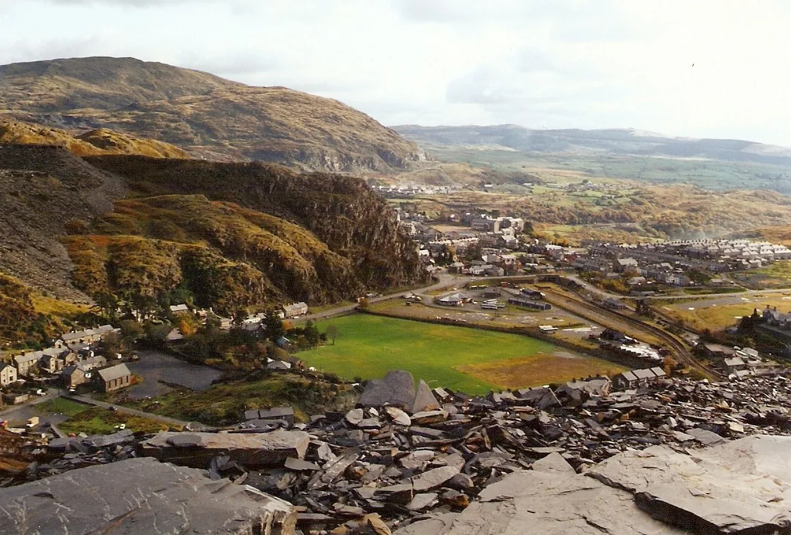
Over the pass, the town where the slate trade won: the industrial scale that Dolwyddelan’s handful of small quarries never reached, at the end of the same line.
About 4.6 miles south-west (straight-line)Before you go
Fifteen minutes of farm track buys you the view the whole place was built to watch.