An easy end-of-island stop where the only real decision is the toll road or the walk in.
CHECK FIRST · OPENING
The Point itself is open access, but the heritage cluster is timed: Penmon Priory, Cross, St Seiriol’s Well and the dovecote are Cadw sites open 10am–4pm (the dovecote closes 24–26 Dec and 1 Jan). Confirm current opening on Cadw.
Time needed
Short stop for the Point · half a day with the priory and dovecote
Best time
Early on busy days: the car park is small · low, raking light
Opening, entry & booking
Free (Cadw sites)
Access & difficulty
Easy · a short, level walk
Parking & start point
Toll road to the lighthouse car park · free from Penmon village on foot
Getting there
East of Beaumaris, via Llangoed
Toilets, food & facilities
Pilot House Café, seasonal · toilets for customers only
Dogs
No dog order published · close control near the water and nesting birds
Plan with confidence.Detailed information on arrival, access, facilities, restrictions and local conditions.
Opening, entry & booking
The Cadw sites
The priory and dovecote are free to enter, with no ticket and no booking.
The Point itself
Open shore, always accessible on foot. What you pay for is the toll road, not entry.
Toll road
A small per-car charge is collected on the private road out to the lighthouse car park. Walkers and cyclists can avoid it by parking back toward Penmon village.
Café
The Pilot House Café keeps seasonal hours of its own, so treat it as a bonus, not a certainty.
Booking
None for any part of a general visit.
Parking, start point & arrival
The road
The last stretch to the Point is a private toll road with a car park by the lighthouse. A small charge applies per car, collected on the road.
Free option
Walkers and cyclists can park back toward Penmon village and continue to the Point without paying the toll.
There is no dedicated stop at the Point. Buses run toward Penmon from Beaumaris; there is no confirmed frequency for this guide.
Plan a route
No operator publishes a route page for this stretch. Plan door to door with Traveline Cymru, and check the current service before travelling.
By boat
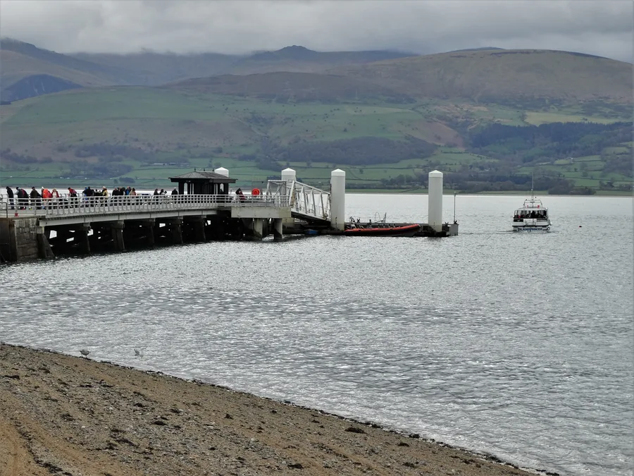
Wildlife cruises that circle Puffin Island run seasonally from Beaumaris.
Toilets, food & facilities
Café
The Pilot House Café sits at the Point. Hours are seasonal, so treat it as a bonus rather than a certainty out of season.
Toilets
Toilets at the Point are for café customers only, so plan it as a no-facilities stop and use Beaumaris beforehand.
Accessibility & terrain
To the Point
A short, level walk from the lighthouse car park, the easiest part of the visit.
Underfoot
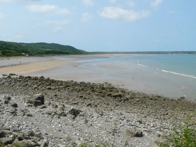
Rock and shingle shore, not sand. Uneven and slippery when wet; stay well back on the rocks.
Driving in
The toll road puts you close to the shore, which is the practical option for limited mobility; the free alternative is a walk in from Penmon village.
Not reachable on foot
Neither the Trwyn Du lighthouse nor Puffin Island is walkable. The sound between them carries strong tides.
Dogs & restrictions
On the shore
No dog order is published for the Point. Keep dogs under close control near the water and nesting birds, and follow any on-site signs.
Safety, weather & local conditions
The shore
This is an exposed sea point of rock and shingle. Stay well back on the rocks. Never try to reach the lighthouse or Puffin Island on foot; the sound between them carries strong tides. Check tide times for Penmon: Met Office, from its Lleiniog Beach page, reading the Trwyn Dinmor station along the same headland. There is no tide at which the crossing becomes walkable.
In an emergency
Dial 999 and ask for the Coastguard.
PLACE-SPECIFIC DETAILS
Puffin Island & conservation
What it is
Puffin Island (Ynys Seiriol) is a protected seabird island, a Site of Special Scientific Interest and Special Protection Area, known for its great cormorant colony.
Access
It is privately owned; you view it from the shore or by boat. Landing is not for visitors.
Other place details
The shore
Rock & shingle, not sand
The lighthouse
Trwyn Du, just offshore
Puffin Island
Low across the sound
Heritage
6th-c priory & c.1600 dovecote
On the coast path
Anglesey Coastal Path
What to bring
Sturdy shoes
Windproof layer
Binoculars
Water
Change for the toll
Don’t come for a beach. Come for the edge.
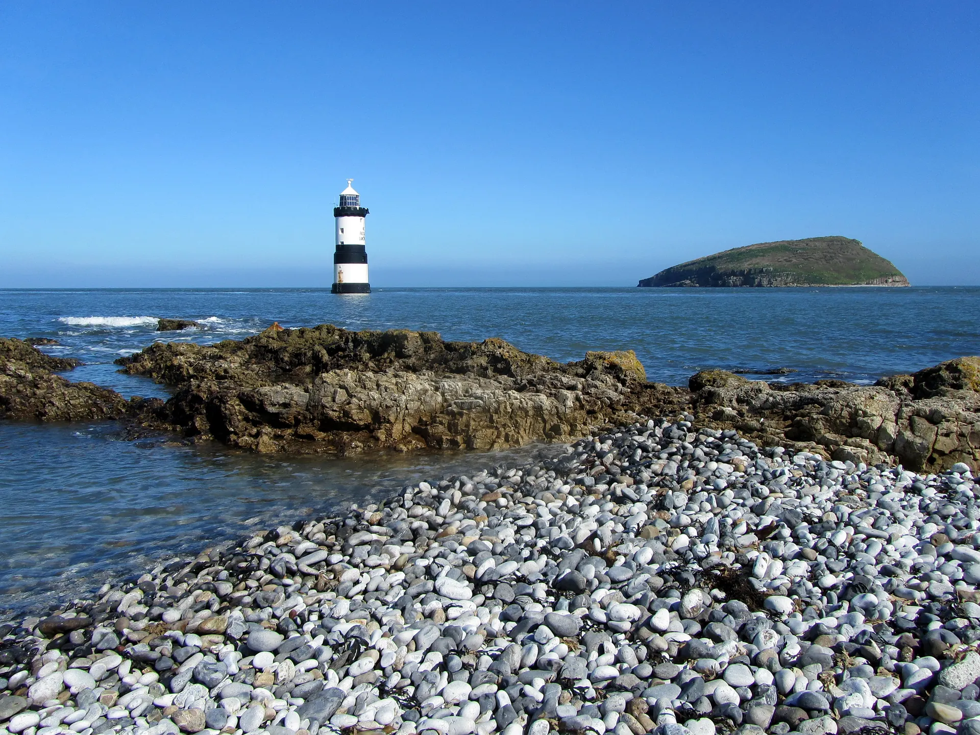
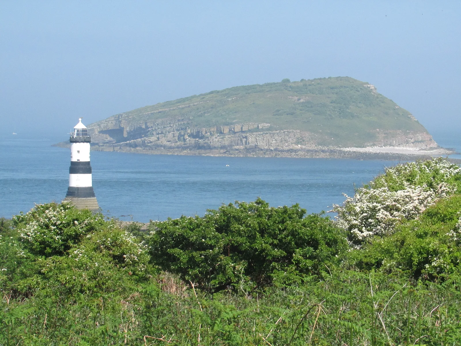
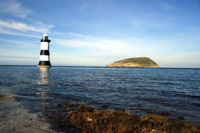
Penmon Point is where Anglesey runs out into the sea. The black-and-white Trwyn Du Lighthouse stands offshore on its own low rock, and Puffin Island lies across a narrow, fast-running sound.
A mile back sit a 6th-century monastery, a carved 10th-century cross and a dovecote from around 1600, so one short stop holds a working sea light, an early-medieval site and a protected bird island.
A light on a rock, an island across the water.
Should this shape your day?
An easy stop that quietly stacks a lighthouse, a monastery and a bird island.
Good fit for
anyone drawn to lighthouses and coastlines
heritage visitors: priory, cross, dovecote
birdwatchers and photographers
families wanting an easy walk to the sea
coast-path walkers pairing Penmon with Beaumaris
Think twice if
you want a sandy swimming beach
you need guaranteed toilets on site
you’d rather not pay a toll or walk the last mile
you’re visiting out of season expecting the café open
you want the priory, cross and dovecote too, because those keep set hours
Before you go
the Point is open access; Cadw sites 10am–4pm
reached by a private toll road, or a free walk in
strong tides in the sound, so stay back on the rocks
A clear, calm day: low light on the tower, Puffin Island sharp across the sound, the priory quiet before the Point.
The sound runs strong between the Point and the island, and you watch it from the shore.
Out to the edge, and back.
See the shape of the visit before you make it.
01 Beaumaris
Leave town, east through Llangoed.
02 The toll road
Pay at the road, or park back and walk in.
03 Priory & well
The monastery, the cross, the dovecote.
04 The Point
The car park; the tower appears offshore.
05 The shore
Cross the shingle to the water’s edge.
06 Puffin Island
Low across the sound; scan for birds.
07 Café & back
Warm up, then the coast path north.
Seen along the way.
The tower, the island, and the old stones: the visit before you make it.
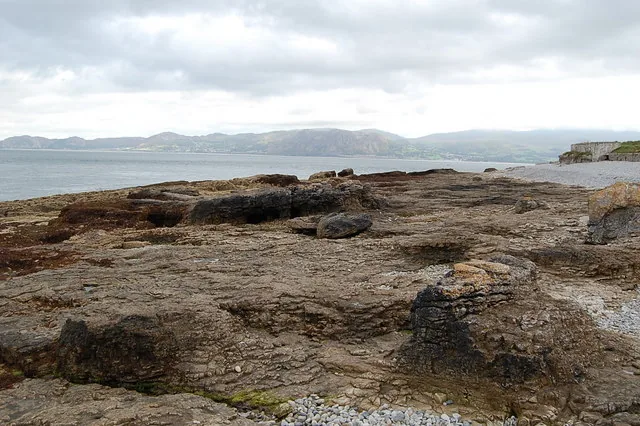
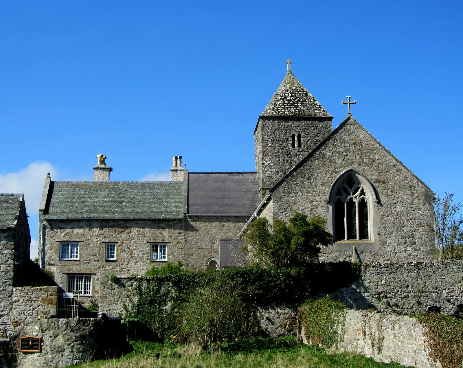
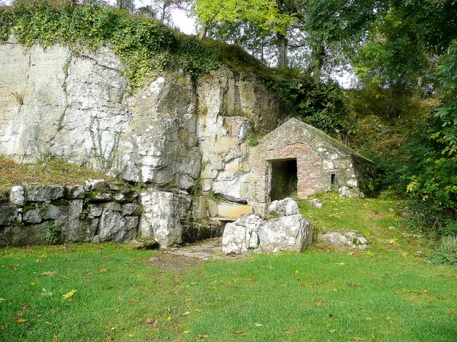
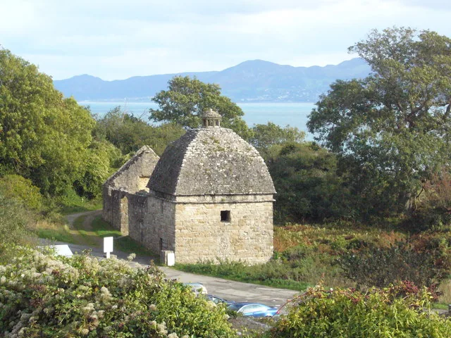
Trwyn Du Lighthouse and Puffin Island, across the soundRock and shingle at the Point: not a sandy beachPenmon Priory church, a mile back from the PointSt Seiriol’s Well, beside the old monasteryThe c.1600 dovecote and its domed roof
The parts people remember
The island runs out gradually, then stops all at once.
01
The road runs out of trees
The lane east narrows past the priory and the ground opens toward the water, until the tarmac simply ends at a shingle shore.
02
A tower on its own rock
Trwyn Du stands offshore, black and white in bands, close enough to read every stripe and entirely out of reach.
03
Down onto the shingle
The shore is rock and coarse shingle rather than sand. Walking to the waterline puts the sound directly in front of you, running fast between the point and the island.
04
The bell at the tower
A heavy bell hangs on the seaward side of the light, small against the tower, and the one part of it built to be heard rather than seen.
05
Puffin Island stays low
Turning inland, the island keeps its place across the sound: a long, low back of rock that never rises far out of the water.
A short stop at the edge, with the sea running hard through the middle of it.
The record
What we know, carefully told.
Four field notes on the eastern tip of Anglesey: a sea light, a monastery, a dovecote and a bird island.
Some of this is Cadw- and Trinity House–solid. Some rests on a single record, and it’s flagged where it is.
Field notes
Four entries. Open one to read the note.
Sea light Fact
Trwyn Du, out on its rock
Field note I · filed under the lighthouse
The black-and-white tower marks the passage between the Point and Puffin Island, at the north entrance to the Menai Strait.
What is known
Trinity House built the lighthouse in the 1830s, completed in 1838, designed by James Walker. Its light flashes white every five seconds, with a focal height of about 19 metres and a range of 12 nautical miles.
What the record adds
It was automated in 1922 and converted to solar power in 1996; a 178 kg fog bell hangs at the tower, once worked by a mechanism built for it. The tower reads “NO PASSAGE LANDWARD” on its north and south faces.Tower height · sources disagree, omitted
What to notice there
From the shingle you can read the tower and its three black bands. Don’t try to reach it; the rock is offshore and the sound runs fast.
Monastery Fact
St Seiriol’s Penmon
Field note II · filed under the priory
A mile back from the Point, Penmon keeps one of the older Christian sites on Anglesey.
What is known
A monastery was founded here in the 6th century, associated with St Seiriol. The standing priory remains are largely 13th-century, from when it joined the Augustinian order; inside the church, which still serves the parish, stands a carved cross of 10th-century date.
Tradition
St Seiriol’s Well nearby is linked by tradition to the earliest monastery; Cadw itself hedges the claim that its lowest walls could make it one of the oldest Christian buildings in Wales.Well · tradition, not proven
What to notice there
Look for the 10th-century cross inside the church and the well in its later stone cell, a short walk apart.
The dovecote Record
A larder in stone
Field note III · filed under the dovecote
Beside the priory stands a domed dovecote, a working food store built for a great house.
What is known
Cadw records the dovecote as built around 1600 by Sir Richard Bulkeley. Its domed roof gave room for up to 1,000 nests, and a stone pillar rises at the centre where a revolving ladder once reached them.
What the record adds
Doves and pigeons were kept for meat and eggs through the year, a practical luxury for the Bulkeley estate.Detail · from the Cadw record
What to notice there
Step inside and look up: the nesting boxes ring the whole dome around the central pillar.
Bird island Record
Ynys Seiriol
Field note IV · filed under the island
The island across the sound is a protected seabird colony: watched from land, not landed on.
What is known
Puffin Island (Ynys Seiriol) is a Site of Special Scientific Interest and a Special Protection Area, classified for its internationally important colony of great cormorants. It is privately owned, and it carries the remains of a 12th-century monastic church tower.
What the record adds
Brown rats reaching the island in the 19th century crashed its puffin numbers; a control programme from 1998 is recorded as helping the seabirds recover.Seabird recovery · recorded
What to notice there
Scan the water and the island’s flanks from the Point for cormorants, gulls and, at times, seals. Boat trips circle it from Beaumaris.
Don’t let the day end at one pin.
Four stops that turn the eastern tip into an Anglesey day.