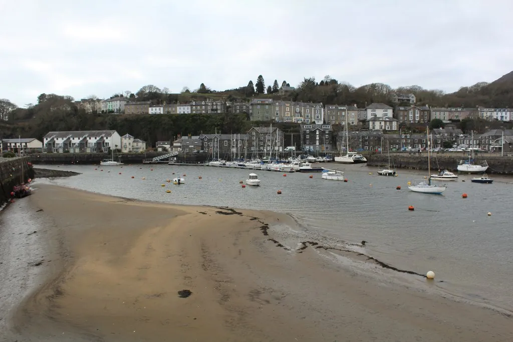
The harbour that shouldn’t exist
An embankment across the estuary reclaimed the land and, by accident, scoured a deep-water harbour.
Gwynedd · Eifionydd
An embankment built to reclaim farmland scoured out a deep-water harbour instead, and the town that grew around it is still working, not preserved.
01The town
Porthmadog exists because an early-1800s embankment reclaimed an estuary and, in the process, scoured out a natural deep-water harbour. The Ffestiniog & Welsh Highland Railways still terminate at the quay, and the High Street runs inland from it: an ordinary Welsh market town built on a genuinely unusual piece of engineering.
Few Welsh towns owe their whole existence to a single embankment. Porthmadog works as a short harbour stop or a half-day that extends naturally to Borth-y-Gest, the older village a mile along the coast.
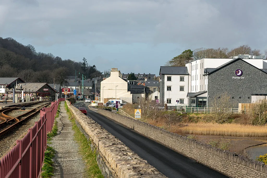
Character
Boats, a heritage railway and an ordinary High Street share the same short walk, not staged for visitors.
Pace
The harbour, station, museum and High Street sit within a few minutes of each other.
Landscape
The Cob’s mile-long footpath looks straight across Traeth Mawr to the mountains of Snowdonia.
Best for
Best for rail heritage, a free harbour walk, and a natural stop on the way into Eryri.
02Discover
An embankment across the estuary reclaimed the land and, by accident, scoured a deep-water harbour.
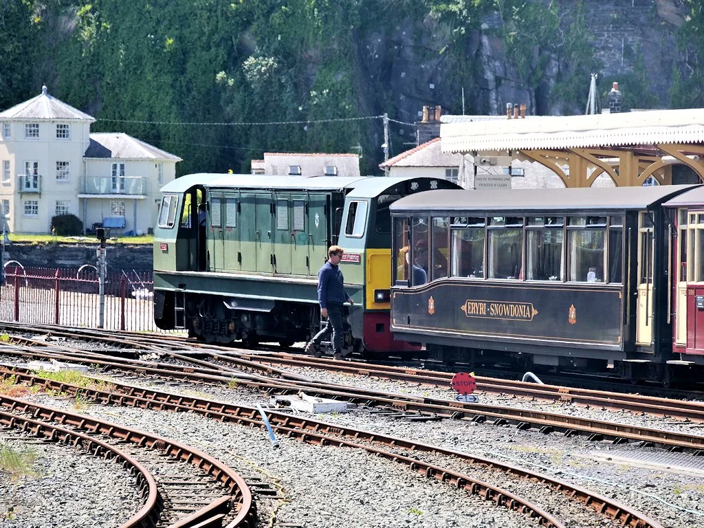
Two restored narrow-gauge lines still run from these platforms, one of them all the way to Caernarfon.
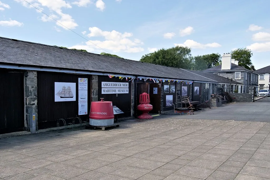
A small museum inside the last slate shed left standing on the quay, telling the story of the port.
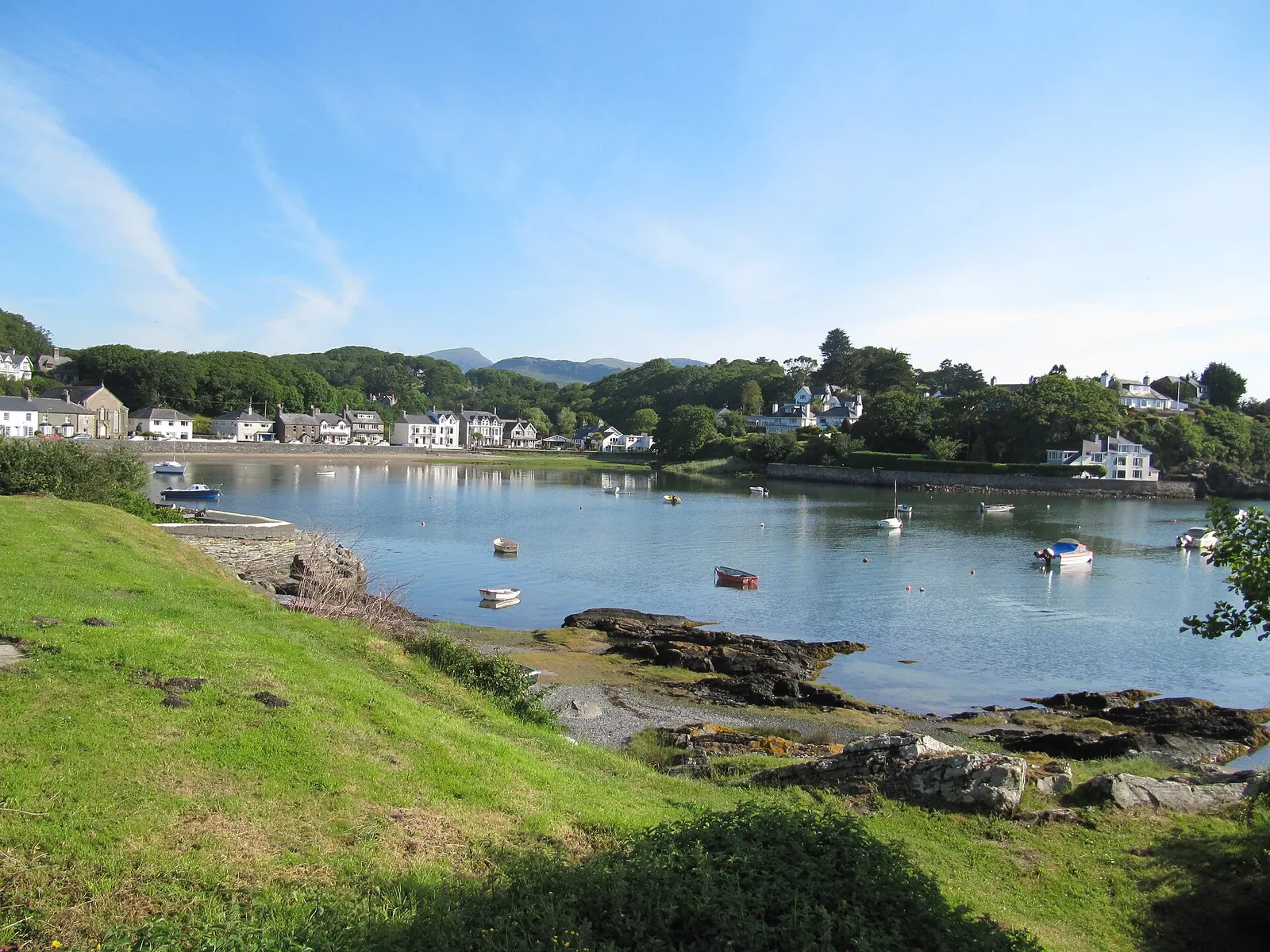
A mile south along the coast path, a curved bay village older than the harbour town itself.
Beyond the first defining moments, the fuller Porthmadog catalogue continues below.
A harbour town built around one working quay: six stops within a short, mostly level walk (Borth-y-Gest is the furthest, a mile along the coast path).
No verified image yet
Porthmadog Harbour & The Cob
The working quay and the mile-long embankment, at the west edge of the centre.
Six sights, all within a short walk of one another: a working harbour, a heritage railway terminus, a slate-shed museum, a shopping street, a parish church, and a quieter harbour village a mile along the coast. No restaurants, pubs or shops are listed here; see Local life for the town’s everyday character.
Harbour
The town exists by accident: an embankment built to reclaim farmland diverted the river and scoured out a deep-water harbour instead. Walk the mile across it.
Heritage railway
A working terminus rather than a museum piece: the slate line down from Blaenau still runs from these platforms, and so does the rebuilt Caernarfon line.
Check timetables and book tickets (opens in a new tab)Seasonal museum
The town’s whole slate-exporting boom, held inside the last surviving slate shed on the harbour. Small, seasonal, and standing exactly where the story happened.
Check opening times (opens in a new tab)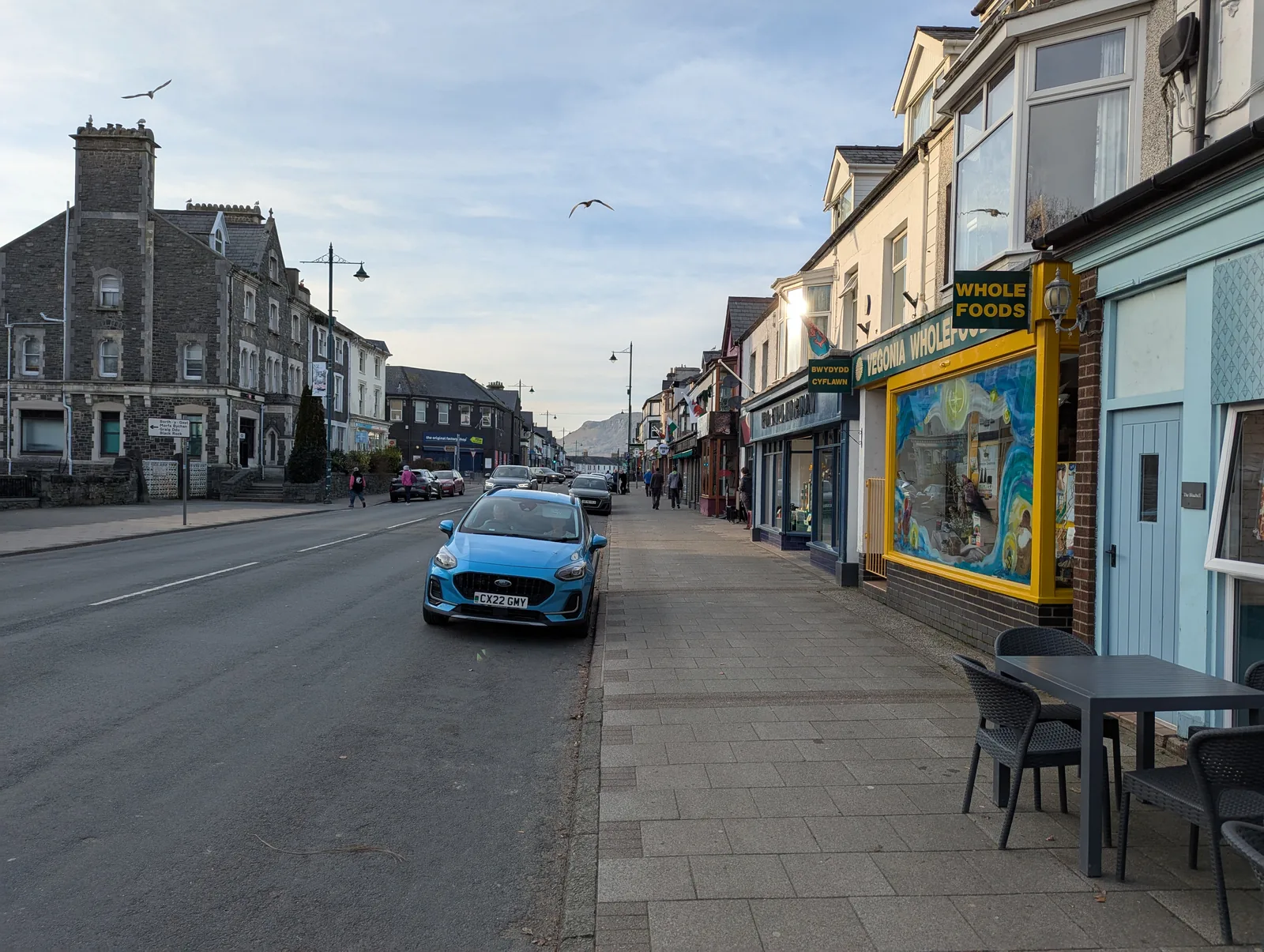
Streets
Independent shops rather than chain fronts, which is why Porthmadog still reads as a real market town rather than a heritage set-piece beside the railway.
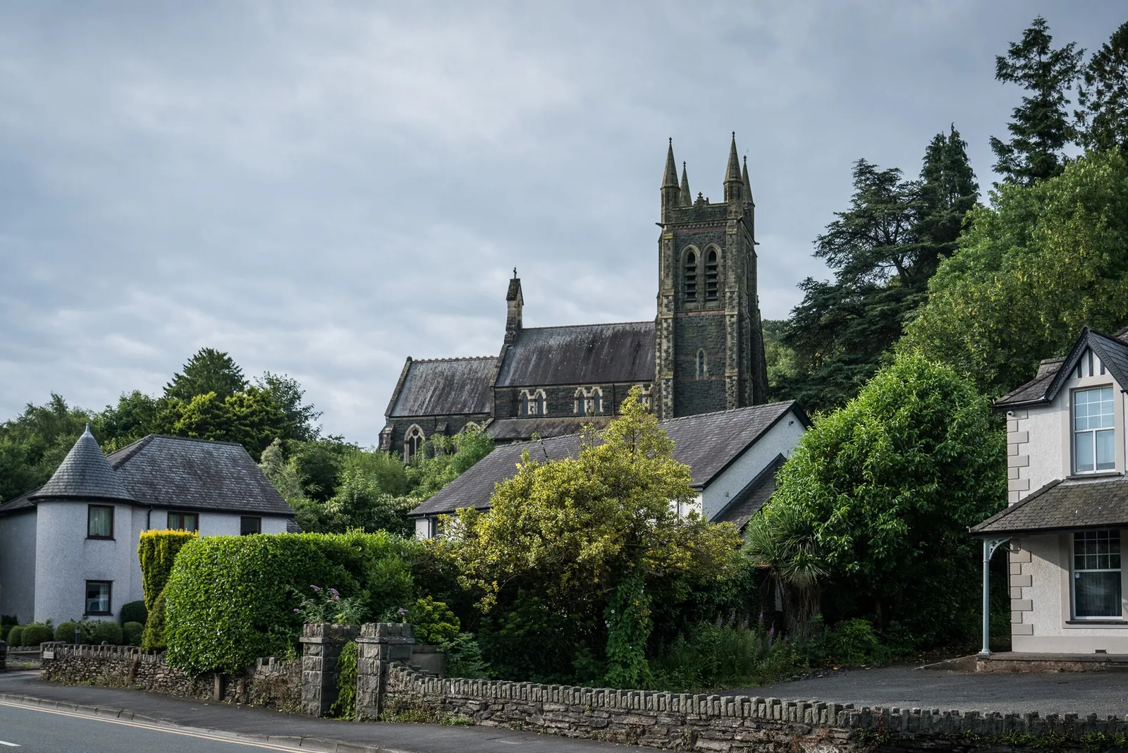
Working church
The tower you keep seeing above the rooftops, on rising ground at the edge of the centre: a working parish church, not a preserved monument.
Waterfront
A quieter harbour village that predates Porthmadog entirely: this was the way over the estuary before the Cob was built, and later a schooner-building shore.
The Maritime Museum’s opening dates and admission price change seasonally. Confirm current details before you plan a day around it.
Ffestiniog & Welsh Highland Railways, official site03Story
Porthmadog takes its name from William Madocks, whose Cob embankment reclaimed an estuary: and, by accident, scoured out the harbour the town then grew around.
Before 1811 this was Traeth Mawr, an open estuary. Borth-y-Gest, a mile south, was the historic crossing point: locals guided travellers across the treacherous sands towards Harlech.
William Madocks built the Cob to reclaim farmland from the estuary. Diverting the river instead scoured out a natural deep-water channel: the harbour the town takes its name from.
The Ffestiniog Railway opened in 1836, carrying slate from the Blaenau Ffestiniog quarries to these wharves. By 1873 alone, more than a thousand ships loaded over 116,000 tons of slate here.
A rival railway in 1867 cut into the trade, and the First World War ended the German slate market for good. Porthmadog turned to tourism as the port trade faded.
The Cob’s toll, nearly two centuries old, ended in 2003. The Welsh Highland Railway’s rebuilt line to Caernarfon began running through again in 2011: a working harbour town, still adding to its own story.
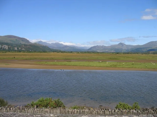
The Cob was meant to reclaim farmland. It reclaimed a harbour instead, and a town grew up around the accident.
Atlas of Wales
Porthmadog is a real Welsh market town first. The harbour and railway share the streets with an ordinary High Street of independent shops, cafés and pubs, not a heritage village built for visitors.
Around three in four residents speak Welsh regularly, rising higher again among school-age children: a working Welsh-speaking town, not a themed one.
Borth-y-Gest, a mile along the coast path, is quieter and more residential: a different pace from the harbour front.
Boats, the Ffestiniog & Welsh Highland terminus, and the Cob’s footpath and cycle route all share the same working waterfront.
Independent shops, cafés, bookshops and outdoor-gear retailers keep the High Street a real shopping street, not a row of gift shops.
A mile south, this smaller harbour village keeps its own rhythm: Victorian terraces and sheltered coves, a slower pace than the main quay.
The town in one walk
Harbour, station, museum, High Street and church all sit within a short walk. Start at the quay and the town reveals itself naturally: through slate, salt water and the everyday life between them.
Plan your time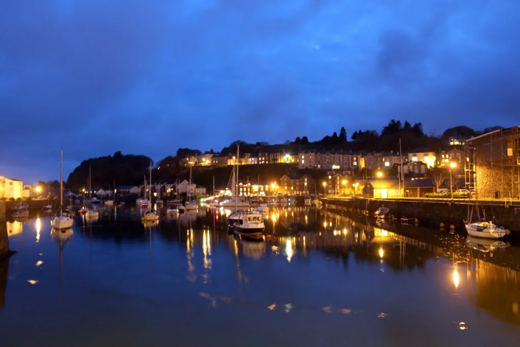
Porthmadog means “Madog’s Port”: named for the man whose embankment built it by accident.
Atlas of Wales
04Plan
By train into Harbour Station, or park nearby.
The heritage-railway terminus, right at the quay.
The last slate shed on the harbour, if it’s open.
Free to walk, Eryri stacked across the water.
By train into Harbour Station, or park nearby.
The slate-shed museum on the quay.
Independent shops, a pause for food.
The town’s skyline marker, on rising ground.
Finish with the harbour view from the embankment.
An early start gets ahead of the day’s trains and crowds.
The slate-shed museum, if it’s open.
Shops, then a break for food.
A pause on the way to the coast path.
About 20–30 minutes along the coast path.
The return walk, harbour and mountains ahead.
Practical
Everything you need for arriving and getting around.
Getting here
Porthmadog is on the Cambrian Coast line, with Transport for Wales services to Pwllheli, Harlech, Barmouth, Machynlleth and beyond: arriving directly into Harbour Station at the harbour edge.
Check current train timesThe A487 runs straight through Porthmadog, crossing the Cob: free since the toll ended in 2003. Seasonal pay-and-display car parks sit around the harbour and town centre.
Open Lombard Street car park in Google MapsThe TrawsCymru T22 calls here between Caernarfon and Blaenau Ffestiniog, and the T2 links Porthmadog with Criccieth, Caernarfon and Bangor. Check the current service before travelling.
TrawsCymru T22 timetablePractical details
Five Cyngor Gwynedd car parks: four around the High Street and the harbour, and one above the cove at Borth-y-Gest. Garden Place is much the largest; three of them have height-restriction barriers.
Check the Cyngor Gwynedd car parks listingCharges and restrictions can change. Check the signs when you arrive.
Garden Place
East of High Street · long stay
Google Maps (opens in a new tab)Heol y Parc
Town centre · short stay
Google Maps (opens in a new tab)Lombard Street
By the harbour · long stay
Google Maps (opens in a new tab)Iard yr Orsaf
North end of High Street · long stay
Google Maps (opens in a new tab)Borth-y-Gest
Borth-y-Gest · above the cove
Google Maps (opens in a new tab)Confirmed toilets, including an accessible one, at Harbour Station; independent cafés and shops along the High Street.
Check Harbour Station facilitiesToilets (incl. accessible) at Harbour Station
Independent cafés and shops: no business named here
The town, harbour front, High Street and the Cob footpath are all free and open: the Cob’s toll ended in 2003.
Free: no ticket or gate for the town itself
The Maritime Museum, seasonal, small admission charge
Harbour Station has a wheelchair-accessible coach with free travel for wheelchair users, loanable wheelchairs, and a mostly level site.
Per-site accessibility beyond the station (museum, church, older streets) is not independently confirmed. Check before visiting if this matters to you.
Wheelchair-accessible coach, free wheelchair-user travel, level site
Not independently confirmed
The harbour, museum, High Street and church are all walkable from the centre; Borth-y-Gest adds a mile each way.
Use Porthmadog as a base
Four real Atlas destinations pair with a Porthmadog visit: distances are straight-line from the town centre, not driving times.
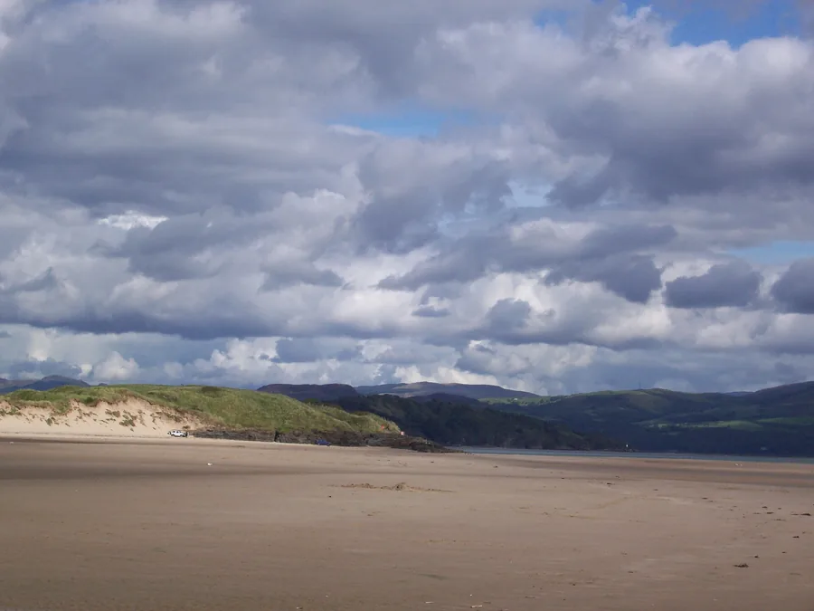
A wide beach at Morfa Bychan where cars can drive onto the sand: the coast Porthmadog’s harbour opens onto, seen from its own shoreline.
About 2.6 miles south-west (straight-line)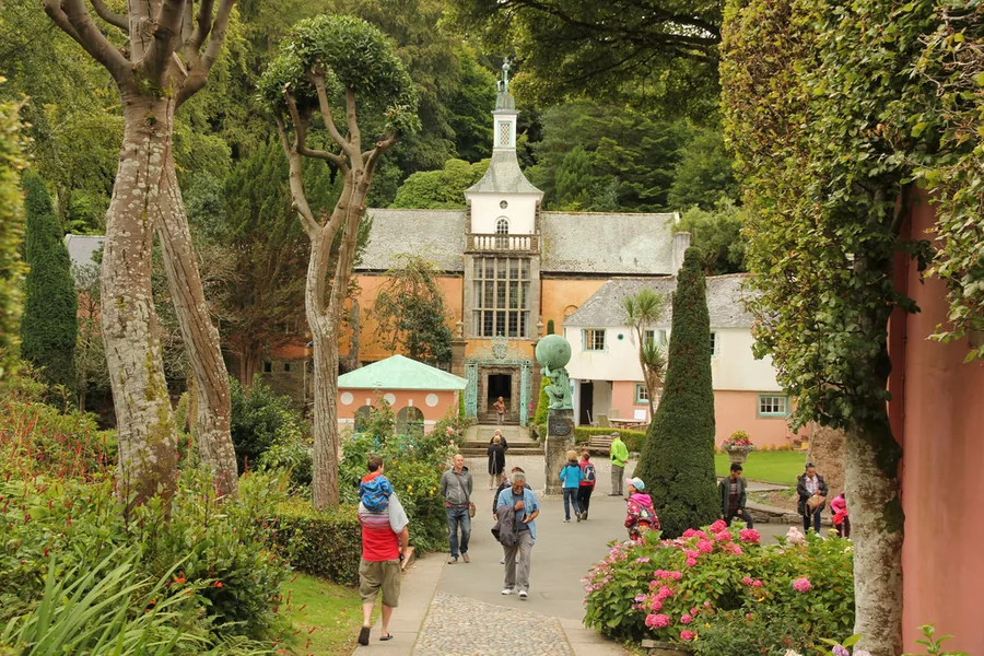
Clough Williams-Ellis’s Italianate village on its own wooded peninsula: a short drive from the working harbour, a very different kind of coastal place.
About 1.8 miles south-east (straight-line)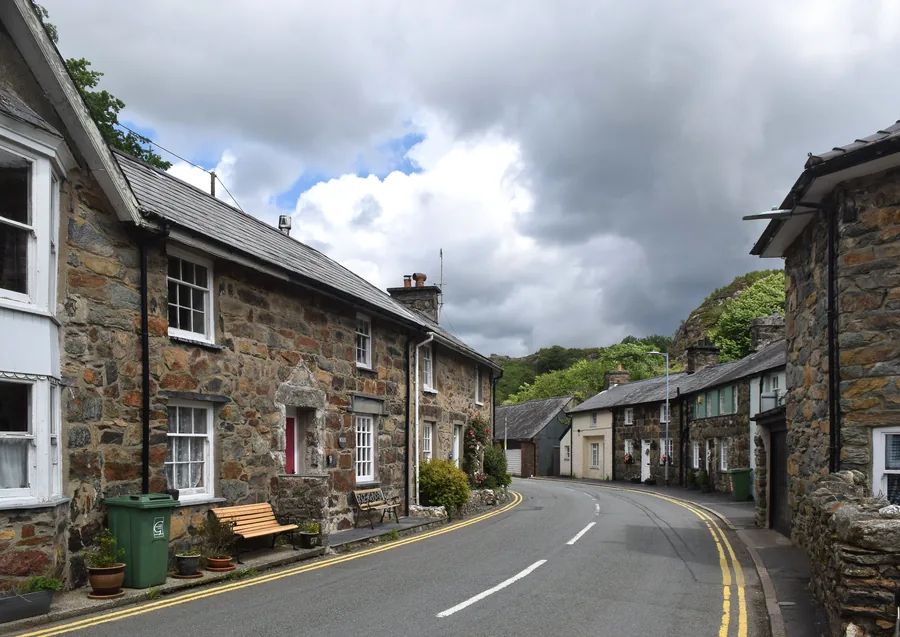
A stone-built village where two rivers meet, deep inside Eryri: the mountain counterpart to Porthmadog’s coastal, working-harbour character.
About 5.9 miles north (straight-line)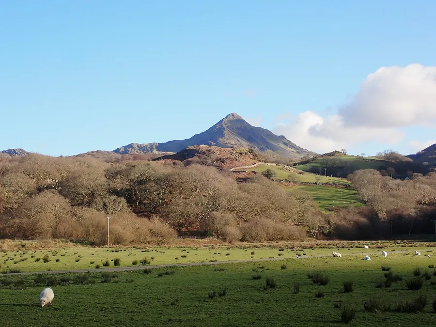
The pointed ridge above Croesor, often called Wales’s “Welsh Matterhorn”: visible from the Cob on a clear day, and reachable within the hour.
About 6.8 miles north-east (straight-line)Before you go
Walk the quay, the museum and the High Street, and the town explains its own unlikely beginning.