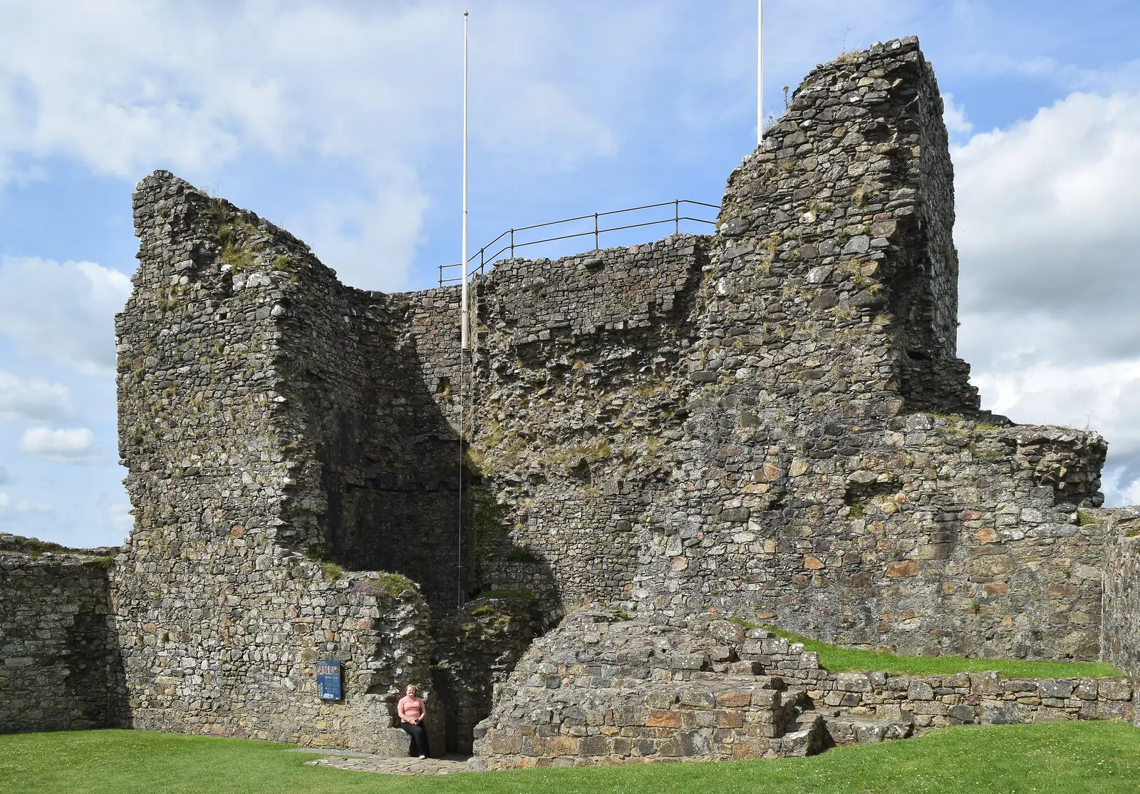
Criccieth Castle
A ruin on a rocky headland between two beaches, in sight from almost everywhere you stand in the town.
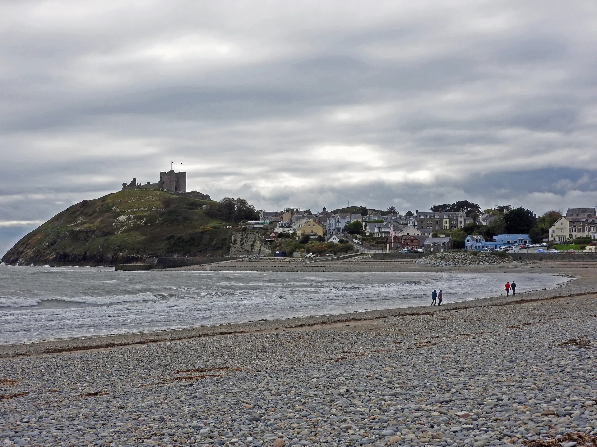
Llŷn Peninsula · Gwynedd
A castle town between two beaches, with its medieval fortress above the bay and the Llŷn coast opening in both directions.
01The town
Criccieth sits on the south coast of the Llŷn Peninsula, where a rocky headland pushes out into Tremadog Bay and splits the shore into East Beach to the north-east and Marine Terrace to the west. The castle occupies the headland’s crown. Y Maes — the old market square — sits at the foot of Castle Street, with the town climbing up toward the gatehouse and the High Street running back from it into everyday life.
Most castles make you go to them. This one is unavoidable: the headland puts it in front of you arriving by road, walking either beach, or looking back from the water. You do not need a ticket, or even to leave the sand, to get the best of it.
Character
Criccieth grew as a Victorian seaside town around a medieval castle that had already stood for six centuries. It remains a lived-in, Welsh-speaking community: a resort by summer, a quiet town in all other seasons.
Pace
The castle, East Beach and Y Maes are all within ten minutes’ walk of each other, and the climb to the castle entrance is the only real gradient in the town.
Landscape
The castle headland divides the shore into East Beach and Marine Terrace. Snowdonia fills the northern horizon across Tremadog Bay. The Afon Dwyfor estuary lies to the east.
Best for
Best for anyone who wants medieval history and a genuine beach in the same morning, and for a base on the south Llŷn that is quieter than Abersoch but no less useful.
02Discover
A ruin on a rocky headland between two beaches, in sight from almost everywhere you stand in the town.
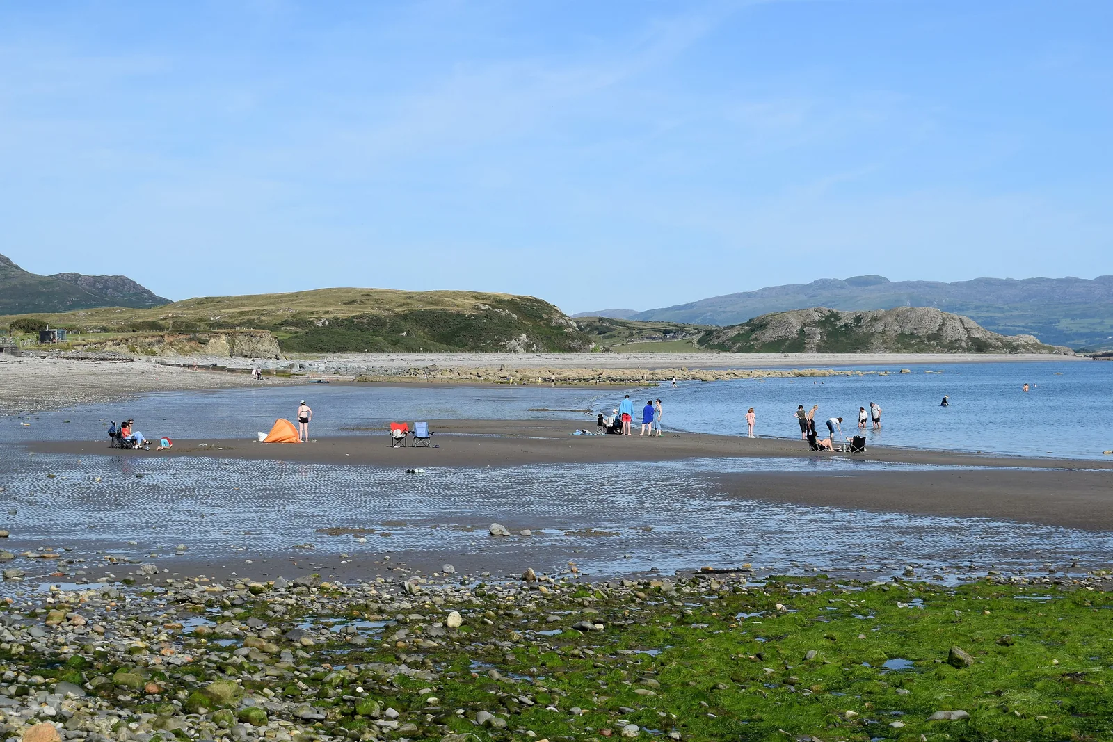
A quiet Blue Flag beach where the castle headland stays in view back along the sand.
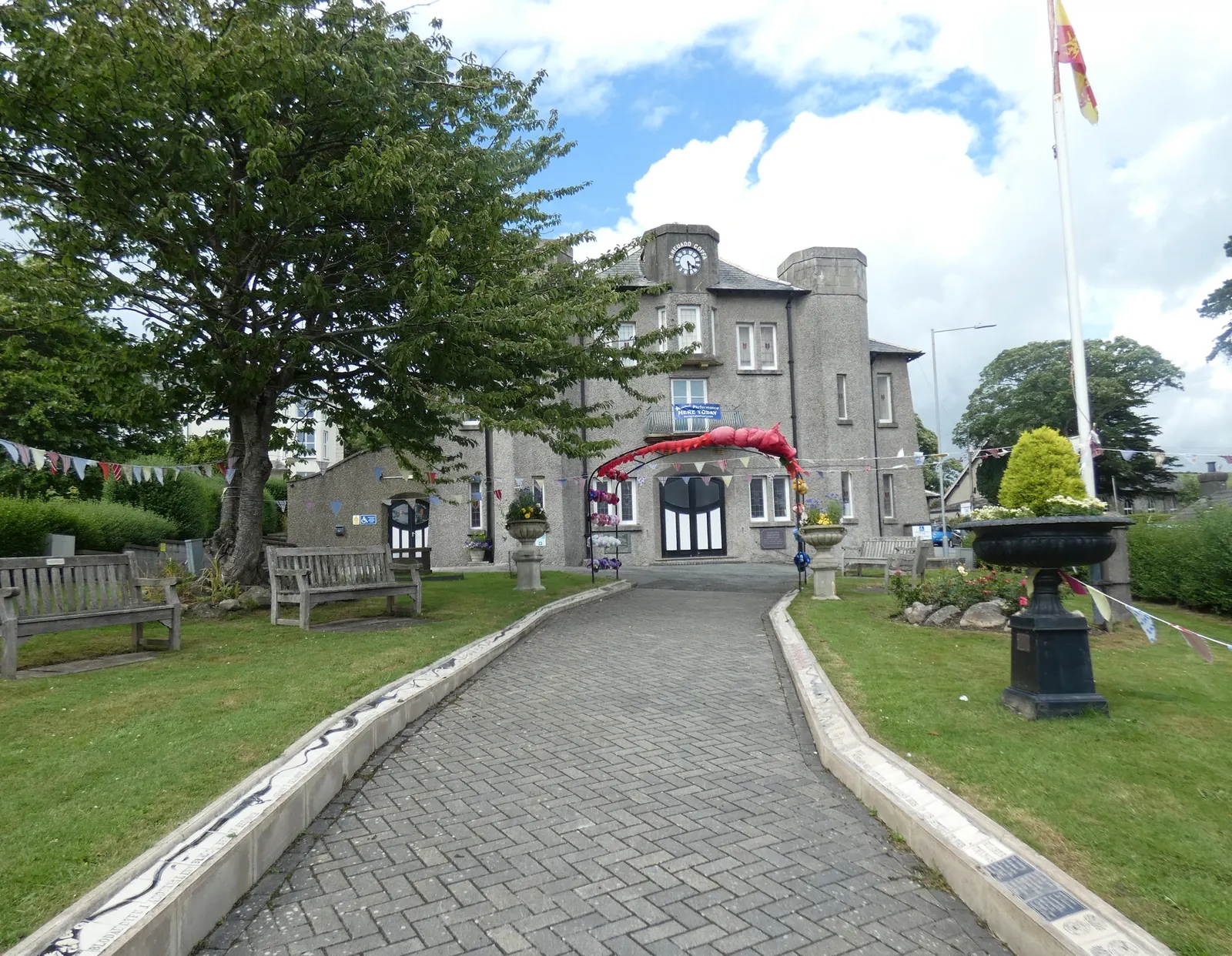
The old market square at the foot of the castle climb, where the everyday town still gathers.
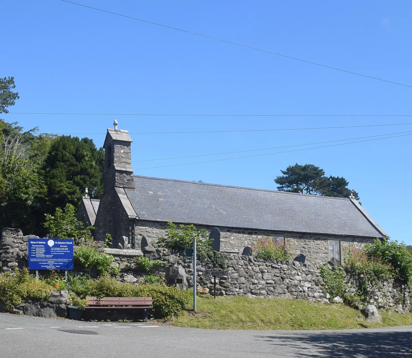
A medieval church above the town on Lon Ednyfed, a short walk up from the High Street.
Beyond these four moments, the fuller Criccieth catalogue continues below.
A headland town with four things to find: the castle above, the beach below, the square at the foot of the hill, and the church on the lane behind the High Street.
No verified image yet
Criccieth Castle
On the headland above the town, up Castle Street from Y Maes: a short steep climb from the square.
Four things to seek out in Criccieth — the castle, the beach, the town square and the medieval church — all within a short walk. No cafés, pubs or shops are listed here; see Local life for the town’s everyday character.
Heritage · Cadw
A native Welsh castle rather than an English one, on a rocky headland between two beaches. A short steep climb from the square, and the view is the reward.
Check opening times and admission (opens in a new tab)Beach · Blue Flag
The beach below the castle headland, and the best view in Criccieth is the one looking back at the castle from the waterline.
Check seasonal dog restrictions (opens in a new tab)Town square & civic
The old market square where the ordinary life of the town meets the climb up to the castle. The Memorial Hall faces onto it.
Church · Grade II*
A medieval double-nave church on the lane above the town, still holding services. Most visitors never climb far enough to find it.
Castle opening hours and admission prices are managed by Cadw and change year to year. Confirm current details before building a visit around them.
Criccieth Castle · Cadw03Story
Criccieth Castle is one of the clearest survivals of native Welsh castle-building in Britain: begun by a Welsh prince on a Welsh headland, taken by an English king, and left as a ruin by a Welsh rebel. The headland was always the point.
The rocky promontory between the two beaches was a natural defensive position on the south Llŷn coast long before any masonry. It controlled access to Tremadog Bay and the sea route between Gwynedd and the south.
Llywelyn ap Iorwerth (Llywelyn the Great) built the first masonry castle on the headland around 1230. It was extended by Llywelyn ap Gruffudd before 1282, and stood as a symbol of Welsh power on the south Llŷn coast for five decades before Edward I’s forces arrived.
Following the death of Llywelyn ap Gruffudd in 1282, Edward I’s forces took Criccieth and incorporated it into his programme of castle-building across north Wales. An English gatehouse was added to the existing Welsh inner ward, and the town developed below the headland as part of the Edwardian settlement.
Around 1404, during Owain Glyndŵr’s rebellion, the castle was partly burned and never fully rebuilt. The ruin remained on the headland as the town below it grew into a Victorian seaside resort, acquiring a train station on the Cambrian Coast Line and a modest reputation as a summer destination. Lloyd George — later Prime Minister — was associated with the town throughout his life; his memorial stands in Y Maes.
A Welsh castle taken by Edward I, burned by Owain Glyndŵr, and left as a headland ruin still visible from the beach eight centuries on.
Atlas of Wales
Criccieth is a lived-in community first and a visitor destination second. The High Street, the square and the seafront serve the same population year-round; the summer crowd adds to it rather than defining it. The castle is visible from the supermarket car park. The beach is a five-minute walk from the station.
Around 56 per cent of residents speak Welsh as a first or everyday language. The town has the unhurried character of a south Llŷn coastal community that has always been aware of the sea and has never tried particularly hard to impress anyone about it.
The view back to the castle from East Beach is better than the view from inside it. Walk down to the waterline and turn around.
The ruin is visible from almost every point in the town: from the car park, from the High Street, from the beach. It sits above ordinary life rather than being separated from it.
East Beach draws a mixed crowd in summer but never reaches the density of the bigger Llŷn resorts. The promenade along Marine Terrace on the west side is quieter still.
The square and the High Street are where the town buys its bread and meets its neighbours. Ordinary, Welsh-speaking, quiet most of the year, and lively enough in summer without being overwhelmed by it.
Castle and coast, in one compact visit
Criccieth is small enough that the castle, East Beach, Y Maes and St Catherine’s Church are all within fifteen minutes of one another on foot. The train station is five minutes from the square. There is no need to drive between points; park once, and the rest is on foot.
Plan your timeA medieval Welsh castle between two beaches, and a small town that has always been defined by its headland.
Atlas of Wales
04Plan
Arrive by car or train and make for Y Maes: the square at the foot of Castle Street. The Memorial Hall faces the castle approach. This is where the visit starts.
Castle Street climbs from the square to the Cadw entrance. The headland path gives the first views over both beaches before you go in.
The Inner Ward, the English gatehouse, and the views over Tremadog Bay toward Snowdonia. About 45–90 minutes inside. Admission applies; check the Cadw website for current prices and opening times.
Walk down from the headland to the beach. Low tide opens the widest sand, and the best view of the castle from the waterline.
Start at the square. The 1925 Memorial Hall — Grade II listed — faces onto Y Maes, with the castle visible above Castle Street from here.
The castle via Castle Street: the Inner Ward, the English gatehouse added by Edward I in 1283, and the panorama from the headland crown over both beaches and the bay to Snowdonia.
Back down Castle Street, then up Lon Ednyfed to the Grade II* medieval church: a short detour that most visitors miss. The double-nave building has 13th-century origins.
Stryd Fawr (High Street, the A497) and the back lanes between the square and the seafront: the everyday commercial and residential fabric of a small Welsh town.
Out to East Beach for the view back to the castle headland, then along the seafront. Marine Terrace on the west side gives the same view from a different angle.
Practical
Everything you need for arriving, parking and getting around.
Getting here
The A497 runs along the south Llŷn coast, connecting Criccieth to Porthmadog (about 6 miles east) and Pwllheli (about 7 miles west). Y Maes and the castle-street area have the nearest car parks. Check current Gwynedd tariffs on arrival.
Open Y Maes car park in Google MapsCriccieth has its own station on the Cambrian Coast Line (Machynlleth–Pwllheli), about 400 metres from Y Maes on foot. Trains run from Porthmadog to the east and Pwllheli to the west.
Check current train timesPractical details
Four Cyngor Gwynedd car parks: Y Maes on the green, Maes Abereistedd above the west beach, and Y Prom and Rhodfa’r Môr along the sea front east of the castle.
Gwynedd Council car parksCharges and restrictions can change. Check the signs when you arrive.
Y Maes
The green · village centre
Google Maps (opens in a new tab)Maes Abereistedd
West end · above the beach
Google Maps (opens in a new tab)Y Prom
Beach front · east of the castle
Google Maps (opens in a new tab)Rhodfa’r Môr
Sea road · east beach
Google Maps (opens in a new tab)Public toilets are reported at the East Beach / Y Maes area.
Check locally for current availability: seasonal facilities can change.
East Beach and the Y Maes area
Availability not officially listed. Check on arrival
The town centre and East Beach promenade are largely level; the castle approach involves a steep climb.
No official accessibility statement was found for Criccieth Castle. Check with Cadw directly if this matters to your visit.
Largely level: Y Maes, the promenade and East Beach
Steep climb from Y Maes. Confirm with Cadw for internal accessibility
East Beach allows dogs year-round. The castle grounds allow dogs on leads.
No seasonal restriction was confirmed for East Beach in current sources. Check local signage on arrival in case this has changed.
Dogs allowed year-round (no seasonal restriction confirmed)
Allowed on leads within the grounds
The castle, East Beach and Y Maes are within ten minutes’ walk of one another. The station is on the Cambrian Coast Line: a short walk from Y Maes. St Catherine’s Church is a short uphill walk from the High Street.
Use Criccieth as a base
Four Atlas destinations within reach of Criccieth: across the bay and along the south Llŷn coast. Distances are straight-line from the town, not driving times.
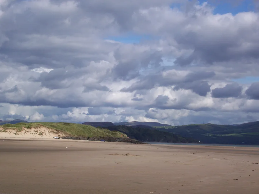
A two-mile Tremadog Bay beach you can drive straight onto, with a rock-pooled headland at low tide: the nearest proper beach to Criccieth in the other direction.
About 1.9 miles east (straight-line)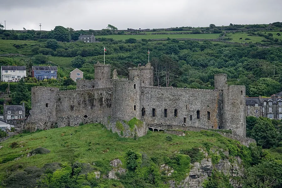
Edward I’s fortress on a sheer crag above the dunes, across Tremadog Bay: the other great castle on this bay, built at almost the same moment as Criccieth’s English gatehouse.
About 6.7 miles south-east (straight-line)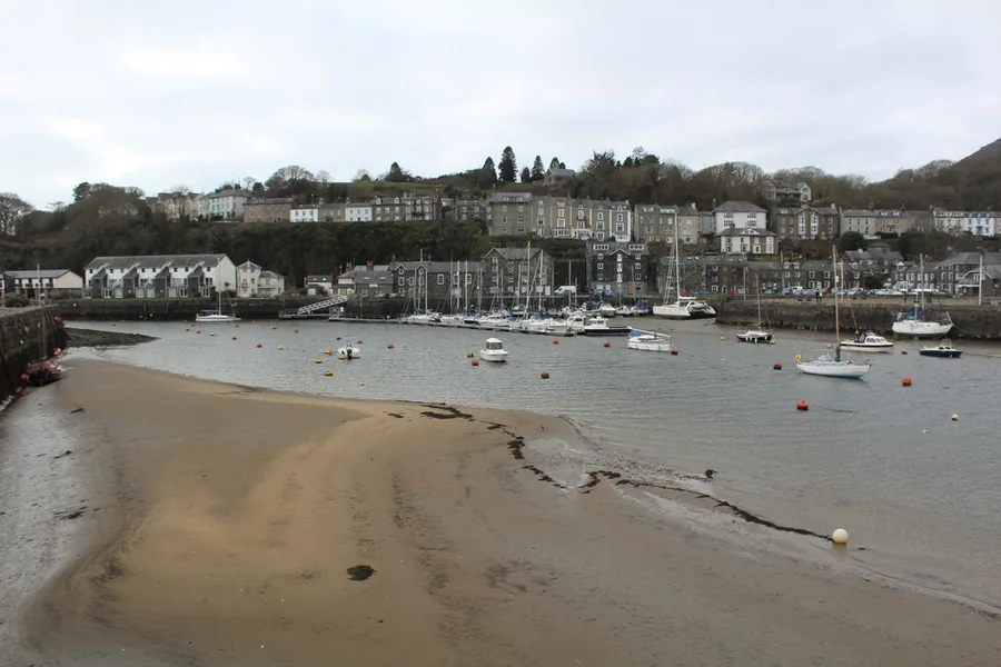
A harbour an embankment scoured into deep water by accident, and two railways’ terminus.
About 4.2 miles east (straight-line)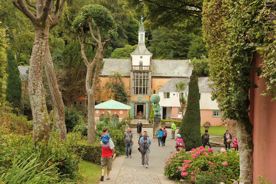
Clough Williams-Ellis’s Italianate village on the Dwyryd estuary, built over fifty years.
About 5.6 miles east (straight-line)Before you go
A medieval castle on a headland between two beaches. The town built itself around that fact eight centuries ago.