A viaduct worth saving twice
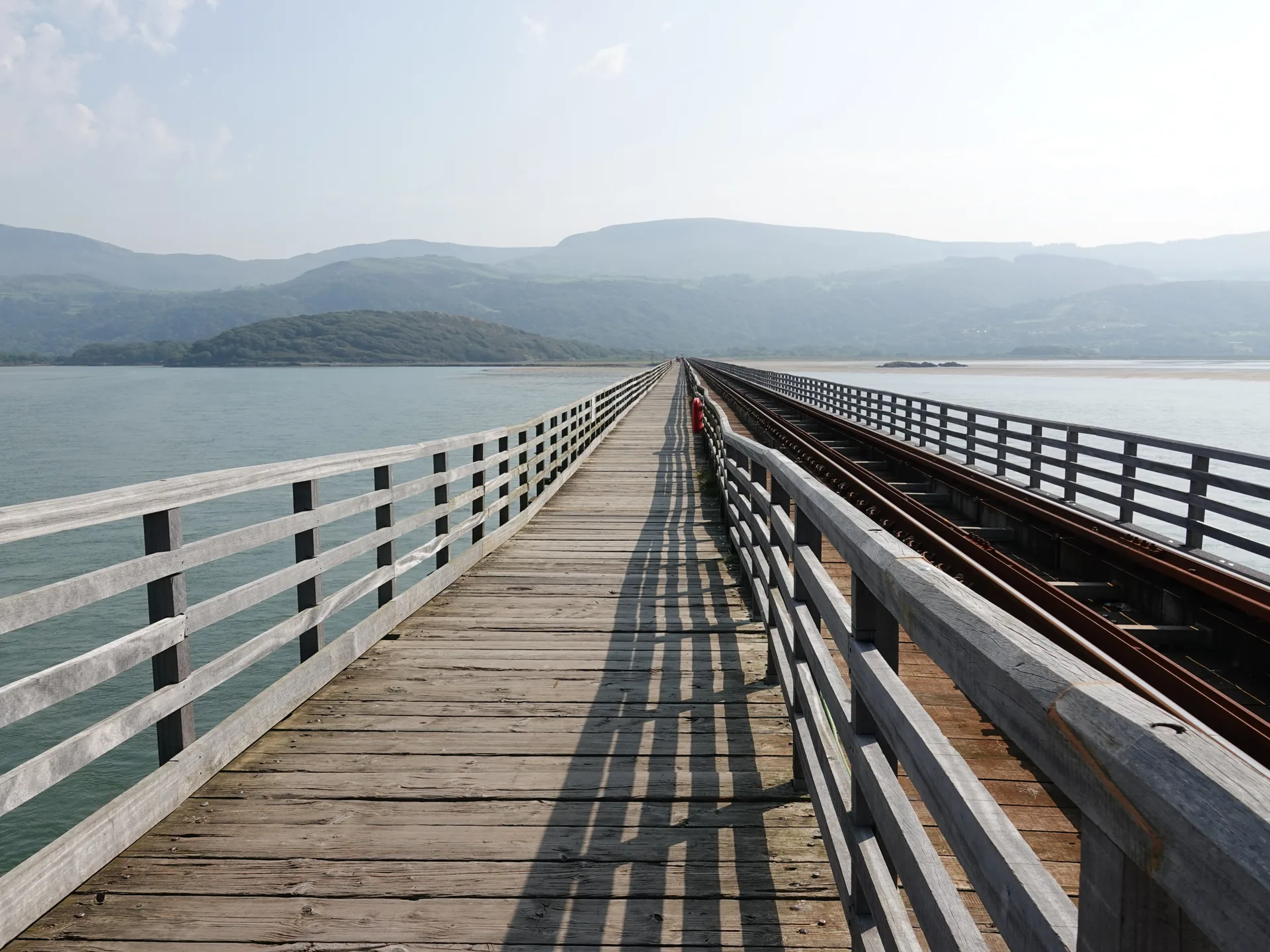
Walk or cycle the footway alongside a timber railway viaduct, out across the full width of the Mawddach estuary.
Gwynedd · Mawddach Estuary
A seaside town whose harbour front holds two national firsts: the birthplace of the National Trust, and one of Britain’s oldest working timber viaducts.
01The town
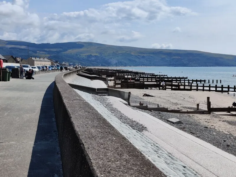
Barmouth is stacked between the sea and a hillside. The promenade and beach run along the front, the harbour and quay sit at the southern end where the estuary opens, and the oldest buildings — a 15th-century merchant’s house and a circular stone lock-up — stand among them. Behind it all, steep lanes climb to Dinas Oleu on the slope above.
Few small Welsh towns hold two genuine national firsts within walking distance of each other. Barmouth works as an easy half-day promenade visit, or a full day that adds the steep climb to Dinas Oleu and the Panorama Walk.
Character
Boats, a Victorian promenade and a cluster of small, genuinely old buildings share the same short walk.
Pace
The harbour and promenade are level; Dinas Oleu and the Panorama Walk both climb hard.
Landscape
The Mawddach opens into Cardigan Bay here, with the Cadair Idris range filling the far side of the estuary and open water to the west.
Best for
Best for a compact walk past two national firsts, or simply the promenade and sand.
02Discover
Walk or cycle the footway alongside a timber railway viaduct, out across the full width of the Mawddach estuary.
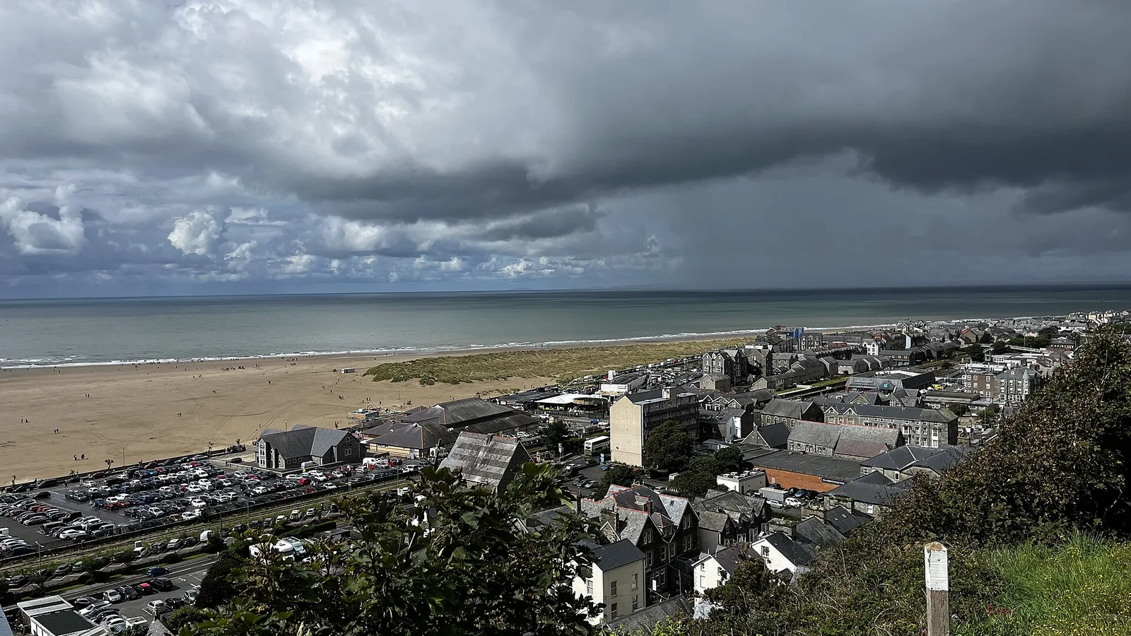
A clifftop above the harbour that became the very first piece of land the National Trust ever owned.
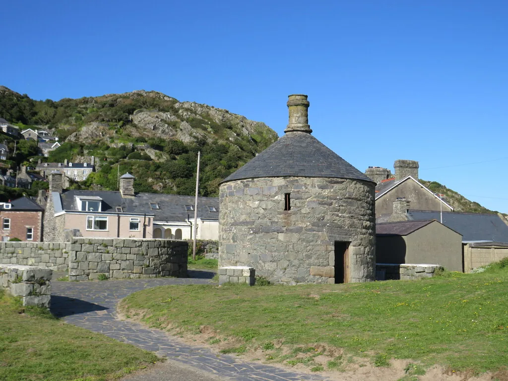
A merchant’s hall house and a round stone lock-up stand a few steps apart on the quay.
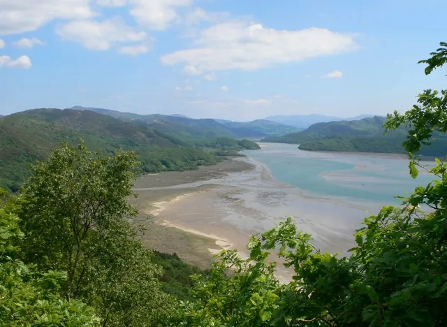
A steep Victorian-laid path that opens out straight up the Mawddach estuary towards Cadair Idris.
Beyond the first defining moments, the fuller Barmouth catalogue continues below.
A harbour town with a short, mostly level front, and two steep climbs above it. Eight stops, from the Bridge to the Panorama Walk.
No verified image yet
Barmouth Bridge
The viaduct crossing the Mawddach, a short walk south of the centre; a footway runs alongside the railway.
Eight sights, from the working harbour front to the climbs above town. No restaurants, pubs or shops are listed here; see Local life for the town’s everyday character.
Viaduct
Walk or cycle the footway across the full width of the Mawddach on a timber viaduct that is still carrying trains. Few places give you an estuary like this.
Harbour
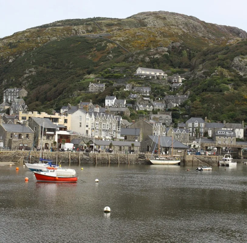
A real working harbour beneath the Old Town’s steep lanes: the front the town was built on, and where its handful of old buildings still stand.
Historic buildings
Two buildings a few steps apart on the quay, and about as far apart as buildings get: a merchant’s hall house, and a round stone lock-up with two cells.
Working church
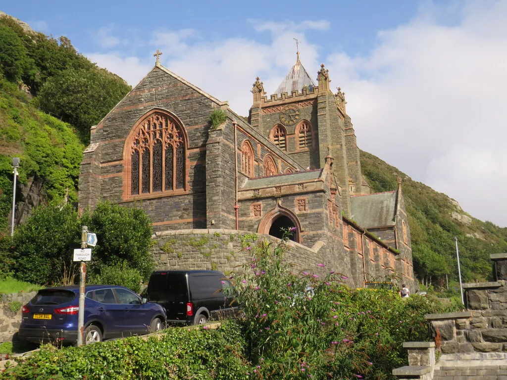
The nearly finished tower collapsed into the unfinished nave before a single service was held here. What you see had to be built twice.
Working station
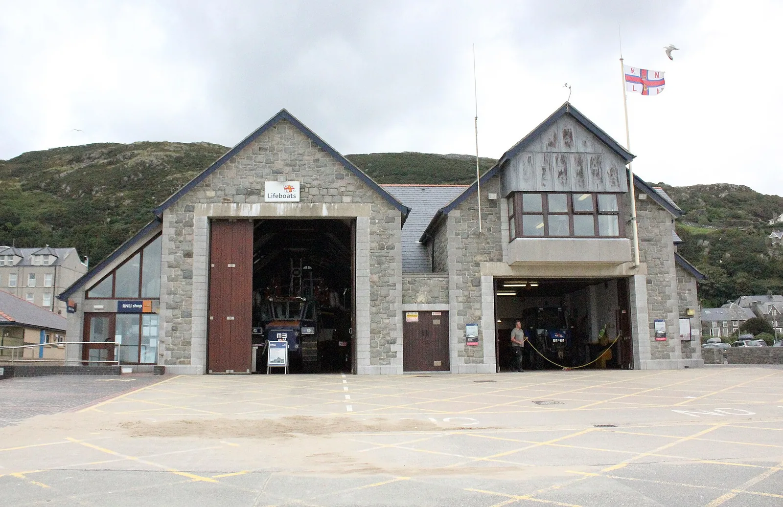
A working lifeboat station on the promenade, not a museum piece: the boat still launches from here, and there is a visitor centre alongside it.
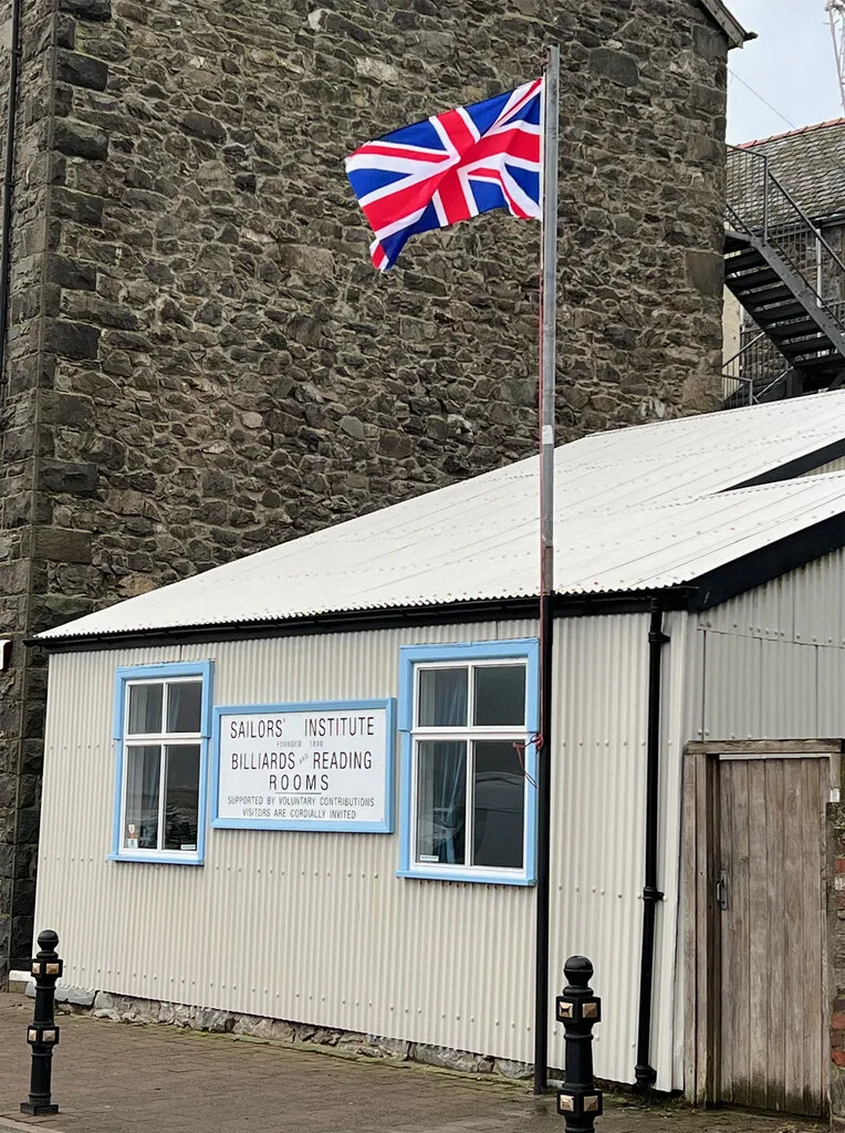
Heritage hall
A reading room built so seafarers’ families could trace long voyages through the shipping registers: one of the last buildings of its kind left in Wales.
National Trust
Climb the steep Old Town lanes to a patch of clifftop gorse that was the first land the National Trust ever owned: before it owned anywhere else at all.
Viewpoint walk
A late-Victorian designed circuit climbing above the town for the Mawddach and Cadair Idris. Genuinely demanding underfoot, not a casual stroll.
The Panorama Walk is officially rated hard/strenuous, with steep and potentially wet sections, not a casual add-on to the harbour walk.
Eryri National Park: Panorama Walk, official route page03Story
Barmouth’s name comes from the Welsh Abermawddach — the mouth of the Mawddach — and its history runs from a handful of fishing houses to a Victorian resort that still holds two genuine national firsts.
Barmouth’s first written record describes a hamlet of just four houses at the mouth of the Mawddach: long before any harbour, bridge, or promenade existed.
The harbour was built for fishing and wool exports as shipbuilding took hold: the working front that Tŷ Gwyn and Tŷ Crwn still stand on today.
The Cambrian Coast railway reached Barmouth in 1867, crossing the estuary on the new timber viaduct, and the town turned from a working harbour into a seaside resort almost overnight.
Fanny Talbot gave 4.5 acres of clifftop above the town to the fledgling National Trust: its first-ever gift of land, made before the Trust owned anywhere else at all.
A £25–30 million restoration kept the 1867 viaduct standing for another generation, reopening in December 2023: a working harbour town still adding to its own story.
Built round, the story goes, so the Devil would have no corner left to hide in.
Atlas of Wales
Barmouth is a real seaside town first: the harbour front, promenade and Old Town lanes share the same streets with an ordinary Welsh community, not a resort built purely for visitors.
The formal Welsh name is Abermaw; locally the town is often just Y Bermo: a working name for a working town.
Most visitors stay on the promenade and never climb the Old Town lanes to Dinas Oleu: the harbour-front cluster and the clifftop above it are comparatively quiet.
Tŷ Gwyn, Tŷ Crwn, the Sailors’ Institute and the RNLI station all sit within a few minutes of each other on the same stretch of harbour front.
A Victorian sea wall, groynes and open sand carry the ordinary rhythm of a working seaside resort, busiest through the summer months.
The steep Old Town lanes climb past terraced cottages to Dinas Oleu and the wider hillside: a genuinely different pace from the front.
The town in one walk
Bridge, harbour, historic buildings and church all sit within a short walk of the promenade. Start at the harbour and the town reveals itself naturally: through salt water, stone and the steep lane above it.
Plan your time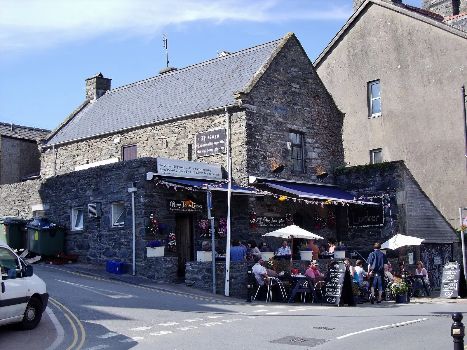
The whole of Barmouth was once just four houses at the mouth of the Mawddach.
Atlas of Wales
04Plan
By train into Barmouth station, or park nearby.
The circular Victorian lock-up on the quay.
The 15th–16th-century hall house next door.
By train, or park nearby.
Two small historic buildings side by side.
Walk the footbridge over the estuary and back.
A pause on rising ground above the town.
Finish with the beach and sea wall.
An early start gives the longest day for the climbs ahead.
The harbour-front historic buildings.
The harbour’s working, seafaring identity.
The National Trust’s first-ever acre, above the Old Town.
A strenuous circuit looking up the Mawddach to Cadair Idris.
Finish the day back down at sea level.
Practical
Everything you need for arriving and getting around.
Getting here
Barmouth is on the Cambrian Coast line, with Transport for Wales services calling right in the town centre. The station has step-free access and an induction loop, but no on-site parking and no toilets outside office hours.
Check current train timesBarmouth sits on the A496, with the Mawddach Trail and the A487 connecting it to Dolgellau. Seasonal pay-and-display car parks sit around the harbour and seafront.
Open Barmouth main car park in Google MapsPractical details
Four Cyngor Gwynedd car parks between the station and the beach. The Main car park behind the front is much the largest; Talbot Square and Jubilee Road are short stay.
Check the Cyngor Gwynedd car parks listingCharges and restrictions can change. Check the signs when you arrive.
Barmouth Main
By the beach · largest
Google Maps (opens in a new tab)Black Patch
North end · promenade
Google Maps (opens in a new tab)Talbot Square
Station Road · short stay
Google Maps (opens in a new tab)Jubilee Road
Behind the front · short stay
Google Maps (opens in a new tab)The railway station has no toilets outside office hours; independent cafés and pubs sit along the promenade and harbour front.
Check Barmouth station facilitiesNo toilets outside ticket-office hours
Independent cafés and pubs: no business named here
The promenade, harbour front and the Bridge’s footbridge are all free and open. Dinas Oleu and the Panorama Walk both climb steeply above the town: the Panorama Walk is officially rated hard.
Free: no ticket or gate for the town itself
Dinas Oleu (Old Town lanes) and the Panorama Walk (rated hard)
A seasonal restriction applies to part of the beach over the summer months: the exact zone is not confirmed here, so check current signage on arrival.
The town’s harbour front, promenade walkway and the climbs above town carry no dog restriction found this pass.
Seasonal restriction in part of the beach (summer months). Check signage
No restriction found this pass
The harbour, historic buildings and Bridge are all walkable from the centre; Dinas Oleu and the Panorama Walk add real climbing above the town.
Use Barmouth as a base
Four real Atlas destinations pair with a Barmouth visit: distances are straight-line from the town centre, not driving times.
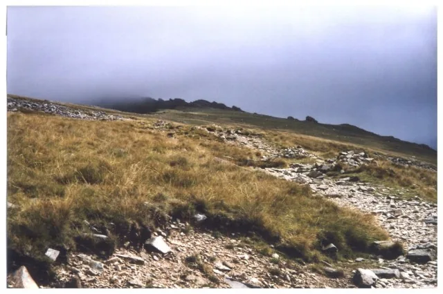
The mountain visible up the estuary from Barmouth’s own Panorama Walk: two official routes climb to its 893 m summit above Dolgellau.
About 6.3 miles east (straight-line)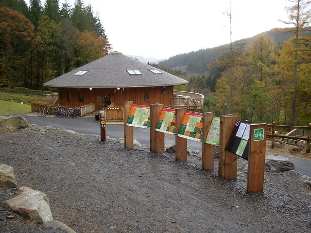
Britain’s first purpose-built mountain-bike forest, a 9,000-acre working forest near Dolgellau: the Mawddach Trail connects towards it from Barmouth’s own estuary.
About 9.7 miles north-east (straight-line)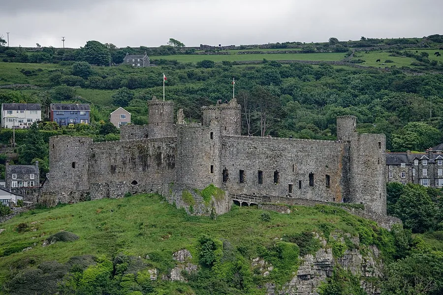
Edward I’s fortress on a sheer rock crag above the dunes: a short hop up the Cambrian Coast line from Barmouth’s own station.
About 9.8 miles north (straight-line)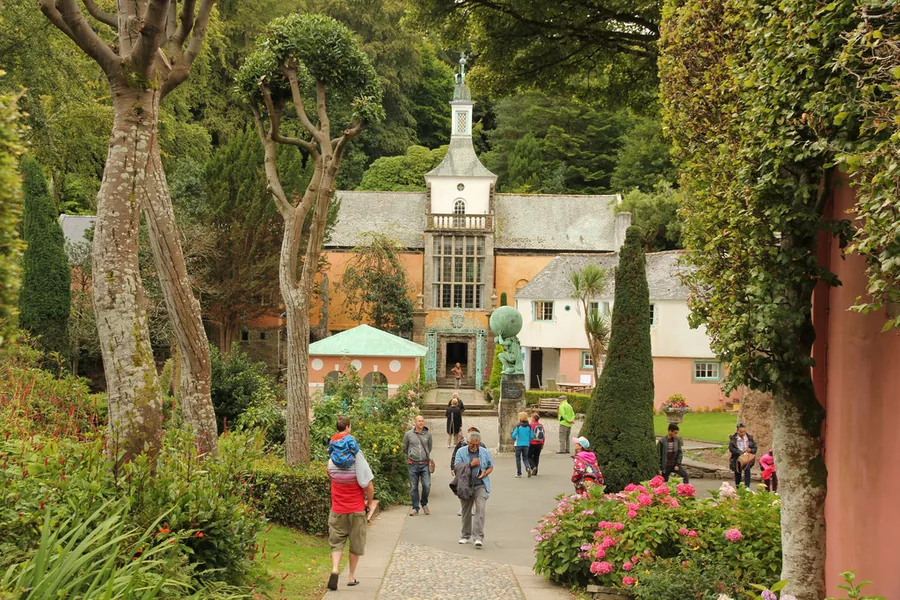
Sir Clough Williams-Ellis’s Italianate village on the Dwyryd estuary: further up the same Cambrian Coast line that crosses Barmouth Bridge.
About 13.3 miles north (straight-line)Before you go
Walk the quay, climb to Dinas Oleu, and the town explains both of its quiet national firsts.