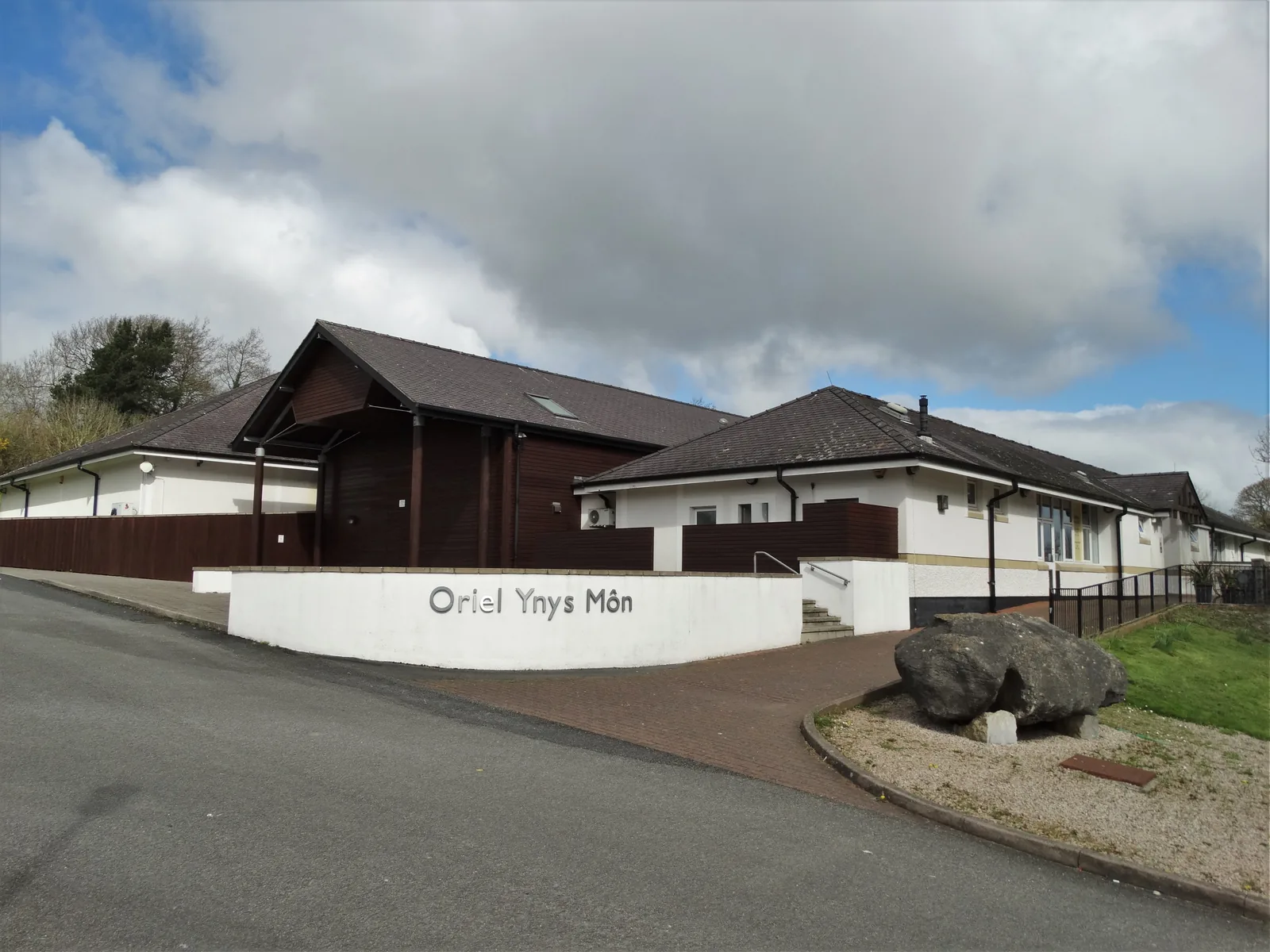
Oriel Ynys Môn
The county’s own museum and gallery, free to enter, holding the Sir Kyffin Williams and Charles Tunnicliffe collections.
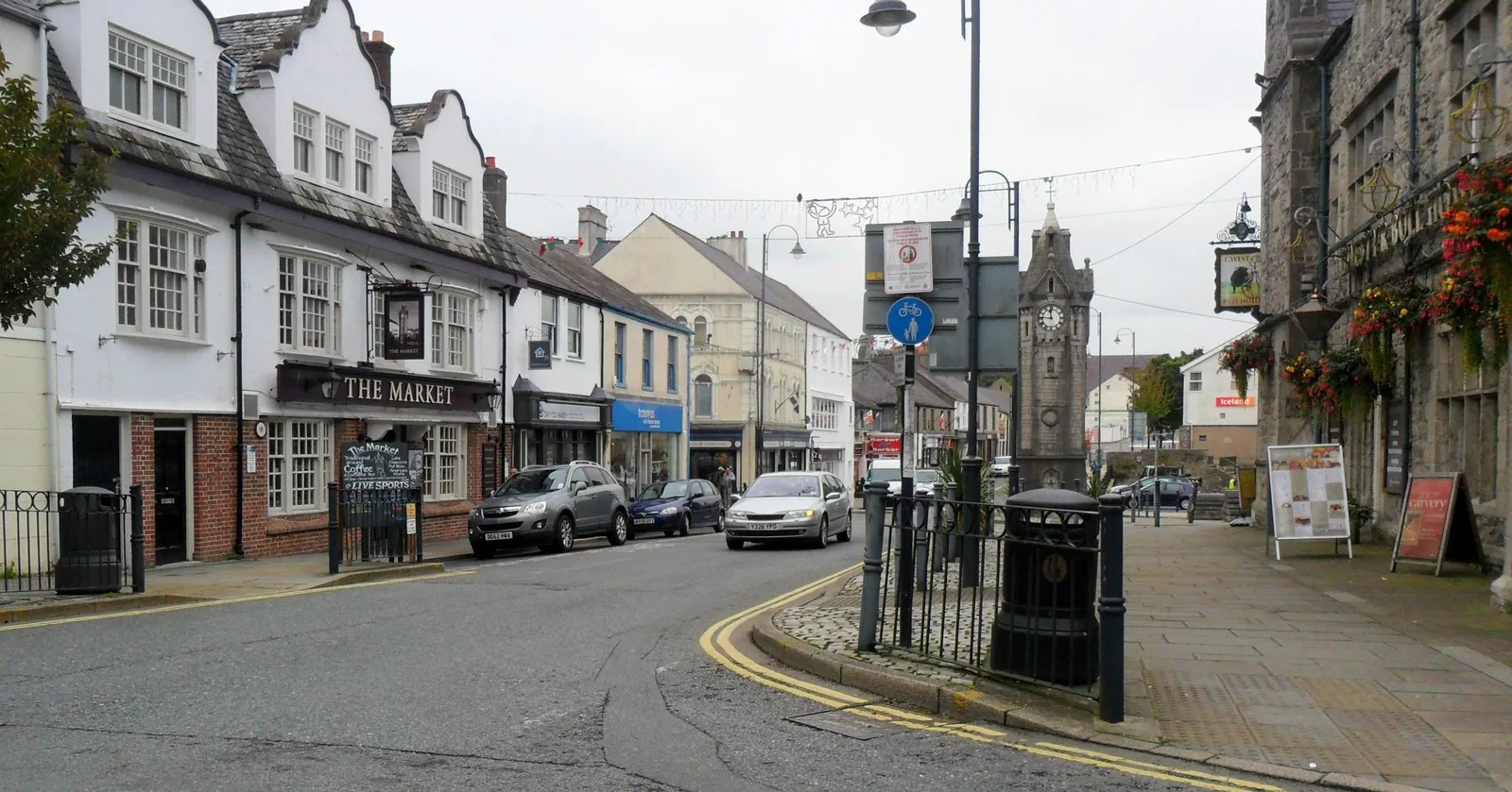
Isle of Anglesey · Afon Cefni
Anglesey’s county town sits inland, on the Cefni: a civic square, a working high street, and a wooded river valley that begins where the pavement ends.
01The town
Llangefni sits in the middle of Anglesey, on the Afon Cefni. Bulkeley Square holds the Victorian town hall, the high street runs off it, and behind the church at the north end the wooded Dingle drops away to the river. Oriel Ynys Môn, the island’s art gallery and museum, stands about a mile further north.
Almost everything people photograph on Anglesey is on the edge of it. Llangefni is the exception, and it holds the island’s Kyffin Williams and Charles Tunnicliffe collections, free to walk into, on a turning most visitors drive straight past.
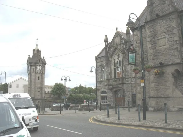
Character
Council offices, a market twice a week, shops and a high street that exist for the people who live here. Llangefni is not arranged for visitors, which is most of its interest.
Pace
Square to high street to church is a few minutes on foot, and the Dingle boardwalk starts just beyond. Oriel Ynys Môn is the one stop worth driving to.
Landscape
The Cefni cuts a wooded valley through the town’s northern edge, ten hectares of it protected as a local nature reserve, with a boardwalk along the water.
Best for
Best for a free museum and gallery, a wooded river walk, and anyone curious about the Anglesey that isn’t coastline.
02Discover
The county’s own museum and gallery, free to enter, holding the Sir Kyffin Williams and Charles Tunnicliffe collections.
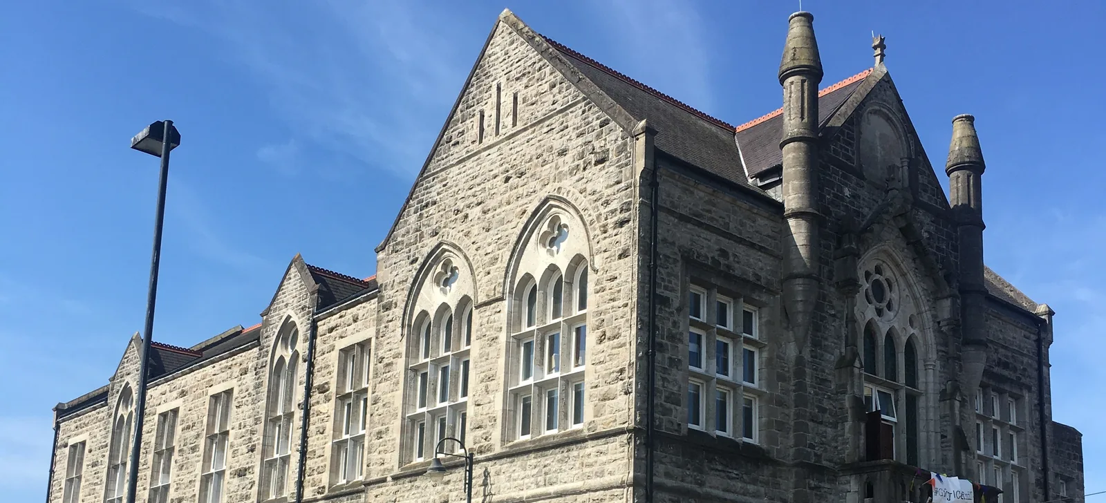
Neo-Gothic limestone, Grade II listed, and the civic anchor of the square, gutted by fire in 1992 and brought back.
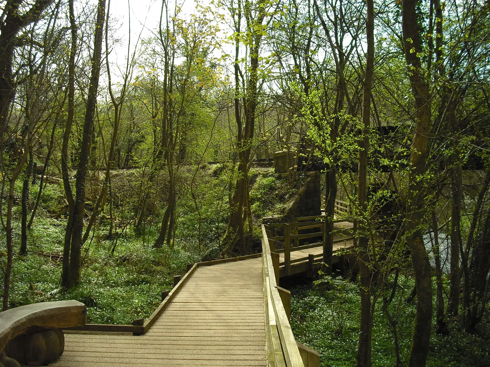
Ten hectares of wooded valley along the Cefni, boardwalked and bridged. The streets stop and the trees start, with no drive in between.
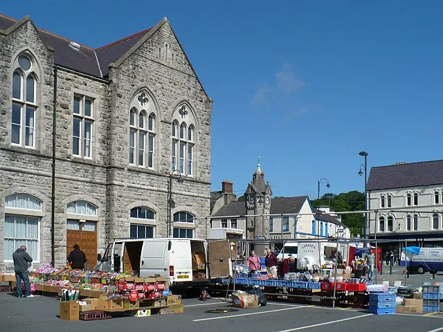
Stalls fill the Town Hall car park twice a week, what is left of the biggest cattle market on the island.
Beyond the first defining moments, the fuller Llangefni catalogue continues below.
Five points sit within a few minutes of one another around Bulkeley Square; the sixth, the gallery, is about a mile north on the B5111 and needs its own trip.
No verified image yet
Bulkeley Square & the town hall
The civic centre: the town hall on the south side, with the market car park beside it.
Six things worth stopping for: a Grade II listed town hall and its twice-weekly market, a free museum and gallery, a working church, a nature reserve, a Boer War memorial clock and a ring of eisteddfod stones. No pubs, cafés or shops are listed. See Local life for the town’s everyday character.
Listed civic building & market
The neo-Gothic building the square was arranged around, and the one that has held every civic role the town has had. The market runs in its car park.
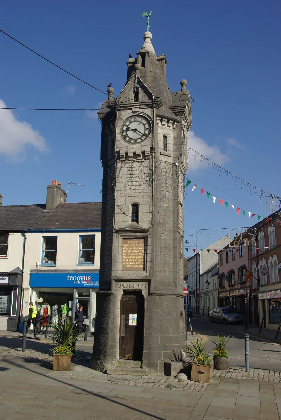
Memorial
A small town put up a tall Gothic tower for one man who did not come back from South Africa. The dedication is legible from the pavement.
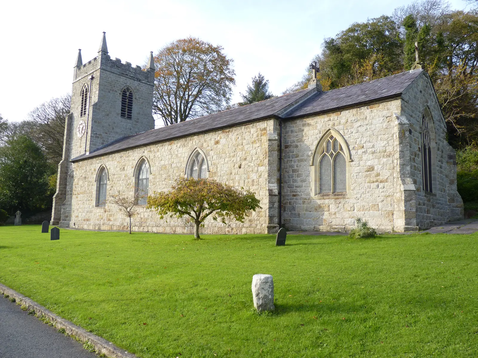
Working church
Llangefni was Llangyngar before the river took the name over. The churchyard sits above the Cefni, and its car park is the main way into the Dingle.
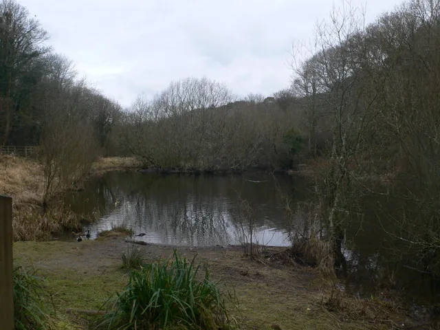
Local nature reserve
A wooded river valley that starts at the edge of the streets: no drive, no admission, just a boardwalk following the Cefni past three bridges.
Free museum & gallery
Kyffin Williams and Charles Tunnicliffe, two of the artists most associated with Wales, have permanent collections here, and it costs nothing to walk in.
Check opening times (opens in a new tab)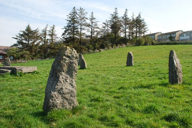
Eisteddfod stones
A ring of standing stones on open grass, raised for a National Eisteddfod and then simply left where they stand. Newer than they look.
Museum hours and market days can change. Check them before travelling, and use the car-park boards for current tariffs.
Oriel Môn · current opening03Story
Llangefni means “the church on the Cefni.” Everything the town later became, from wool and cattle to council and gallery, grew along that same river.
The town first took its name from St Cyngar’s church, and only later from the river it stands above. The present church is an 1824 rebuild, listed since 1952, and the older dedication survives in the name the town used to carry.
The valley’s Welsh name records what was done in it: pandy is a fulling mill, where woven cloth was pounded in water. The English name, the Dingle, only arrived in the 1830s. The mill pond is still there in the trees.
Llangefni once held the largest cattle market on Anglesey, and a railway from 1864 to carry the trade. The livestock sales moved to a purpose-built auction centre at Gaerwen; the auctioneers’ head office is still on Church Street, and the general market still takes the car park twice a week.
The town hall opened on Bulkeley Square, on a date the Town Council gives as 1884, and became the urban district council’s seat in 1895. The clock went up in 1902. Passenger trains stopped in 1964, the council moved to new offices after 1974, and in 1992 fire gutted the town hall. It came back, and won a national restoration award in 2015.
The county bought the Charles Tunnicliffe collection in 1981, built Oriel Ynys Môn to hold it in 1991, and added a gallery for Sir Kyffin Williams in 2008. Two of Wales’s best-known artists, in a purpose-built museum, north of a market town, free to walk into.
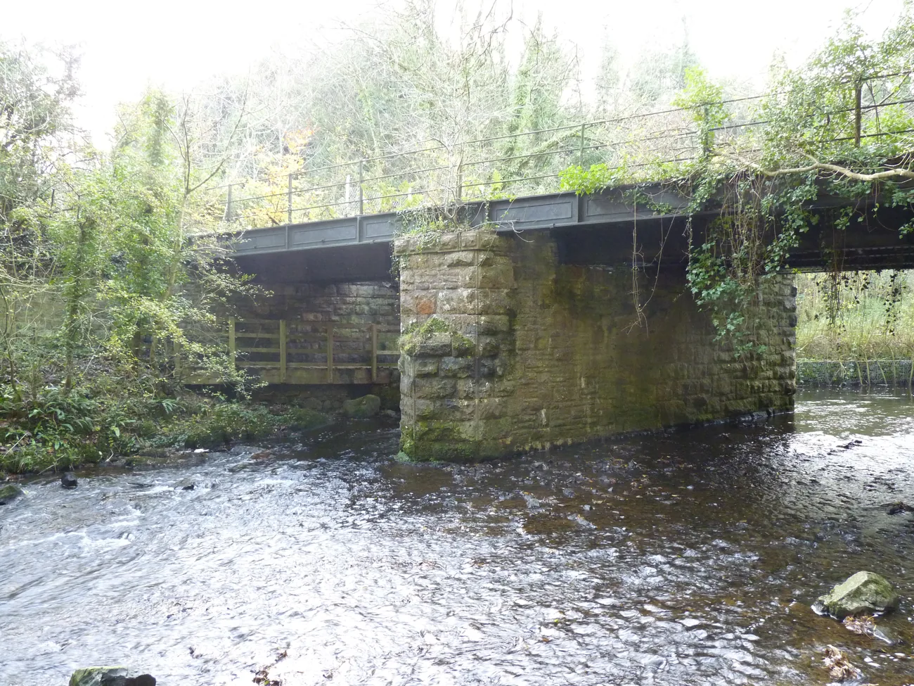
The railway that carried the cattle away is now a bridge over a river in a wood, with a boardwalk running under it.
Atlas of Wales
In the 2011 census 80.7% of Llangefni’s residents aged three and over reported being able to speak Welsh, the highest proportion of any community on Anglesey that year, and the sixth-highest in Wales. No later community-level figure has been confirmed, so treat that as the 2011 picture rather than today’s.
What that means on the ground is simply that Welsh is the working language of the square, the market and the shops. Visitors are not a category the town organises itself around, which is a large part of why it is worth an hour.
Visitors report red squirrels in the Dingle, including a regular afternoon feed on the boardwalk. They aren’t on the reserve’s own species list, so it’s a local report, not a promise.
Cafés, shops and independent businesses run from the square to the clock. This is a high street used by the people who live above it, not a parade of visitor shops.
The Dingle is a dog walk, a school trip and a lunch break as much as a nature reserve. It is the reason the town does not need to send you anywhere else for a walk.
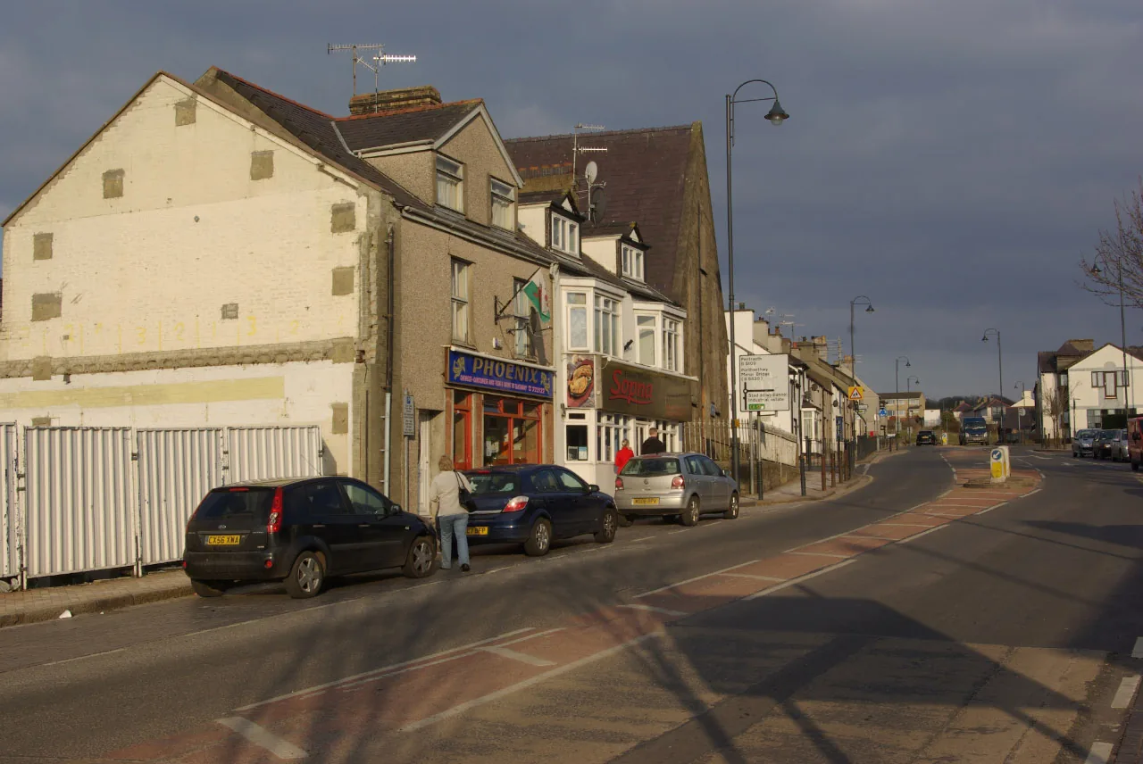
Past the square the town becomes streets of houses, takeaways and a road out towards Menai Bridge. Most of Llangefni is this, and it is the half a visitor never sees.
Middle-of-the-island character
Every road across Anglesey runs near Llangefni, which is exactly why it gets driven past. The things worth stopping for are five minutes apart and none of them charges anything.
Plan your timeNant y Pandy: the fulling-mill brook. The valley is named for the work that used to be done in it.
Atlas of Wales
04Plan
The Town Hall car park is the obvious one; the Dingle and Station Yard car parks are the alternatives.
Read the façade from the square: the gable, the rose window, the corner spires.
The high street, then the 1902 memorial clock at the top of it.
Park, and start at the town hall.
Shops, cafés and the clock at the head of it. On a Thursday or Saturday, the market first.
North to the church above the river, and the way into the reserve is from its car park.
The boardwalk along the Cefni, three bridges, carved benches.
Turn round here, or keep going: the path continues north-west towards Llyn Cefni, which is a longer walk than the town.
Free entry, a mile north on the B5111, and closed on ordinary Mondays, so get that out of the way first.
Down to Bulkeley Square. If it is a market day, this is when to see it.
Cafés and shops line the street.
The boardwalk is the right way to end a day here; it is the quietest part of the town and the last thing you expect of a county town.
Practical
Everything you need for arriving and getting around.
Getting here
Central Anglesey, on the A5114 off the island’s main road network. Six town-centre car parks: the Town Hall, the Dingle, Mill Street, Penyrorsedd, Station Yard and Station House — and the gallery has its own, a mile north.
Open the Town Hall car park in MapsRoute 42/42A links Bangor and Llangefni via Menai Bridge and Llanfairpwll. Other routes are reported to serve the town. Check current times before travelling. The nearest railway station is Llanfairpwllgwyngyll, about five miles away.
Route 42/42A timetablePractical details
Six council car parks within a few minutes of the square, plus free parking at Oriel Ynys Môn a mile north. The Town Hall one fills with market stalls on Thursdays and Saturdays.
Check the IACC car parks listingCharges and restrictions can change. Check the signs when you arrive.
Town Hall
Town centre · at the town hall
Google Maps (opens in a new tab)Mill Street
South-east of the square · Mill Street
Google Maps (opens in a new tab)Penyrorsedd (Library)
East of the square · by the library
Google Maps (opens in a new tab)Dingle
By St Cyngar's · for the Dingle
Google Maps (opens in a new tab)Station Yard
North-west of the clock · Station Yard
Google Maps (opens in a new tab)Station House
North-west of the centre · Station House
Google Maps (opens in a new tab)Oriel Môn
At Oriel Ynys Môn · north of the town
Google Maps (opens in a new tab)One public block in the town, on Lôn y Felin, open all year.
Check the IACC public toilets listingLôn y Felin, LL77 7RT
Isle of Anglesey County Council · listed as open all year
The Dingle’s boardwalk came out of a 2003 access-improvement scheme; the town centre sits above a river valley and is not confirmed level.
No source checked confirms step-free access to the town centre, the gallery or the boardwalk. Oriel Môn publishes its own access statement, which is the place to check if this matters to you.
Boardwalked, from a 2003 scheme that funded improved disabled access. Extent not documented
Not confirmed level · the streets sit above the river valley
An island-wide order requires you to clean up after your dog in designated areas: parks, car parks, picnic sites, churchyards among them.
Check the IACC dog control pageNo reserve-specific dog rule is published on the council’s own reserve page · the island-wide fouling order still applies
A wider council Public Spaces Protection Order was consulted on in early 2026; whether it has been adopted is not confirmed, so it is not stated here as a current rule
Everything in this guide except Oriel Ynys Môn is walkable from the square. The gallery is about a mile north on the B5111.
Use Llangefni as a base
Four real Atlas destinations pair with a Llangefni visit, all of them south-east or east, towards the Menai Strait. Distances are straight-line from the town centre, not driving times.
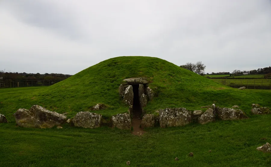
A Neolithic passage tomb aligned to midsummer dawn: the oldest thing on this part of the island, against a town whose oldest building is 1824.
About 4.5 miles south-east (straight-line)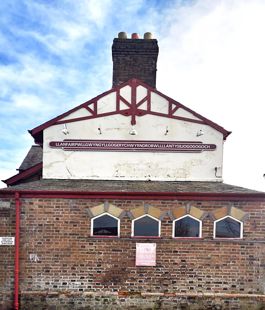
The first village on Anglesey after the Britannia Bridge, world-famous for its 58-letter station sign, and for a reopened 1817 column and the site of Britain’s first Women’s Institute meeting.
About 5.0 miles south-east (straight-line)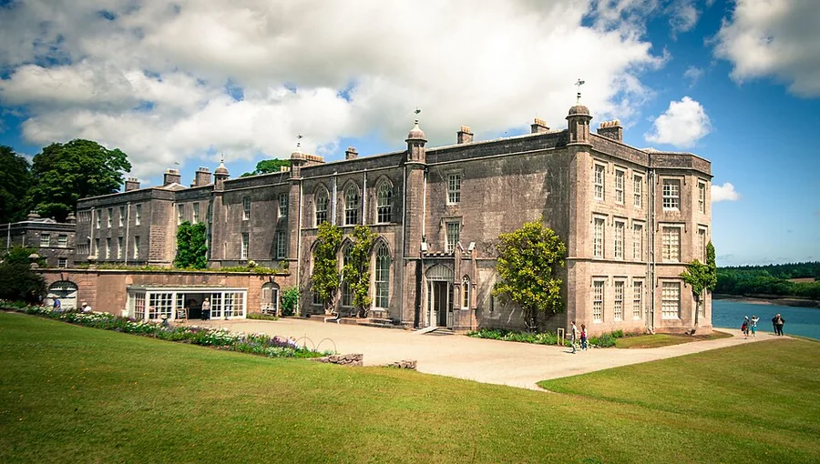
A National Trust house and garden looking across the Strait to Eryri, and, like Llangefni, somewhere the art is the reason to go in.
About 5.2 miles south-east (straight-line)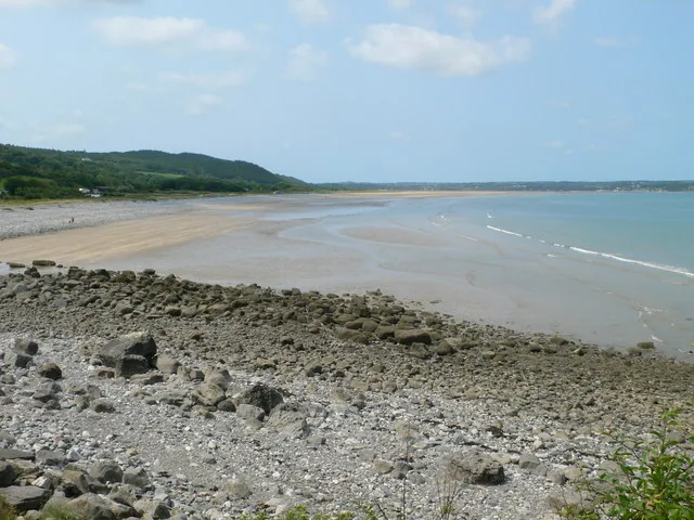
A wide tidal bay on Anglesey’s east coast, its miles of sand only there to walk on part of the time.
About 5.5 miles north-east (straight-line)Before you go
Two of Wales’s best-known painters hang a mile north of a market-town square, and nobody charges to look.