The full name, all at once
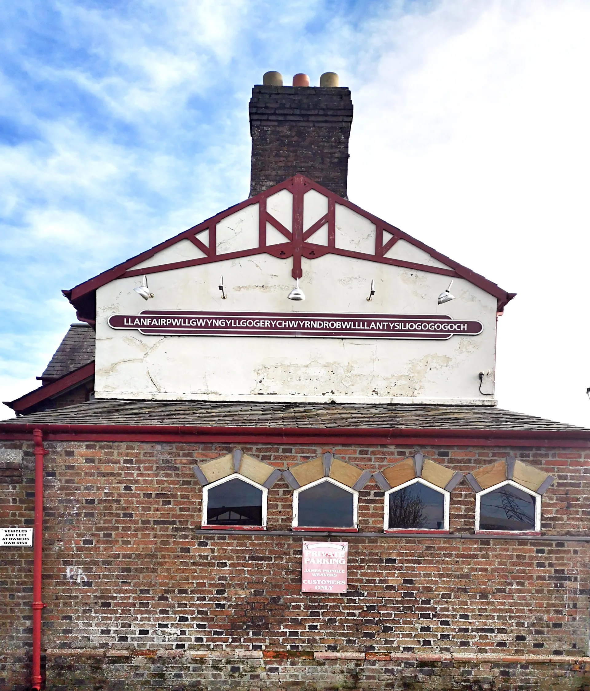
The platform sign carries all fifty-eight letters in one line, exactly as long in person as in photographs.
Isle of Anglesey · Menai Strait
The first village on Anglesey after the Britannia Bridge, famous for a 58-letter station sign, and for rather more than that once you stop.
01The village
Llanfairpwllgwyngyll is the first village on Anglesey after the Britannia Bridge, and it reads as one street. The station and its 58-letter sign sit at the bridge end; Holyhead Road runs from there past the church and Telford’s surviving tollhouse to the Marquess of Anglesey’s Column at the far end, which you can climb. The Strait is a short walk below.
Most visitors stop for five minutes and a photograph. The village rewards the ones who stay for an hour, with a genuine, sourced civic-history story the sign alone doesn’t tell.
Character
People live and work along the same street the coaches pull into. The 58-letter version was a Victorian publicity device; the village underneath it was here long before.
Pace
The village itself is flat and follows Holyhead Road. The Column is the exception, with 115 internal steps if you choose to climb it.
Landscape
The Anglesey bank of the Menai Strait, where both of the island’s crossings come ashore within a couple of miles of each other.
Best for
Best for anyone crossing the bridge who has an hour rather than five minutes, and for a column you can actually go up: 115 steps to the viewing platform, no lift.
02Discover
The platform sign carries all fifty-eight letters in one line, exactly as long in person as in photographs.
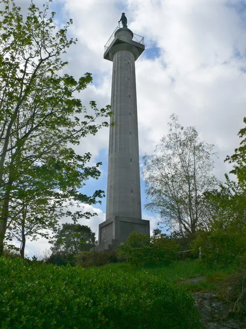
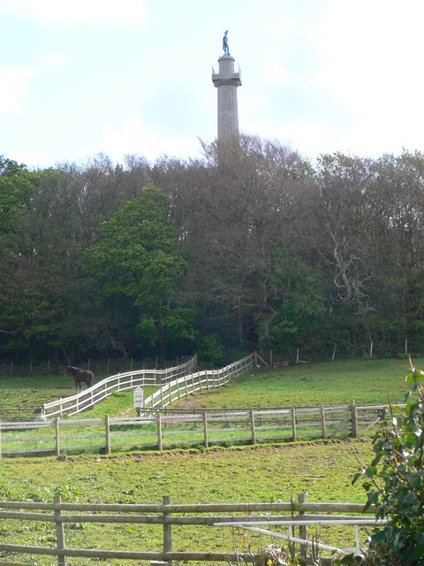
A restored column with 115 steps up to a view over the Menai Strait and the mountains of Eryri.
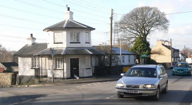
The tollhouse beside the hall where a group of local women started something that spread across Britain.
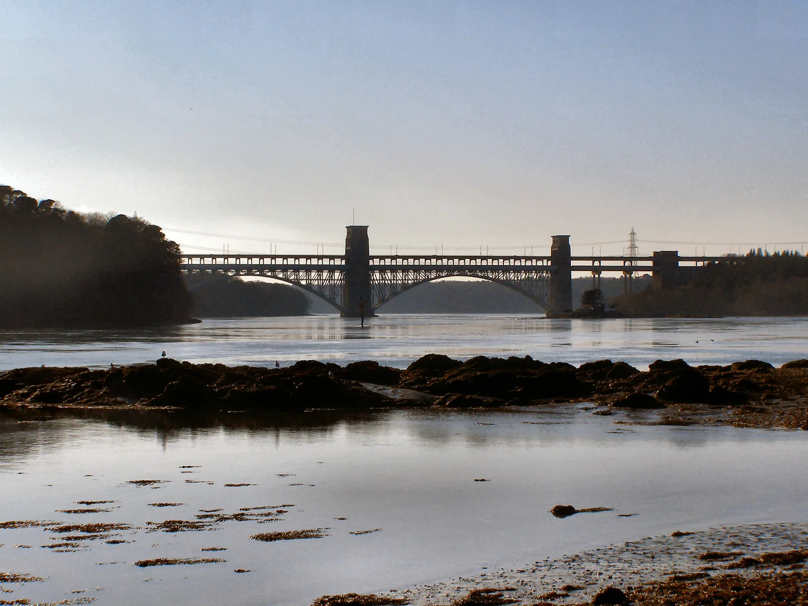
This is the crossing where Telford’s road and, later, Stephenson’s railway first reached Anglesey.
Beyond the first defining moments, the fuller catalogue continues below.
A village built along one road: the station and Britannia Bridge approach at one end, the Column and Toll House cluster at the other.
No verified image yet
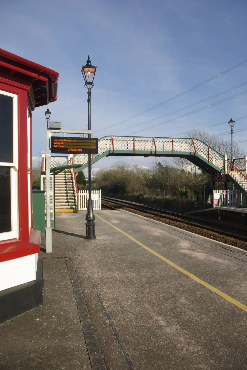
Llanfairpwll Railway Station
The arrival point at the village’s west edge, by the Britannia Bridge approach.
Five sights: the famous station sign, a restored column, a surviving tollhouse with a genuinely under-told civic-history story, a working church, and the bridge that made the village a gateway. No cafés, pubs or shops are named here as recommendations; see Local life for the village’s everyday character.
Landmark
The reason most people stop: all fifty-eight letters of the extended name, set out in a single line on the platform sign.
Heritage
Climb the internal stair for the Strait and Eryri laid out below. It reopened after a decade-long closure, so check current opening before you go.
Check opening times (opens in a new tab)Heritage & civic history
One of three tollhouses left from Telford’s road across Anglesey, and in the hall beside it, Britain’s first Women’s Institute held its first meeting.
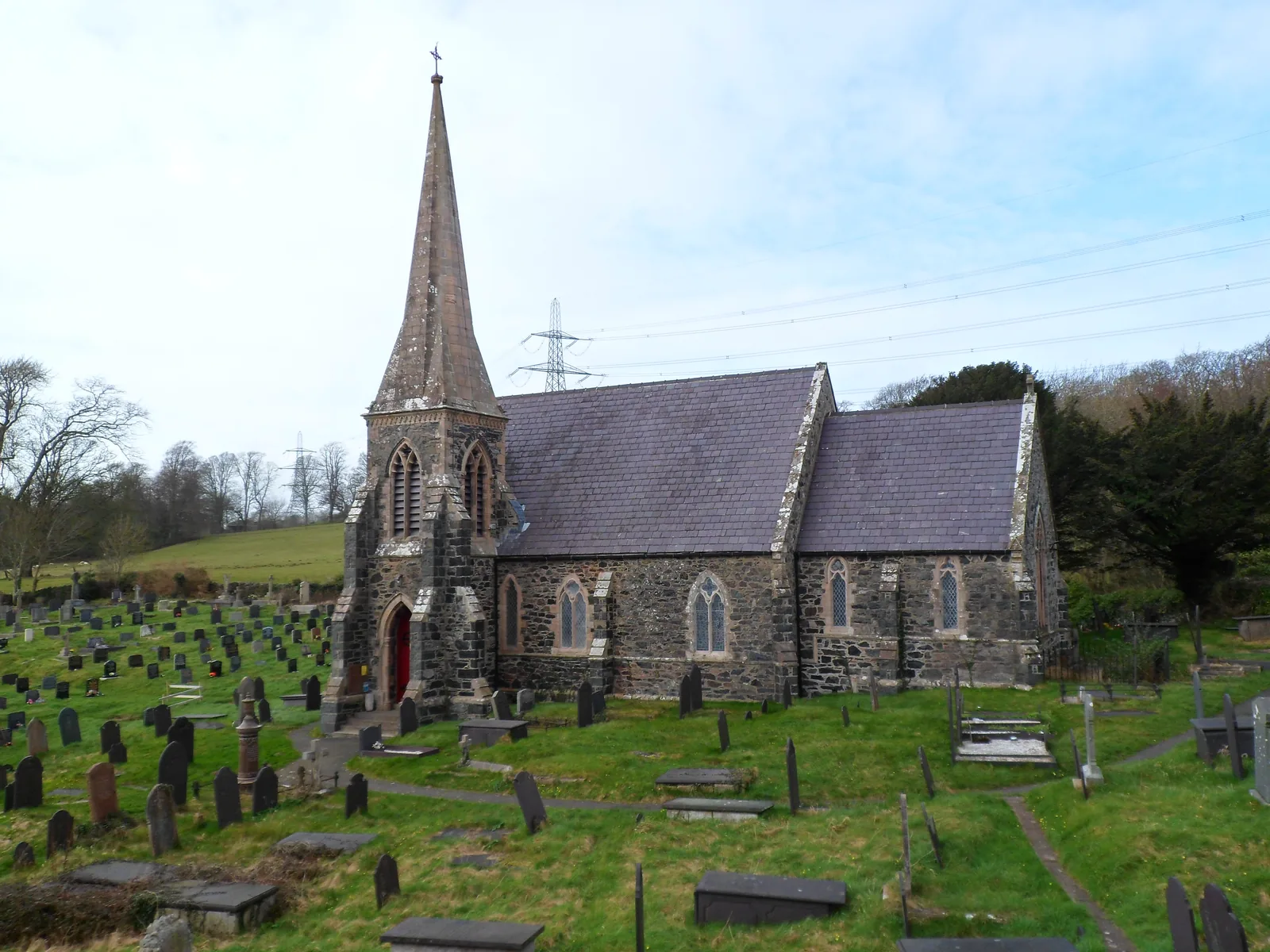
Working church
The church that gives the village the first half of its name, still working rather than preserved, close to the Britannia Bridge approach.
Landmark
The crossing that makes this village Anglesey’s front door. Stephenson’s tubular bridge burned, and what carries the A55 and the trains now is its replacement.
The Column’s opening days and admission price are set seasonally by the Trust. Confirm current details before you plan a climb around them.
Anglesey Column Trust, official site03Story
The short form of the name already means something real: “St Mary’s Church by the pool of the white hazels.” Everything since has been added to a place that started as a small medieval parish.
The village’s core name records a medieval church dedicated to St Mary, by a pool fringed with white hazel. The parish name was first recorded as “Piwllgunyl” in the 1250s.
Thomas Telford’s Holyhead road brought a tollhouse to the village’s east edge around 1823, and the Menai Suspension Bridge opened in 1826, the first fixed crossing onto Anglesey.
The station opened in 1848 as the line’s terminus. When the Britannia Bridge opened in 1850, that status ended overnight. By 1869 the extended 58-letter name had appeared, a piece of Victorian publicity for a station that had lost its reason to matter.
On 16 September 1915, local women met here to form the first Women’s Institute branch in Britain. It followed a talk given to the village by Madge Watt, a founder of the WI movement in Canada, at the invitation of Colonel Richard Stapleton-Cotton and his wife Jane.
The Marquess of Anglesey’s Column, standing since 1817, closed for safety reasons as its internal steps deteriorated. It reopened in March 2024, restored by the Anglesey Column Trust with National Lottery Heritage Fund support, a village still adding to its own story.
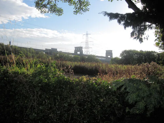
Long before the extended name existed, this was simply the point where a road, then a railway, first crossed onto Anglesey.
Atlas of Wales
Llanfairpwllgwyngyll is a real Anglesey village first. The sign, the Column and the tollhouse share the same short stretch of Holyhead Road with a Co-op, a Spar/garage shop, and a long-running woollen-mill gift shop trading under the village’s own extended name.
The 2011 census recorded seven in ten residents as Welsh speakers, a working Anglesey village, not a themed one.
For journey planning, search for Llanfairpwll or Llanfair PG rather than typing the full station name.
The Column, St Mary’s Church and the Toll House are the village’s older layer, spread along the road rather than gathered in one place.
Britannia Bridge carries the road and railway onto Anglesey right beside the village, the reason this was ever a stopping place at all.
Britain’s first Women’s Institute met in the hall beside the tollhouse in 1915, and within two years more than a hundred branches had formed across the country.
The village in one walk
The road through the village is Telford’s, and almost everything the place is known for was set down along it over the century that followed. None of it arrived for the same reason.
Plan your time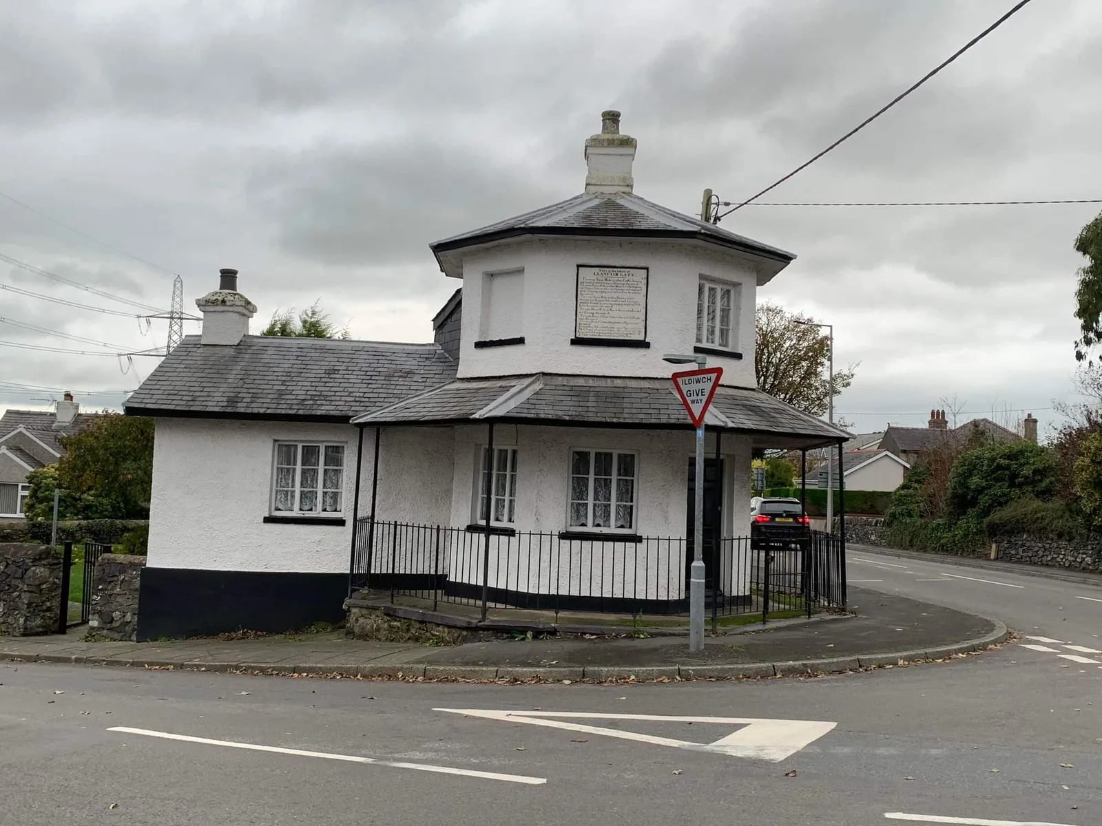
The extended name was added around 1869, after the Britannia Bridge ended the village’s brief career as a railway terminus.
Atlas of Wales
04Plan
By train into Llanfairpwll, or park nearby.
All fifty-eight letters, in one line, on the platform.
A short walk east, exterior only.
The station and the famous 58 letters.
115 steps, a café, and the Strait laid out below. Check it is open first.
Telford’s tollhouse, and the site of Britain’s first WI.
The parish that gives the village half its name.
An early arrival gets ahead of the day’s photo stops.
The climb, the café and the view. Worth checking before you travel.
A pause on the way to the church.
Close to the Britannia Bridge approach.
The crossing that made the village a gateway.
Practical
Everything you need for arriving and getting around.
Getting here
Llanfairpwll station (code LPG) is on the North Wales Coast line, with Transport for Wales services connecting to Bangor, Holyhead and beyond, the station the extended name made famous.
Check current train timesThe A5/A55 corridor crosses onto Anglesey via the Britannia Bridge, right beside the village, the first stop for most drivers arriving from the mainland.
Anglesey Column directions & parkingBus routes connect the village with the rest of Anglesey and Bangor, among them route 4 and route 42/42A. Check the current service before travelling.
Route 4 timetablePractical details
Three car parks: pay-and-display in the village centre, free parking by St Mary’s Church for the Column, and the council’s park-and-ride at the edge. The retail complex parking is for its customers.
Check the IACC car parks listingCharges and restrictions can change. Check the signs when you arrive.
Llanfair PG
Village centre · by the station
Google Maps (opens in a new tab)St Mary's Church, Holyhead Road
By St Mary's Church · for the Column
Google Maps (opens in a new tab)Park and Ride / Share Facility
North-east of the village · park and ride
Google Maps (opens in a new tab)There is a café at the Anglesey Column, and the village has a Co-op and a Spar/garage shop. No public toilet is listed for the village, so plan without one.
Check the Column café & facilitiesCafé at the Anglesey Column
A Co-op and a Spar/garage shop · no business named here
The station platform, sign, and the exteriors of the Toll House and St Mary’s Church are free to see. Only the Column’s interior is ticketed.
Check Column opening and admissionFree · village, sign, and exteriors
The Anglesey Column. Prices and opening days are set by the Trust and change with the season.
The village centre is flat. The Column’s viewing platform is reached by 115 internal steps, with no step-free alternative published.
No dog policy is published for the Column or the village centre. Check locally if this matters to you.
115 steps, no step-free alternative published
Flat, though no step-free route is documented
Arriving by train puts you on the platform beside the sign, which is the one arrival here that needs no car park at all.
Use Llanfairpwllgwyngyll as a base
Four real Atlas destinations pair with a visit here. Distances are straight-line from the village centre, not driving times.
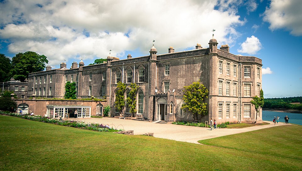
A National Trust house and garden on the Strait, home to the Marquess of Anglesey whose column stands above the village.
About 1.4 miles south-west (straight-line)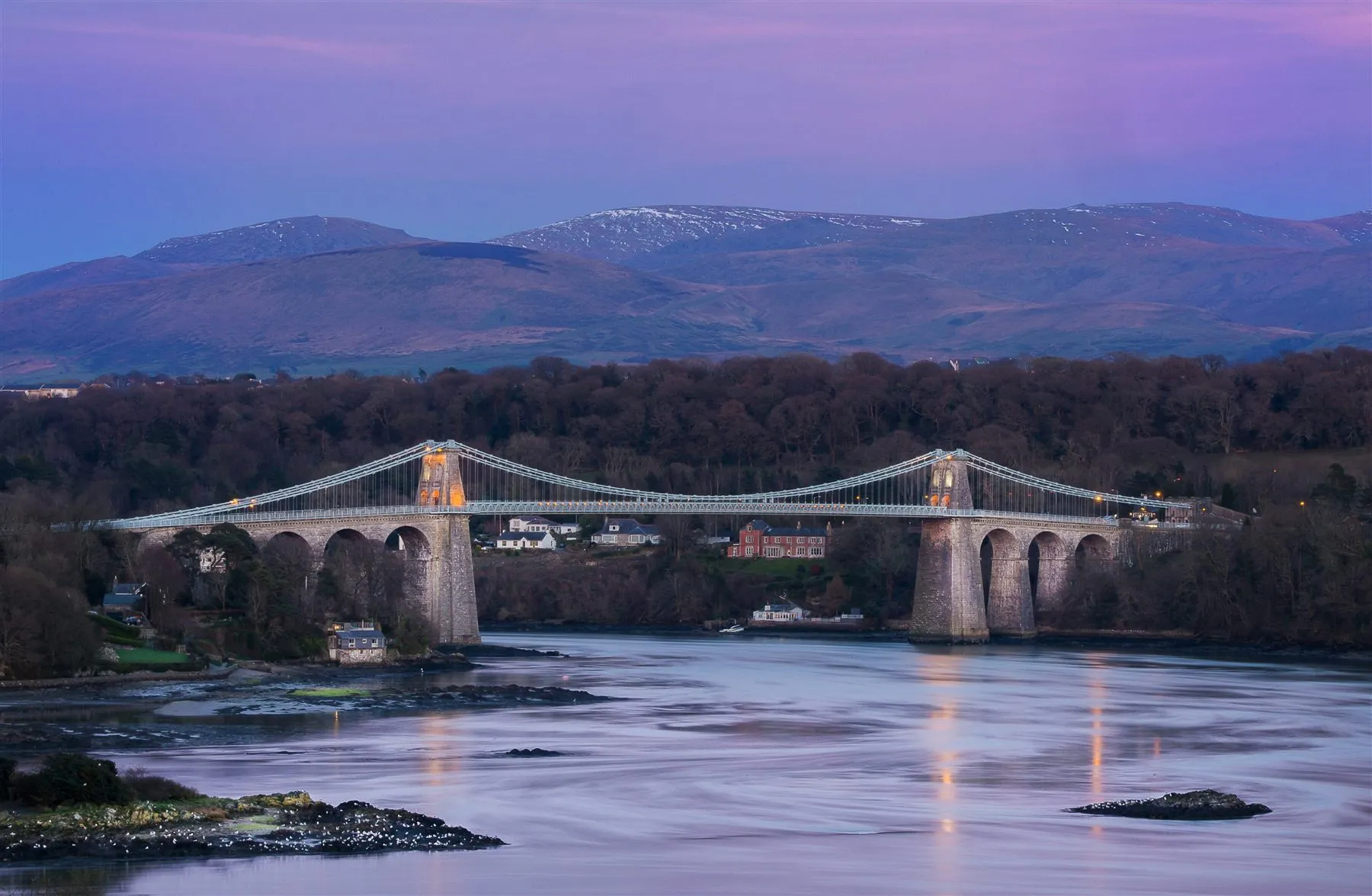
Thomas Telford’s 1826 bridge, the first fixed crossing onto Anglesey, the road that reached the village before the railway did.
About 1.6 miles east (straight-line)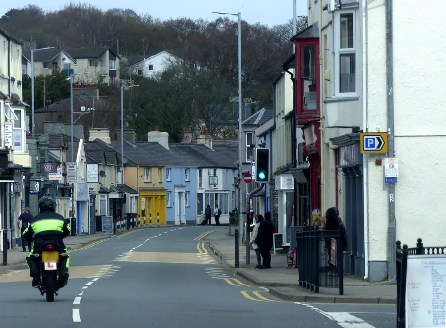
The Anglesey town Telford’s bridge created: a two-kilometre shoreline loop past a promenade built by First World War refugees, a tidal causeway to a medieval island church, and a pine-wood nature reserve.
About 1.6 miles east (straight-line)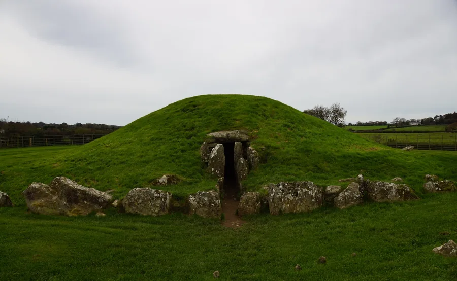
A Neolithic burial chamber aligned to the summer solstice: a much older Anglesey story, a short drive from the village.
About 1.8 miles south-west (straight-line)Before you go
Read the sign, climb the Column, and the village explains a history most visitors drive straight past.