A short landmark stop on a working road bridge, easiest folded into a wider Anglesey day.
CHECK FIRST · ACCESS
This is a working historic road bridge. Check Traffic Wales before travelling if crossing the bridge itself matters to your visit.
Time needed
20–45 min · longer with the village
Best time
Sunrise, sunset or dusk for reflections
Opening, entry & booking
Public road bridge · open at all times, free · occasional closures
Access & difficulty
Easy, short walk
Parking & start point
Paid town parking (e.g. Wood Street car park) · Menai Bridge village
Getting there
Bangor station ~3 km · bus, taxi or a 45-min walk
Toilets, food & facilities
Toilets, cafés and shops in the village · nothing on the Bangor side
Dogs
No restriction · keep close for traffic and a narrow footway
Plan with confidence.Detailed information on arrival, access, facilities, restrictions and local conditions.
Opening, entry & booking
Open
This is a working A5 road bridge, not an attraction. It is open at all times, free to cross on foot, and there is nothing to book.
Vehicle limits
A 7.5 tonne weight limit and a 3 m height limit apply; heavier or taller vehicles are diverted to the Britannia Bridge.
Closures
Planned maintenance, lane restrictions and occasional full closures do happen; phased refurbishment has continued through the 2020s. Check before making a special trip.
Heritage centre
Menai Heritage / the Thomas Telford Centre in the village tells the bridge story; its opening is seasonal and separate from the bridge. See Menai Heritage opening times.
Parking, start point & arrival
Best base
Paid town parking in Menai Bridge village, the practical side for a visit. Wood Street car park is one example.
Charges & payment
Current charges and the accepted payment method are shown on the on-site signs.
Mainland side
The Bangor side by the bridge is more residential, with fewer practical visitor parking options.
Busy times
Town parking can fill on summer weekends, so don’t count on a space at peak times.
Public transport & car-free access
Nearest rail
Bangor station, roughly 3 km east, is the nearest useful railway station. Times and tickets from Transport for Wales.
Onward from Bangor
A bus towards Menai Bridge, a short taxi, or a walk of about 45 minutes (3.7 km) via the bridge.
Village stop
The Menai Bridge bus stop sits close to the bridge, a few minutes on foot.
Before travelling
Bus timetables change through the year. Plan door to door with the Traveline Cymru journey planner, and check the current service before travelling.
Toilets, food & facilities
In the village
Menai Bridge has public toilets, plus cafés, pubs and shops for refreshments.
Heritage centre
Menai Heritage / the Thomas Telford Centre is nearby in the village and tells the bridge story. Opening is seasonal and hours aren’t listed here.
Mainland side
The Bangor side immediately by the bridge has fewer visitor facilities.
Accessibility & terrain
The reality
This is a functional road bridge, not a curated visitor attraction. A footway runs alongside the traffic.
Step-free, quiet conditions are not guaranteed, so choose your parking and approach with that in mind.
Dogs
Keep dogs on a short lead near traffic and on busy pavements.
Dogs & restrictions
Rule
No dog restriction applies; it is a public highway, not a managed site.
In practice
Keep dogs close and on a short lead. The footway runs alongside live traffic, with kerbs, road noise and wind on the exposed span.
Village end
Menai Bridge village has cafes and shops with their own door policies; the bridge itself has none.
Safety, weather & local conditions
Traffic
A footway runs alongside moving traffic on a working A-road. That, not the water, is the main hazard.
Wind
High winds can be felt strongly on the span and have triggered restrictions on the crossing.
Underfoot
Kerbs, narrow-feeling edges and uneven approaches at both ends.
Children
Supervise closely: the footway is narrow and the drop to the strait is significant.
PLACE-SPECIFIC DETAILS
Best light & the view
Best light
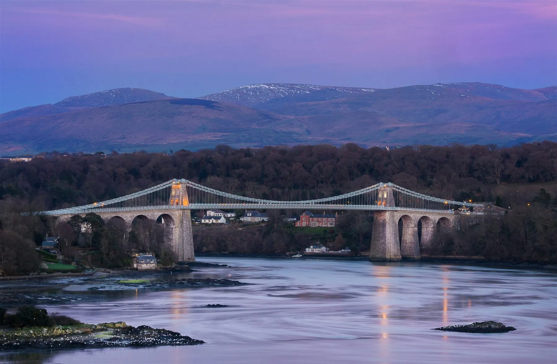
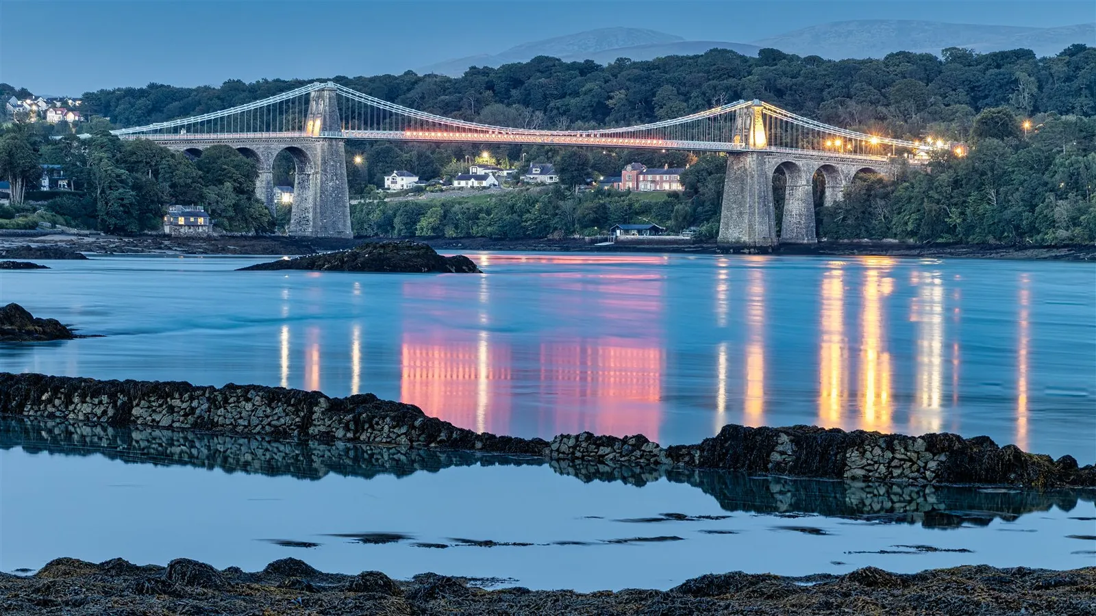
Sunrise or sunset, when low sun catches the towers; at dusk the lit bridge reflects in the strait.
Crossing, restrictions & safety
Vehicle limits & closures
Weight and height limits, and the periodic maintenance closures, are set out under Opening, entry & booking above.
Wind
High winds can trigger restrictions, especially for high-sided and vulnerable vehicles.
On foot
Pedestrian access is generally maintained during many traffic restrictions, though this isn’t guaranteed on the day. Don’t climb barriers or enter restricted areas. Drone use is restricted, so follow the current CAA Dronecode.
Emergency
In an emergency on or near the water, call 999 and ask for the Coastguard.
Other place details
The crossing
Working A5 road bridge
On foot
Footway for walkers & cyclists
Restrictions
Occasional restrictions for size, weight & maintenance
What to bring
Windproof layer
Comfortable shoes
Camera
Charged phone
Travel check if crossing by car
Dog lead if needed
Atlas of Wales Discovery Highlight
The crossing that changed Anglesey.
Before the bridge, reaching the island meant a ferry across the Menai Strait: tide-dependent, weather-beaten and, at times, dangerous.
Telford’s bridge, part of the London–Holyhead road, opened in 1826 as the longest suspension span in the world. Two centuries on, it still carries the everyday traffic of the A5.
Where island meets mainland.
Atlas of Wales Verdict
Should this shape your day?
A short, memorable stop, not a full day on its own.
On foot from the village, with the Strait and Eryri in view.
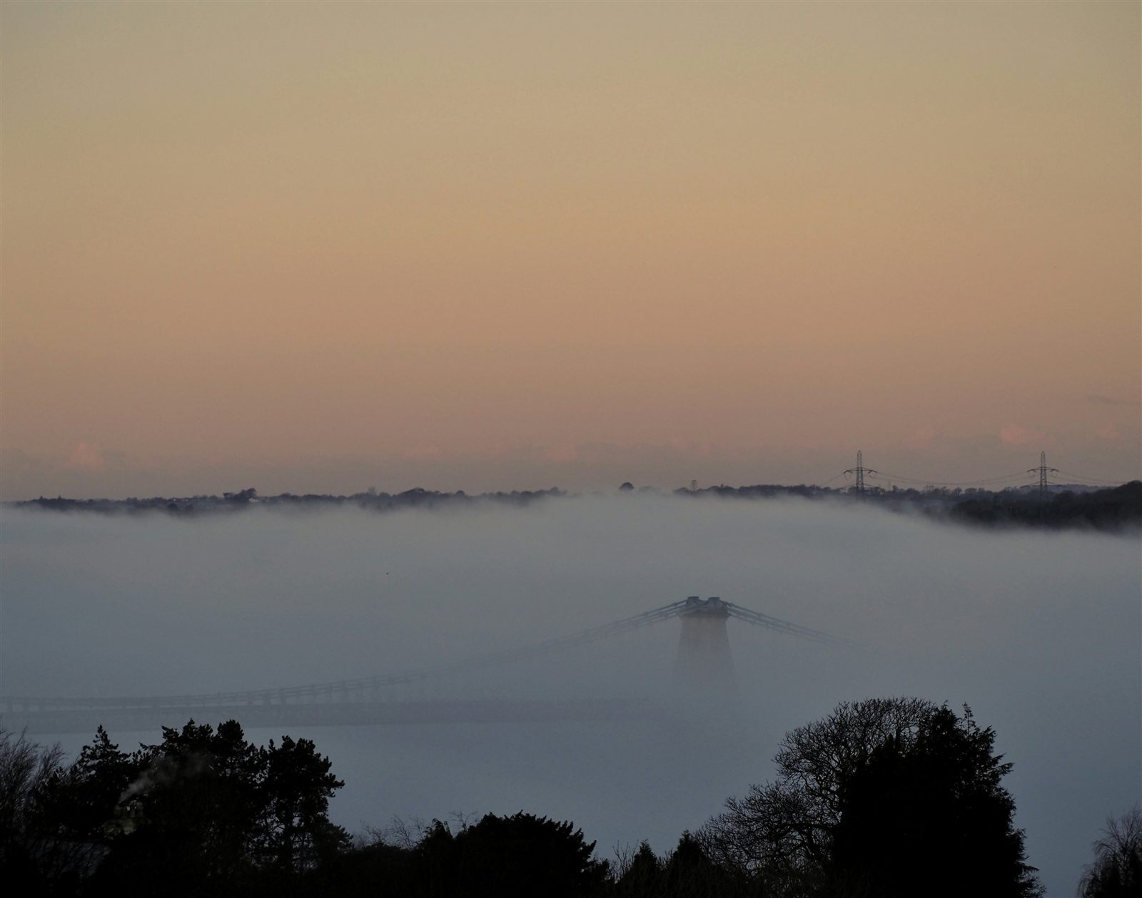
Some mornings, only an outline in the fog.
How your visit unfolds
One bridge, seven small moments.
A compact landmark visit, and here’s the shape of it before you go.
01 Village
Start in Menai Bridge, Porthaethwy in Welsh.
02 Waterside
Drop toward the water on the Beach Road side.
03 Towers
Penmon limestone towers rise over the road.
04 Chains
The blue-grey suspension chains draw the eye across.
05 Footway
Cross part or all of it, if conditions feel right.
Check restrictions
06 The view
Out to the Strait and Eryri on a clear day.
07 Back
Return for village cafés, Menai Heritage or Church Island.
The bridge, in pictures
Seen from the Strait.
Towers, chains, road and water: the crossing before you make it.
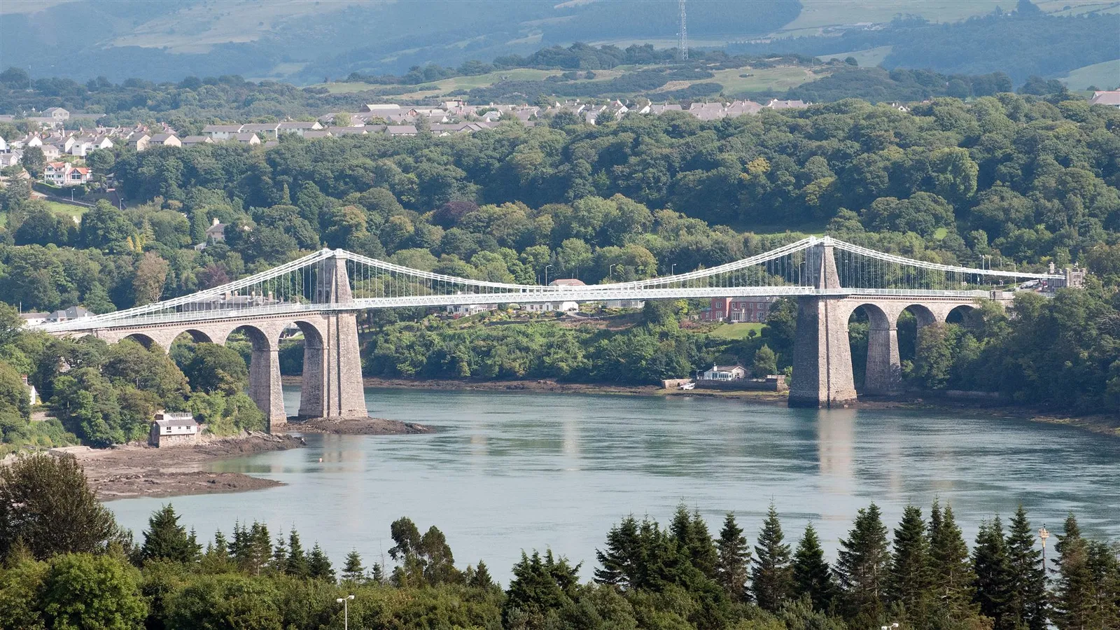
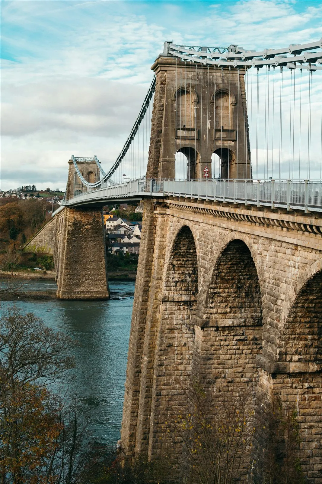
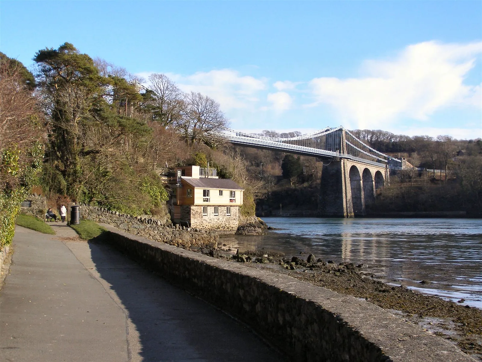
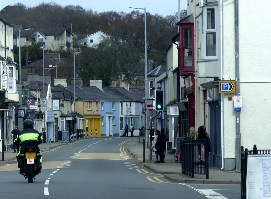
The full span over the Strait: mountains on the mainland skylineOne of the two masonry towers: Penmon limestone, roughly 30 m above the deckLit and still at dusk: the bridge doubled in the strait belowMenai Bridge village: the practical base for the visit
What stays with you
The parts people remember
The bridge is never seen all at once. It arrives in pieces, on the way down to the water.
01
Down through Porthaethwy
The village keeps the crossing hidden almost to the last. Beach Road drops toward the shore, and the deck is overhead before the span itself is.
02
The chains draw the gap
Blue-grey lines lift away from the towers and carry across open water, the whole width of the Strait held on something that looks far too thin for it.
03
Out on the footway
Walking the deck puts moving traffic at your shoulder and tide underneath at the same time. The crossing is a working road first and a landmark second.
04
Arches under the road
At the tower, the limestone opens into arched passages, with the chain anchorages set into the stonework and the viaduct arches stepping away below the deck.
05
The span from the shore
From the waterside path the bridge finally reads whole: towers, chains and deck in one line, with Eryri stacked behind it on a clear day.
A crossing you walk over, then stand back and look at properly.
From the bridge archive
The history, carefully told.
Four field notes on Telford’s crossing: why it was built, the milestone it set, how it was strengthened, and the protection it carries now.
This is documented engineering history, not legend, and where a detail is uncertain, it says so.
Field notes
Four entries. Open one to read the note.
Engineer & road Fact
Telford’s crossing
Field note I · filed under why it was built
The bridge exists because the road to Ireland had to cross the Menai Strait.
What is known
The bridge was designed by Thomas Telford as part of the London–Holyhead road, the great mail route towards the Irish ferries. It was built between 1818 and 1826.
What the record adds
Roughly 300 workers built it, raising two masonry towers of Penmon limestone with the suspension chains anchored deep into bedrock.
What to notice there
The line of the A5 still runs straight at the crossing; the bridge isn’t a monument set aside, but a working link on a road two centuries old.
Engineering milestone Fact
1826: the longest span
Field note II · filed under the record set
When it opened, nothing else like it spanned so far in a single leap.
What is known
The bridge opened on 30 January 1826. Its main span of about 176 m (579 ft) made it the longest suspension span in the world at the time.
What the record adds
Cadw describes it as the first known modern suspension bridge. Before it, the Strait was crossed by ferry: tidal, weather-dependent and dangerous.
What to notice there
From the shore the deck looks almost level, carried on those long draped chains. That clean, simple line was the breakthrough.
Working history Fact
Strengthened to survive
Field note III · filed under kept in service
What you cross today is Telford’s bridge, repeatedly reinforced to keep carrying traffic.
What is known
It was strengthened in 1840 to reduce wind sway. The original timber deck was replaced with steel in 1893 by Sir Benjamin Baker.
What the record adds
Major restoration in 1938–1940 replaced the original wrought-iron chains with steel. It was repainted in 2005, and phased refurbishment has continued in the 2020s.
What to notice there
Despite all that work, the bridge broadly keeps Telford’s intended look, painted blue-grey now to resist corrosion.
Protected Fact
Grade I & a landmark
Field note IV · filed under protection
It is protected as a building and celebrated as a piece of engineering.
What is known
The bridge is a Grade I listed structure, the highest level of protection, and forms part of the Menai Bridge conservation setting.
What the record adds
It is recognised by the Institution of Civil Engineers as a historic civil engineering landmark.
What to notice there
Protection is why the visual character survives. It also means restrictions: an old, listed structure carrying a modern road, so closures and limits are part of its life.
Continue exploring
Make it more than a bridge stop.
Four stops that turn a quick crossing into an Anglesey afternoon, each with its own Atlas guide.