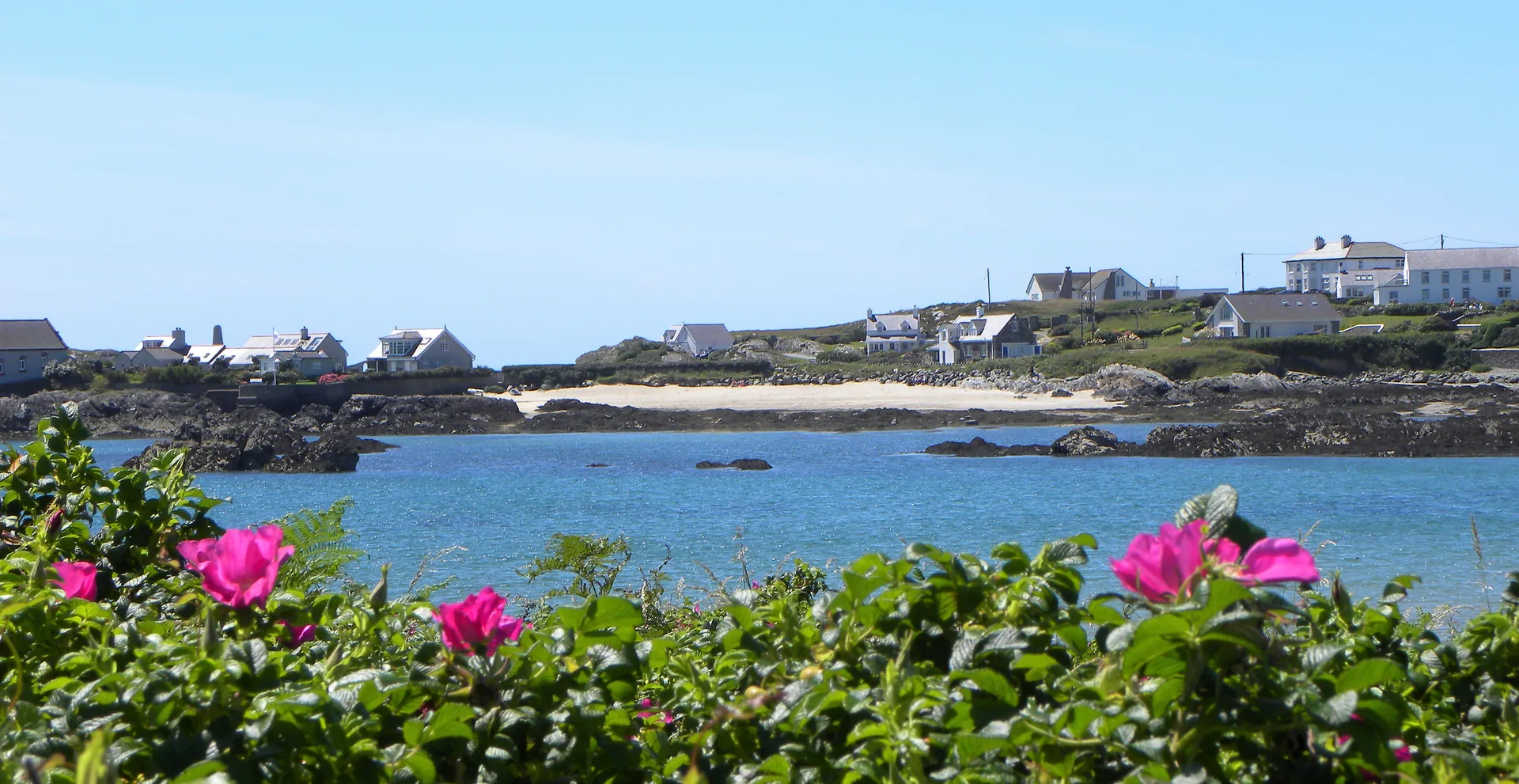
A south-facing bay at the end of a narrow lane, and the coast walk that starts on its sand.
CHECK FIRST · PARKING
Borth Wen is reached down a narrow lane to a small car park at the head of the bay, and there is no overflow. Sources disagree on whether it charges, and phone reception here is reported as poor, so carry coins, arrive early on a fine summer day, and have a fallback beach in mind.
Time needed
An hour on the sand · half a day with the headland loop
Best time
Spring and autumn · early on summer weekends
Opening, entry & booking
Open beach · no ticket · no booking
Access & difficulty
Straight onto sand · uneven underfoot on the headland
Parking & start point
Small car park at the head of the bay
Getting there
Narrow lane from Rhoscolyn · Valley station about 4 miles
Toilets, food & facilities
Plan as if there are none · pub on the approach road
Dogs
Not on Anglesey’s restricted-beach list
Plan with confidence.Detailed information on arrival, access, facilities, restrictions and local conditions.
Opening, entry & booking
Open
An open public beach with no ticket, no gate and no booking. Nothing here is staffed, and reaching the sand itself costs nothing; what is unsettled is the car park, below.
Designation
Borth Wen is a designated bathing water, which is why it carries an annual water-quality classification rather than opening hours.
Parking, start point & arrival
Where
A small car park at the head of the bay, reached by a narrow lane south from Rhoscolyn village (postcode LL65 2NX). From the A55 junction 3, take the A5 to Valley, the B4545 towards Trearddur Bay, then turn left for Rhoscolyn after Four Mile Bridge.
Space
Limited, with no overflow and a narrow lane to reverse back down if it is full. Arriving early matters more here than the size of the beach suggests.
Cost
Genuinely unresolved. One official tourism listing describes free parking; the destination body says charges may apply; a beach directory describes cash-or-app payment. The council’s own car-parks page names no individual car park. Carry coins rather than rely on either answer, or on phone signal.
Second start point
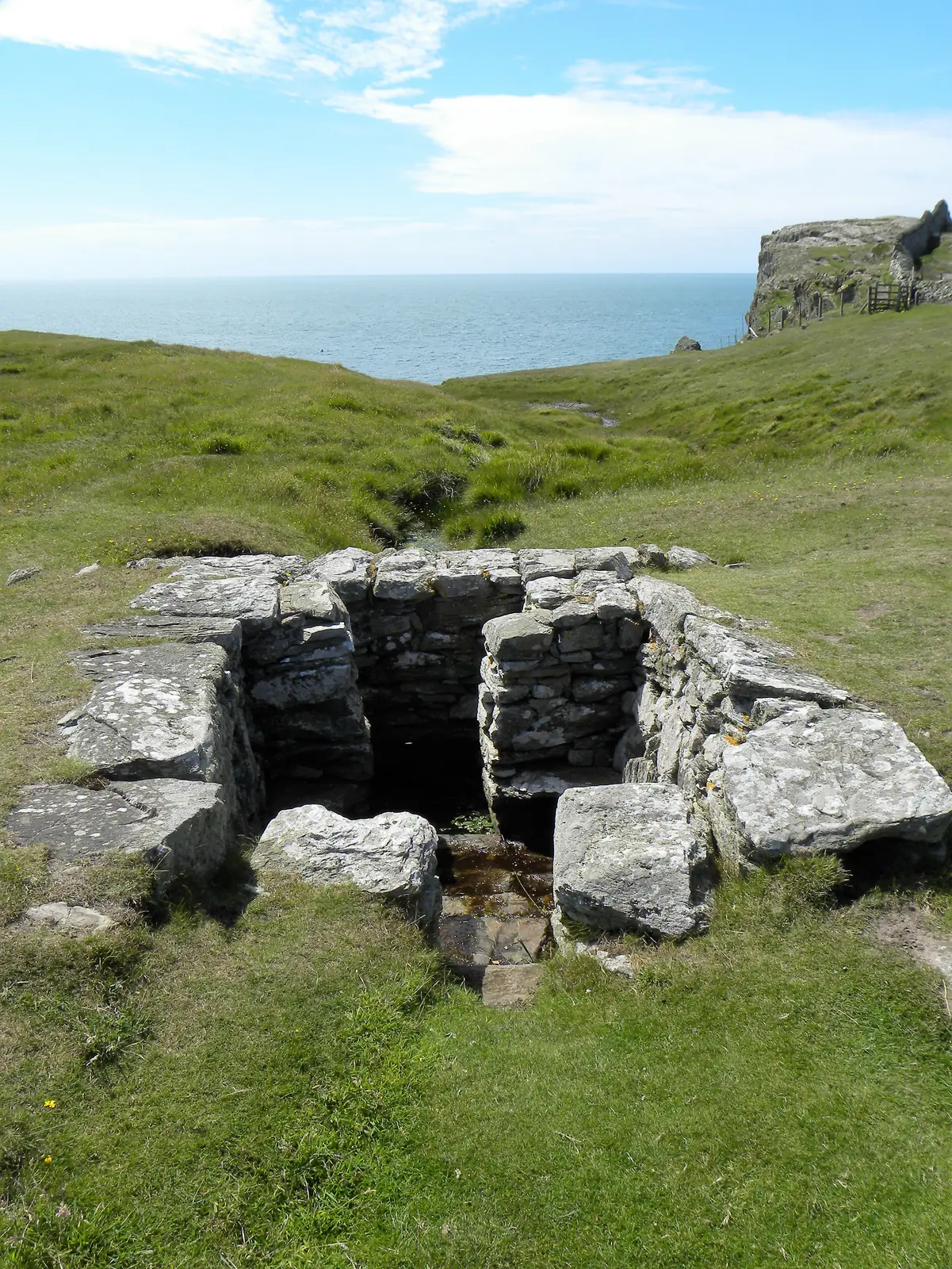
The headland walk is usually started from St Gwenfaen’s Church instead (postcode LL65 2NZ, grid SH268757), which keeps the beach car park free for people using the beach. The link opens the church as a start point. The church start point has no clearly designated visitor parking. Park considerately on the lane and expect limited space.
Public transport & car-free access
Bus
Route 23 (Holyhead–Trearddur–Rhoscolyn) serves the Rhoscolyn area. Journeys are few, so read the timetable before relying on it.
Rail
The nearest station is Valley, about four miles away, with no direct connection to the beach.
Plan a route
Check the current service before travelling, or plan door to door with Traveline Cymru.
Toilets, food & facilities
Toilets
Do not rely on beach toilets being available. Use Trearddur Bay or Holyhead beforehand.
Food & drink
There is a pub on the approach road, and refreshments at Silver Bay Holiday Park along the coast. No opening hours were sourced for either. Check before counting on them.
Visitor centre
None. There is no shop, no kiosk and nobody on duty at the bay.
On the water
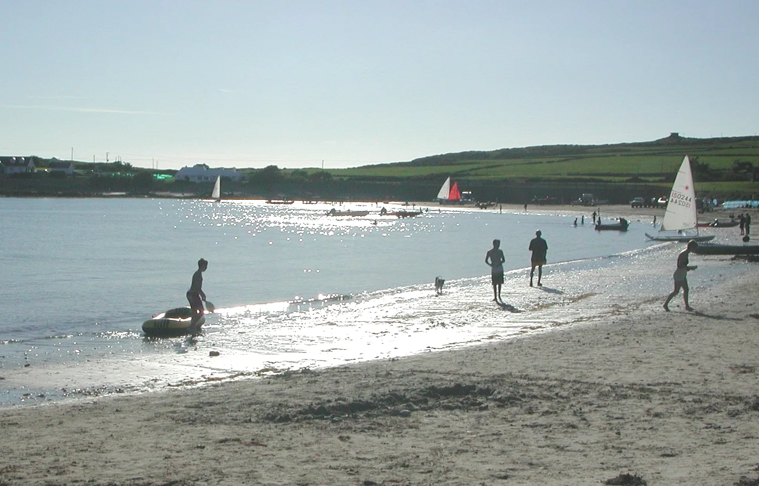
A slipway serves the bay, which is why you will often see moorings and small boats on the sand.
Accessibility & terrain
The beach
Sand begins effectively at the car park, and the bay is gently sloping and south-facing rather than stepped or steep.
No published assessment
Published accessibility information is limited. Do not assume a step-free approach or consistently firm surfaces, and check locally if gradients or surface conditions affect your visit.
The headland
Beyond the sand the ground turns to grass, rock and heath. It is uneven, boggy in places after rain, and the lanes at the far end of the loop have no pavement.
Dogs & restrictions
Rule
Borth Wen is not on Isle of Anglesey County Council’s seasonal restricted-beach list. That list names seven beaches (including Trearddur Bay and Porth Dafarch, both within a few miles of here) where dogs are restricted from designated areas between 1 May and 30 September.
What that does and does not mean
It means no seasonal ban is published for this beach. It is not a permission, and on-site signage remains the authority on the day.
Fouling
Island-wide rules apply here as everywhere else on Anglesey, under the Isle of Anglesey (Dogs Fouling of Land) Order 1997. Visitor reports for this beach make that worth stating plainly rather than softly.
Livestock
The headland circuit crosses grazed ground: leads through sheep pasture.
Plan as though Borth Wen is unpatrolled: assume no lifeguard cover, swim within your depth, and keep children close in the water.
In an emergency
Dial 999 and ask for the Coastguard.
The water
The bay is sheltered and shallow-sloping, which is much of its appeal, but the usual open-coast care applies around the rocky edges, the islets and an incoming tide. Forecast and tide times for Borth Wen: Met Office, reading the Trearddur Bay station 1.9 miles north.
The headland
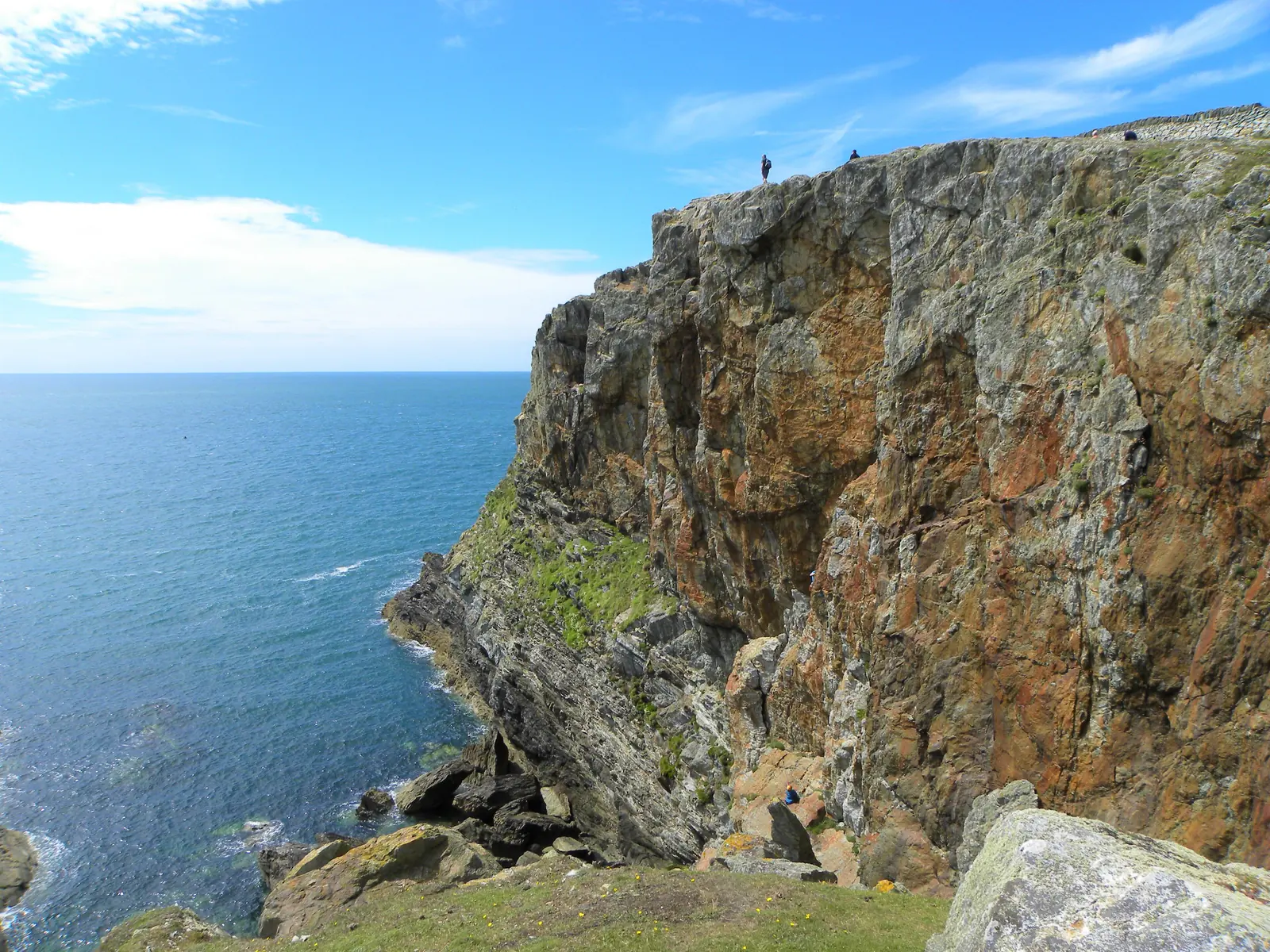
The coast path runs close to exposed cliff edges, and the ground is boggy after rain. This is the part of the visit that needs proper footwear and attention, not the beach.
PLACE-SPECIFIC DETAILS
Water quality & awards
Borth Wen
Classified Good for the 2025 bathing season.
Not the same beach
Silver Bay, along the coast in the same parish, is a separate designated bathing water, classified Excellent for 2025 and holding a 2026 Green Coast Award. Directories sometimes treat the two as one place. They are not, and Silver Bay’s rating and award are its own.
The coast either side of the bay is Glannau Rhoscolyn, a Site of Special Scientific Interest since 1961, running about 6.5 km along Holy Island’s west coast and notified for both its geology and its birds.
Birds
Chough, peregrine, shag, raven and kestrel are recorded breeding on this coast, the chough being part of why the site was selected.
Seals
Grey seals are frequently seen in the water around the headland.
Plants
The spotted rock rose grows here in two places. Only nine populations are recorded in the UK.
Landscape
The whole coastline is inside the Anglesey Area of Outstanding Natural Beauty, designated in 1966 and confirmed in 1967.
The headland walk
Two published routes
Visit Anglesey publishes a Rhoscolyn circular of about 5.8 miles, graded moderate and mostly level. Walking Britain publishes a headland walk of 5.5 miles with 148 m of ascent, about three hours, graded easy, starting at the church. They are different routes with different start points, so use one set of figures, not a blend.
What it passes
Porth Saint, Rhoscolyn Head with the two sea arches, St Gwenfaen’s Well, the coastguard lookout, Porth y Corwgl, Borth Wen itself, and on to Silver Bay.
Route notes
Exposed cliff edges, muddy after rain, and narrow roads without pavements near the finish. Dogs on leads through the sheep pasture.
Climbing
The quartzite below the path is an established sea-cliff climbing venue, with named zawns that are reached only on the lower half of the tide. It is a separate activity from the coast walk, with its own approach from the church, not something to wander into from the beach.
What to bring
Coins for the car park
Water
Shoes for uneven ground
Windproof layer
Everything you’d want if there are no toilets
Most people stop at the sand. The sand is the trailhead.
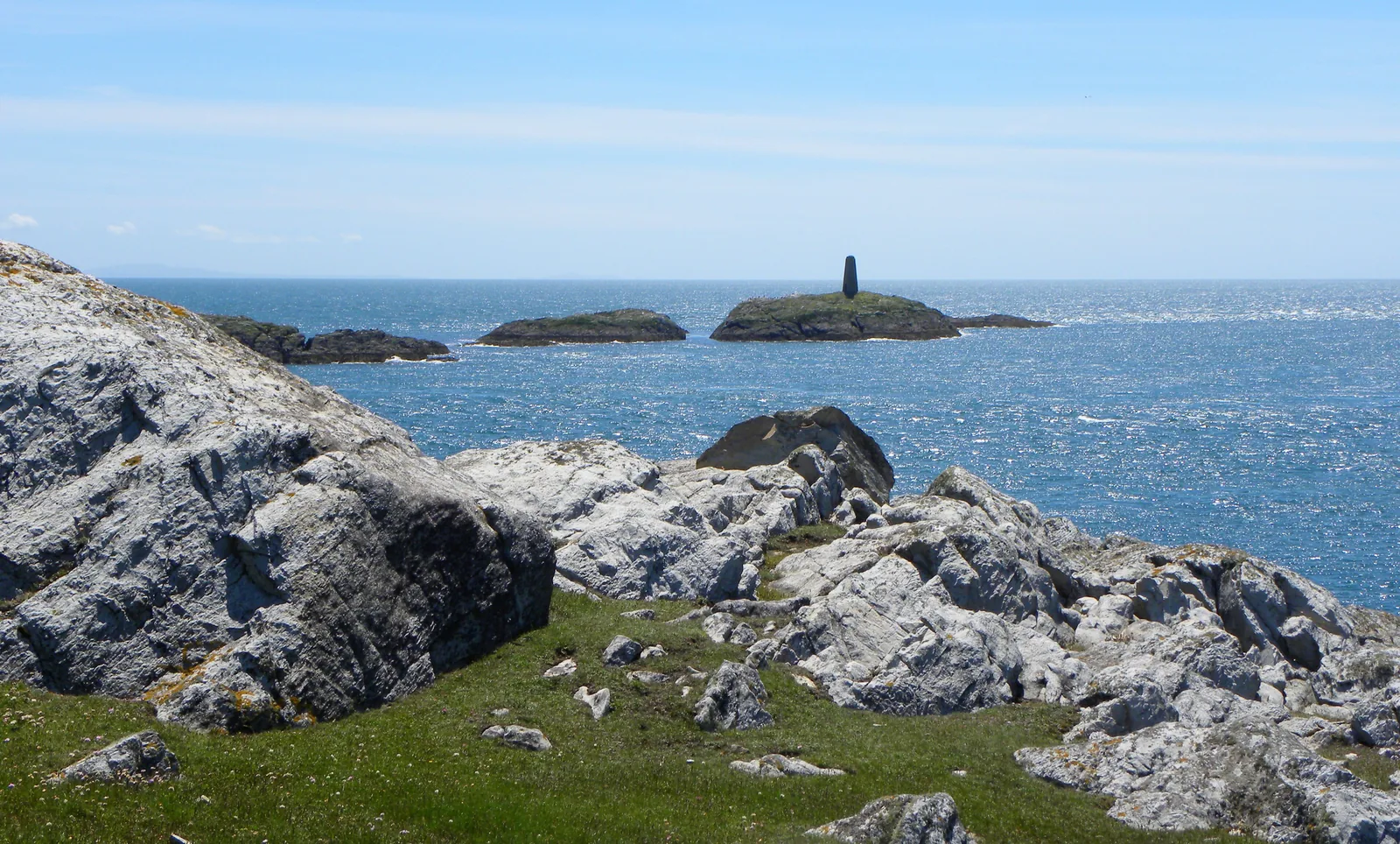
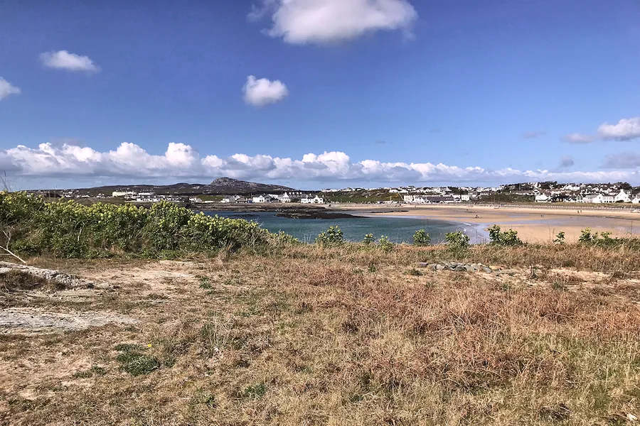
Borth Wen faces south into the Irish Sea, sheltered, shallow-sloping and edged with rockpools, with the Rhoscolyn Beacon standing out on the Gulls’ Islands where a lifeboat station once worked.
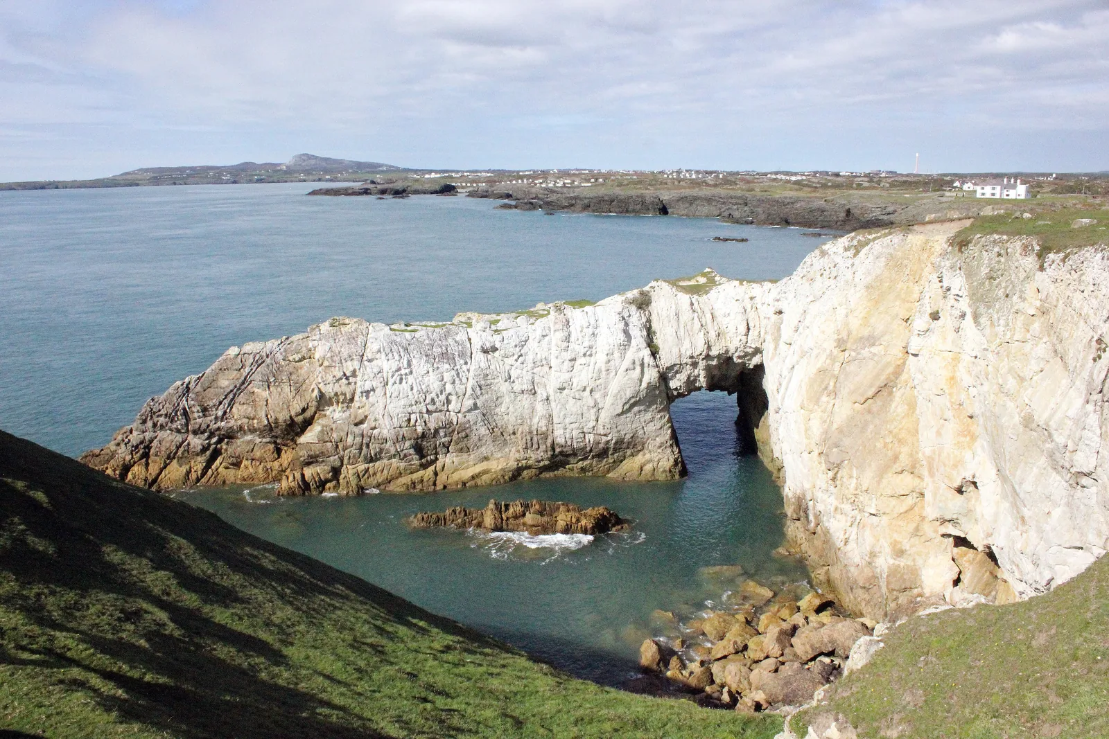
Walk up off the beach and the coast path gives you two named sea arches, a holy well sunk into a cleft above the cliffs, and rock folded so thoroughly that geologists have been arguing over it since before the site was protected.
A sheltered bay, an arch in the headland, and the beacon offshore.
Is this your kind of bay?
Sheltered sand and rockpools, a walk worth half a day above it, and a lane that decides how many people get in.
An early spring or autumn arrival: the beach first, then up onto the headland for the arches and the well.
Borth Wen on a working tide: shallow, sheltered, and easy to get afloat from.
Down the lane, then up onto the headland.
See the shape of the visit before you make it.
01 The lane
Narrow, hedged, and dropping to the bay.
02 The sand
South-facing, gently sloping, rockpools at the edges.
03 The beacon
The marker out on the Gulls’ Islands.
04 Porth y Corwgl
The cove the lifeboat launched from.
05 The arches
Bwa Gwyn and Bwa Du, cut into the cliff.
06 The well
Sunk in a cleft above the cliffs.
07 Silver Bay
On east, then back through the village.
Seen along the way.
Arches, beacon, well and cliff: what the headland gives you above the sand.
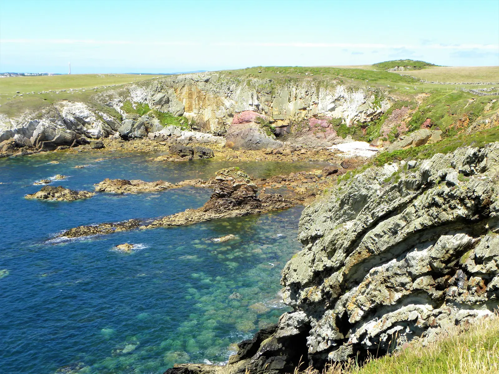
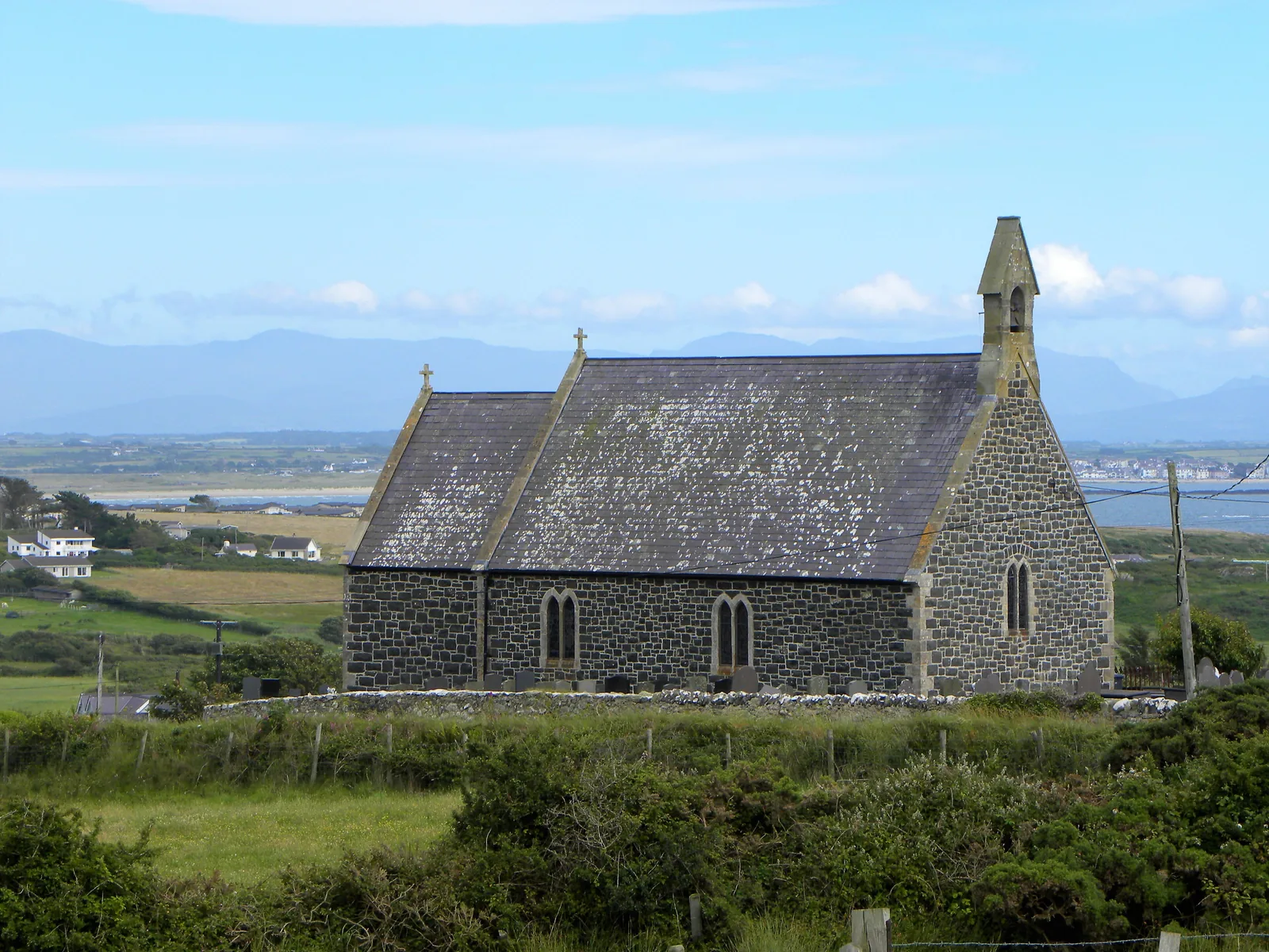
Bwa Gwyn, the white arch: the reason most people walk the headlandThe beacon on Ynysoedd Gwylanod, seen from the headland: the view you get from landSt Gwenfaen’s Well, sunk below the turf: easy to walk straight pastPorth Gwalch: the cliff edge the coast path runs alongPorth Saint: the banded quartzite the SSSI was notified forSt Gwenfaen’s Church, with Eryri across the water behind it
The parts people remember
A small bay that turns out to be the front door to a much bigger piece of coast.
01
The lane closes in
The road narrows past the village and the hedges come up on both sides, so you arrive at the coast without ever having seen it coming.
02
A column out on the rocks
The bay opens south, and the first thing that fixes your eye isn’t the sand; it’s the dark beacon standing on the islets offshore.
03
The tide goes a long way out
At low water the sand keeps going, the rocky edges surface, and the bay becomes much bigger and much slower than it looked from the car park.
04
The white arch, from above
Up on the headland the cliff pales almost to white, and the sea has cut clean through it, and you look down into the arch rather than up at it.
05
Mountains on the way back
Turning inland at the end of the loop, the skyline across the water gives you the whole Eryri range behind the churchyard wall.
You come for a beach and leave having walked a coastline.
The record
What we know, carefully told.
Three field notes on one small parish: a lifeboat station and the marker that replaced it, a holy well with two designations, and rock that geologists keep coming back to.
The designations and the water quality are settled. The dates, the disaster and the tradition come from secondary records, and where that is the case, it is said so.
Field notes
Three entries. Open one to read the note.
Maritime Record
The beacon and the boat
Field note I · filed under Porth y Corwgl
The marker standing offshore took the place of a lifeboat station that worked this water for ninety-nine years.
What is known
A lifeboat was first stationed at Porth y Corwgl, immediately west of Borth Wen, in 1830 by the Anglesey Association for the Preservation of Life from Shipwreck, passing to the RNLI in 1855. The station closed in 1929 and was replaced by the navigational beacon on Ynysoedd Gwylanod. The 1877 boathouse is now a private house; the 1903 boathouse is Grade II listed. The beacon itself is separately listed, a tall round tower of local rubble, recorded as a good and substantially intact 19th-century day-mark.
What the record adds
On 3 December 1920 the station’s lifeboat was capsized twice in Caernarfon Bay going to the steamer Timbo. Five of her thirteen crew were lost, along with four of the Timbo’s. A memorial was unveiled at St Gwenfaen’s Church two years later.Dates and names · secondary record
What to notice there
The beacon reads as scenery from the beach. From the headland path it reads as what it is: a warning, put on the rocks that made a lifeboat station necessary.
Early medieval Record
St Gwenfaen’s Well
Field note II · filed under Ffynnon Wenfaen
A drystone well house in a cleft above the cliffs of Porth Gwalch, recorded as both a scheduled monument and a listed building.
What is known
The well sits west of the village, below the level of the surrounding ground. Its drystone house measures about 4.5 m east to west by an original 5.5 m north to south, with a central chamber roughly two metres square, a flagstone floor and stone seats in the corners. A small well chamber opens off it, and a channel carries the water to a pool some 35 m to the west. It is recorded as a scheduled monument and, separately, as Grade II listed.
What the record adds
A recorded tradition holds that an offering of two white quartz pebbles dropped into the water cured troubles of the mind. The well is named for Gwenfaen, whose name the parish church also carries.Tradition · recorded, not a claim
What to notice there
It is below ground level and roofless, so it does not announce itself. Look for the dip in the turf on the seaward side of the path rather than for a building.
Geology Record
The folded coast
Field note III · filed under Glannau Rhoscolyn
The coast either side of the bay has been a Site of Special Scientific Interest since 1961, for its birds and for rock that was folded more than once.
What is known
Glannau Rhoscolyn runs about 6.5 km along the west coast of Holy Island, from Porthygaran to Silver Bay, covering roughly 145 hectares. It is notified for both geological and biological interest, and is managed by Natural Resources Wales. The rock is late-Precambrian quartzite, bent into a kilometre-scale upfold with smaller folds on both of its limbs.
What the record adds
The site’s own citation describes it as carrying some of the finest polyphase fold structures known in southern Britain, and as one of the most intensively studied stretches in the British Isles.Citation wording · secondary source
What to notice there
At Porth Saint the strata run in visible bands of pale, orange and rust across the cove. The same rock, pale and clean, is what makes the white arch white.
Don’t let the day end at one bay.
Four stops that turn a morning on the sand into a day on Holy Island and its edge.