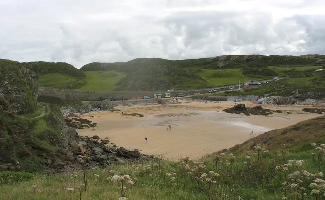
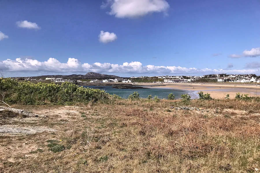
An exposed coastal hill walk where the route you choose matters more than the height.
CHECK FIRST · WEATHER
Check the wind and visibility before committing to the full summit-and-cliff circuit, an exposed coastal hill, not just a 220 m height. Read the Met Office forecast for Holyhead before you set off: the nearest station, a couple of miles east and at sea level, so expect more wind on the tops.
Time needed
~3 hr classic circuit · 1.5–3 hr South Stack visit · 4.5–6 hr at leisure
Best time
Spring–early summer for seabirds · late summer for heather
Opening, entry & booking
Reserve free and open access, no booking · parking £3.50–£7.50
Access & difficulty
Moderate to challenging · steep, rocky, exposed cliff paths
Parking & start point
£3.50–£7.50 · Breakwater Country Park or RSPB South Stack
Getting there
Holyhead station, then taxi · no public transport to the reserve
Toilets, food & facilities
RSPB South Stack only · visitor centre and café not 24-hour
Dogs
Welcome on the reserve, under control on paths · not inside the café
Plan with confidence.Detailed information on arrival, access, facilities, restrictions and local conditions.
Opening, entry & booking
The reserve
Open access and free to enter. The cliffs and paths are not gated and have no closing time.
Parking
Free to RSPB members and Blue Badge holders. Otherwise £3.50 up to one hour, £7.50 all day (rate recorded June 2026).
Visitor centre, shop & café
Seasonal and staffed hours: explicitly not 24-hour, unlike the reserve itself. Do not plan a late walk around a hot drink.
Booking
None for general visits.
Seasonal rules
A no-drone policy runs 1 March to 31 July, and conservation notices change with the season. Read on-site signage on the day.
Parking, start point & arrival
Reserve entry
Free. RSPB members park free; Blue Badge parking is free.
All facilities are at the RSPB South Stack visitor centre: toilets, shop and café.
Accessible
An accessible toilet is available at South Stack, alongside seven Blue Badge spaces.
Hours
The visitor centre, toilets, shop and café are not 24-hour, while the reserve is. Outside staffed hours treat the whole mountain as a bring-everything stop.
On the circuit
Nothing at all on the Breakwater Country Park side or along the coastal trail. Carry water for the full round.
Accessibility & terrain
Level route
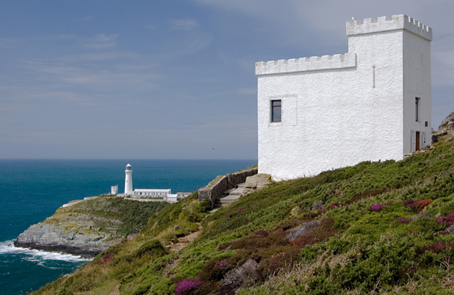
From Ellin’s Tower car park to the viewpoint outside Ellin’s Tower, suitable for pushchairs and wheelchairs.
Facilities
Blue Badge spaces and an accessible toilet at South Stack.
Alternative route
The visitor-centre to Ellin’s Tower route has 25 uneven steps.
Coastal trail
Rugged, uneven and narrow.
The mountain
Summit paths are rough and exposed; Holyhead Mountain itself is not mobility-accessible in any meaningful sense.
Dogs & restrictions
Dogs are welcome on the reserve and in Ellin’s Tower, but not inside the café; assistance dogs are welcome throughout. Keep dogs under control and on the paths.
This matters here for a reason: breeding birds, fragile heathland, livestock and sensitive cliff habitat all sit close to the route.
Safety, weather & local conditions
Expect steep sections, exposed cliff edges and a rugged, uneven, narrow coastal trail. Wind can materially affect comfort and balance, and in poor visibility route choice becomes more serious. Families should supervise children closely near the cliffs.
Wear grippy footwear, carry waterproof/windproof layers, water and a route map or GPX. Do not improvise cliff-edge shortcuts. If you are trapped or in danger, call 999 and ask for the Coastguard.
Main planning gate
Wind, weather & cliff exposure
PLACE-SPECIFIC DETAILS
Parking · Breakwater Country Park
Breakwater Country Park, on Holyhead’s old quarry coast, is the start for the classic full circuit. It is a council car park with its own charges, reviewed periodically, so go by the tariff board on site or check the council page for the car park before you travel.
Conservation
Stay on paths
Established paths only; no barbecues.
Drones
RSPB operates a no-drones policy from 1 March to 31 July.
Local notices
Conservation rules change with the season.
The Range
A seasonal access restriction covers the open ground between the Wales Coast Path and the sea along this stretch, through the spring and summer breeding season. The coast path itself stays open. Check Natural Resources Wales for the current dates before planning anything below the path.
Seasons & wildlife timing
Spring–early summer
Best for seabird interest and active cliffs, and the most sensitive wildlife period. Stay on paths; respect drone and dog rules.
Late summer
Best for heather, wildflowers, warm light and scenic photography.
Autumn
A good shoulder season on a clear forecast; weather is more variable.
Winter
Quiet and potentially dramatic, but exposed, windy and slippery: for experienced walkers on favourable forecasts only.
What to bring
Grippy footwear
Windproof/waterproof layer
Water
OS route / GPX or RSPB trail map
Binoculars in spring & early summer
Camera / longer lens optional
Charged phone
Choosing your version of the day
There are two walks here, and the forecast picks one.
The full summit-and-cliff circuit and the South Stack viewpoint side are not the same outing. On a settled day the circuit is one of Anglesey’s best half-days. On a windy or clagged-in one, the viewpoint side still gives you the cliffs, the lighthouse and the birds without the narrow ground. Decide which you are doing before you park, not halfway round.
The circuit: about three hours, steep in places, with narrow coastal path and cliff edge. Best on a clear, settled forecast.
The viewpoint side: Ellin’s Tower and the South Stack cliffs, an hour or two, with a level option at the top.
It is not a technical or alpine mountain, but route choice gets serious in poor visibility.
Plan your route in advance (e.g. an Ordnance Survey Holyhead Mountain circular) and don’t improvise cliff-edge shortcuts.
Turning back is a legitimate outcome. The viewpoint side is still a good day.
Atlas of Wales Discovery Highlight
A small mountain with too many stories for its height.
The surprise is how much is packed into such a small area: a quartzite summit, folded sea cliffs, breeding seabirds, hut circles, a hillfort, lighthouse engineering and the remains of fog-warning history, with summit views, North Stack and Holyhead’s working harbour all in reach.
Holyhead Mountain is only 220 metres, but it feels bigger because of its exposure and setting. That compression is what makes it special.
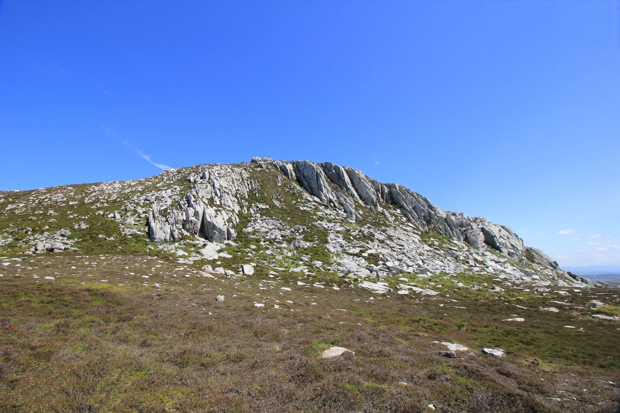
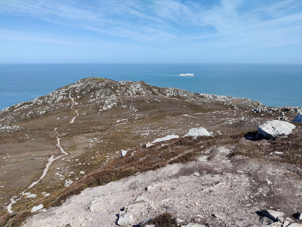
The cliff line running out towards North Stack.
Atlas of Wales Verdict
Best for walkers who want Anglesey at its wildest, not easiest.
One of Anglesey’s strongest half-day walks: summit views, seabird cliffs, archaeology and maritime history in one route. Exposed and uneven, though, and not for every casual visitor.
Good fit for
confident walkers
landscape photographers
birdwatchers, especially spring & early summer
visitors who want South Stack plus a proper walk
anyone drawn to archaeology, geology & maritime history
Think twice if
you want a flat, easy stroll
you are uncomfortable near cliff edges
you have young children who may run ahead near drops
you need mobility-accessible summit access
the forecast shows strong wind, poor visibility or heavy rain
Wind & exposure decide the day
the mountain is not high, but the exposure is real
steep, rough, narrow cliff paths once you leave the viewpoints
South Stack has accessible viewpoint options; the mountain itself does not
on a poor forecast, save the full summit-and-cliff circuit for another day
A clear, breezy-but-manageable day from late spring to late summer, with time for the summit, South Stack, North Stack and slow wildlife watching.
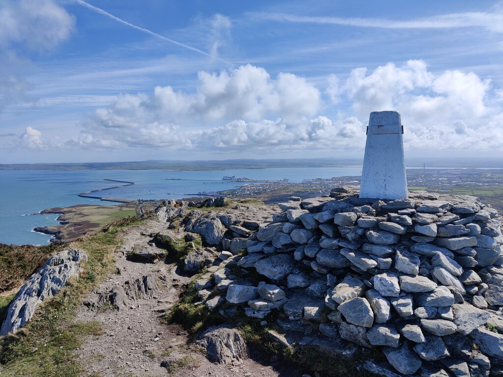
Holyhead Mountain: Holy Island’s highest point above the western cliffs.
How your walk unfolds
One circuit, seven scenes.
See the shape of the walk before you commit to the cliffs.
The Ordnance Survey circular runs about 7.3 km / 4.51 mi in around 3 hours, with steep sections and exposed cliff edges; a broader newspaper-guide variant is described as a challenging 5.5 miles. A shorter ascent from the South Stack side is also possible. Treat it as a flexible shorter visit rather than a fixed route.
01 Breakwater
Quarried edges and harbour views, where the breakwater stone was cut.
02 The climb
Up onto the quartzite high ground, the sea widening behind you.
03 The summit
Trig point and Caer y Twr’s old lookout country at 220 m.
04 South Stack
The land drops and the folded sea cliffs open below you.
Exposed · wind check
05 The lighthouse
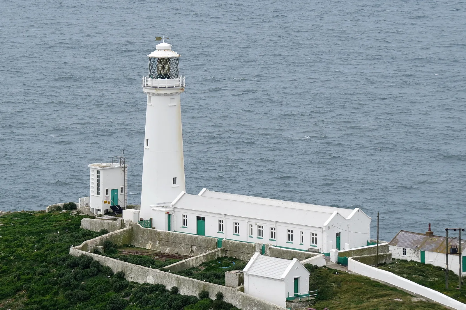
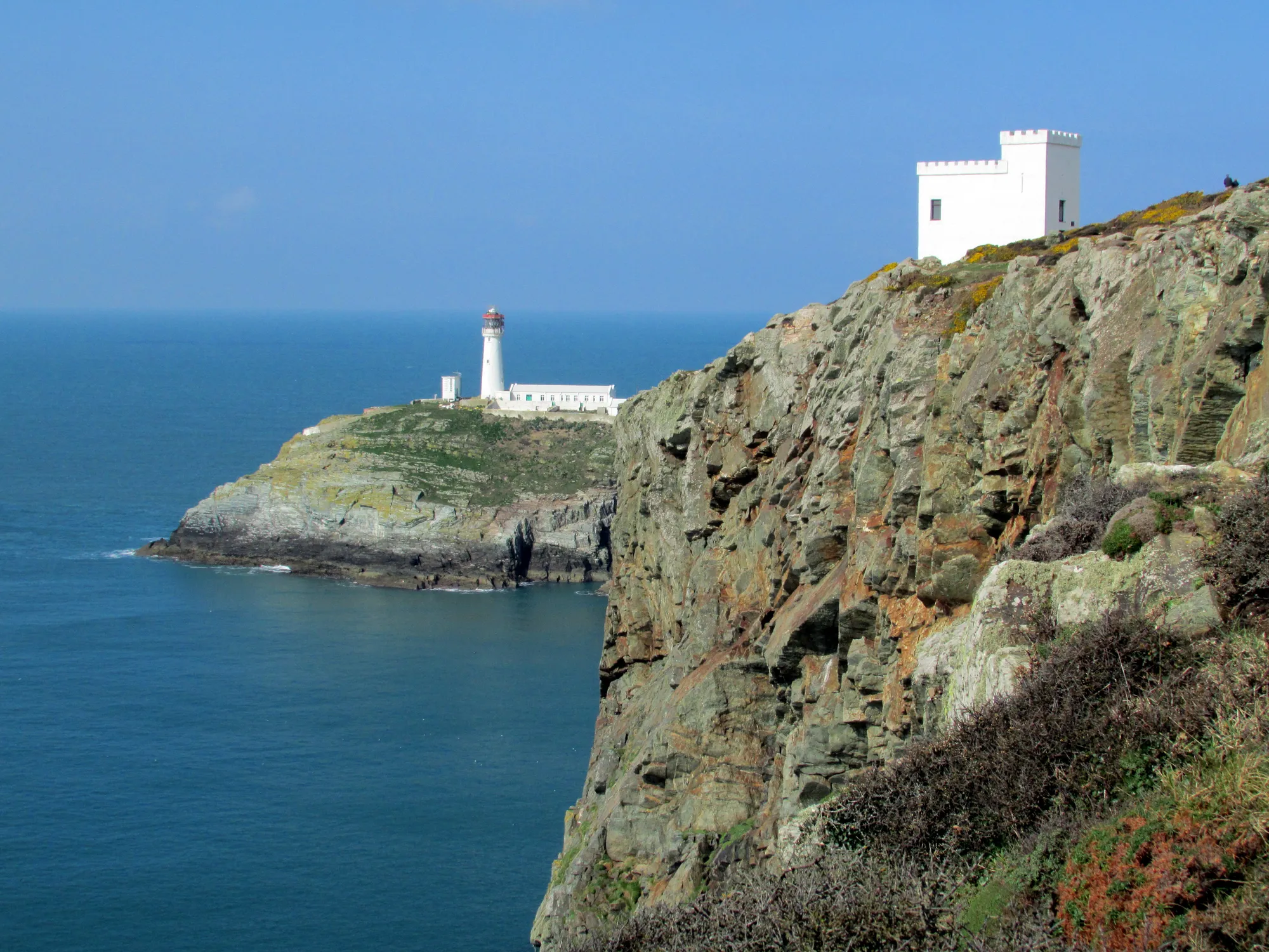
South Stack Lighthouse far below, one of Anglesey’s iconic scenes.
06 North Stack
Cliff-country and the old fog-station’s harder, quieter edge.
07 Back to Breakwater
Close the loop along the coast, the harbour ahead once more.
Holyhead Mountain, in pictures
Seen along the walk.
Quartzite, cliff and sea: the route before you make it.
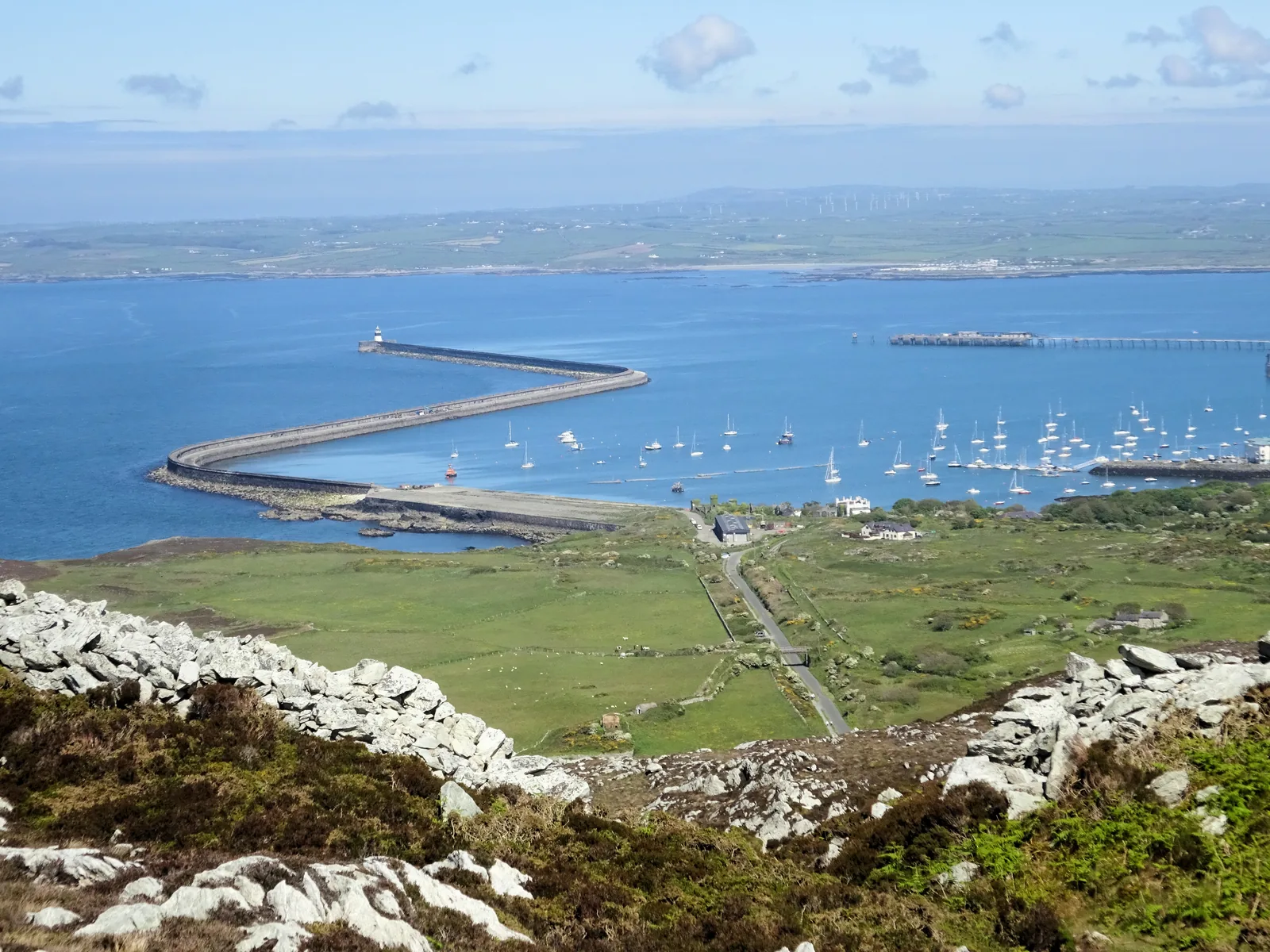
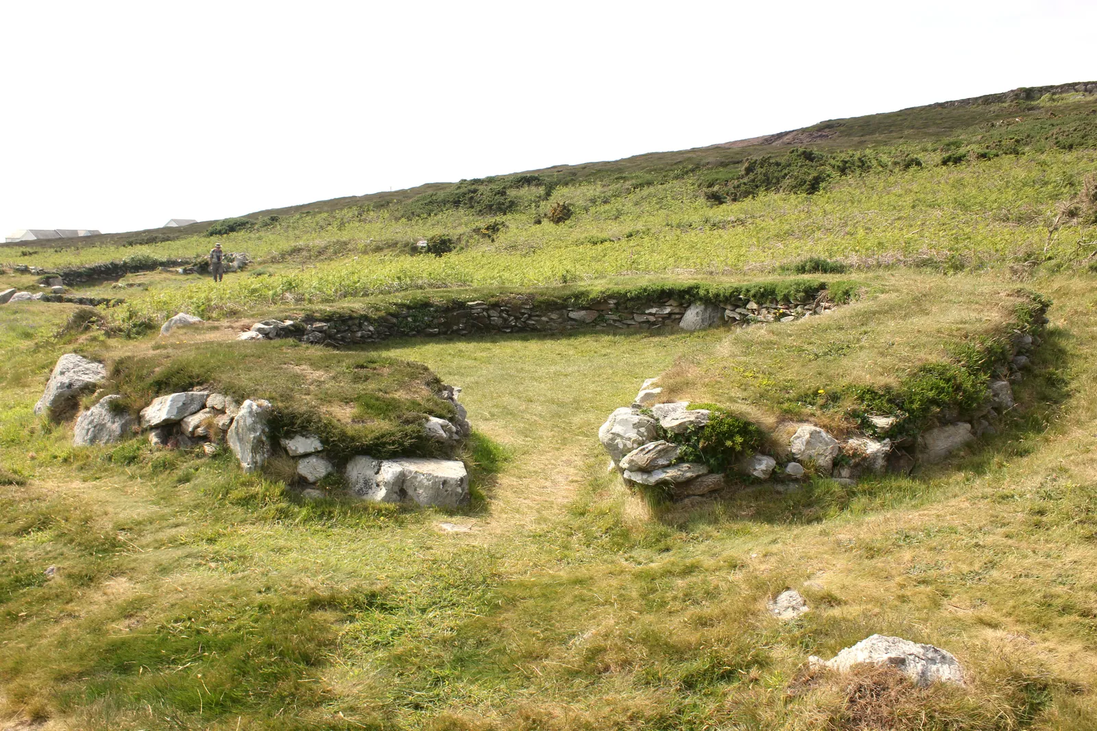
The lighthouse reveal: South Stack far below the cliffs of the walkEllin’s Tower country: the RSPB seabird cliffs along the routeThe trig point at 220 m: the summit of Holy IslandThe other way: Holyhead, the marina and the breakwater from the summitNorth Stack: the quieter, harder edge of the cliff lineHut circles on the mountain slope: Iron Age homes below Caer y Twr
What stays with you
The parts people remember
Two hundred and twenty metres does not sound like much until you are on it. The sea is on three sides and there is nothing between you and it.
01
A trig point with nothing above it
Holy Island runs out in every direction from the summit, and the horizon is water on three sides. It is a small hill that behaves like a big one.
02
The lighthouse reveal
You are looking down on it, not across at it. South Stack stands on its own rock below the cliff line, white against dark water, with the sea running through the gap between the island and the headland. It is the one view on this hill that stops people walking.
03
The sound coming up the rock
In season the cliffs are loud from above before you see anything, the noise rising off ledges hidden under the path.
04
Round footings in the heather
On the lower slope the ground keeps resolving into circles of low stone. Once you have seen one you start seeing them all the way down.
05
The far headland
North Stack has a more isolated headland setting than South Stack. Its weathered maritime buildings sit farther along the route, beyond the main lighthouse viewpoints.
A compact mountain where summit, cliffs, archaeology and maritime history sit within one walk.
From the Holyhead Mountain archive
A summit with too much packed into it.
Four field notes on what makes this small mountain matter: the rock, the archaeology, the maritime coast and the wildlife. Source-backed, and where sources differ or are uncertain the note says so.
This is history and habitat kept honest. Where a date or detail is uncertain, it says so plainly rather than guessing.
Field notes
Four entries. Open one to read the note.
The rock Fact
Quartzite & folded cliffs
Field note I · filed under geology
Holyhead Mountain is hard quartzite, and the cliffs below it expose some of Britain’s most significant folded rock.
What is known
The mountain is largely associated with hard quartzite. The South Stack cliffs expose the South Stack Formation, and the South Stack fold structures are recognised as nationally significant geology, selected by the Geological Society among the UK’s top geosites.
What it means underfoot
For a walker that translates into rugged crags, rocky ribs, folded cliffs, thin soils, heath and uneven ground: the reason the route feels harder than the height suggests.
What to notice there
The folded bands and contortions in the cliff faces below the summit, and the bare quartzite ribs breaking through the heath on the high ground.
Ancient ground Fact
Caer y Twr & the hut circles
Field note II · filed under archaeology
The summit and its lower slopes hold a hillfort, a possible Roman lookout and one of Wales’s best-known groups of hut circles.
What is known
Caer y Twr sits on the summit area, an Iron Age hillfort and scheduled monument. The summit also carries evidence interpreted as a later Roman watchtower or lookout.Roman use · interpreted, not certain Tŷ Mawr (Cytiau’r Gwyddelod) hut circles sit below the summit on the south-western flank.
The hut circles
More than 20 huts survive from a larger complex of about 50 recorded in the 19th century. Excavations began with William Owen Stanley in the 1860s, and finds and occupation evidence suggest a complex history spanning prehistoric and Roman-period layers.
What to notice there
The circular stone footings of the huts on the lower flank, and how Caer y Twr uses the summit’s natural defences, the same high ground later watchers wanted.
The working coast Fact
Lights, fog & breakwater
Field note III · filed under maritime history
This is a coast built for watching the sea: a lighthouse, a fog station, and a breakwater quarried from the mountain itself.
What is known
South Stack Lighthouse was completed in 1809 and protected the Dublin–Holyhead–Liverpool route. North Stack developed as a fog-warning and signal-station area. The North Stack fog station served until 1986.1986 date · not fully confirmed
Where the stone went
Holyhead Breakwater was built with more than seven million tonnes of stone quarried from the mountain area, which is why the Breakwater Country Park start is so apt: it begins in a worked industrial-maritime landscape before climbing into protected cliff and heath country.
What to notice there
The great breakwater reaching out from Holyhead, the old quarry ground at the start, and the redundant fog-station buildings on the North Stack headland.
The living cliffs Fact
Seabirds, chough & heath
Field note IV · filed under wildlife
The cliffs and heath are a working wildlife site, not a backdrop, but nothing here is ever guaranteed.
What is known
The RSPB South Stack cliffs are a key spring breeding area for guillemots, razorbills and puffins, and chough, red-billed and acrobatic, are a signature species along the cliffs year-round.
On the cliffs and heath
Peregrine and kestrel hunt the same cliffs, and the heathland above them carries specialist species of its own, among them the silver-studded blue butterfly and the South Stack fleawort. Which of these you actually see on a given day is another matter.Some species records uncertain
What to notice there
Bring binoculars and learn the chough’s red bill and ringing call. Treat puffins as a seasonal possibility, and don’t plan the day around a sighting.
Continue exploring
Don’t let the day end at one pin.
Four stops that turn one summit into a Holy Island day.