The beach the village is built around
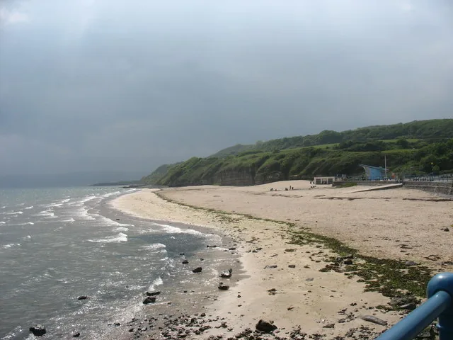
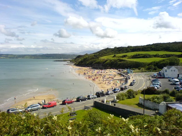
A wide flat sweep of sand with a promenade behind it and rock pools along the margins.
Isle of Anglesey · East coast
A sandy beach and a working promenade anchor this east-coast village, with an Iron Age hut group and a vanished Edwardian railway close by.
01The village
Benllech is arranged around one wide, flat beach on Anglesey’s east coast. The promenade and the beach car park sit at the bottom, and the village centre (the shops and Benllech Square) is a short walk inland and slightly above it. The sand curves away south from there towards Red Wharf Bay.
Anglesey’s best-known beaches ask something of you first: a drive, a dune crossing, a tide table. Benllech asks nothing. You park above the sand and you are on it, which is the whole point of the place.
Character
Around 3,400 people live here, with shops, pubs and a school behind the promenade. Benllech is not a preserved seaside town; it still does what it always did.
Pace
The promenade and the sand are flat throughout. The village centre sits a little above them, the only climb in a visit here, and a short one.
Landscape
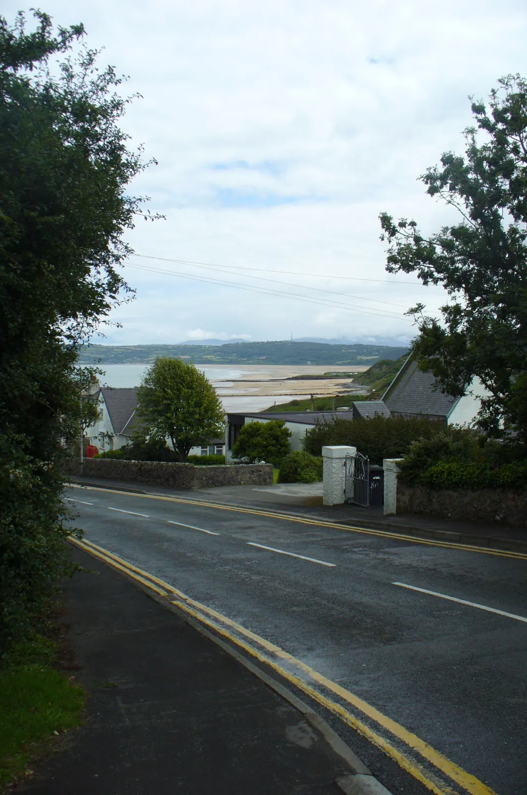
The beach curves south towards Red Wharf Bay, with Snowdonia visible across the water on a clear day.
Best for
Best for families wanting parking, toilets and sand sorted without a plan.
02Discover
A wide flat sweep of sand with a promenade behind it and rock pools along the margins.
The low stone footings of a prehistoric hut group on the limestone plateau above the village.
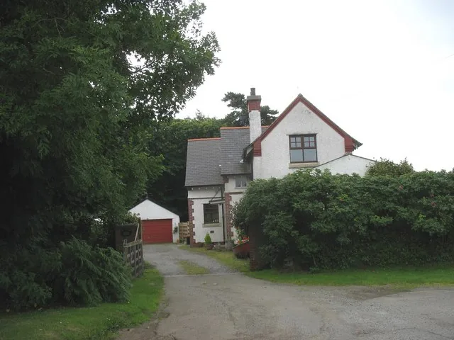
The surviving building of a short-lived branch-line terminus, now a private yard seen from the road.
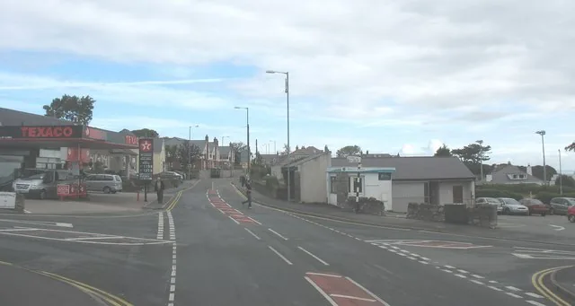
The crossroads and the village’s everyday centre, shops and services five minutes from the sand.
Beyond the first defining moments, the fuller Benllech catalogue continues below.
A village built around one beach: five stops, with Pant-y-Saer and the old railway site the furthest out, a mile or so south-west and south of the sand.
No verified image yet
Benllech Beach & the promenade
The wide sandy beach and promenade: the natural first stop, at the eastern edge of the village.
Five stops: a beach and promenade, the beach-side car parks, a village centre, and two older layers on the edge of the village. No cafés, pubs or shops are named here; see Local life for the village's everyday character.
Beach
Wide flat sand with rock pools at the margins and a proper promenade behind it. This is the reason Benllech is a stop at all.
Official visitor information (opens in a new tab)Car parks
Where to actually leave the car: one pay-and-display right on the sand with toilets, and an unsurfaced overflow on the ground above it.
Check car park charges (opens in a new tab)Streets
The crossroads where the village does its everyday business: shops, services, toilets and a car park, a short walk back from the sand.
Heritage
An enclosed group of Iron Age and Romano-British hut circles on a limestone plateau, a real excavated settlement, not a presented visitor site.
Industrial heritage
The one surviving building of a branch line that barely lasted a generation. It is a private wood yard now, so the look is from the road.
Parking tariffs and the current Blue Flag award are reviewed annually, so confirm current details before you plan a day around them.
Isle of Anglesey County Council, car parks03Story
Benllech's name is still argued over: a mutated penllech, “head rock”, or a shortening of ar ben llech, “on slate”. Either way, people were here long before the beach became the reason to visit.
Above the village, Pant-y-Saer's enclosed hut group was excavated in 1932 and dates from the Iron Age into the Romano-British period, people here centuries before anyone came for the sand.
Benllech sits in the parish of Llanfair-Mathafarn-Eithaf, birthplace of the 18th-century poet Goronwy Owen, still remembered in the village's primary school and its memorial hall.
The Red Wharf Bay and Benllech branch line opened in 1909 and closed to passengers by 1930; full closure followed in 1950. The station building survives half a mile south of the village, now a private wood yard.
As the railway faded, Benllech's beach and promenade became the village's real draw, a seaside resort widely reported to have held Blue Flag status since the early 2000s, served by two council car parks and a beach café.
Today Benllech is a family and retirement village first, a beach stop second: pubs, a primary school, a library and a surgery sit a short walk from the sand, with nothing performed for visitors.
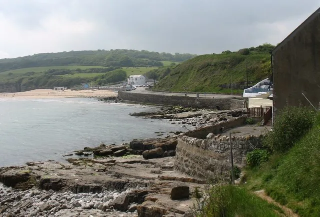
The beach came after the settlement, and outlasted the railway that once tried to serve it.
Atlas of Wales
A primary school, library, doctors' surgery and churches sit behind the beach. Cafés, pubs and shops gather around Benllech Square and along the seafront; no single business is recommended here.
The village is also known, in passing, as the place where Motörhead's Lemmy Kilmister spent part of his teenage years, long before the band existed.
The seasonal dog restriction only covers a zone of the main beach, and dog-friendly stretches exist year-round outside it.
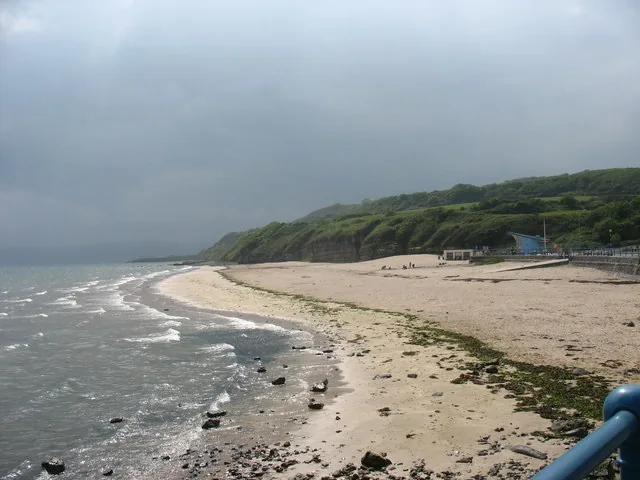
Sand, rock-pool margins and a promenade with a café share the same short stretch, the reason most people come.
Shops, services and the village-centre car park sit around the crossroads on the A5025, an ordinary Anglesey village behind the beach.
A scheduled Iron Age hut group and a vanished Edwardian station sit within a short drive: Benllech's history before the beach became the draw.
The village in one visit
The beach is the whole visit for most people. What you add, if you want more, is a hut group on the plateau above and a station yard behind a fence, neither of them presented for visitors.
Plan your time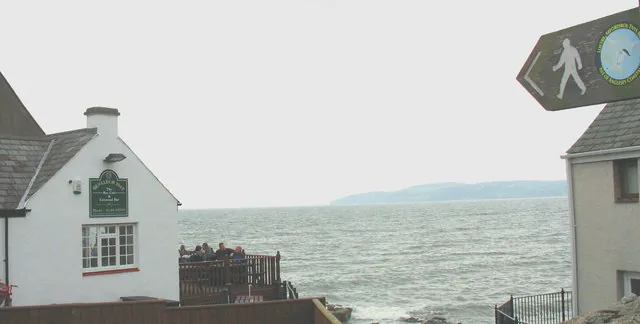
Benllech means, roughly, “on slate”, or “head rock”, and nobody has quite settled it.
Atlas of Wales
04Plan
The beach-side car park, with toilets on site.
Flat sand, with rock pools at the margins.
A café and a sea view, before heading back.
Whichever car park has space.
Sand, rock pools, and the café.
About five minutes inland.
Shops, then a pause before heading back.
An early start gets ahead of the car parks filling.
Shops, then a break for food.
The scheduled hut group above the village.
A private wood yard now, so view from the road.
The promenade, and the beach again if there's time.
Practical
Everything you need for arriving and getting around.
Getting here
The A5025 coast road runs straight through Benllech, with pay-and-display car parks at Lower Wendon, Upper Wendon and The Square, and a free one by the library.
Open Lower Wendon car park in MapsRoute 62 (Arriva) runs the A5025 coast-road corridor, connecting Benllech with Moelfre, Amlwch and Bangor. Check the current service before travelling.
Route 62 timetablePractical details
Four council car parks — two on the Wendon terraces above the beach, one on the square, one by the library.
Check the Isle of Anglesey car parks listingCharges and restrictions can change. Check the signs when you arrive.
The Square
Village centre · The Square
Google Maps (opens in a new tab)Lower Wendon
Beach level · Wendon
Google Maps (opens in a new tab)Upper Wendon
Above the beach · Wendon
Google Maps (opens in a new tab)Benllech Library
South of the square · by the library
Google Maps (opens in a new tab)Public toilets at Lower Wendon and Benllech Square; a café at the beach, with wider shops and cafés around the village centre.
Check Visit Anglesey’s Benllech Beach pageToilets at Lower Wendon and Benllech Square car parks
The Bay Café · no other business is named here
The beach and village are free and open; the one date-sensitive rule is the seasonal dog restriction on part of the main beach.
Free · no ticket or gate
Dogs restricted on a zone of the beach, 1 May–30 September
Disabled bays at all three car parks, and a bookable beach wheelchair at The Bay Café.
Accessibility beyond the car parks and the beach wheelchair (village-centre shops, older streets) is not independently confirmed here, so check locally if this matters to you.
Bookable wheelchair loan, 9am–5pm daily except Mon/Tue, via The Bay Café
Disabled bays at Lower Wendon, Upper Wendon and Benllech Square
The beach, car parks and village centre are all within a short, flat walk of each other; Pant-y-Saer and the old railway site are a short drive beyond.
Use Benllech as a base
Four real Atlas destinations pair with a Benllech visit. Distances are straight-line from the village centre, not driving times.
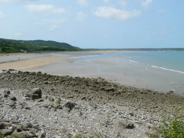
A wide tidal bay immediately south of Benllech: miles of sand only there to walk on part of the time, with a landmark rock and a hillfort inland.
About 1.2 miles south-east (straight-line)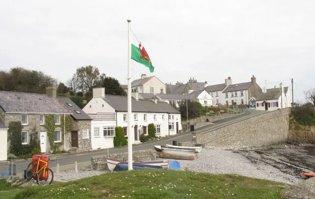
A working Anglesey harbour village with a free RNLI museum, the 1859 Royal Charter story, and a headland view across to a tidal island.
About 2.3 miles north (straight-line)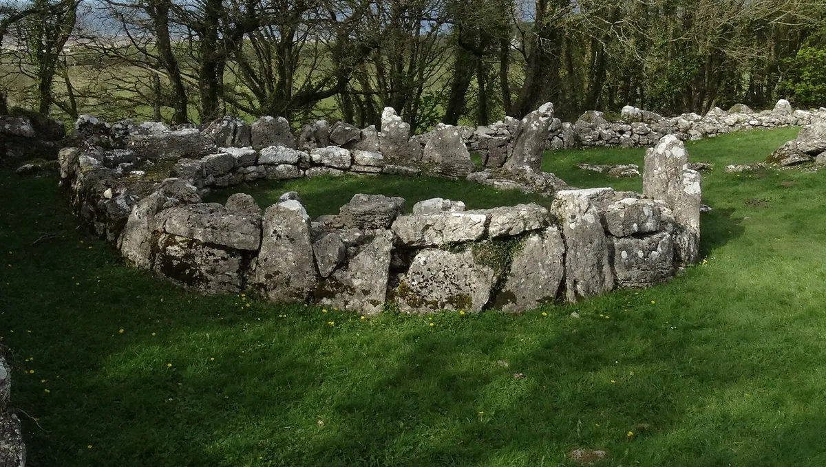
Three free Cadw monuments above Traeth Lligwy: a Roman-era walled village, a Neolithic burial chamber and a medieval chapel, in one short walk.
About 2.4 miles north-west (straight-line)
A broad east-coast beach with pale sand and low dunes, a little further north: a calmer, quieter Anglesey horizon.
About 3.7 miles north-west (straight-line)Before you go
Park, cross the promenade, and the sand does the rest, and the older village is still there if you look.