Come for the Great Opencast and the strange mineral colours, but treat Parys as an old mine landscape, not an ordinary hillside.
CHECK FIRST · TERRAIN
This is rough, uneven former mine ground and the trail is moderate rather than easy. Stay on the marked paths. Spoil slopes are less forgiving in wet weather, and poor visibility takes away the main viewpoint entirely.
Time needed
25 min viewpoint · 1–2 hr trail · 2–3 hr geotrail
Best time
Dry, clear weather
Opening, entry & booking
Open trail, no fixed hours, no booking · charges may apply
Access & difficulty
Moderate: rough, uneven mine ground · stay on paths
Parking & start point
Parys Mountain car park, B5111 near Amlwch
Getting there
B5111 near Amlwch by car · no bus to the trailhead
Toilets, food & facilities
Parking on site
Dogs
On a lead: old workings and acidic water · no published rule
Plan with confidence.Detailed information on arrival, access, facilities, restrictions and local conditions.
Opening, entry & booking
The trail is open ground with no gate, no ticket and no fixed hours. It is unstaffed, so nothing is checked or supervised while you are there.
Parking, start point & arrival
Where
The Parys Mountain car park off the B5111 near Amlwch, at the trailhead.
Charges
Charges may apply and can change. Carry a means of payment rather than assuming it is free.
Tall vehicles
Do not rely on being able to enter the trailhead car park with a campervan or high van. Check the entrance before travelling or plan an alternative start.
Public transport & car-free access
By bus
No service runs to the trailhead. Buses reach Amlwch, about a mile and a half north, leaving you the walk or a taxi for the last stretch.
Plan for no facilities: no toilets, no café and nobody on duty at the trailhead.
Nearest
Amlwch, about a mile and a half north, for toilets and food. Bring water for the walk itself.
Accessibility & terrain
The full route
Rough, uneven former mine ground. Not suitable for wheelchairs or buggies.
The short version
The viewing platform above the Great Opencast is the shortest way to see the pit. Treat the surface between car park and platform as unassessed rather than step-free.
Dogs & restrictions
No site dog rule is published, so the hazards set the rule: keep dogs on a lead throughout, because of open workings, acidic water and protected ground. Expect livestock on the surrounding land.
Safety, weather & local conditions
Dry, clear weather is best. Wet weather makes spoil slopes and rough ground less forgiving, and poor visibility weakens the main viewpoint experience.
PLACE-SPECIFIC DETAILS
Booking
No booking requirement was found for the outdoor trail.
Visitor centre
The former Copper Kingdom museum at Amlwch Port closed in late 2022. A new visitor and learning centre near Parys Mountain has been proposed but is not yet open.
Safety on the mine landscape
Parys Mountain is a protected former copper mine landscape, and the ground rules that come with that are set out in full under Mine-landscape safety. Read them before you leave the car park.
Other place details
Site safety
Keep to marked paths; old workings & acidic water
Setting
Copper-coloured former mine landscape
What to bring
Strong shoes
Water
Weatherproof layer
Phone / map backup
Dog lead if needed
Before you explore
Mine-landscape safety.
Stay on marked paths. Old mine workings, steep spoil and acidic water make off-route exploring unsafe. Parys is safe enough for careful walkers and genuinely rewarding; it simply is not a place to roam freely.
Keep to the marked or obvious paths across the site.
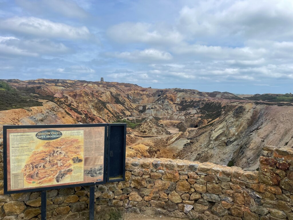
Do not descend into the Great Opencast. View it from above.
Avoid pools and drainage water; some of it is acidic.
Spoil slopes can be loose or slippery underfoot.
Leave rocks, spoil, ruins and mine features undisturbed. This is protected ground.
In an emergency, call 999.
Atlas of Wales Discovery Highlight
A hill that was taken apart for its copper.
Parys Mountain is not dramatic because it is high. It is dramatic because the ground has been opened, coloured and marked by centuries of mining.
The Great Opencast, old engine-house remains, the windmill, precipitation pits and mineral-stained spoil turn a low Anglesey ridge into one of Wales’s most distinctive industrial landscapes.
A low ridge, opened and coloured by mining.
Atlas of Wales Verdict
A copper-coloured industrial landscape that rewards careful walkers.
One of Anglesey’s most distinctive places: visually strange, historically serious, and best on the marked trail rather than wandering freely.
Good fit for
industrial history
geology and photography
short or moderate walks
Anglesey heritage trips
anyone drawn to unusual landscapes
Think twice if
you need a smooth, accessible route
you have very small children who may run off path
you want on-site toilets, café and a visitor centre
The hazards here are industrial, not rural. If roaming off-path is the point of a walk for you, this is the wrong hill.
Best experience
A dry, clear day: the viewpoint and part of the heritage trail, paired with Amlwch Port.
The walk begins on a low Anglesey ridge, but the ground quickly turns copper, ochre and industrial.
How your visit unfolds
How the visit unfolds.
A guided shape for the visit, from the car park to the wider copper story.
01 The car park decision
At the B5111 car park, choose your length: viewpoint, short route, heritage trail or geotrail.
02 The first copper colours
Ordinary countryside turns to mineral reds, oranges, yellows and dark spoil.
03 The Great Opencast
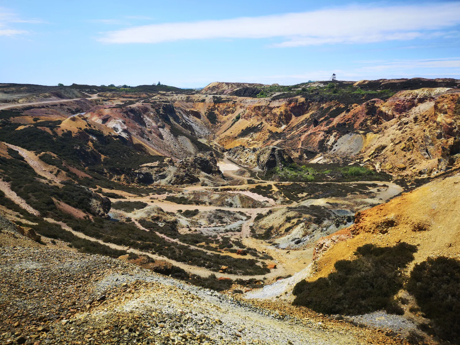
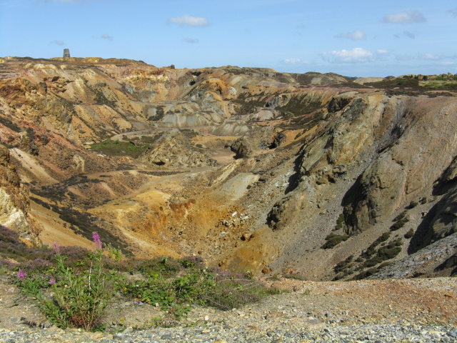
The main reveal: a vast exposed working. View it safely from above.
View from above
04 Industrial remains
Mine yards, precipitation pits, kilns and engine-house remains: protected, not decorative.
05 Windmill and ridge
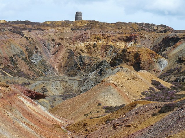
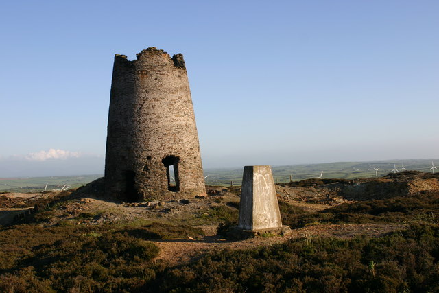
The windmill gives the ridge its strongest silhouette and its machinery story.
06 The Amlwch connection
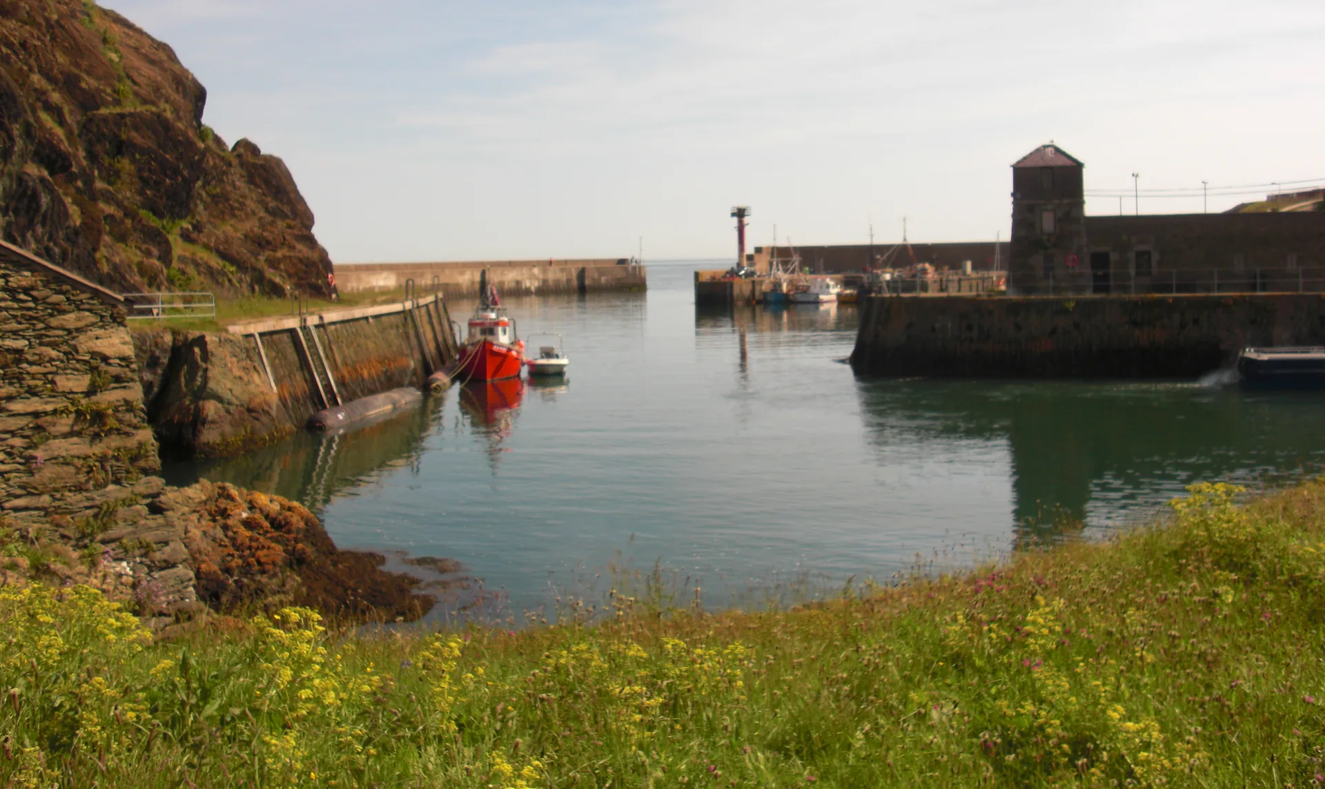
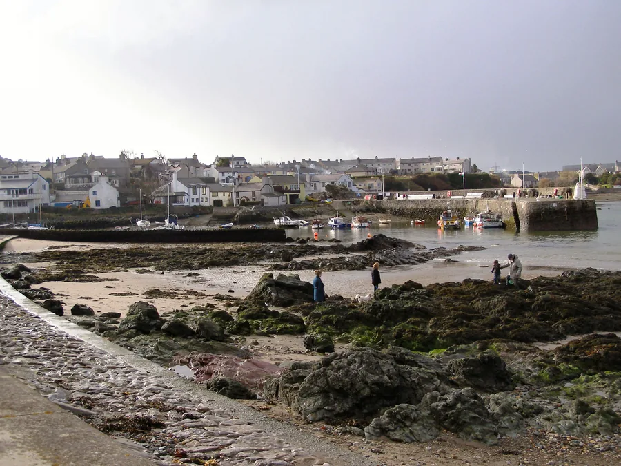
The story continues to Amlwch Port: extraction here, export and growth there.
07 Return with context
By the end it reads as a compact history of geology, labour, industry and conservation.
The landscape, in pictures
Seen across the mountain.
Colour, pit, machinery and mineral: the visit before you make it.
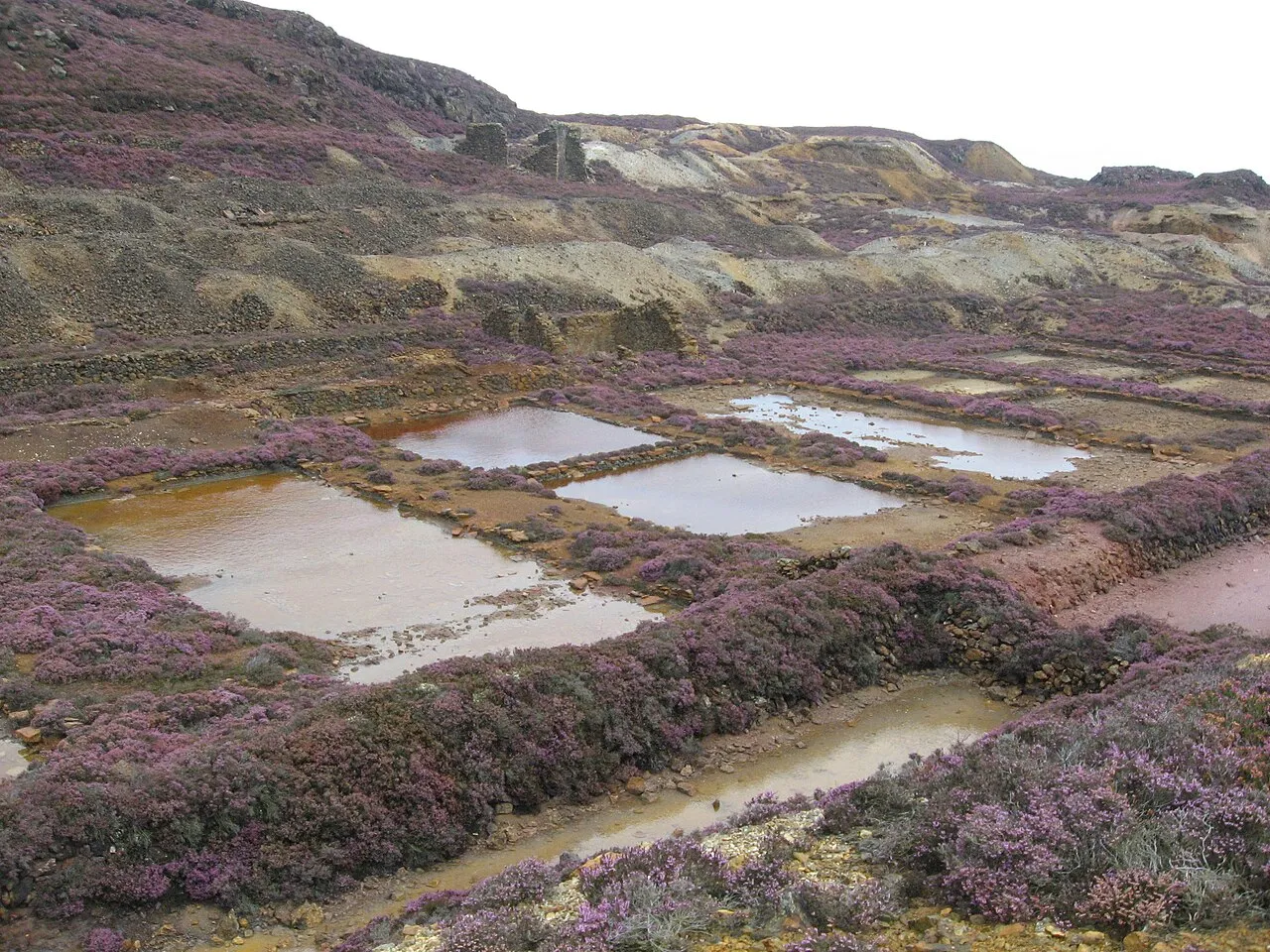
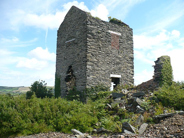
The copper mine landscape from above: Parys Mountain, AngleseyThe windmill on the ridge: the mountain’s strongest silhouetteThe precipitation ponds: acidic water, not a place to paddleThe Pearl Engine House: stone remains of the pumping ageThe copper pit: the colour comes from the rock itself
What stays with you
The parts people remember
Nowhere else on Anglesey looks like this. The ground is the wrong colour, and it stays wrong for the whole walk.
01
The turn out of ordinary fields
You leave the B5111 in plain Anglesey farmland and within a few minutes the grass gives out entirely.
02
Water the wrong colour
The pools hold still, flat colour: orange, green, sometimes almost red. They are the most photographed thing here and the least inviting.
03
A tower with no sails
The windmill stub stands on the highest point with nothing around it, and it is the one thing on the ridge you can navigate by.
04
Colour all the way through
The colour runs through the spoil itself rather than appearing only in certain light. Reds, oranges and ochres remain visible across the worked ground.
05
How still it can feel
For such heavily worked ground, the ridge can feel unexpectedly still. The scale of the Great Opencast becomes clearer when you stop at the viewing platform rather than walking straight past.
A hill turned inside out, and left that way.
From the copper archive
Why this strange ridge mattered.
Five field notes on a low Anglesey ridge that once reached far beyond the island: early mining, industry, geology and local texture.
Some of this is firmly recorded. Some is local texture. This page keeps the two apart.
Field notes
Five entries. Open one to read the note.
Ancient ground Heritage
Early & ancient mining
Field note I · filed under deep time
People were taking copper from this ridge long before the famous 18th-century boom.
What is known
Parys Mountain (Mynydd Parys) is a low ridge near Amlwch, not a high mountain. It carries evidence of very early mining, including Bronze Age mining debris noted in Copper Kingdom trail material.Early dating · treat with care
What is less certain
How far the earliest working, and any Roman-era activity, extended is not fully mapped. Where the record is thin, this page says so rather than filling the gap.
What to notice there
The ground itself is the document: centuries of digging, not a single event, shaped what you see today.
Industry Fact
The 1768 discovery
Field note II · filed under industry
A single 18th-century discovery turned a quiet ridge into an industrial powerhouse.
What is known
Major post-medieval copper working began in the 18th century. The key discovery is commonly placed in 1768, associated with Jonathan Roose and the Golden Venture Lode. In the late 1700s Parys became one of Britain and Europe’s most important copper-producing landscapes.
What it led to
Parys copper reached the wider maritime and industrial world, including ship sheathing and bolting. Amlwch grew rapidly on the back of the copper industry and its port.
What to notice there
The scale of the Great Opencast is the clearest reminder of how much was taken from this ridge, and how quickly.
Two mines Working history
Mona & Parys
Field note III · filed under two operations
The divided mountain ran as two operations, and helped make at least one famous fortune.
What is known
The mountain supported two main operations: the Mona Mine in the east and the Parys Mine in the west. Thomas Williams, remembered as the “Copper King,” became a major figure in the industry.
Why it mattered
Two operations on one ridge, feeding a growing port, helped make Anglesey copper a real force in 18th-century industry.
What to notice there
Engine-house remains, mine yards and structures across the site belong to this working past: protected, not decorative.
Geology & life Fact
Rock, lichen & protection
Field note IV · filed under geology & life
Parys is protected for what the rock holds and for what manages to live on it.
What is known
The landscape includes the Great Opencast, the windmill, the Pearl Engine House, precipitation pits, Mona Mine kilns and sublimation chambers. Parts of the site are scheduled monuments, and Mynydd Parys is an SSSI important for its geology and unusual metal-tolerant lichen communities.
Part of a bigger story
The site belongs to Anglesey’s wider GeoMôn geopark story, where geology is read across the whole island.
What to notice there
The strange colours are mineral, not paint, and the sparse, specialised plant life is part of why the ground is protected.
Local texture Local texture
Names & the copar ledis
Field note V · filed under local memory
Some of what surrounds Parys is local memory, held carefully rather than proven.
What is recorded
The Welsh name is Mynydd Parys. GeoMôn records cultural references including the copar ledis (women who cleaned and broke copper ore) and a Welsh-language ballad.
Local texture
An older Welsh name, Mynydd Trysglwyn, is referenced by the Parys Underground Group. Treat this as local-history texture, not hard fact.Local texture
What to keep in mind
This page does not turn texture into legend. Where something is uncertain, it stays labelled as uncertain.
Continue exploring
Don’t let the day end at one pin.
Four stops that turn one mountain into a north-Anglesey day.